
At the Geospatial World Forum 2023, in the session on ‘Land And Property: Emerging Technology Enabling Land Economy’ discussions took place on monitoring carbon emissions using multi-source geographical data and providing a platform to solve these problems related to land usage.
The panel on ‘Geographical Monitoring system for CO2 emissions and Land Use Changes’, moderated by Dr. Simon Musaeus, VP, Geospatial Content Solutions, Hexagon, President, EAASI. He began the session by introducing other panel members.
Simon Kay, Dep Head of Unit | European Commission, DG Climate Action, presented the climate law of the EU, the objective of the EU is to achieve climate neutrality by 2050.
He shared the revised Land Use, Land Use Change, and Forestry (LULUCF) Regulation, ambitious target for net carbon removals in soil, forests and wood products: 310 Mtonnes by 2030.
Enhanced LULUCF Monitoring System
- High carbon stocks
- Protection sites
- Restoration sites
- High climate risk zones
- Soil Carbon stocks
“Land is really a part of the equation of the climate neutrality in Europe”, he added.
Rachel Tidmarsh, Managing Director at Bluesky talked about the National Tree Map (NTM), a product of Bluesky. National Tree Map, a detailed dataset of its kind with the coverage of England, Wales, Scotland, and the Republic of Ireland. It is a database of location, height, and canopy/crown extent for trees 3m and above in height. It has enabled and assisted conversations about current & future tree cover. It allows to visualize the urban environment including the urban forest & make data-driven decisions that will inform future policies & budgets.
She also shared an NTM case study from Waterford City & County Council of Ireland. The objective of the study was to make the entire city decarbonized zone under Ireland’s Climate Action Plan, which will make Waterford a carbon-neutral city by 2030.
Nicola De Quattro, Head of Innovation and Technology Governance, Telespazio Belgium talked about the goals of Telespazio, to integrate satellite data into existing ecosystems and to support companies to decarbonize their supply chain.
Emerging Trends in Land Economy
The next panel on ‘Technology adoption and emerging trends in Land Economy’ was moderated by Caroline Robinson, Journalist, Maplines, British Cartographic Society.
The land is a critical asset for economic growth, social development, and reducing poverty. The terms on which land is held, used, and transferred have important consequences for economic growth.
Jones Ofori-Boadu, Deputy Executive Secretary – Corporate Services, Land Commissions shared the goals of Ghana to address critical challenges in the land sector to optimize the contribution of land to the socio-economic development of Ghana.
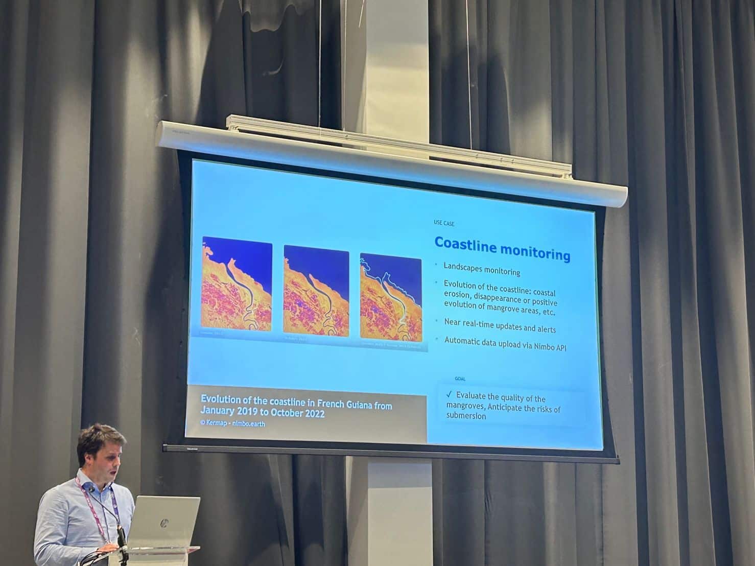
Satellite images are valuable data but it is hard to access, process, analyze and display. Antoine Lefebvre, CEO of KERMAP showcased a SaaS platform, nimbo, based on satellite imagery to show how the Earth changes.
He also shared the use cases of nimbo in Wildfire monitoring; identified burned areas in three countries during the summer 2022 (USA, Spain, Greece). It continuously monitors the damage caused by wildfires at the scale of a country or a continent.


