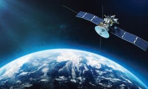
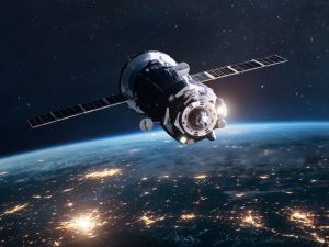
Space and geospatial information applications have played an important role in handling COVID-19 pandemic in the past, both with respect to its epidemiology and its socio-economic impacts. The results have been achieved in tandem with other innovations, such as big data and artificial intelligence.
Many countries leveraged digital innovations in multiple ways to provide crucial insights to national and regional decision making, and to engage citizens in managing and responding to the pandemic.
The affected countries launched their own national or subnational dashboards to leverage geospatial data and applications to provide updated, on demand statistics for their citizens. Such online data-sharing tools were vital in providing citizens with up to date information on pandemic at the national level.
In addition to these online dashboards, countries also used artificial intelligence (AI) and big data tools and created several monitoring and health apps. Such applications continued to be developed throughout the pandemic and gave affected countries the critical tools for monitoring cases and administering vaccines.
Use of apps during COVID-19
One such app was the Aarogyasetu app developed by the government of India. It uses contact tracing to record details of all the people you may have come in contact with, as one goes about normal activities. Till now it has total download of 21,82,00,000.
Aarogyasetu has transformed into National Health App, brining a whole plethora of digital health services powered by Ayushman Bharat Digital Mission (ABDM). One can leverage the app for interaction with participating healthcare providers, and allows you to receive your digital lab reports, prescriptions, and diagnosis seamlessly from verified healthcare professionals and health service providers.
It also helps you to schedule online doctor appointments powered by eSanjeevani OPD Application. One can schedule doctor appointments and consult with doctor from the comfort of your home.
Aarogyasetu helps to schedule/ reschedule/cancel appointments for COVID-19 vaccination. Using Aarogyasetu one can download the vaccination certificate or can request for changes in certificate as well. Your certificate will be readily available once synced.
Maximum countries in South-East Asia maintained data visualization platforms and applications to report COVID-19 cases and the vaccination status of their citizens over the course of the pandemic. Thailand created the COVID-19 iMap Dashboard, which was used to monitor cases within each province.
Such data innovations from South-East Asia are examples of the rapid digitalization that countries adopted to respond to the dynamic requirements of the pandemic, and help policymakers make informed decisions on response and management. This was achieved by making geospatial data accessible and actionable at all levels.
Tracing history of data usage
Using data for sustainability is not new to the world. According to Vipul Singh, Professor of Environmental History, University of Delhi, “The study of trade winds, monsoons, and cyclones piqued the curiosity of many explorers in the eighteenth and nineteenth centuries. However, they were still apprehensive about the unexpected weather shift in the midst of the ocean. The tropical cyclones that unexpectedly erupted in the Indian Ocean sank many their ships. Its strength and devastation compelled trading businesses in Europe to create meteorological models. An amateur meteorological observations and records gave birth to a more methodical examination of cyclones in the Indian Ocean in the nineteenth century.”
Indonesia, the Philippines, Singapore, and Thailand have begun to strengthen their capacity to capture the socio-economic benefits of space applications through institutional and policy developments and reforms. While technological developments figure prominently in these efforts, they all have remarkable and strong user orientation to support development objectives.

Recognizing that progress varies across countries, the latest UN report on sustainability says, “Given the current pace of progress by countries in the subregion, South-East Asia is not on track to achieve any of the 17 goals set by the UN by 2030.”
Using geospatial data for informed decisions
Space applications and geospatial information are critical part of the tools needed by decision makers and policymakers to develop and execute evidence-based policies and make decisions to address the multidimensional challenges that are undermining progress in achieving the goals.The recent policy and strategic level reforms in South-East Asia demonstrate the importance that countries have accorded to strengthening of capacities to capture the socio-economic benefits of space science, technology, and its applications for achieving developmental objectives.
Prof. P K Joshi, Chairperson Special Center for Disaster Research (SCDR) and Professor School of Environmental Sciences (SES), Jawaharlal Nehru University, New Delhi said, “By mapping and analyzing data on parameters such as population density, land cover, and natural resources, geospatial technology can provide insights into the potential impacts of development projects on environment, economy, and society.”
SDG goals by UN
High human and economic losses due to disasters and how space applications can help accelerate progress. Geospatial and satellite data can be very useful in disaster preparedness, risk reduction and emergency response, reducing both economic and social losses.This was done very effectively to achieve the results in Vietnam.
No poverty: High human and economic losses due to disasters. In addition, geospatial data can supplement census data to map spatial distribution of poverty and guide development and targeting of poverty programmes. This was done very effectively to achieve the results in Indonesia and Thailand.
Sustainable cities and communities: Accidental deaths on roads and loss of lives and property from disasters can be minimized by the application of satellite-based data in conjunction with data from road emergency stations to map road traffic accident hotspots, observe traffic conditions and analyze driving behaviour. This was done very effectively to achieve the results in Singapore and Cambodia.
Geospatial 3D data models and applications can also combine cross-sectorial data to model and predict different scenarios, from road traffic management to disaster modelling within urban environments. This was done very effectively to achieve the results in Singapore.
Responsible consumption and production: Regression in improving efficiency in use of natural resources.
Geospatial technology can help to optimize resource allocation and improve the efficiency of public services. One key aspect of sustainable development is the efficient use of resources. For example, by analyzing patterns of traffic flow and population density, planners can determine the most effective locations for public transportation routes and facilities.
Similarly, by mapping the distribution of natural resources, policymakers can make more informed decisions about how to allocate resources such as water and energy.
“The technology can help by providing accurate and up to date information on the distribution and availability of resources such as water, minerals, and timber. This information can help decision makers allocate resources in a more sustainable manner and identify areas where conservation efforts are needed,” said Prof. P K Joshi.
Location data & electric vehicles
The Association for Geographic Information (AGI), a UK body working in the geospatial sector, has recently supported a government report on how location data can drive the rollout of electric vehicle infrastructure.
The report says, “Charge points must be rolled out where they are needed. Location data is key to building the right infrastructure at the right places, giving confidence to current and future EV owners that they can efficiently reach their destination.”
The report identifies how location data can help model future demand, select suitable sites, create a seamless consumer experience, and track rollout. This application of geospatial technology is being used very effectively in India’s move towards geospatial technology.
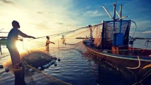
This technology also plays an important role in marine spatial planning and thus supporting sustainability. Common marine spatial planning challenges include lack of data on the marine environment, high mobility of both animals and humans, and plan implementation challenges including lack of enforcement and compliance with regulations along with monitoring deficiencies. These can be potentially addressed using geospatial technologies such as remote sensing, GPS and GIS.
For aqua farming database collection and the real-time monitoring of different working functions of aqua farming, it’s essential to enhance and digitalize aqua farming.
Data collection and real time monitoring are done using technologies, which are useful for the conservation and advancement of traditional aquatic farming, particularly in hilly areas with sustainable development goals (SDGs).
Geo-tagging and geo-mapping of the aqua resources will play an important role in monitoring the species in the aquatic environment and can track the real time health status, movement, and location, and monitor the foraging behaviors, of aquatic species.
This is again an area in which not much has been done and there is a lot of scope of using marine resources for human sustainability.