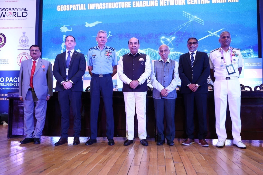
The inaugural session of the Indo Pacific GeoIntelligence Forum 2026 commenced with a welcome address by Lt Gen AKS Chandele, PVSM, AVSM, PhD (Retd) President – Defence Geospatial World, who highlighted the growing significance of networking, data centricity, and geospatial intelligence in modern military operations.
Reflecting on the relevance of this year’s theme, Lt. Gen. Chandele noted that the focus on connected systems and data-driven decision-making is becoming increasingly central to defence preparedness and operational effectiveness.
He set the stage by stating, “The Indian Army has declared the current year as the Year Sof Networking and Data Centricity.”
Vice Admiral AN Pramod, AVSM, YSM Director General Naval Operations (DGNO)
Indian Navy,examined the rapidly evolving geopolitical landscape and its implications for regional security, military preparedness, and strategic partnerships.
Drawing attention to the increasing complexity of global security challenges, he highlighted how geopolitical uncertainty, ongoing conflicts, and the growing importance of strategic chokepoints are reshaping defence priorities worldwide. He also underscored the strategic significance of the Indo-Pacific as a region that connects major centres of commerce, innovation, and military power.
“We are more connected, yet more vulnerable; more technologically sophisticated, yet more exposed to misuse; more deeply interdependent, yet increasingly susceptible to pressure and coercion.”
Taking a bigger picture and focusing on the entire region, he said, “The Indo-Pacific connects the east coast of Africa to the western Pacific, linking major centres of commerce, production, innovation, and military power. In many ways, it is the world’s most consequential strategic theatre.”
Christopher Fowler, National Government Team Lead Asia Pacific, Esri
Singapore, highlighted how Geographic Information Systems (GIS) provide the framework to bring together disparate datasets, support the intelligence cycle, and enable a common geospatial operating picture across the defence and intelligence enterprise.
“A GIS provides the framework to see and to understand what is occurring in the environment you are operating in and by bringing together and integrating multiple disparate datasets. This allows you to make informed decisions, take actions, and communicating this across all users,” he noted.
“The challenge isn’t just detecting individual events, it’s connecting them,” Christopher reiterated.
Air Marshal Praveen Keshav Vohra, UYSM, AVSM, VM DCIDS (PP & FD), HQ IDS, underscored the growing importance of geospatial infrastructure as a critical enabler of decision superiority in modern warfare. He highlighted how advances in AI, real-time ISR, cloud-based data fusion, and secure communications are transforming the way military forces perceive, understand, and act across the battlespace.
He also addressed the challenges associated with data interoperability, bandwidth, security classifications, and data quality that continue to shape the development of robust geospatial infrastructure.
Emphasizing the foundational role of geospatial infrastructure in modern warfare, he stated, “The geospatial infrastructure is the foundation of any modern battlefield. It gives the wisdom to understand and the precision to act.”
Highlighting the importance of geospatial advantage in future conflicts, he observed, “As we look forward to the future of multi-domain operations, the side with the best spatial map to the digital and physical world will be the side that will eventually prevail.”
Shri AS Kiran Kumar, Member, Space Commission and Former Chairperson
ISRO,reflected on the transformative impact of space technology on society, security, and the way information shapes human behaviour. He noted how advancements in space-based observation, communications, and information dissemination have fundamentally changed the way humanity lives, interacts, and responds to global challenges.
Looking beyond technology alone, he emphasized the growing influence of narratives, information ecosystems, and emerging technologies on societies and nations. Calling for greater foresight and preparedness by urging stakeholders to look beyond immediate challenges and anticipate future disruptions that could reshape security, governance, and human progress, Shri Kumar brought forward the urgent need for deliberations.
“We need to look beyond what is happening today and start looking at how we can change the whole narrative and come up with solutions which will ensure that humanity not only survives on this planet but also lives peacefully.”
Underscoring the importance of human judgment in the age of AI, he noted, “Human intelligence needs to anticipate while world is trying to create artificial intelligence mimicking the human intelligence. Human intelligence itself, many times, is playing second fiddle.”
Lt Gen Syed Ata Hasnain, PVSM, UYSM, AVSM, SM, VSM*, Hon’ble Governor of Bihar, the Chief Guest for the inaugural session, shared his perspectives on the rapidly evolving character of warfare and the growing importance of geospatial intelligence, information dominance, and strategic sovereignty in modern security environments.
“The battlefield is now continuously observed, continuously analyzed, and continuously interpreted. Geography itself is no longer static terrain. It has become a dynamic data environment.”
On the Strategic Importance of the Indo-Pacific, he said, “The Indo-Pacific cannot be secured merely through naval presence or military posture. It must first be understood through persistent geospatial awareness.”
“Strategic sovereignty in the 21st century will increasingly depend not merely upon territorial control, but upon informational sovereignty,” he emphasized.
His address provided a powerful perspective on how nations must build resilience, strengthen geospatial capabilities, and embrace emerging technologies to navigate an increasingly complex security landscape.
Concluding the inaugural session, Sanjay Kumar, Chief Executive Officer, Geospatial World, reflected on one of the central themes that emerged throughout the discussions, the need to build sovereign geospatial and space infrastructure that strengthens national security while ensuring technological independence.
Drawing from the deliberations of the Executive Roundtable and the day’s discussions, he emphasized that sovereignty is not limited to ownership alone. Rather, it is about having command and control over critical technological assets, whether developed indigenously or strategically acquired, customized, and integrated to meet national requirements.
Reflecting on the meaning of sovereignty in today’s technology-driven world, he noted, “Sovereignty means that we need the control and command on the technological assets which we have.”
Highlighting the need for a balanced approach towards capability development, he emphasized, “We build our own. We procure, leverage, customize, and actually develop whatever is available in the best of the markets so that we don’t lose time.”
Underscoring the role of defence in technological advancement, he observed, “Defense around the world has been the incubator of technology.”