
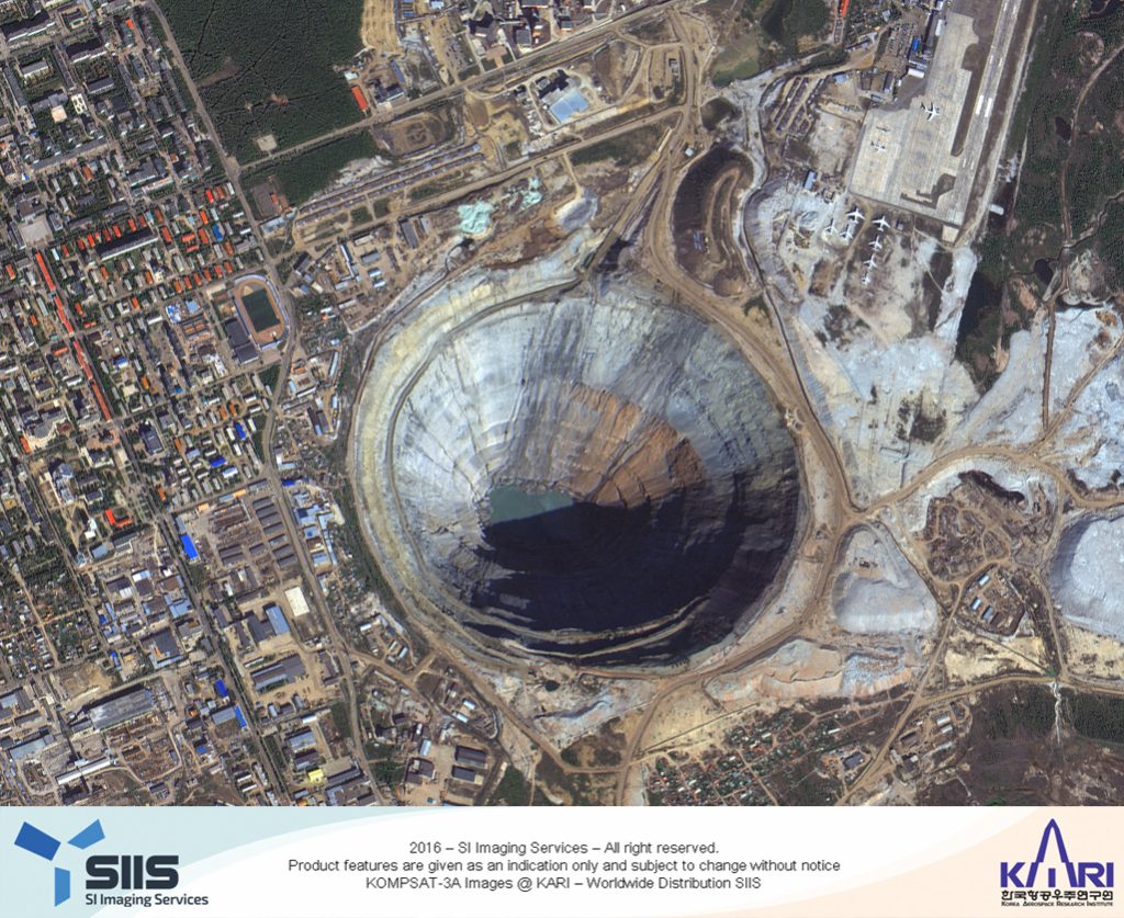
Canada: PhotoSat has announced that that the survey data processed from the new 40-centimeter resolution satellite, KOMPSAT-3A, has been verified as accurate to within 21 centimeters in elevation. The stereo KOMPSAT-3A data was provided to PhotoSat by SI Imaging Services (SIIS). SIIS is in charge of commercial marketing of KOMPSAT satellite series that Korean aerospace research institute (KARI) has developed and operates.
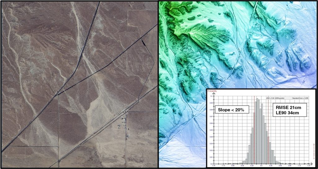
Direct comparison to a highly accurate LiDAR elevation grid
For the study, PhotoSat produced a 1m grid of elevations using its proprietary geophysical processing technology with stereo satellite images taken by KOMPSAT-3A. The resulting elevations were then compared to a 1m LiDAR elevation grid in Southeast California, accurate to approximately 5 cm in elevation and available on the OpenTopography website.
The size of the comparison area was 86 square kilometers. The resulting 21 cm RMSE elevation accuracy was measured at 6,294 survey check points. The full KOMPSAT-3A accuracy study is available on the PhotoSat website.
Stereo KOMPSAT-3A available throughout the world
PhotoSat’s highly accurate satellite survey grids have been used for years by oil and gas and mining engineers as a cost-effective alternative to ground GPS and airborne LiDAR surveying. The stereo satellite photos from KOMPSAT-3A will enable PhotoSat to deliver engineering quality topographic survey data everywhere in the world.
Most accurate KOMPSAT satellite to date
“The KOMPSAT-3A satellite data is the highest quality KOMPSAT satellite photo data that PhotoSat has processed,” said Gerry Mitchell, President of PhotoSat. “In this test, an elevation grid extracted from stereo KOMPSAT-3A satellite photos matches a highly accurate LiDAR elevation grid to better than 21 cm in elevation. This result takes satellite elevation surveying into the engineering design and construction markets and directly competes with LiDAR and high-resolution air photo surveying for applications like mine tailings monitoring.”
“We truly appreciate the astonishing work by PhotoSat and pleased to see the good result of elevation grid derived from KOMPSAT-3A satellite data,” said Moongyu Kim, President & CEO of SIIS. “We are happy to have worked together with PhotoSat, which is very capable company in elevation extraction from satellite imagery. They showed us that KOMPSAT-3A data are competitive with conventional methods such as aerial photo mapping, and can be used satisfactorily in the engineering design, mapping and construction applications and other industries.”


