
India: The Indian Space Research Organization has released the first image captured by Cartosat-2 series satellite which was launched on January 12. The satellite is seventh in the remote sensing Cartosat series.
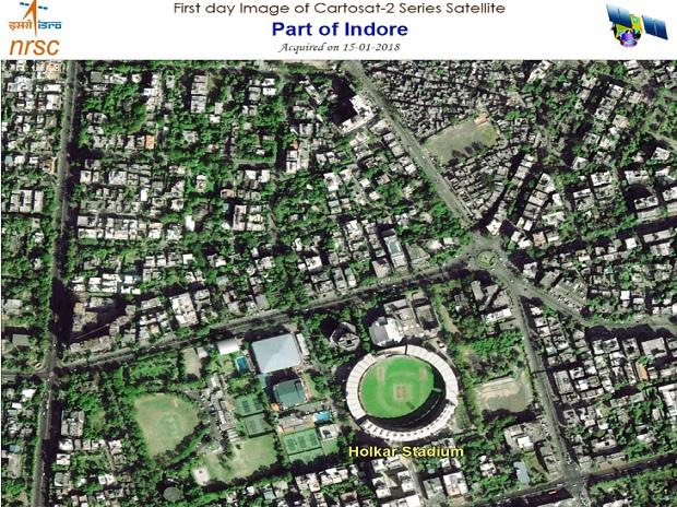
Isro released an image of a part of Indore with Holkar Cricket Stadium in the centre. The image was captured by the satellite on January 15.
Cartosat-2 series was launched aboard PSLV-C40, which took off from Sriharikota. The rocket carried 30 other satellites including 28 from six foreign countries.
According to ISRO, the remote sensing satellite is similar in configuration to earlier satellites in the series and would data services to the users.
The images relayed by the satellite will be valuable for cartographic applications, urban and rural applications, coastal land use and regulation, utility management like road network monitoring, water distribution as well as Geographical Information System (GIS) applications.


