GW CONSULTING
GW EVENTS
GW MEDIA
ABOUT US
Search
Login
Logout
My Profile
Subscribe/Trial
Prime Stories
Special Features
Technology & Innovation
Business & Industry Trends
India
Interview
Opinion
Case Study
AEC
Business Intelligence
National Mapping
Sustainable Development
Agriculture
Defense & Security
Video
Podcast
Prime Stories
Special Features
Technology & Innovation
Business & Industry Trends
India
Interview
Opinion
Case Study
AEC
Business Intelligence
National Mapping
Sustainable Development
Agriculture
Defense & Security
Video
Podcast
GIS
GNSS
EOS
LiDAR
Location & BI
AEC
Autonomous
Sustainable Development
More
News
Articles
Blogs
Hall of Fame
Videos
Events
Newsletter
GIS
GNSS
EOS
LiDAR
Location & BI
AEC
Autonomous
Sustainable Development
More
News
Articles
Blogs
Hall of Fame
Videos
Events
Newsletter
Home
Natural Hazard Management
7 days popular
Latest
Featured posts
Most popular
7 days popular
By review score
Random
Natural Hazard Management
Risk maps show USA, China to top global ranking for economic...
Geospatial World
-
Vanuatu elevation data to benefit future planning
Geospatial World
-
04/18/2014
Assam may face major earthquake: US scientists
Geospatial World
-
01/03/2005
Indonesia releases new disaster management software
Geospatial World
-
04/18/2014
DOST prepares for LiDAR survey of ARMM
Geospatial World
-
04/29/2014
PAF’s UAV crashes in area near Pakistan Punjab
News Desk
-
06/21/2016
Philippines develops 3D flood hazard map
Geospatial World
-
09/26/2013
Supercomputer K reduces disaster risk in Japan
Geospatial World
-
05/15/2015
Honolulu unveils extreme Tsunami evacuation zone
Geospatial World
-
07/24/2015
Researchers use tiny drones for dangerous rescue missions
Geospatial World
-
08/28/2015
ISRO’s NISAR EO satellite to be launched in 2021
Geospatial World
-
09/02/2015
Intermap releases earthquake data via InsitePro
Geospatial World
-
09/24/2015
More UAVs needed for surveillance, mapping in Nepal
Geospatial World
-
10/21/2015
Stratospheric Satellites: a New Technology for Monitoring Global Disasters
Geospatial World
-
07/04/2002
Simulation maps show Japan’s possible quake damage
Geospatial World
-
Jakarta prepares earthquake microzonation map
Geospatial World
-
05/19/2011
Japan tsunami caused icebergs to break off in Antarctica
Geospatial World
-
09/01/2011
China develops GNSS-based earth crust monitoring system
Geospatial World
-
03/05/2012
Natural hazard maps for home buyers in the US
Geospatial World
-
08/19/2013
Satellite flood maps for better emergency response
Geospatial World
-
10/03/2013
Online map to reveal which roads could flood during storm season
Geospatial World
-
01/16/2014
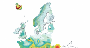
Researchers map Europe’s earthquake risk
Geospatial World
-
03/06/2014
1
2
3
...
40
Page 1 of 40