GW CONSULTING
GW EVENTS
GW MEDIA
ABOUT US
Search
Login
Logout
My Profile
Subscribe/Trial
Prime Stories
Special Features
Technology & Innovation
Business & Industry Trends
India
Interview
Opinion
Case Study
AEC
Business Intelligence
National Mapping
Sustainable Development
Agriculture
Defense & Security
Video
Podcast
Prime Stories
Special Features
Technology & Innovation
Business & Industry Trends
India
Interview
Opinion
Case Study
AEC
Business Intelligence
National Mapping
Sustainable Development
Agriculture
Defense & Security
Video
Podcast
GIS
GNSS
EOS
LiDAR
Location & BI
AEC
Autonomous
Sustainable Development
More
News
Articles
Blogs
Hall of Fame
Videos
Events
Newsletter
GIS
GNSS
EOS
LiDAR
Location & BI
AEC
Autonomous
Sustainable Development
More
News
Articles
Blogs
Hall of Fame
Videos
Events
Newsletter
Home
Natural Hazard Management
Page 3
7 days popular
Latest
Featured posts
Most popular
7 days popular
By review score
Random
Natural Hazard Management
Satellite imagery show full extent of damage of Washington mudslide
Geospatial World
-
04/02/2014
Kazakhstan’s first EO satellite enters final preparation phase
Geospatial World
-
04/23/2014
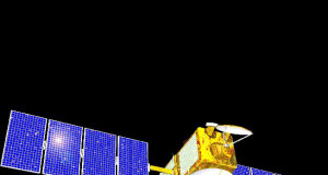
Japan all set to launch new mapping satellite Daichi-2
Geospatial World
-
05/22/2014
Philippines prepares hazard maps for Yolanda rehabilitation mission
Geospatial World
-
05/26/2014
GIS to help detect oil spill
Geospatial World
-
08/12/2014
Bangladesh floods: satellite imagery shows extent of damage
Geospatial World
-
09/11/2014
Kashmir may witness another flood in 2030s: NRSC
Geospatial World
-
10/31/2014
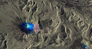
Surface changes of Villarrica from Sentinel-1A
Geospatial World
-
03/06/2015
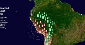
US researchers test smartphones for earthquake warning
Geospatial World
-
04/15/2015
Nepal raises awareness to fight fires through satellite imagery
Geospatial World
-
04/17/2015
Satellite boosts flood prediction in Bangladesh
Geospatial World
-
04/21/2015
Geothermal energy study underway in Oregon
Geospatial World
-
08/06/2015
Red Cross offers interactive tool to track live wildfire information
Geospatial World
-
09/28/2015
Peru using GPS-fitted vultures to check illegal waste dumps
Geospatial World
-
01/20/2016
ESA satellite monitors Australian bushfires
Geospatial World
-
01/27/2016
Jeep Rescue
Geospatial World
-
Successful OGC demonstration launches FEMA Hazard Mapping Framework
Geospatial World
-
06/19/2002
ERS-2 peers into Hurricane Isabel’s heart
Geospatial World
-
09/19/2003
Japanese researchers succeed in detecting quake movement with GPS
Geospatial World
-
12/21/2004
AAG supports and helps rebuild Geography Departments and assist others affected...
Geospatial World
-
09/06/2005
Support for elite force of firefighters
Geospatial World
-
05/22/2008
Taiwan’s National Space Organisation has released satellite images of the Beichuan...
Geospatial World
-
06/04/2008
1
2
3
4
...
40
Page 3 of 40