Home 2024 January

Monthly Archives: January 2024

How Geospatial Technology is Revolutionizing Urban Planning and Development

0
How Geospatial Technology is Revolutionizing Urban Planning and Development

The United States has an urban planning problem. No American city has made the top 10 of the Economist Intelligence Unit’s (EIU) Global Liveability Index. Some of the nation’s most desirable places to live have been moving down the rankings. An excellent case is Los Angeles, dropping from 37th place in the world in 2022 to 57th in 2023.

Even worse, the latest reading recorded the highest average index score for cities in 15 years. The standard of living outside the U.S. is improving while American towns are trending in the opposite direction.

Infrastructure was only one of five metrics the EIU used to assess city liveability. Still, the U.S. could have performed much better over the years had government spending on maintaining roads, bridges, public water, sewage, trains and ports as a fraction of gross domestic product didn’t drop by nearly 53% from 1961 to 2022.

Is there a solution? Aside from government interventions — like the passage of the Infrastructure Investment and Jobs Act — geospatial technology is a critical innovation that can help urban planners fix the situation.

What Are the Major Concerns in Urban Infrastructure?

Government neglect isn’t the only culprit for the country’s crumbling infrastructure. These challenges are also plaguing urban planners:

  • Ballooning population: Even prudent and well-meaning local and state governments with swelling coffers can find difficulties in updating existing and building additional infrastructure due to rapid migration-driven population growth.
  • Worsening traffic congestion: Bottlenecks resulting from mismanaged urban areas ironically slow modernization and development because road closures can prolong commutes for extended periods.
  • Natural disasters: Storms, earthquakes, wildfires and floods impede construction projects.
  • Environmental degradation: Urban planners must keep sustainability in mind, but balancing development and environmental protection can be taxing.
  • Looming climate change effects: Global warming’s threatening consequences put more pressure on updating building standards, designing resilient structures and funding vital projects.
  • Finite resources: Government units, including the richest ones, have limited funds and various expenses. Political priorities may shift after every election when a new administration comes in. Budget cuts can also put off critical infrastructure developments.
  • Unreceptive communities: Residents’ “not in my backyard” attitude in some locations makes effecting essential changes more challenging.

How Geospatial Technology Addresses Urban Infrastructure Issues

Geospatial tools and processes — including remote sensing, GPS, georeferencing, geographic information systems (GIS) and spatial data analysis — are instrumental in revolutionizing urban planning and development. Policymakers have successfully used them in these four ways.

1.   Improving Public Transportation

Portland has leveraged geospatial data to serve citizens better. The government’s PortlandMaps gives the general public access to transportation and street data around the clock to navigate the city more easily.

Transit Tracker uses GPS to track bus locations in real time. It shares many functionalities with Google Maps — such as aerial photos and street view — except it’s more granular. This app lets users search for public amenities, including sidewalks, benches, curb cuts, traffic signals and lighting, and may provide information on road changes and available parking spots.

Even if you’re not a native Portlander, you can use it to leisurely wander through the Beaver State’s largest city as if you’ve known it your whole life.

PDX Bus is another GPS-based app designed to help commuters find stops and know when public transport will arrive.

2.   Identifying Underserved Areas

San Diego uses GIS to create maps to discover economically disadvantaged communities. The city government relies on location intelligence to understand social justice problems, deliver equitable services and inform decisions when planning future developments.

America’s Finest City understands that inequality has a geographic component because some of its poorest communities are linguistically isolated. Geospatial data enables authorities to see the whole picture, zoom in on neglected neighborhoods and prioritize them for investment.

3.   Building Climate-Resilient Structures

Geospatial tech arms urban planners with knowledge of a city’s environmental challenges, telling them which areas merit closer attention. GIS-based data visualizations reveal flood-prone places, localized air quality measurements, transportation networks, green space accessibility and economic hotspots. Geospatial data also helps policymakers grasp a city’s potential for renewable power generation — particularly solar — and urban expansion.

For example, New York City has a treasure trove of geospatial data it intends to use to fund climate resilience efforts and guide its future infrastructure investments. The Big Apple expanded its database using street-level LiDAR, complementing existing borough block lot numbers.

Geospatial data-based insights are critical building blocks for climate-resilient infrastructure projects. The right construction professionals can take them to the next level.

Many developers make the mistake of confusing competent and qualified individuals. The Occupational Safety and Health Administration defines them differently, assigning hazard identification and elimination responsibilities to competent personnel while declaring safety structure design and supervision to fall within the purview of qualified employees.

Therefore, qualified persons must handle geospatial insights while competent workers must be at the job site. This way, you can ensure climate-resilient infrastructure projects finish without delay and budget overruns.

4.   Mitigating Disasters in the City

Geospatial technologies are low-hanging fruit among the latest innovations practical for every stage of disaster management. They can give you eyes from above and help you view urban areas from unique vantage points.

Geospatial data is at the heart of any detailed city maps decision-makers use to develop robust disaster management plans and mitigate crises. Such clear visualizations are game-changing regarding accurately identifying environmental hazards and at-risk areas.

The NASA Disasters Mapping Portal depends on GIS to examine changes on the planet and deliver findings to the public intuitively and digestibly. This tool helped first responders handle simultaneous wildfires across California in 2020. NASA assisted disaster coordinators in pinpointing active fire points, fire modeling, and analyzing smoke plumes and air quality.

Plan Urban Environments Better With Geospatial Tech

Modern, climate-resilient public infrastructure alone doesn’t automatically make a city liveable, but they elevate the standard of living. Fixing America’s cities won’t happen overnight, but geospatial technology will help urban planners improve the status quo slowly but surely.

1Spatial Secures Multi-year Contract to Provide Geospatial Services in Belgium

0
1Spatial Secures Multi-year Contract to Provide Geospatial Services in Belgium

1Spatial, a global leader in Location Master Data Management (LMDM) software and solutions, has secured a three-year contract with a leading Distribution System Operator for electricity and gas networks in Belgium, following a competitive tender.

The contract is for geospatial data processing services and will see 1Spatial’s 1Integrate product used for its unique data quality control and data validation capabilities, alongside 1Spatial’s geospatial data production services.

1Spatial will assist the utility company in the production of a Digital Twin of its distribution network and enhance the quality and accuracy of its geospatial data. The project will enable the utility company to carry out a wide range of activities, including distribution network management, connection works and repairs, in a more efficient, cost-effective manner, ensuring the safety of its team and customers.

The total contract value to 1Spatial is €9.0 million of which 1Spatial will deliver €4.1 million including €0.3 million in term software licence revenue. 1Spatial will utilise partners to deliver the balance of the work, with a total value €4.9 million, over the three-year duration of the contract.

1Spatial CEO, Claire Milverton, said: “This is a great competitive win for 1Spatial, further expanding our presence in Europe. Our new customer will use our unique technology and solutions to produce and improve the quality and accuracy of its geospatial data. This contract win adds to our growing ARR revenues and demonstrates the credentials of our enterprise offering and with the potential for expansion, we are excited to be working with this leading-edge operator.”

Stuart and Deliverect Partner to Enhance Food Delivery Experience

0
Stuart and Deliverect Partner to Enhance Food Delivery Experience

Today, last-mile delivery solutions specialist Stuart has announced a new partnership with operations and order management platform Deliverect. This partnership will help restaurants increase and improve their delivery offering through an integrated platform by connecting Stuart’s leading last-mile delivery platform with Deliverect’s seamless order and operational management technology.

Both organizations have technology at the centre of their business and have worked to make their platforms as user-friendly as possible for restaurant partners. Now, large or small restaurant businesses can access this combined platform to tap into the delivery market.

This new capability will enable businesses to expand their customer base through a robust delivery offering, increasing their overall revenue and helping them navigate slower economic periods. Especially for small restaurant businesses, delivery can significantly grow their business and enable them to weather difficult economic periods.

“Businesses now operate in an increasingly digital-first economy where consumers demand a frictionless order experience,” says Cornelia Raportaru, CEO of Stuart. “This partnership marks a new chapter for both Stuart and Deliverect, uniting the best of Stuart’s expertise in urban logistics and Deliverect’s integrated tech capabilities to improve the digital food ordering experience for both business owners and consumers.”

“As Deliverect continues to revolutionize the restaurant industry, our partnership with Stuart marks a significant stride forward in expanding our ecosystem,” says Joe Heather, Regional GM Northern Europe at Deliverect. “With Deliverect’s Dispatch solution and innovative delivery capabilities from a multitude of partners like Stuart, we are empowering restaurants to manage their own last-mile delivery experience, seamlessly connect with their customers, redefine their delivery experience, and unlock new dimensions of operational efficiency.”

Qualinx Partners With EUSPA to Develop GNSS Receiver

0
Qualinx Partners With EUSPA to Develop GNSS Receiver

Qualinx is partnering with the European Union Agency for the Space Programme (EUSPA) under the Fundamental Elements EU R&D funding mechanism to develop a consumer-grade, low-power GNSS receiver for the agency’s GNSS authentication service.

The free Galileo Open Service Navigation Message Authentication (OSNMA) service is designed to provide a guarantee to users that they are receiving data from Galileo satellites.

It has been introduced in response to a growing number of spoofing incidents from malicious actors, which have disrupted GNSS services. Qualinx secured the project after a 6-month selection process by EUSPA.

Qualinx’s Digital Radio Frequency (DRF) technology converts most of a wireless chip’s analog functions into digital circuits. The DRF functions can then be tailored to each application in software.

Compared with traditional GNSS receivers, the technology boasts 10X power reduction to extend the operating life of battery-powered navigation devices, and smaller, lower-cost packages.

Tom Trill, Qualinx CEO, said, “This partnership with EUSPA is a powerful endorsement of Qualinx’s DRF technology and the benefits it delivers in GNSS applications. Our relationship with EUSPA developed via the European Commission’s CASSINI initiative to support space-related, deep-tech startups. This project is a perfect fit for DRF. It will keep Qualinx at the leading edge of next-generation GNSS technology and we’ll deliver robust, reliable, low-power GNSS receivers for this vital security service.”

On behalf of EUSPA, Fiammetta Diani, head of the Market, Development and Innovation unit added, “Qualinx’s proven core technology and adaptability without significant hardware redesign were a crucial factor for low-powered consumer-grade receivers building on our innovative OSNMA service. We look forward to partnering with them to bolster Galileo’s service resilience for all users.”

True Elements, Carahsoft to Bring Water Intelligence Solutions to Public Sector

0
True Elements, Carahsoft to Bring Water Intelligence Solutions to Public Sector

True Elements announced a partnership under which, Carahsoft will serve as True Elements’ Master Government Aggregator, making the company’s Water Intelligence SaaS solutions and data sets available to the Public Sector.

This will be enabled through Carahsoft’s reseller partners and NASA Solutions for Enterprise-Wide Procurement (SEWP) V, National Cooperative Purchasing Alliance (NCPA) and OMNIA Partners contracts.

“The partnership with Carahsoft will provide Water Intelligence to Public Sector agencies, enabling them to better understand current water challenges and effectively prepare for a very different water future,” said Kim Patrick Kobza, CEO of True Elements.

“The key is to provide agencies with dynamic workflow solutions that are cost effective and easy to procure so they can succeed in assessing the present and forecasting the future. With Carahsoft as a partner, we can accomplish our mission to ensure all agencies have the best decision support available when responding to rapidly changing climate conditions.”

True Elements’ SaaS solutions and data sets quickly and easily provide Public Sector leaders with in-depth insights necessary to address water challenges at the local, regional, and national levels.

Water Intelligence is a unique combination of state-of-the-art technology, scientific analysis, and AI capabilities that continuously aggregates, synthesizes, and transforms expansive amounts of complex water data into easily understandable, increasingly precise analyses and forecasts via scores and visualizations.

These analyses and forecasts produce deep, clear insights that help decision-makers better understand water resources to make fully informed decisions about how to manage and optimize resources.

Changing weather patterns are creating climate crises across the globe. Ninety percent of those crises are experienced through water.

True Elements’ SaaS solutions and data sets quickly and easily provide Public Sector leaders with in-depth insights necessary for fully informed, confident decision-making to address water challenges at the local, regional, and national levels.

Insights into current water quality and quantity challenges (pollution, demographic considerations, etc.) as well as future disruptive events or long-term changes to water resources (drought, sea level rise, flood risk, etc.) help Government leaders make the strategic decisions necessary to ensure their organizations, assets, operations, and communities can adapt and thrive in a climate with rapidly changing hydrologic cycles.

True Elements’ Water Intelligence platform easily, efficiently, and cost-effectively delivers the understanding decision makers need with color-coded scores and visualizations.

“The Public Sector is currently facing water-related challenges that are expected to increase in number and severity if left unaddressed,” said Harjeet Khalsa, Sales Director, Google ISV Ecosystem at Carahsoft.

“Through collaboration with our reseller partners and the addition of True Elements’ Water Intelligence solutions to our offerings, Government agencies are empowered to procure the resources necessary to proactively address existing water related challenges and work toward a water-resilient future.”

True Elements, integrated within Google Cloud Marketplace, is now available through Carahsoft and Google’s partner ecosystem.

This collaboration simplifies procurement for Government agencies, granting seamless access to their Water Intelligence solutions powered by Google’s robust infrastructure, ensuring efficient decision-making tools for addressing water challenges.

Geospatial Critical to Solve Dire Global South Issues

Geospatial Critical to Solve Dire Global South Issues

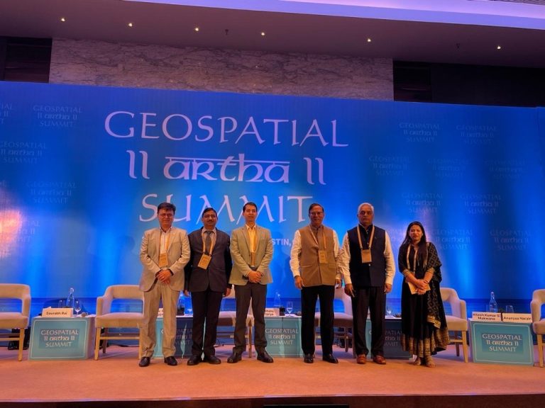
Amitabh Kant, Former CEO of NITI Aayog and India’s G20 Sherpa delivered special address at the Geospatial Artha Summit 2024.

Connected Construction for Enhanced Asset Monitoring

0
Connected Construction for Enhanced Asset Monitoring

Infrastructure is a crucial pillar of connectivity, inclusion, and economic growth. Though the sector has been traditionally perceived to be inertial to tech adoption, now digital workflows and processes are reinventing it, making connected construction an imperative.

In the words of Shri Nitin Gadkari, Minister of Road Transport and Highways, “Digital technology and infrastructure is a vital subject, not only for rural sector but for roads, power projects, and all sorts of things. Digital technologies are crucial for reducing the cost and improving the quality”.

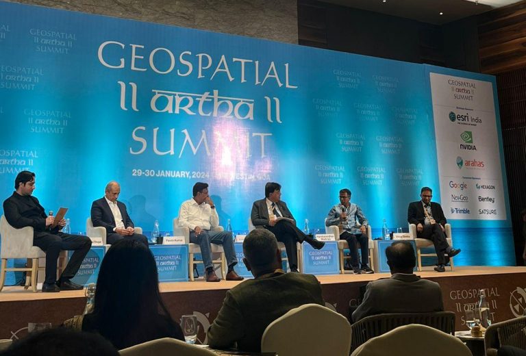
At the second day of Geospatial Artha Summit 2024 light was shed on the crucial aspect of connected construction.

“Connected construction has become indispensable today”, said Sekh Samim, Deputy Chief Architect/Business Development, DMRC (Delhi Metro Rail Corporation Ltd).

“Modular construction saves time as well as money. For major infra projects, this is a big factor”, he added.

Better Monitoring

“Connected construction requires a common data environment. Large construction projects have multiple stakeholders, so they all require information in a near real-time manner with minimal lags and delays”, stated Abhay Kimmatkar, Managing Director, Ceinsys.

Dr. Bhargav Dave, Founder & CEO, Visilean, stated that connected construction is vital for everything from asset monitoring to project lifecycle management.

“There’s a need to connect the projects vertically as well horizontally. We are also looking at open architecture project”, said Sunil MK, Director, Business Development, Bentley Systems.

Shantanu Phalnikar, General Manager (Arch), Airport Authority of India, emphasized on the need of BIM and connected infra to ensure timely and reliable monitoring.

Location Intelligence Key BFSI Metric

Location Intelligence Key BFSI Metric

India is among the fast-growing Fintech markets globally. At USD 31 billion, it is the world’s third-largest and is expected to cross the 50 billion dollar mark by 2025.

Digital payments play a big role in the widespread reach of Fintech in India. Geospatial data and location intelligence is critical for the dynamic BFSI sector in India.

Fast connectivity and precise analytics are going to be game-changers in this sector, further expanding its reach as well as market size.

Tech-Led Growth

“The next big wave in Indian FinTech is Big Data with Machine Learning and AI. These are the key metrics that will drive future growth”, says Pankaj Bansal, Chief Business Officer, Bank Bazaar.

India’s Fintech story in the recent time is revolving around government impetus, be it India stack, UPI, or ONDC. The best part is that it is not limited by any regulations, which ensures reach down to the last mile”, believes Jagdish Narayanan, a BFSI expert.

“In financial services, technology is crucial. For instance, in the insurance sector earlier underwriting was done manually. While now it is getting digitalized very fast”, states Sumit Singh, Vice President, PayTm Payments Bank.

“Data co-relation with geography is an important parameter to devise innovative solutions. Super imagery resolution using Generative AI is another use-case”, argues Dhruva Rajan, ex-Founder, GeoSpoc.

Enhanced Security

Ashish Agrawal, President and Head Agri Business, Bajaj Allianz General Insurance, says that during underwriting, geospatial is of great help. Geographic data about say weather forecast is crucial for insurance plans and premium. It also helps to detect frauds and strengthening security.

“The entire KYC (Know Your Customer) process is now conducted online, with every transaction water-marked and time-stamped, ensuring security.  Geospatial information is crucial for tracking and monitoring transactions, making them more secure”, Narayanan adds.

OpenAI and Common Sense Media Partner on AI Guidelines and Education

0
OpenAI and Common Sense Media Partner on AI Guidelines and Education

On January 29, 2024, OpenAI, the research and development company behind the popular ChatGPT language model, announced a partnership with Common Sense Media, a non-profit organization focused on digital media and technology for children and families. The goal of this collaboration is to address AI safety concerns, particularly for young users.

The initial focus will be on developing AI guidelines and educational materials for teenagers, parents, and educators. This includes resources to help them understand the potential benefits and risks of AI, and how to use these tools responsibly.

Why is this important?

As AI technology becomes more prevalent, concerns about its potential negative impacts, particularly on children, are growing. This collaboration addresses these concerns directly by providing educational resources and promoting responsible AI development.

This partnership reflects a growing recognition of the need for collaboration between AI developers, educators, and organizations focused on child safety to ensure that AI technology is developed and used responsibly.

It’s important to note that this is a recent development, and the specific details of the guidelines and educational materials are still being developed. However, this partnership represents a positive step towards addressing AI safety concerns and promoting responsible AI development.

Collaborative Efforts Key for Geospatial Infrastructure

Collaborative Efforts Key for Geospatial Infrastructure


The opening session on the 2nd day at the Geospatial Artha Summit focused on the theme of “National Geospatial Infrastructure through Public-Private Partnerships.” Here’s a deep dive into the key insights and perspectives shared by leading figures in the field.

Dr K Sreenivas, the Deputy Director at the National Remote Sensing Centre, highlighted the crucial role of academia in the national geospatial infrastructure.

“The integration of educational institutions with industry players is not just beneficial but necessary for the advancement of geospatial technology. This collaboration can provide a fertile ground for innovation and practical application of academic research in real-world scenarios,” he said.

SK Sinha, Additional SG of the Survey of India, emphasized the importance of collaboration in implementing geospatial infrastructure effectively. He outlined the need for multifaceted partnerships, encompassing government-to-government (G2G), government-to-private (G2P), and private-to-private (P2P) collaborations.

“These partnerships are instrumental in leveraging the strengths of each sector to achieve a common goal,” he emphasised.

Learning through Global Practices

Sajid Malik, Chairman & Managing Director at Genesys International Corporation, urged the audience to consider successful global geospatial models. He discussed the potential of public-private partnerships in bridging the gap between public needs and government capabilities. Malik’s insights into Genesys’ projects, like the digital twin cities of Ayodhya and Dharavi, served as practical examples of what these collaborations can achieve.

Milind Wadodkar, the Chief Soil Survey Officer at Soil & Land Use Survey of India, delved into the complexities of the geospatial database, particularly regarding urban features. He stressed the need for optimizing the utilization of resources from both the public and private sectors to manage these vast databases effectively.

Transformative Strategies

Sameer Datar, State Information Officer at NIC, raised crucial points about the readiness and transformation of government datasets. He called for innovative solutions to integrate and accurately interpret extensive land records, highlighting the necessity of collaboration for effective data management.

Vijay Kumar, Senior Vice President and CTO at Esri India presented a strategic framework for geospatial success. He identified four key pillars: findable data, interoperable technology, collaborative efforts, and the application of geospatial solutions to solve real-world problems. His emphasis on capacity building and awareness underscored the holistic approach needed for success in this field.

Ramakrishnan Ramamurthy, Principal Advisor at Geokno, reflected on the evolution of public-private partnerships in the geospatial sector. He illustrated this evolution through the example of Bombay Airport and highlighted the transformative potential of PPPs in creating market opportunities and impacting communities positively.

Policy and Infrastructure Development

Pankaj Gupta, Director of Sales at Hexagon GeoSystems, expressed satisfaction with the current geospatial policy and discussed the ongoing developments in infrastructure. He emphasized the importance of consistent, quality-controlled data collection for the future of geospatial technology.

Dr K Sreenivas reiterated the importance of Intercoordination in site selection and the evolving role of government in owning geospatial infrastructure. He used the partnership of Genesys as a model for future collaborations, emphasizing the vital role of geodetic and knowledge infrastructure.

The session provided a panoramic view of the current state and future possibilities of the geospatial sector showcasing the power of public-private partnerships and potentially charting a course for future innovations and collaborations.

GSIS Honors Prof. John van Genderen’s Birthday with Special Issue on Remote Sensing

0
GSIS Honors Prof. John van Genderen’s Birthday with Special Issue on Remote Sensing

In honour of the 80th birthday celebration of GSIS Associate Editor, Professor John van Genderen, ITC, the Netherlands, Geo-spatial Information Science (GSIS) is welcoming submissions to a special issue on Remote sensing: past, present and future trends.

Prof. van Genderen has been a leader in the remote sensing field for over 50 years. His research has covered image processing, image and data fusion, SAR interferometry and signal processing.

This special issue will be a look back at the progress made in remote sensing over the last fifty years, the current state of remote sensing and related topics as well as looking at the future of remote sensing.

Submissions are open to original research papers or review articles on any topic. However, here is a list of potential topics to choose from:

  • History of remote sensing
  • New applications of remote sensing
  • Digital urban twins
  • New developments in image and data fusion
  • SAR Interferometry
  • The influence of AI in remote sensing
  • The role of location intelligence
  • The contribution of Big Data to remote sensing analysis
  • The role of drones in field verification

The deadline for submission of full paper is 1st August 2024, deadline for finalized manuscripts is 31st October, 2024, and the special issue will be published on the first quarter of 2025.

The Guest editor for this issue is Dr. Christine Pohl, Project Leader Urban Digital Twin Wuppertal, Division Surveying, Cadastre and Geo Data, Wuppertal, Germany.

All submissions should be made through the Taylor & Francis Submission Portal at https://rp.tandfonline.com/submission/create?journalCode=tgsi.

Geospatial Artha Leadership Awards Recognize Excellency in the Industry

0
Geospatial Artha Leadership Awards Recognize Excellency in the Industry

The Geospatial Artha Summit, held today in the picturesque setting of Goa, witnessed the grand celebration of the Geospatial Artha Business Leadership Awards, recognizing exemplary contributions in the geospatial industry.

The awards night, graced by the presence of esteemed guests, including Mr. Amitabh Kant, G20 Sherpa & Former CEO, NITI Aayog was an evening dedicated to honoring pioneers, innovators, and leaders who have significantly advanced technology, innovation, and societal progress.

Last-Mile Delivery: Delhivery

The award for Outstanding Last-Mile Delivery Channels in India was bestowed upon Delhivery for its exceptional coverage and leadership in India’s supply chain and logistics. Mr. Prashant Parashar, Senior Vice President & Head-Technology at Delhivery, received the honor for the company’s remarkable achievements.

Geospatial Excellence in Water Utility: Bioxgreen and BMC

Bioxgreen and BMC were honored for their outstanding contributions to the bio-remediation treatment of wastewater in the Mumbai region under the category of Geospatial Excellence in Water Utility. J Venketesh, COO of Bioxgreen, and Dr. Ajit V Salvi, Deputy Engineer from BMC, received the well-deserved recognition.

Policy Implementation: National Remote Sensing Centre (NRSC)

The award for Policy Implementation was presented to the National Remote Sensing Centre (NRSC) for standardizing norms in the industry and continuous improvements in observing/imaging capabilities. Dr. K. Sreenivas, Deputy Director of NRSC, received the honor for the outstanding achievements.

Start-up of the Year: Skyserve

Skyserve, an Insights-as-a-Service platform, was recognized as the Start-up of the Year for its commitment to satellite-based edge-computed insights. Vinay Simha, CEO of Skyserve, accepted the well-deserved honor.

Emerging Company of the Year: Suhora

Suhora, a pioneering tech startup at the intersection of spatial science, earth data, and artificial intelligence, received the Emerging Company of the Year award. Krishanu Acharya, CEO of Suhora, was congratulated for the well-deserved recognition.

Solutions Company of the Year: NeoGeoInfo Technologies Pvt. Ltd.

NeoGeoInfo Technologies Pvt. Ltd. was honored as the Solutions Company of the Year for its exceptional 15-year contribution to geospatial services. Sreeramam GV, CEO of NeoGeoInfo Technologies Pvt. Ltd., accepted the recognition.

Geospatial Company of the Year: RMSI

RMSI received the Geospatial Company of the Year award for its remarkable contributions to the nation’s development through innovative geospatial solutions. Anup Jindal, representing RMSI, accepted the prestigious award.

Geospatial Business Leader of the Year: Rohan Verma, MapmyIndia

Geospatial Business Leader of the Year, was presented to Rakesh Verma, CEO of MapmyIndia. Mr. Verma’s exceptional leadership in technology innovation, productization, and commercialization within the geospatial industry set an inspiring standard.

Space, Geospatial Convergence for Future Growth

Space, Geospatial Convergence for Future Growth

History of civilization is the story of mapping evolution, from papyrus to the forthcoming era of HD maps. The power of maps spells our choices, constraints, and lays down pathways.

“First maps came into existence when sketches were geographically referenced”, says Hitesh Makwana, Surveyor General, Survey of India (SOI).

With the advent of digitalization and increasing private sector participation, map-making and geodata management have transformed as well. This has led to increasing democratization of cartographic information, as well as SOI devolving many of its traditional roles and supporting the fledgling private sector.

“With the maturity of the private sector, gradually SOI will scale down from many areas. However, we will continue the modernization of geodetic data, and offer ortho-rectified imagery, and digital elevation models”

“Agility and giving opportunities to the private sector is important these days. 30,000 manpower we have reduced to 3,000”

Conducive Policy

The Surveyor General believes that new opportunities are coming up in the geospatial sector, especially after the National Geospatial Policy,

“Geospatial policy has liberated us from many archaic colonial era norms”, says Rakesh Varma, CEO, MapyINDIA.

“While the government is spending money on geospatial, there’s a need to support products and platforms mainly by MSMEs. GDPDC and Survey of India can work with the government for a hand-holding mechanism”, he adds.

While the policy is in the right direction there’s a need for a feedback loop, says Krishanu Acharya, CEO, Suhora.

He believes that Indian companies should not be restricted but allowed to venture overseas as well.

Global Push

Rakesh Varma believes that if proper hand-holding and support is provided to Indian geospatial companies they have the potential to become truly global MNCs.

“We collaborate with the National Remote Sensing Centre( NRSC). NASA satellite imagery, analyzed by NRSC and downloaded by us. This is an example of global collaboration”, says Anoop Singh, Director General, the Forest Survey of India

Problem-Solving Approach

There’s a need to be more people-centric to foster greater collaborations and look at newer opportunities.

Dr. SP Agarwal, Director, North East Space Application Centre, thinks out loud on the use-cases of geospatial across sectors to solve problems afflicting the citizens.

He cites the example of traffic congestion in Aizwal, Mizoram, and explores how we can look into how geospatial to solve it.

System Integrators

“Space, geospatial, and drones all need to be thought out together as real-life use cases. We need to push the pedal towards achieving a 5 trillion dollar economy”, states Saurabh Rai, CEO, Arahas Technologies.

He also emphasized the need to develop local system integrators in India and gain more investor confidence.

“Discourse has shifted from data piracy to data privacy, data security to data democratization. With these, there is no dearth of new funding, but we need to showcase the value of what we are doing”, he adds.

Geospatial Intelligence to Optimize Last-Mile Delivery

0
Geospatial Intelligence to Optimize Last-Mile Delivery

Last-mile delivery has been a contested field with frail optimization and a longing for accurate distribution. Through geospatial, most inaccuracies of last-mile are resolved, providing enhanced value for the entire supply chain.

Geospatial Artha Summit 2024’s session on “Optimizing Last Mile Delivery with Geospatial Intelligence” brought together industry leaders who provided comprehensive insights into the challenges and innovations in the field.

Moderated by Dhruva Rajan, Entrepreneur and Ex-Founder, GeoSpoc, the panel exchanged thought-provoking, solution-oriented last-mile delivery retorts.

Enhancing Efficiency

Prashant Parashar, Senior Vice President and Head of Technology at Delhivery spoke about the implementation of deep learning techniques to enhance the efficiency of last-mile delivery.

He raised crucial points about the significance of public information and also stressed the need for accessible public data through APIs, envisioning it as a valuable resource to enhance optimization strategies.

Meanwhile, Lakshmi Narasimhan, Head of Uber Maps India, highlighted the importance of predicting optimal routes among the fleet of vehicles and highlighted the need for predictive analysis to assist vehicle drivers.

He also emphasized the critical role of indoor maps in providing precise directions, especially in complex environments. “Building an intelligent system capable of suggesting the most efficient walk points for riders is crucial for enhancing the overall capability and optimization of routes,” Lakshmi said.

“The integration of augmented reality and algorithms also extended to assisting drivers in locating amenities like restrooms, tailored to individual preferences and optimizing routes based on driver profiles,” he added.

Agro Productivity 

Bringing the agriculture sector into the discussion, Sidharth Sinha, Geo and Climate Policy Lead of Google India said, “Geospatial technology could significantly contribute to improving the productivity of farmers.”

He discussed the positive outcomes of geospatial policy reforms and their impact on optimizing supply chains while reflecting on the private sector’s perpetual challenge of balancing sustainability with profitability.

Talking about Google’s Project Green Light he said, “This project, utilizing AI and Google Maps, aims to model traffic patterns globally, offering intelligent recommendations to city traffic engineers for optimizing traffic flow.”

Challenges

Ashwanii Rawat, Director-Project Management of Precisely delved into the persisting challenges faced by last-mile delivery companies, expressing concerns about profitability.

“Despite the availability of cutting-edge technologies, the lack of sufficient data in the country is hindering effective optimization,” he said.

He further proposed the development of a fabric system to map addressable units, aiming to enhance the cost-effectiveness of last-mile delivery.

Frontier Tech to Transform Geospatial Landscape

Frontier Tech to Transform Geospatial Landscape

The session held at the Geospatial Artha Summit, 2024 titled “Frontier Technologies: Expanding Market Value Chain of Indian Geospatial Industry,” proved to be a crucible of innovative ideas and insights on frontier technologies reshaping the landscape of the Indian geospatial industry.

Frontier technologies in this era include advanced technologies like AI, IoT, big data analytics, and blockchain. These technologies, when integrated with geospatial tools, enhance the capacity for data processing, real-time analysis, and predictive modeling.

Ongoing Evolution

“We inhabit an era of ‘creative destruction’, unanticipated disruptions, and fast-paced transformations, leading to newer alignments and synergies between geospatial and frontier technologies”, said Aditya Chaturvedi, Deputy Executive Editor, Geospatial World.

Vinay Simha, CEO, Skyserve, explored the impact of technologies like AI, IoT, cloud computing, digital twins, and the metaverse on geospatial operations.

These tools, he argued, are revolutionizing the management, distribution, and dissemination of geospatial data. A particular emphasis was placed on the use of AI and Machine Learning (ML) for driving effective actions and decisions.

Harsha Madiraju,

Dr. Vishnu Chandra from the Ministry of Panchayati Raj discussed the evolution of geospatial ecosystems since the early 1990s. His talk focused on how technologies such as geoAI, 5G, and edge computing are being seamlessly integrated into geospatial workflows. This integration is crucial for addressing various challenges, ranging from data capture to regulatory aspects.

Driving Value

Vishal Dhupar, Managing Director, NVIDIA South Asia, emphasized Earth’s economic value and the urgent need for sustainable computing practices. He underlined the importance of accelerating computing processes to better understand and address complex global issues.

Dhupar highlighted AI’s role in making computing more accessible and efficient, presenting India with an opportunity to become the “back office of the world” in this arena.

AI and ML algorithms can be used to optimize data centre operations, one of the most significant energy consumers in the IT industry. These algorithms can predict and manage workloads, thereby reducing unnecessary energy consumption.

For instance, Google uses DeepMind’s AI to optimize energy usage in its data centres, achieving significant reductions in cooling energy usage.

Pavan Kumar,  Senior Vice President, Global Indirect Business, Altair Engineering, shared insights on how to leverage AI and ML in mechanical simulation computing.

He stressed the importance of learning from proven data, particularly in the geospatial sector where trends are increasingly pointing towards the cross-integration of IoT and geospatial data.

The convergence of these technologies also presents unique challenges, particularly in terms of data management, privacy, and regulatory compliance.

Europe’s Leading Airline Takes off with Iris Using Satellite Technology

0
Europe’s Leading Airline Takes off with Iris Using Satellite Technology
Image courtesy of John Ballantyne.

easyJet has taken to the skies as the first airline partner of the ground-breaking Iris programme, an initiative led by the European Space Agency (ESA) and global communications company Viasat, which is using the latest generation of satellite technology to help modernize air traffic management (ATM).

The EASA-certified Iris service provider ESSP has involved 15 leading Air Navigation Service Providers (ANSPs) in support of the first commercial flights taking place across Europe this year – with up to 11 easyJet Airbus A320neo aircraft taking part. This initiative is a European first in putting the Single European Skies initiative into action.

Through the use of Iris, easyJet  will be able to operate its aircraft as efficiently as possible to achieve further fuel burn improvements and emissions reductions. More broadly, the programme will be a key component in helping deliver airspace modernization across the industry.

Airspace modernization and subsequent gains in efficiencies is one crucial element in the airline industry’s path to net zero. In 2022, easyJet announced its interim science-based carbon reduction target – 35% carbon emissions intensity improvement by FY2035, on a FY2020 baseline. This came as part of the airline’s commitment to achieve net-zero carbon emissions by 2050.

More efficient use of airspace is crucial for aviation to reduce emissions, as it is the most achievable source of carbon reductions right now. This is because more direct flight paths lead to shorter flying times, and thus use less fuel burn and generate fewer emissions.  Achieving this will be critical to reaching the Single European Sky’s ATM Research (SESAR) ambition to deliver 10% carbon emissions savings from European aviation.

Iris represents an important technology evolution, delivering faster and more reliable satellite communications between the aircraft and the ground. This will help air traffic controllers and pilots to achieve further operational efficiencies, by calculating the shortest available routes, cruising at optimum altitudes, and using continuous climb and descent paths.

ESA has led and funded Iris with the aim of supporting the European Policy on Single European Skies through a solution that has full European coverage and is based on state of the art, highly secure, satellite communication mobile technologies. This has been carried out by ESA in full coordination with European aviation stakeholders, including the International Civil Aviation Organisation (ICAO), to ensure Iris is fully compliant with European and worldwide aviation needs and requirements. In order to achieve this goal ESA has set up a European industrial consortium of more than twenty companies, with Viasat (which recently acquired Inmarsat) as prime contractor.

Powered by Viasat’s award-winning SwiftBroadband-Safety (SB-S) connectivity platform, Iris paves the way for multilink data link communications – a cornerstone to implementing new ATM functionalities.

Offered as a fully developed and certified capability by Airbus on the A320 andA330 series aircraft, Iris shares trajectory and intent-based operational information, allowing airlines to avoid holding patterns, calculate the shortest available routes and optimum altitudes, and benefit from continuous climb and descent pathways.

Hugh McConnellogue, Director of Operations & Navigation at easyJet said, “More efficient use of airspace is a critical way we can tackle the industry’s emissions right now. Adopting Iris technology on these aircraft will enable easyJet to fly more directly and efficiently, thereby reducing carbon emissions as well as enhancing our on time performance – which in turn improves our customers’ experiences.

“We’re thrilled to be paving the way in this area whilst working towards our goal to achieve our net-zero ambitions by 2050, as outlined in our roadmap.”

Charlotte Neyret, Chief Executive Officer, ESSP, said, “These first commercial flights are bringing to reality a decade of both vision and investment in this new datalink communication solution to achieve safer and greener aviation. ESSP is delighted to operate this moment of synchronization between all stakeholders, from industry to airlines, with the proactive contribution of numerous Air Navigation Service Providers. Thanks to all partners, ESSP is proud to provide Iris Satcom datalink service to Europe, as well as to initiate the Iris flights with a key airline such as easyJet. Iris technology allows the development of new environmentally friendly routes, which will improve ATC management, reduce fuel costs and lead to the deployment of more efficient air operations.”

Javier Benedicto, acting Director of Connectivity and Secure Communications, ESA, said, “These first Iris commercial flights put Europe firmly at the forefront of the digitalisation and modernisation of Air Traffic Management. Iris enables tangible benefits to the commercial aviation community and society at large, including reduced emissions of carbon dioxide and fewer delays for passengers through more efficient flight paths.

“As a follow on of Iris, Iris global, which was launched in 2022, aims to extend the benefit of Iris beyond Europe. This will be achieved through geographical expansion, including Asia, the USA, the Middle East and Australia, and through service expansions by adding new ICAO aviation standards  as well as new satellite-based communication solutions for supporting future air traffic management of Remotely Piloted Aircraft Systems. We are very proud to share this historic milestone for commercial aviation with the ESA Member States that have funded Iris activities and that will continue to support it in the future.”

Joel Klooster, SVP Flight Safety and Advanced Air Mobility (AAM), Viasat, said: “We are thrilled to see Iris flying with a leading airline such as easyJet, a crucial step on our pathway to reducing emissions and easing congestion in European skies. We want to thank all the partners who played a part in achieving this long-term goal, and we look forward to seeing the results of these first commercial flights. Even more than that, we look ahead to the industry reaping the rewards of this innovation well into the future – and to passengers and airlines alike benefitting immensely.”

In 2022, Viasat and ESA signed a new contract to globalize its Iris programme. Iris Global will focus on the technologies and certification required to share the fuel, CO2, and congestion-saving benefits of Iris with regions beyond Europe, and such developments are already well underway.

India as the Next Global Geospatial Hub?

India as the Next Global Geospatial Hub?

Since the Y2K, India has carved a reputation as a reliable hub for IT (Information Technology) services offshoring. What’s less noticed, but equally storied, is the three-decade footprint of geospatial outsourcing.

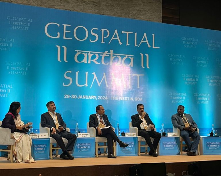
“India always held the lion’s-share of geospatial outsourcing. Some of the biggest players have been there for the past 30 years, says Ramesh Ananth Krishnan, CEO, DSM Soft.

“India has been conducive to outsourcing due to technical expertise.  Future is going to hold a great potential as well”.

From Services to Solutions

The road ahead for geospatial looks equally promising amidst market shifts, technology evolution, and on-demand solutions.

Across verticals, there is a demand for customized solutions to specific problems. This has led to a paradigm shift in the realm of geospatial. However, there’s a need for qualitative upskilling as well as navigating newer opportunities.

“Integration of spatial analytics and AI offers new opportunities. Though there is need to take feedback from customers, as well work towards newer revenue models such as licensing, Saas”, says PV Rai, MD, Pixel Softek.

Pitfalls and Opportunities

Krishnan believes that while globalization has lost some of its sheen, there is a lot of scope. Local language is also a hindrance in many markets.

Domain expertise and data acquisition capabilities are two things that India lacks”, he adds.

“There is a lot of growth potential in geospatial across different sectors. While there are lots of apps, GIS is playing a key role in route optimization. A lot other future-ready would be coming up”, says Vattem Narendra Babu, CEO, iSpatial Techno Solutions.

There’s a need to define priority areas and set goals.

Government Support

To venture into uncharted territories and expand trade outreach, there is a need to network, deliberate, and expand outreach. The Indian government is quite proactive in this regard.

“There are commercial officers in all Indian missions abroad to help Indian industries to find market opportunities abroad”, states Dr. Mahaveer Singhvi, Joint Secretary, Ministry of External Affairs, Government of India.

Baidu AI Cloud Partners with Samsung Electronics China

0
Baidu AI Cloud Partners with Samsung Electronics China

Samsung Electronics China and Baidu AI Cloud announced a strategic partnership on AI ecosystems, co-creating a transformative AI experience for Samsung’s latest flagship smartphone, the Galaxy S24 Series, utilizing the advanced AI capabilities of Baidu’s ERNIE foundation model.

The deep integration of ERNIE into Galaxy AI, Samsung’s latest mobile AI product, equips the S24 Series with enhanced functionalities including intelligent summarization, advanced typesetting, and real-time call translation.

Baidu AI Cloud and Samsung Electronics China Announce Strategic Partnership

Now featuring ERNIE’s understanding and generation capabilities, the upgraded Samsung Note Assistant can translate content and also summarize lengthy content into clear, intelligently organized formats at the click of a button, streamlining the organization of extensive text.

The S24 Series’ onboard AI can now transcribe speech into text in real-time, differentiate between speakers, and support multi-language translation and meeting minutes generation. It enhances efficiency in cross-language communication and office work.

The innovative “Circle to Search” Feature in the S24 series allows users to perform intuitive searches on texts, images, or videos through simple hand gestures, providing quick and precise results from Baidu Search.

Chen Yifan, Vice President of Baidu, stated that the applications of ERNIE Bot will become increasingly rich and diverse in the future. With its profound capability to process multimodal data such as text, images, audio and video, and its precise ability to tap into the personalized needs of users, ERNIE is poised to develop a range of AI products that resonate with individual user needs.

Samsung Galaxy S24 Series

In October of last year, Baidu launched ERNIE 4.0, the company’s most advanced and powerful foundation model to date, significantly boosting core AI capabilities in understanding, generation, reasoning, and memory. ERNIE Bot has garnered over 100 million users.

Baidu AI Cloud also streamlines AI-native application development with its ModelBuilder and AppBuilder, offering tools for easy customization of fine-tuned models and lowering development barriers.

Global market intelligence firm IDC forecasts that by 2024, “over 70% of devices in the Chinese market will feature AI functionality, and AI devices will constitute 55% of the market.”

Lavender Farms in J&K Spearhead India’s Agritech Surge, Says Union Minister

0
Lavender Farms in J&K Spearhead India’s Agritech Surge, Says Union Minister

Jammu and Kashmir is emerging as an agri start-up hub, said Union Minister of State (Independent Charge) Science & Technology; MoS PMO, Personnel, Public Grievances, Pensions, Atomic Energy and Space, Dr Jitendra Singh.

Dr Jitendra Singh said the Republic Day tableau at Kartavya Path depicting lavender farms of Bhaderwah is a testimony of J&K being nationally hailed as the birthplace of the “Purple Revolution” which is now being emulated in other Himalayan States like Uttarakhand and Himachal Pradesh as well as Nagaland.

He said the foundation of this Agri StartUp hub has been laid in the picturesque Bhaderwah town of district Doda in Jammu and Kashmir, where cultivation of lavender has been taken up on a large scale.

He recalled that Prime Minister Shri Narendra Modi had in detail explained this success story in farming from district Doda, J&K in his “ Mann Ki Baat” broadcast and told the listeners about the small town of Bhaderwah where this experiment had been carried out as Aroma Mission by Ministry of Science & Technology, Govt of India.

This endeavour provides  India an alternate source to propel its economy, Dr Singh stated.

Over 3,000 flourishing lavender entrepreneurs from Bhaderwah have shown the youth of India a new and lucrative avenue of StartUp through agriculture which is an exclusive domain of this country and will contribute value addition to India’s future economic growth and realisation of PM Modi’s vision of “Viksit Bharat” by 2047, he said.

Addressing a Kisan Sammelan organised by CSIR-Indian Institute of Integrative Medicine in Hiranagar, Kathua today, the Union Minister expressed delight at the recent depiction of lavender farms of Bhaderwah through a tableau on Kartavya Path in the national capital on the occasion of the Republic Day. Counting it as a success story, Dr Singh said that drawing inspiration from the Aroma Mission, the States of Himachal Pradesh, Uttarakhand and Nagaland have now started cultivation of lavender.

The Minister informed that more than three thousand youth of J&K are engaged in this mission which has emerged as an avenue of self-employment as these youngsters are earning in lakhs.

Dr Singh underscored that this has been achieved due to the personal efforts of Prime Minister, Shri Narendra Modi, and the government’s measures to provide all possible support, be it imparting training to the youth or ensuring industry linkages for lavender products or provision of other necessary logistical aid, to spur this revolution. Lavender-made products are sold in thousands in States like Maharashtra, fetching rich revenue for the producers, he informed.

The Minister recalled that it was Prime Minister Modi who gave a clarion call to Startup India, Stand Up India from the ramparts of the historic Red Fort. Following the Prime Minister’s call, people joined the movement. As a result, the number of start-ups has now gone past 1.25 lakh from a mere 350 existing at the time, thereby placing India at number three spot in this field in the world, Dr Singh informed.

The Union Minister urged the youth to join the agri start-up ecosystem so that they can contribute to making value addition to the economy, and help in realising the national goal of making India a number one economy in the next 25 years of Amrit Kaal.

Calling for action, Dr Singh said the areas that are either unexplored or under-explored hold the potential of making value addition to the economy, adding that the role of Jammu and Kashmir- pioneered purple revolution will be of critical importance to make India a developed nation by 2047.

Talking about the measures taken for the safety and security of residents of border areas in Jammu and Kashmir, especially Kathua, the Union Minister informed that bunkers have been constructed for them so that they can take shelter from unprovoked firing from across the border. Earlier, these residents were left to fend for themselves. They would take shelter either in their relatives’ places or in the panchayat, he rued. Similarly, road connectivity has been improved in remote areas for ease of travel, Dr Singh added.

Woolpert Acquires Florida-Based Architecture Firm

0
Woolpert Acquires Florida-Based Architecture Firm
The combination of Woolpert and Bermello Ajamil & Partners creates an ecosystem of integrated maritime solutions that leverages architecture, marine engineering, modeling, strategic consulting, and geospatial services.

Woolpert has acquired Bermello Ajamil & Partners (BA), a full-service architecture, engineering, planning, and landscape architecture firm that specializes in services for the maritime, aviation, health care, commercial, and municipal markets.

Among the largest AE firms in South Florida, BA has more than 160 staff members, is headquartered in Miami, has additional offices throughout Florida, and has an office in New York.

BA has grown through a 30-year partnership between the Chairman of the Board and Principal in Charge Willy Bermello and President and CEO Luis Ajamil, a planner and professional engineer known for his expertise in the maritime industry.

Bermello and Ajamil came together through a shared goal to meet client needs by integrating innovative design and technologies to produce functional, intelligent, and sustainable solutions. This partnership has yielded more than 200 awards for design excellence and project wins across six continents.

BA is known internationally for the planning and design of cruise line and port terminals. The combination of Woolpert and BA creates an ecosystem of integrated maritime solutions that leverages architecture, marine engineering, modeling, strategic consulting, and geospatial services.

These include acquiring topographic, bathymetric, and hydrographic data and imagery along coastlines and the near-shore environment.

Bermello said BA chose to join Woolpert to deepen its AE services and to successfully tap into new and adjacent industries with Woolpert’s geospatial and strategic consulting capabilities.

“Woolpert provides BA with the opportunity to expand and integrate technologies across markets, accelerate our growth in geospatial technologies and artificial intelligence, increase our geographic footprint, and enrich what our talented staff can provide our clients,” Bermello said.

“Together with Woolpert, we will be able to develop and deliver comprehensive and potentially trailblazing services to coastal zones worldwide. Additionally, the combination will allow us to accelerate the growth of our aviation, health care, commercial, and municipal markets.”

Woolpert Vice President and Buildings Sector Leader Suzette Stoler said this merger enhances Woolpert’s ability to provide full architecture, engineering, and interior design services with an emphasis on strengthening design capabilities and expertise across a multitude of markets servicing both private industry and public development.

“BA is a progressive and high-performing firm that embodies our core values,” Stoler said. “Gaining bench strength and adding geospatial solutions to their architecture, engineering, and interior design capabilities will expand our collective ability to advance the built environment—whether we’re talking about ports and airports, health care facilities, educational facilities, municipal parks, hotels, etc. This combination makes us all stronger.”

Neil Churman, Woolpert chief corporate development officer, said he looks forward to working with this outstanding new team of architects and engineers.

“Willy and Luis have built BA with the same philosophy as Woolpert: To create a culture that is rooted in deep industry leadership and is continually motivated to drive innovation to benefit each client and the industry as a whole,” Churman said. “We are very excited to welcome BA into our Woolpert family.”

Italian Spacetech Startup Secures €1.6 Million Funding

0
Italian Spacetech Startup Secures €1.6 Million Funding

Space Product and Innovation S.r.l (SPiN), a leading provider of innovative modular space manufacturing solutions, has announced the successful closure of a €1.63 million seed funding round led by Galaxia, the Italian Technology Transfer Hub on Aerospace powered by CDP Venture Capital, together with Obloo Ventures, with participation from Scientifica Venture Capital and Innova Venture. This significant investment will propel SPiN’s mission to revolutionize space manufacturing and democratize access to space.

Founded in 2015 in Frascati, Italy, SPiN’s mission is to democratize access to space by providing high-quality, innovative, and affordable space manufacturing solutions. SPiN’s modularity-as-a-service approach reduces design costs by 50%, production costs by 30%, and integration time by a year for spacecraft manufacturers. The company empowers satellite manufacturers to allocate resources where they matter most, fostering the pursuit of new ventures in the short and long term.

Ran Qedar, SPiN’s Chief Executive Officer, says, “Space exploration is limited by inefficient designs and lengthy processes. SPiN empowers satellite manufacturers to focus resources where it matters, enabling them to pursue new ventures efficiently. Our goal is to redefine space manufacturing, making it accessible and efficient. This funding will accelerate our efforts to bring about positive change in the space industry.”

SPiN has raised a total of €1.74M to date, including a previous investment of €140 thousand from Business Angel investment and accelerator programs. Galaxia led the recent seed round, with Scientifica Venture Capital and Innova Venture participation.

Claudia Pingue, the manager of CDP Venture Capital’s Tech Transfer Fund, commented, “SPiN’s innovative approach aligns with our vision to promote and advance breakthrough technologies and new businesses in aerospace.”

“Our decision to invest in SPiN is based on the solid belief that advanced technologies, such as its multipurpose plug-and-play adapter, play a crucial role in the evolution of the aerospace industry,” stated Riccardo D’Alessandri, Managing Partner of Scientifica Venture Capital. “We are confident that this innovative solution has the potential to revolutionize the modularity and efficiency of space missions, opening up new possibilities for space exploration and utilization,” he added.

BlackSky Wins $1 Million Contract to Deliver Space-based Intelligence in Indonesia

0
BlackSky Wins $1 Million Contract to Deliver Space-based Intelligence in Indonesia

BlackSky Technology won a multi-year contract from PT Len exceeding $1 million supporting the Ministry of Defense of the Republic of Indonesia to provide immediate access to subscription-based real-time, high-frequency imagery and analytics services.

“Meeting the growing global demand for real-time monitoring solutions, BlackSky has the unique ability to activate instant access to high-cadence imagery and AI-driven analytics for our customers,” said Brian E. O’Toole, BlackSky CEO.

“The Indonesian MoD has made a bold and innovative step towards defense modernization as an early adopter of space-based intelligence, surveillance and reconnaissance on-demand.”

The Assured Access program gives customers guaranteed capacity within a predefined area of interest. Within this area of interest, an Assured customer’s tasking requests are given the highest priority and cannot be preempted by other customers.

The Assured program is commercially available and powered by the BlackSky Spectra tasking and analytics platform. Assured customers receive high-resolution imagery and automated detection analytics seamlessly and securely within their current workflow environment in less than 90 minutes.