Home 2022 April 11

Daily Archives: 04/11/2022

Fighting climate change should be top corporate priority: Robin Saluoks, eAgronom

Fighting climate change should be top corporate priority: Robin Saluoks, eAgronom

Fighting climate change should be top corporate priority: Robin Saluoks, eAgronom

Robin Salukos
Robin Salukos, CEO & Co-Founder, eAgronom

Happenchance occurrences, mishaps, and twists of fate often lead to something wildly different from what was expected. These sudden encounters prove to be turning points.

The genesis of eAgronom, an Estonian AgTech company founded in 2016, can be traced to a broken computer and the scramble to fix it. Over the years it has grown to a network of cultivators. The company recently raised over $7 million to create a carbon credits platform for farmers.

“Agriculture is an industry ripe for disruption and the AgTech market is already accelerating as the world wakes up to the fact that we soon need to feed 10BN people with fewer available resources”, says Robin Saluoks, CEO and Co-Founder, eAgronom in an exclusive interview with Geospatial World.

What inspired you to establish eAgronom, and how has been the journey so far?

The beginnings of eAgronom were quite accidental and came about when my father broke his computer. Today’s farmers rely heavily on computers for running their businesses, but unfortunately, the software my father was using to manage his farm was connected to his physical computer and it was a costly mission to transfer the data to a new machine.

At that point I came into the story. Since I was still studying computer science at university, I programmed the first version of a SaaS-based farm management software for my father’s exclusive use. However, other farmers got wind of it and wanted to start using it too. Recognizing my own limitations, I engaged Stenver’s help who assisted me in developing a scalable product and that’s how eAgronom was born!

From our accidental beginnings, to when we raised €500k, to now receiving €7M of investment during our latest funding round, it’s been a whirlwind of a journey. Starting from the first customer, my father, we today have a network of 1,500 grain growers.

What is the eAgronom vision for sustainability and resilience?

We have boundless ambitions, especially when it comes to doing our bit to fight climate change. As young entrepreneurs we feel we have a huge responsibility to work towards making the world a better place. While working within the agricultural sector, there is an immense potential for not just cleaning up the industry but turning it into something that actively helps the environment. That’s why our entire business model is focused on supporting farmers in moving to sustainable practices by providing them with access to knowledge, finance, and the right tools.

Our ambitious goal is to make fighting climate change the corporate world’s number one

business priority, toppling shareholder profits off the first spot. This might sound crazy, but humanity is slowly waking up to the fact that our survival on this planet is at stake and we need to start throwing everything at it to avoid catastrophe.

Tell us more about your farm management software system, and how does it help farmers?

eAgronom’s farm management software is designed for grain growers to improve their record-keeping, organize their tasks and plans, and analyze progress to a granular level. It allows farmers to easily create and adjust crop rotation plans for up to five years, keep track of tasks, track weather, have real-time overview of the inventory, make notes, and analyze data, including comparing yields, fertility and profit. The handy mobile app allows farmers to manage everything on the field, even offline without internet coverage. 

eAgronom is much more than a piece of software. We are here to help our farmers every step of the way with a human touch. Our team of agribusiness consultants combine the use of FMS data with business expertise to look at each business as a whole and focus on profit as well as yield, making each farm achieve the best possible results.

Who are your main partners and collaborators?

Our main partners and collaborators are farmers. We work for them, and we work with them. Our whole world centers around them and our business develops according to their needs. We set up Solid World DAO as we spotted a major gap that hindered the carbon market to run effectively and for farmers to take advantage of the opportunities it offers. 

From a technological perspective, we have worked closely with scientists from the Estonian University of Life Sciences on developing a carbon sequestration model, while we collaborate with data science and machine learning company STACC in the development of our AI tools. The Estonian startup scene is thriving, and Tartu is full of smart brains. It’s great to be in the midst of it all. 

What does your AI crop planner do, and what is your take on Agriculture 4.0?

Crop planning is hard. Farmers need to make sure they comply with regulation, logistics, the market situation, and paddock history. According to our research, it takes a 500ha farm an entire week to plan the crop for a single year, with bigger farms taking even longer. Some farmers have told us that crop planning sometimes takes a whole year because plans keep changing.

At the same time, over 90% of farmers we have spoken to plan only one year at the time, planning themselves into a corner by leaving fewer and fewer options open for the future. 

eAgronom’s crop planner, on the other hand, can produce a 5-year plan that is agronomically sustainable, logistically optimized, and complies with all relevant legislation in minutes. It can even consider price and market fluctuations. That plan then gets reviewed and fine-tuned by one of our agribusiness consultants.

What makes eAgronom’s approach so special is that our service combines the power of the machine with human expertise and experience, tailored to the specific needs of the farm. A solid plan can be put in place in half a day and easily tweaked and adapted when situations change. 

Agriculture is an industry ripe for disruption and the AgTech market is already accelerating as the world wakes up to the fact, we soon need to feed 10BN people with fewer available resources while fighting climate change. Technology will play an increasingly important role in all aspects of agriculture as the focus turns to cutting waste and emissions, increasing yield whilst preserving water, nature, and wildlife.

The reason why I am so passionate about improving farmers’ lives is that I was born into a family of small-scale farmers and know from firsthand experience how hard life on a farm is.

Where do you think is the AgTech sector is headed and what would be the key trends that will play a key role in the future?

The global Agtech market is forecast to grow by nearly 20 percent annually, rising to USD 32.5BN by 2027. The reason investors are circling the scene is that the traditional societal, political and economic value systems are being challenged and AgTech is emerging as one of the most future-proof investments. In addition, the Russian war with Ukraine presents a very imminent threat to the global food supply chain, a crisis that is accelerating the need to urgently transform the agricultural sector. 

From developments in indoor farming systems, smart sensors, soil testing, autonomous vehicles, alternative feed supplies, and soil sequestration to name but a few, our extremely traditional and low-tech industry is now a hotbed for innovation like no other.

At the same time, the carbon offset market is expected to explode by a magnitude of 100 within the next eight years as pressure builds on private sector organizations to slash their carbon emissions. In my mind, with the global investment community now zooming in on agriculture, the speed of change will be immense. 

Most of the cultivators across the globe are sustenance farmers or small farm owners who lack the wherewithal for digitalization and can't compete with big farms when it comes to scalability, productivity, and yield. What role can eAgronom play in empowering them?

Absolutely, technology should not only be for the big farm conglomerates. Therefore, our work on the Solid World DAO is so important. By being able to offer pre-finance to farmers and onboard them onto a carbon project means they will be able to improve productivity and yield whilst opening an additional income stream.

The reason why I am so passionate about improving farmers’ lives is that I was born into a family of small-scale farmers and know from firsthand experience how hard life on a farm is. 

Tell us about your carbon credits and CO2 sequestration platform? Also, to what extent can carbon credits help in Climate change mitigation?

Being part of a carbon offsetting programme has the potential to provide an extra income to farmers by assisting the process of soil sequestration. However, for farmers to become more sustainable requires a substantial upfront investment and access to finance as the process of carbon credit certification takes an average five years. This involves huge risks and uncertainty over future payout, making involvement in carbon projects unappealing in its current state. 

This is the conundrum we are trying to solve. We recently launched the blockchain-based carbon protocol Solid World DAO, which focuses on selling pre-certified carbon credits that in turn help finance new carbon sequestration projects on farms. 

More Prime Read

CHC Navigation introduces the i83 IMU-RTK GNSS Receiver

0
CHC Navigation introduces the i83 IMU-RTK GNSS Receiver

CHC Navigation (CHCNAV) has announced the availability of the i83 GNSS receiver, a new and innovative addition to its premium GNSS receiver series for surveying, mapping and construction professionals. The i83 GNSS is powered by 1408-channel multi-band GNSS, the latest iStar technology, and a calibration-free, high-end IMU sensor for faster and reliable field GNSS surveying.

“The i83 receiver combines GNSS and IMU into one single receiver to provide optimal automatic pole tilt compensation that requires no calibration and is fully immune to magnetic interference. Operators just need to focus on their tasks and no longer need to level their pole vertically,” said Rachel Wang, Product Manager of CHC Navigation’s Surveying and Engineering Division. “In addition, we design a high-resolution color display where users can clearly and intuitively get the GNSS receiver status to take full control of their survey operation.”

Improve survey performance in challenging GNSS environments – The third-generation high-gain antenna with the latest advanced CHCNAV iStar algorithm improves GNSS satellite signal tracking efficiency by over 30%. The i83 GNSS receiver features 1408 GNSS channels for unparalleled performance across GPS, Glonass, BeiDou, Galileo and QZSS constellations. The i83’s onboard GNSS technology delivers centimeter-level positioning, maintains reliable fixed RTK accuracy, and collects points faster than ever before, even in demanding conditions.

Compensate for pole tilt automatically – The i83 GNSS’ built-in IMU automatically compensates for pole tilt, increasing surveying, engineering and mapping efficiency by 30% over conventional GNSS RTK surveying methods. In less than 5 seconds, the 200 Hz inertial module is initialized to ensure survey-grade accuracy over a pole tilt range of up to 30 degrees. Productivity is dramatically increased, RTK usability greatly improved, and potential human error reduced, whether you are an engineer, site foreman or surveyor.

Universal GNSS tool for surveyors in all their projects – Integrated Wi-Fi, Bluetooth and NFC modules provide seamless connection to field data controllers or tablets. Integrated 4G and UHF modems enable any GNSS survey mode, from RTK Networks NTRIP connections to UHF base-rover configurations. GNSS RTK corrections can be accessed or broadcasted continuously for accurate positioning in all circumstances.

Increased operation time in the field – Users do not need to carry backup or external batteries in the field thanks to the i83 GNSS’ ultra-low power SoC (system-on-chip) electronic design and smart power management. The i83 GNSS can operate for up to 18 hours as an GNSS RTK network rover or more than 8 hours as an RTK base station.

Electreon announces extension of world’s first wireless electric road for trucks and buses

0
Electreon announces extension of world’s first wireless electric road for trucks and buses
Electreon has successfully demonstrated the operation of Electric Road Systems at scale utilizing a 40-ton e-truck and a commercial passenger e-bus. (Photo: Business Wire)

Electreon, the leading provider of wireless and in-road wireless electric vehicle (EV) charging technology, has announced the one year extension of the Smartroad Gotland pilot project in Sweden. The €2 million ($2.17 million) budget for the extension is funded by the Swedish Transport Administration and includes an upgrade of 400 m of the existing installation. Electreon will also extend the run of the electric airport shuttle bus—the shuttle will continue to undergo testing and simultaneously be available for commercial rides, and will open to the public in the summer of 2022. Government stakeholders, commercial fleet operators, and businesses interested in the technology are welcome to visit the project site and learn more about the project.

“The team at Smartroad Gotland is excited for the one year extension of this project and for the opportunity to demonstrate the continued endurance of our wireless charging technology in Swedish weather,” said Håkan Sundelin, director of the Nordic Region at Electreon and project manager for Smartroad Gotland. “The planned large scale electric road pilot in Sweden, in addition to the French government’s decision to fund pilots for wireless charging roads, shows high demand for Electreon’s technology in Europe.”

Jan Pettersson, program manager of electrification, Swedish Transport Administration said, “We are very positive about the opportunity to test higher wireless charging performance, as well as road durability. Now that the corona restrictions have eased, we are also looking forward to spreading the knowledge from the project more widely.”

As part of the project extension, Electreon will increase the capacity of its receivers to transfer energy to approximately 30 kW and examine a new generation of its technology. This will demonstrate how the wireless charging infrastructure can be upgraded to meet evolving needs over time. Electreon will also deploy its software capabilities, such as its billing feature, which enables the Company to invoice vehicle subscribers using the Electric Road System.

After the upgrade is complete, the long-haul e-truck and commercial passenger e-bus, that have now been utilizing the wireless charging infrastructure for one year as part of this project, will undergo continued testing. The Swedish National Road and Transport Research Institute (VTI) will perform third-party endurance and stress tests to verify that Electreon’s technology and charging coils are unaffected by road construction and heavy-duty truck use. Electreon’s wireless charging technology is designed to be future proof, and this project will continue to prove that Electreon offers long-term performance with minimal maintenance. Additional third-party endurance tests of Electreon’s wireless charging technology are currently being performed as part of the BASt project in Germany and the Arena of the Future project in Italy.

Doosan Mobility Innovation secures 27 billion won

0
Doosan Mobility Innovation secures 27 billion won

Doosan Mobility Innovation (DMI) has announced on March 29th that it had secured approximately 27 billion won worth of investment from IDG Capital, Korea Investment Partners, and DS Asset Management in recognition of its growth potential in the hydrogen mobility business. The funds will be mainly invested in developing logistics cargo drones with hydrogen fuel cell technology.

DMI has issued 260,383 shares of Redeemable Convertible Preferred Stock (RCPS) at 103,693 won per share. After the increase in capital, Doosan Corporation-the parent company-‘s stake in DMI is expected to decrease from 100% to about 86.96%. In the end, DMI will be recognized for its market value of about 210 million assuming a 100% stake.

By securing the investment, DMI has proved its technology in the hydrogen fuel cell mobility sector and its future growth potential.

DMI plans to spend the acquired funds on strengthening its product line-ups, enhancing global capabilities, attracting top talent, and developing the next generation water-cooled fuel cells crucial for larger and heavier mobility such as logistics drone. Already, DMI is participating in the national project to develop the logistics and cargo drone with 10 to 50kg payload. The project aims to complete the commercialization after 2025, which is the general period when logistics drones are expected to be on full-scale.

“The success of this investment implies that ultra-light fuel cell market possesses high growth potential and future value. DMI will expand its product line-up through the development of its original technology, diversify the fuel cell mobility business by actively venturing into global market and lead the field of industrial drones.” Said Doosoon Lee, the CEO of Doosan Mobility Innovation.

DMI, a leader of the industrial drone market, showed tangible results last year such as sales to military troops, development of gas pipeline inspection solution, and the successful launch of wind-resistant model DS30W.

DMI’s hydrogen drone is suitable for reconnaissance, surveillance, and monitoring as it can stay airborne for more than 2 hours and has little noise or vibration. With these strengths, DMI built special task force for defense sector last year to preoccupy the military market, which accounts for the largest portion of the industrial drone market. DMI has also participated in governmental projects such as rapid trial acquisition project with DAPA (Defense Acquisition Program Administration), outstanding commercial goods project with Ministry of National Defense and combat test project with Republic of Korea Army, striving to develop military solutions.

In addition, the company also provides various solutions such as gas pipeline monitoring, search & rescue, environmental monitoring, and utility inspection. It also provides a variety of services for customer convenience such as real-time monitoring that integrates digital technology and national-wide hydrogen supply system.

The industrial drone market is still dominated by public and military markets, but the private market is also growing in the fields of filming and video surveillance. Global industrial drone market is expected to grow up to 80 billion dollars by 2030, since it is highly aligned with other industries such as logistics delivery, drone taxi and safety monitoring.

Accelerating the growth of the geospatial industry to the world’s economy and society

0
Accelerating the growth of the geospatial industry to the world’s economy and society

Accelerating the growth of the geospatial industry to the world's economy and society

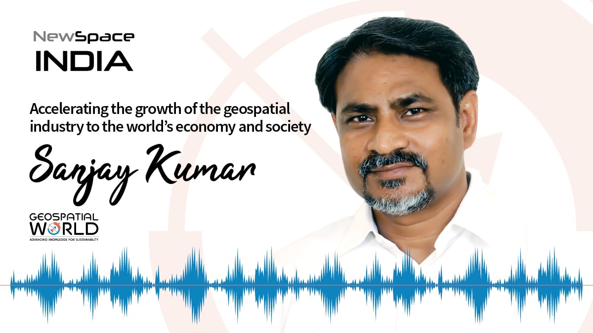
In the latest episode of the NewSpace India podcast, Sanjay talks about his experience of working towards facilitating and accelerating the growth of the geospatial industry worldwide and raising awareness of the industry‘s value proposition and contribution to world’s economy and society. Sanjay Kumar is the founder and CEO of Geospatial Media & Communications. He also lends his time and experience to many organizations helping them to further the cause of increasing the impact of geospatial technology and its applications at a global scale.

Our Planet is Incredibly Complex and Ever Changing: Dr. Stephen Volz

0
Our Planet is Incredibly Complex and Ever Changing: Dr. Stephen Volz

Our Planet is Incredibly Complex and Ever Changing: Dr. Stephen Volz

Improving our forecasting of weather, water and space weather events, enhancing understanding of our changing climate, and monitoring environmental hazards requires high-quality, timely, and global observations from Earth Observation satellites.
Dr. Stephen Volz, Assistant Administrator for Satellite and Information Services, NOAA

Year 2020 was among the three warmest years in records dating back to the mid-1800s, even with a cooling La Niña influence in the second half of the year, setting new high-temperature records globally. The 31st annual State of the Climate Report for 2020, which was led by the National Oceanic and Atmospheric Administration’s (NOAA’s) National Centers for Environmental Information (NCEI) and published by the American Meteorological Society in August 2021, also found that the major indicators of climate change continued to reflect trends consistent with a warming planet. Several markers such as sea level, ocean heat content, and permafrost once again broke records set just one year prior. Notably, CO2 levels in the atmosphere reached record highs in 2020, even with an estimated 6-7 percent reduction of CO2 emissions due to the economic slowdown from the global pandemic.

The effects of climate change are there for all to see now. Both 2020 and 2021 were among the most devastating in terms of extreme weather events. In the United States alone, there were 20 weather and climate disasters in 2021, while 2020 recorded billion-dollar events, the highest number of disasters recorded in the country in a calendar year. Overall, these 20 disasters in the year 2021 resulted in the deaths of 688 people — the most number of disaster-related fatalities since 2011 and more than double the 262 recorded in 2020. Total damages from these 20 disasters were approximately USD 145 billion.

The number and cost of disasters have been increasing over time due to a combination of increased exposure (that is, values at risk of possible loss), vulnerability (that is, where we build and how we build), and climate change, which is increasing the frequency of some types of extremes that lead to billion-dollar disasters. More specifically, these trends are further complicated by the fact that much of the growth has taken place in vulnerable areas like coasts and river floodplains.

NOAA’s Satellite and Information Service is responsible for one of the most comprehensive data holdings on Earth. We archive and provide access to data and information from the surface of the sun to the bottom of the ocean. Some of our data records extend back millions of years, while we also serve real-time satellite observations to users. Understanding past environmental conditions is paramount to putting current events and future projections into a proper historical and climatic context. Our Earth Observation (EO) data provides critical inputs for climate projections, which allows us to better prepare for a changing world. We provide the foundational data that allows policy- and decision-makers at all levels to make informed decisions based on past, current, and future environmental conditions.

A favorable policy environment

The policy environment in the US has provided enhanced opportunities for federal agencies to work collaboratively on issues of critical importance to the country, from the fires in the West to our changing climate.

We are pursuing multiple policy advancements in data sharing, in environmental justice, in Space operations standards and orbital debris management, in collective climate observations, and climate change mitigation monitoring. This is a lot to process all at once, but it is reflective of the clear national and global awareness of the critical value Space provides to address these challenges.

Each of these initiatives has an immediate audience or set of participants, both inside and outside the federal government, who are working on this agenda. But there is also a lot of overlap amongst the communities involved and their experts. Our collective challenge is to make coordinated and collective progress on the initiatives and to take advantage of the synergies when we see them. For example, an initiative in Open Data sharing is essential to successfully address the need for global climate observations, and you can’t successfully address the long-term orbital debris problems without talking about Space operational standards and norms.

Global Earth Observation System of Systems

Our planet is incredibly complex and ever changing. Improving our forecasting of weather, water and Space weather events, enhancing understanding of our changing climate, and monitoring environmental hazards requires high-quality, timely, and global observations from EO satellites.

We cannot accomplish our mission using NOAA satellites alone. To meet the level of coverage needed, we work with the international community, sharing the EO data required for weather and environmental predictions on a full, free, and open basis.

We receive three times more meteorological data from our international partners than we provide the international community. We receive data from our partners in Europe, particularly the European Organization for the Exploitation of Meteorological Satellites (EUMETSAT), the European Commission’s Copernicus Programme of Sentinel satellites, as well as our partners in Japan, India and Canada to name a few. Moreover, we use our participation in a variety of multilateral venues (CGMS, CEOS, WMO, GEO) to support identification of observing system requirements, coordinate commitments of Space-based assets to meet global requirements, and to promote full and open data sharing.

We also benefit when one country or agency makes an advancement and the others follow its example. For example, our Geostationary Operational Environmental Satellite — R Series (GOES-R) improvements in the Geostationary Lightning Mapper instrument, now being followed by Europe and China, and in the Advanced Baseline Imager, were deployed by the Japan Meteorological Agency and Korea Meteorological Administration for their global coverage. Also EUMETSAT and China Meteorological Agency’s deployment of Hyperspectral Infrared Imaging from geostationary Earth orbit is a technology the US intends to develop as well.

Data and analytics

Data may be like the new oil, but much better and cleaner of course. Even better, it can be used over and over again by different people for different applications. An atmospheric sounding observation is critical for the Numerical Weather Model to produce today’s forecast, but then it becomes part of a Climate Data Record (CDR), where it can be combined with the 50-year history of for climate
analysis, and with other observations of the land sea and air taken by other instruments and satellites at the same time to produce new understanding of different phenomena.

Data without analytics cannot lead to understanding and application. But models with sparse data are limited as well. We live in a world of incredible satellite data richness, and are pressed to integrate the data to produce better understanding and forecast/predictions. Like a lot of things in the information space, it depends on the problem. If you ask a scientist, or someone studying the planet, they would almost always say more data, or higher resolution data, or new data, is better.

But can we make the data we already have more vital than it already is?

Absolutely. We have been doing so for a long time with real-time and retrospective data. In the past, we would refine data by making maps, atlases, analyses, and summaries. These were ‘analytics’, using yesterday’s tools. In today’s world, technology has enabled a much greater demand for, and many more tools to perform, this kind of work. Meeting that expanded demand is a wonderful challenge for us. At the same time, we see clearly the value of more and better observations to improve our models and forecasts.

New Developments in the Space Sector: Dr. Josef Aschbacher

New Developments in the Space Sector: Dr. Josef Aschbacher

New Developments in the Space Sector: Dr. Josef Aschbacher

There is a lot of innovation happening in the Space sector. We are pushing the technology frontier — from launchers, Earth Observation and telecommunications to quantum communication and navigation.
Dr. Josef Aschbacher, Director General, European Space Agency

There is a lot of innovation happening in the Space sector. We are pushing the technology frontier — from launchers, Earth Observation, and telecommunications to quantum communication and navigation. Artificial intelligence (AI) on board satellites is going to be the future. That’s why this term is called cognitive cloud computing — with AI and machine learning (ML) on the one hand and systems of interconnected satellites on the other — thereby building a mesh of network capabilities and then transmitting the data down to individual users. All of this basically amounts to personalization of acquisition, processing, and dissemination.

On the ground we’re using geospatial data to build a Digital Twin Earth, a simulation of our planet on a big computer. Again, we can apply AI on different models, and combine Earth Observation with socioeconomic data and information to gain valuable insights. In this way we can study climate change, assess its impact on people, and analyze what if scenarios.

New opportunities

Today, quantum gravimetry is emerging as a concrete technology process, and it is quite exciting. It works on the ground and on airplanes and uses cold atom interferometers to provide higher gravimetry measurement precision, based on a new measurement technology, with accuracies by a facto 10-100 better than from today’s satellites. Just imagine measuring changes to gravity from Space with such accuracy; it can open up so many new applications in different domains.

On the launchers side, more and more small launchers are being established. They are very flexible in terms of launch schedules, masses, and orbits. In Europe, we have more than a handful of projects in the pipeline and are expecting maiden flights of small launchers in a year’s time. These launch systems are complementary to our classical launchers, such as Vega, which will have its maiden flight in May this year. We will also have the Ariane 6 flight. Together, these developments are going to create many new opportunities.

The green push

We have recently defined three new accelerators and two inspirators. One of the accelerators is called Space for Green Future, which is aimed at implementing the Green Deal. There are many equations that need to be examined, starting with the transition towards low carbon emissions of energy, cars, and traffic, to the use of modern methods in agriculture and forestry. Several domains will be impacted by a carbon neutral or carbon friendly economy that is currently being built.

A survey was conducted in Europe recently and 90 percent of the respondents, especially young people, were in favor of taking serious measures in terms of policy and technology implementation to protect our planet. To do that you require a two-pronged approach: make changes on the ground and monitor what’s happening where, so that the policymakers have the right decision-making tools at their disposal. Space will play a critical role in this process.

UP42 partners with Nearmap to offer high-resolution aerial imagery of US, Canada, ANZ

0
UP42 partners with Nearmap to offer high-resolution aerial imagery  of US, Canada, ANZ
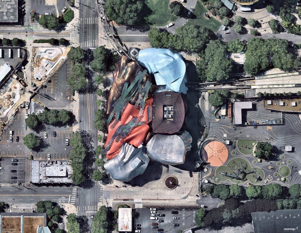
“Photo provided by Nearmap”

Nearmap’s high-resolution aerial imagery of major urban areas in the United States, Canada, Australia, and New Zealand will soon be available through UP42. The initial offering will include the Nearmap vertical imagery, which is updated multiple times each year at 5.5- to 7.5-cm (2.2″to 3″) spatial resolution for more over 1740 urban areas in the US and over 100 in Australia.

With global headquarters in Sydney, Australia, vertical imagery from Nearmap provides an orthogonal imagery base layer that offers consistent clarity, precision, and spatial detail for cities and their surrounding areas. In the United States alone, coverage includes more than 80% of its population with 308,000 unique square miles – including some of the most rapidly growing municipalities – surveyed each year.

The Nearmap Vertical imagery archive dates from 2011 in Australia and New Zealand, and 2014 in the US – with an annual refresh schedule of 3X to 6X per year. New imagery is orthorectified, georeferenced, and uploaded to the cloud for purchase within days of collection.

“Our partnership with Nearmap delivers value to UP42 customers by providing direct access to high-precision urban imagery of remarkable quality and detail,” said UP42 CEO Sean Wiid. “The extensive Nearmap archive and refresh rate combined with other geospatial data sets on the UP42 platform enable highly detailed monitoring applications related to asset management in the utility, construction, and local government sectors.”

UP42 is lowering the barrier to entry for customers to extract unique geographic insights and create scalable geospatial solutions. To this end, customers can integrate the Nearmap Vertical imagery with other data sets available from UP42. The marketplace currently contains over 160 products from more than 50 of the world’s leading geospatial organizations.

“We are pleased to deliver our current, clear and consistent high-resolution imagery to UP42 customers,” said Nearmap North America General Manager, Tony Agresta. “Combining our

industry leading aerial imagery with UP42’s extensive database, will ensure customers are getting the most up-to-date and reliable data as they make business decisions.”

UP42 customers will find the Nearmap Vertical images, as well as Digital Surface Models and 3D data sets, deliver consistent spatial detail, confident measurements, and frequent updates for any geospatial application. The following use cases will be among the most beneficial for UP42 customers using Nearmap data:

Energy and Water Utilities – The Vertical imagery provides the refresh rate and spatial detail to continually monitor the condition of utility infrastructure and surrounding environments. The centimeter-level resolution and vertical measurements that can be taken from the imagery also serve the needs of 5G wireless network planners.

Construction – Nearmap data is used extensively by Architecture, Engineering and Construction (AEC) firms to select suitable construction locations and to monitor the progress of major building projects underway, especially in remote locales.

Local Government – City managers can rely on frequently refreshed Nearmap orthoimage products to monitor municipal assets, while Urban Planners use the data to predict growth and to accurately plan when and where new infrastructure should be built to keep pace with development.

Expanding Excellence in Space: Dr. Simonetta Cheli

0
Expanding Excellence in Space: Dr. Simonetta Cheli
Dr. Simonetta Cheli, Director- Earth Observation Programmes, European Space Agency

Expanding Excellence in Space: Dr. Simonetta Cheli

Exploring Space required breakthrough innovations, which subsequently spilled over to broader applications in society.
Dr. Simonetta Cheli, Director- Earth Observation Programmes, European Space Agency

The Space sector has a long history of pushing the borders of knowledge through scientific missions. Exploring Space required breakthrough innovations, which subsequently spilled over to broader applications in society. In recent years, new technologies like edge computing, Artificial Intelligence (AI), quantum computing, Internet of Things (IoT), Digital Twins, and Blockchain have transformed the business world with new efficiency and insights. This has expanded our knowledge of Space, reduced costs, and boosted our ability to gather and process critical information with greater speed and scale. The emerging private Space industry, or New Space, doesn’t rely on government support but follows game-changing business models that either compete with or complement the existing commercial Space services.

New Space initiatives

These initiatives are generally characterized by:

  • Simple spacecraft architectures, often standardized with miniaturized elements.
  • Use of commercial components, streamlined testing, automated operations.
  • Fast, incremental development providing quick return of experience.
  • Constellations of small satellites produced in series, exploiting paradigms derived from the large production industry to achieve very frequent revisit, targeting applications often not addressed by other missions.
  • Data distribution and data analysis through hi-tech IT platforms, allowing application developments on Cloud.

As a result of these new directions, the European Space Agency’s (ESA’s) role has also evolved in recent years, and it has acted as an anchor customer by buying data provided by New Space companies through the EU Copernicus Contributing Missions activity for operational purposes, the ESA Earthnet Third Party Missions activity for scientific purposes, and the ESA InCubed EOP commercial co-funding program.

Space ambitions

Europe’s Space ambitions, in particular Earth Observation (EO) ambitions and results, are recognized worldwide. Copernicus is the most ambitious EO program to date. It provides accurate, timely, and easily accessible information to improve the management of the environment, understand and mitigate the effects of climate change, and ensure civil security. However, it is also facing growing competition from private actors. While keeping the fundamentals of Copernicus in place, we need to rethink how it works and how it can better answer evolving user needs towards more green, more digital, and more responsive society.

To meet our ambitions for a green, digital, safe, and inclusive Europe and world, ESA has defined, and is implementing its Agenda 2025 — a plan for Europe to maintain and expand its excellence in Space. Last year, a high-level advisory group convened to discuss ways to accelerate the use of Space in Europe; it identified three main thematic areas of action and recommended that ESA adopt a new approach. They termed this new way ‘Accelerators’. The approach was endorsed by ESA member states during an inter-ministerial meeting in November last year, which resulted in the Matosinhos Manifesto. The three Accelerators are:

  • Space for a Green Future,
  • Rapid and Resilient Crisis Response, and
  • Protection of Space Assets.

The objective of these Accelerators is to strengthen Europe’s leadership in Space and to benefit society and the economy with a particular emphasis on the commercialization dimension.

Partnering for a cause

The European Commission and ESA have signed Contribution Agreements for the implementation of the Destination Earth (DestinE) initiative. In line with the goals of the ‘twin transition’, green and digital, and the objectives of the European Green Deal, the partnership will significantly improving Europe’s environmental predictions and climate crisis management capabilities.

GroupM and Moving Walls deliver DOOH advertising across Malaysia

0
GroupM and Moving Walls deliver DOOH advertising across Malaysia

GroupM, the world’s largest media investment company and global outdoor advertising technology provider, and Moving Walls announced a partnership to bring automation and accountability to Digital Out-of-Home (DOOH) advertising in Malaysia.

The partnership enables clients of GroupM agencies (Mindshare, m/Six, MediaCom, and Wavemaker) to leverage Moving Audiences Plus, an audience data-driven planning, buying, measurement, and ad-play verification solution that can activate all connected DOOH screens across the country.

Moving Walls has developed a comprehensive technology stack including a DOOH planning tool that predicts audiences based on the most recent movement trends, a demand side platform that activates against these plans, and an in-campaign analytics tool that measures actual campaign performance that can then be compared against the predictions.

The inventory is connected to this ecosystem by Location Media Xchange (LMX), the supply-focused subsidiary of the Moving Walls group and a variety of advertisers including Chevron, Dell, Lancome, and Shell have already run outcome-based outdoor advertising campaigns powered by the new solution.

Bringing accountability and automation to DOOH Media

The solution’s launch is well-timed as people continue to increase their time spent outside the home with the easing of various movement restrictions. The number and type of digital screens available for advertising have also been on the rise. Clients will now be able to estimate and measure audience delivery down to specific ad plays rather than relying on historical vehicle traffic numbers.

GroupM Malaysia continues to make advertising work better for people with a unified technology and data-driven approach that helps brands deliver impactful and effective campaigns. According to Anne Leow, Head of GroupM Outdoor GroupM Malaysia, “As outdoor advertising embraces digital efficiencies, it is important to first streamline and legitimize the delivery of the advertising in a manner that is verifiable by all parties – the media owner, media buyer, and the tech providers. This partnership enables us to apply market-leading DOOH technology to optimize media spends across thousands of screens that are present in different venues, both indoor and outdoor locations.”

Meanwhile, Srikanth Ramachandran, Founder and CEO of the Moving Walls Group highlighted how this partnership will grow the role of DOOH as a measurable video advertising channel: “We are excited to launch this with GroupM Malaysia in a market that has some of the region’s most iconic DOOH sites and where many static sites continue to convert to digital panels. Verification of ad plays and campaign performance will improve confidence among brands to extend their digital video campaigns to the big screens.”

Affordability, Scalability Key to Ubiquitous Space Access: Yuya Nakamura

0
Affordability, Scalability Key to Ubiquitous Space Access: Yuya Nakamura

Affordability, Scalability Key to Ubiquitous Space Access: Yuya Nakamura

Tech advancements will make Space access more widespread in the years to come.
Yuva Nakamura, President & CEO, Axelspace Corporation

Technology advancements in artificial intelligence (AI) and machine learning (ML) make it easier to extract data from satellite constellations. In order to analyze datapoints and fetch information that can be converted into actionable insights, AI plays a crucial role in meeting accuracy, efficiency and customer expectations. AI is crucial for business diversification and value enhancement as well. We are hiring AI engineers and partnering with analytics companies all over the world to provide solutions for end users.

Enabling access

Affordability remains another key factor in democratizing Space access. We have a slogan: Space within Your Reach. In the past, everything about Space was prohibitively exorbitant. Hundreds of millions of dollars were needed just to make one satellite. The advent of microsatellites proved to be a true game-changer. AxelSpace has been a pioneer in microsatellites. The first commercial meteorological micro satellite was made by us. We are able to offer insights from our data sets at a really low cost.

AxelGlobe is our key platform. A lot of our constellation data is processed and stored on it. We capture data every day and analyze it according to change detection, as per client needs. Currently, we have five satellites in orbit. We will be launching four additional satellites by the end of this year. With nine satellites, we can monitor things anywhere in the world on a daily basis. Axelspace uses satellite imagery for various purposes such as forestry, agriculture, and infrastructure monitoring. We are also working with organizations on linear infrastructure detection, be it for railway monitoring projects or Smart City initiatives.

Our aim is to lower entry barriers for clients who wish to utilize Space data. So we are providing them not only with satellite data but also with insights we can get from analysis.

Disaster response and resilience

Japan is vulnerable to many natural disasters, so disaster mitigation and resilience have always been our focus. Disaster mitigation and assessment are areas where satellite imagery plays a key role.

We’re actively looking into how our data can contribute to monitoring the environment. Another interesting application of satellite imagery is in supply chain monitoring. Due to COVID, no one can travel freely. But even in this situation, monitoring is vital. While satellites cannot solve every problem, they can definitely help garner crucial information. Supply chain monitoring is an emerging application area that would become ‘the new normal’ in the near future.

One of our key strengths is tasking capability. Many organizations don’t have flexible tasking mechanisms, but we are able to task as per client requirements.

Way ahead

We want to make a scalable business for supply manufacturing. To achieve that we are working towards a mass manufacturing system. By 2024 we aim to manufacture at least 50 satellites a year. The Japanese government is supporting us in this project.

Going forward, we will be focussing on both the upstream and downstream satellite business. From the upstream point of view, we will be in mass manufacturing of satellites for various use cases. And in downstream, we will use AxelGlobe to solve lots of different issues: sustainability issues, ecology, defense, land monitoring, etc.

ISRO to handhold private sector to create innovative space ecosystem in the country: S. Somanath, Chairman

0
ISRO to handhold private sector to create innovative space ecosystem in the country: S. Somanath, Chairman

ISRO to handhold private sector to create innovative space ecosystem in the country: S. Somanath, Chairman

S. Somanath ISRO
S. Somanath, Chairman, ISRO

Dr. S. Somanath, Secretary, Department of Space, and Chairman, Indian Space Research Organisation, shares his thoughts on everything from innovation to sustainability, AI to student support, tech incubation to deep space exploration, human spaceflight to economic potential, and the future roadmap of Indian space sector, in an exclusive interview with Arup Dasgupta, Managing Editor, Geospatial World.

On ISRO and Innovation

The Indian Space Research Organisation (ISRO) is home to many innovations taking place in all sectors of space technology: applications, spacecraft bus, launchers, and advanced technologies for payloads, exploratory missions, and science missions.

Innovation in Communications

We were able to build High-Throughput spacecrafts in the last few years and put them in place, so that we have the capability to achieve something like 20 Gbps. But that is just not enough. I think the demand is much higher. This is one area where we have to innovate to create spacecraft buses for the future. There is no difficulty in doing so, but the real issue is: who is the user who wants it, and who is going to deploy it and economically exploit it?

We need optical communication links so that we can establish High Throughput and secure communications networks. Here, we started with the small payloads demonstration, but it did not go far. We need to go further in creating very reliable optic communications networks. Inter-satellite communication is another area that needs to be developed. We also have to go into various other bands in the communication domain. We have gone up to Ka; now we are moving to Q and V bands also. These need to be developed and we have to deploy these bands for our regular communication use, including for various other institutional users and for commercial exploitation.

Innovation in Remote Sensing

The demand for remote sensing data in various sectors is increasing and people are looking for high resolution imagery. They are also looking for various advanced technologies in other spectra. We have demand for radar imagery for agriculture use and other resources mapping, alongside the demand for continued support for existing satellite observation platforms. This is a conflicting demand. We need to look at how this can be met, because lower resolution demand is also there while we look for a higher resolution solution.

Then there is another demand for geo-based optical observations, and geo-based other spectra observations for various users, including strategic users. The challenge today is not only for resolution but the periodicity or revisit capability, and availability of data in a very short time. These two things demand that we put more platforms in orbit.

Currently, around 20-23 Earth Observation satellites are in orbit but this is just not enough for India. The challenge is who is going to build them and operate them, and how will they get commercially viable. This is a very difficult question. More so because everything cannot be funded by the government, and we cannot put hundreds of Earth Observation satellites into orbit and make all the data available to everyone for free. While everyone may want it for free, but no one is ready to actually build satellites. 

The demand for Small Launch Vehicles

We looked at the entire design process to see if an on-demand launcher can be realized in the complex domain of launchers. I think we have been successful in that, although the development has taken a long time; the vehicle is in shape now and we are going to launch it soon. After this, it will go to the industry for production and launch to meet consumer demands.

Reusable Launch Vehicles

We are also looking at innovation in reusable launch vehicles; work on this has been going on for some time. We will have a landing demonstration soon, followed by an orbital launching demonstration. A reusable launch vehicle of this class is critical for strategic users rather than commercial users, because we can take a payload up into space and bring it back safely. This is significant.

We are also looking at how future launch vehicles can be built and how to bring down the cost of the launcher. Currently, the launch per kg is typically USD 20,000. We have to bring it down to USD 5,000. This will be possible only by bringing reusability into the rocket. And a reusable rocket will become profitable only if it is used very frequently.

Suppose we were to build a reusable rocket and launch it only once or twice a year ─ that would not be economical at all. In fact, it will be costlier than an expendable launcher. We need to first create the background on which the reusable rocket will be required, work out

the business and launch opportunity, and only then will a reusable rocket become economically viable. This is precisely the challenge we are working on. And once we see market potential, we will work on such a rocket.

Innovation in Technologies

We are also working on a number of other technologies within the organization. We have to work on a huge number of satellites technologies, miniaturization of electronics, new material development, additive manufacturing, new chemical processes, new algorithms for autonomous operation of satellites and rockets, and new intelligence systems and rockets so that failure detection isolations can be avoided.

When I was the Director at Vikram Sarabhai Space Centre (VSSC), we worked on 600 new technologies! We are in the business of innovating and improving our existing knowledge.

On Artificial Intelligence

We are not using artificial intelligence (AI) deeply, because AI and Machine Learning (ML) and data analytic applications are still evolving. They have not entered our work in a big way. But, of course, I can say there are examples of AI usage in our work – image processing, space for data images, object identification and classification. We were able to create 3D images from 2D images using AI technology and various other methods.

There are various AI applications. For example, in a launch vehicle, we look at AI for data analysis, because during every launch we get so much data that nobody can complete the analysis in real-time. So, we are looking at that type of AI there. Defect identification through test data, defect identification missions is one big domain.

On Space environment and debris mitigation

We have followed conventions. We are active partners in space debris management teams and inter-agency committees for space debris management.

We made sure that all upper stages will be de-energized. That means if there are pressure runs, it’ll be relieved, propellants will be let out, so that the stage will remain passive, and doesn’t generate secondary debris. We have been following this procedure for many years for all PSLV and other rockets.

We need to ensure that all soon-to-be defunct satellites are moved to the graveyard orbit. We do this systematically. Last month, we moved one of our end-of-life satellites to a graveyard orbit, which is thousands of hundreds of kilometers above the GSO so that it doesn’t come back and create us a debris for at least hundreds of years.

For low earth orbits we have to ensure that the satellites are brought down to a level where it will decay in less than 25 years of time, not in hundreds of years. This  we are trying to do whenever a low orbit satellite becomes non-functional. If we have propellant left we can use it to reduce its orbit, so that it will reenter after a few years.

Observational Capability and Modeling

The most important part is we must have observational capability. It requires interagency coordination, and exchange of data between different agencies that have the ability to observe and predict the devolution of debris in orbit.

Owing to the  capability we have developed we can predict the conjunction analysis between these debris and share this information with everybody working in the world.

ISRO’s Observational Capability

We are also looking at how to create observational capability. Definitely, all these debris should be about 10 centimeter in size, anything less than 10 centimeter is not observable. We have to establish radars and optical ground stations of our own, to observe not only our satellites but other objects in space.

Long Term View

We want to tell you that the demand for satellites is increasing, and thousands of satellites are coming, especially in the low earth orbit. This a potential threat to the entire humanity or space activity. But of course we have no way to regulate it, or control it in any manner. We can only watch it and then be careful about it. But there is a big danger waiting.

Collaboration with other Space agencies

There are plenty of such collaborations, but the collaborations are mostly in the science domain, and some in applications domain. For example, NISAR, carries a  L and S band Synthetic Aperture Radar which is useful for both India and the USA. It is an experimental one, but has a lot of applications in agriculture and soil monitoring. L band has a specific advantage, and this comes from NASA, while S band is supplied by us.

We are also working with various other agencies. We are currently working with the French agency, CNES, on a mission to look at a satellite called TRISHNA, which can address various science objectives, especially in the agriculture sector, using various spectra, which I will not reveal, because both of us are developing payloads in that domain.

We are working with JAXA on developing a payload, as well as a mission to go to moon. This will be launched using Japan’s launch vehicle, but the spacecraft will be jointly developed by ISRO and Japan. A lander which will land on the moon. This will be after Chandrayaan 3 It will take three, four, five years to develop.

We had an engine technology discussion going on with the Russia. We have so much of support coming from Russia, Europe and America for the Gaganyaan program. We have a specific technological support coming in from US for deep space missions, like Chandrayaan 2 and Aditya L1.

We also look at how we can create facilities for other nations, like ground stations, data dissemination centers, so that it becomes a global facility. We are also looking at how GNSS, we have the NAVIC system, can have cross calibration facilities in other centers, how our data can be used for various other GNSS providers, and then joint operation of these GNSS systems in case of requirement. We are developing multi GNSS chip sets. We have discussion with the various users like Russia and Europe on whatever GNSS they are developing.

Collaboration with Academia

We have space technology cells in most of the first layer IITs and also the second layer IITs, which came up later. We are now establishing space technology incubation centers, or joint space technology centers there with funding from ISRO for faculty and labs

Now, we are also going to institutions like the National institutes of Technology, NITs. Then there are private institutions that are ready to create space-based centers within them. We allow them to do that with our scientific support. There is no financial engagement with them, but we try to create an ecosystem if the faculty and students are interested.

Motivating Students

Last month we inaugurated Satish Dhawan Space Science Center in Jammu. We invested around INR 12.5 crores and created this facility. We are starting an academic program there for aerospace and other avionics. Some students will learn this and will contribute to our space sector, not for ISRO alone. We are looking at human capital creation for the entire space sector.

We also engage with the young students, through a program, which is already announced. They will have an opportunity to come and train for a short duration within ISRO. We go across the country to conduct exhibitions, and motivate youngsters to take up STEM.

On Respond Basket 2022

All these projects are linked to some or other activity already ongoing at ISRO. How we identified these projects are they ever connected with our long term vision of each of the centers. Ultimately, once it is developed, it will get fit into either a launch vehicle, or a satellite, or a payload, or a mission. It is connected in some way or another. It is not just an open-ended research. “Okay. I have an interest in some new material, let us explore and understand the material.” Nothing like that. They’re all linked to something.

Setting up Incubators and Promoting Startups

We have created IN-SPACe, which is going to be a regulator and a promoter. The regulation function is for all those who want to work in space sector,. They will be regulated by whatever application they put up, and license will be given. Like building launch vehicles, operating satellites, having space assets, conducting experiments.

Second role is promoter. Promotion includes industries who are willing to come and start up ecosystems. Already some area at Ahmedabad is built up and is available to set up such an ecosystem. This will be replicated across various places in the country, wherever investment is possible. Investment is possible from private enterprises as well. This is also mandated to IN-SPACe.

New Space India Limited, is going to be the operators of operational systems. For example, if you put a satellite for communication, remote sensing, they will continue to own this assets, and they will operate. Also, they can build launch vehicles or order new satellite for commercial purpose. This activity has already started.

ISRO will be the technology holder. Whatever is required for governmental strategic users will be done by ISRO. They’ll develop new technologies as needed, as found fit to be developed. Private enterprises also can develop technologies. Nobody’s stopping them. ISRO will handhold to create a better space ecosystem in this country. So this is the new mandate.

Financial support to startups

We have to definitely propose such an idea, because some of the entities have been proposing. They ask, “Yes, we need seed  money for handling,”. There are big business houses who are willing to fund these startups. It’s not the funding that is actually limiting, it is idea that has been limiting us. So if there is a good idea, there is always good money available.

On Roadmap for Human Space program

The current definition of the human space life program is to send Indian astronauts to space, and bring them back safely. Only one mission is defined. We hope that after the successful accomplishment of this, we’ll have a long-drawn roadmap. It is important that we develop the roadmap. Currently we are not into a long-term definition, like building a space station or every day somebody will go to moon.

The first step is having an ability to take a man to space and bring them back safely. This is called Gaganyaan project. And for that, we have already got funding. Once we are successful in accomplishing it, definitely the next phase of human space flight program could be unveiled at an appropriate time.

India’s position on America’s Artemis program

I won’t answer it either way in this case, because it is a very strategical, political question, which I cannot answer in the public domain. We did not join ISS because in our assessment, we didn’t find merit in joining it. With respect to Artemis, this decision needs to be taken at an appropriate time.

India’s stand on moon treaty

On the moon treaty we also have signed. To that extent, we are honoring it, but then they are discussing about extraction, mining, setting up a colony.

We are a country who has accomplished a mission to moon. We also have a due claim on the moon. It depends on what our priorities are, and how much funding we will get, what is the national demand on us. These things which we have to discuss in a policy level, political level. It’s not within my purview at this moment to answer.

Contribution of India’s Space program to country’s GDP

There’s a humanities department in Indian Institute of Space Science and Technology. I was the director there for a short duration. At that time, I asked the faculty, “Why don’t you do a study on the size of space economy in India, and how we contributed to this?”

Two of the faculty are currently working with a ISRO scientist to come out with a very clear program. National Institute of Advance Studies is also part of it. I believe in another one year or so we will have some report on the contribution of space to national GDP.

More Prime Read

More Prime Read