
With population explosion and freight traffic expected to double by 2050, the dependency on railways is only going to rise further, which is why safety and security expectations are higher than ever.
Recently, India witnessed three railway accidents, out of which one is the worst of its kind in over two decades, claiming more than 300 lives. The reason behind the train mishaps is stated to be signal error and fires.
According to the National Crime Records Bureau’s 2022 report there were more than 100,000 train-related deaths in India between 2017 and 2021. In 2021, more than 16,000 people were killed in nearly 18,000 railway accidents in India. These accidents not only take a human toll but huge expenses go into repairing the tracks, and developing new coaches. Indian Railways also has to foot the bill due to rerouting of goods and passenger trains while repair and rescue work is underway. It’s not just India that is accident prone.
According to data from the Federal Railroad Administration in the US, in 2022 there were more than 1,000 train derailments. The average per year figure between 2005 and 2021 comes out to be 1,475. In 2022, the US registered 950 deaths and around 6,400 non-fatal injuries on the railroads.
One of the major reason for train accidents in large parts of the world is aging railway tracks and infrastructure, followed by maintenance issues, and outdated equipment. Often same tracks are used for goods and passenger trains, which means overutilization of the railway lines, leaving not enough time for routine maintenance work to be carried out.

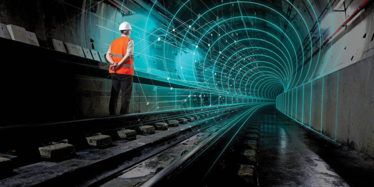
Role of GIS
Indian Railways plans to map all the railway assets in the country and develop a dedicated GIS portal. To map the assets they have signed MoU with ISRO to use their satellite imagery and maps.
After the development of GIS portal, planning for enhancement/ augmentation of various facilities such as new lines, doubling/ multiple lines, traffic facilities etc. can be done more efficiently.
With the help of satellite images it will easy for them to regularly monitor the tracks and spot encroachments around the stations and other areas. GIS will provide valuable information during the life cycle of assets for efficient management, maximizing throughput, ensuring safety and minimizing disruption/delays to traffic.
The use of maps within the transport industry is growing significantly. Location is vital to many of the operations that railways/metro needs to carry out, hence, the use of GIS is the optimal means for centralizing and coordinating these activities.
“With an accurate GIS database of land and assets, users can derive effective plans for land management, asset mapping and maintenance, including encroachment and lease information management,” states Agendra Kumar, MD, Esri India. “Indian Railways is one of the biggest landowners in the country. With GIS maps, decision makers and stakeholders will know what assets they own, their current condition and understand environmental constraints,” he adds.
He further adds, “Safe, efficient operations depend on accurate, real-time information. GIS can help visualize events as they unfold, deliver greater insights to respond fast to any incident. This is essential in coordinating across divisions and contractors to ensure the most efficient use of time while ensuring the safety of maintenance crews and optimizing efficiency.”
GIS will also be a critical element in case of disaster management, rescue planning, and implementation by helping to locate the accident site, provide essential information to rescue team, nearby hospitals, fire stations, etc. and alarm other approaching trains, finding optimum routes between resources locations and the site.
How Digital Twin can help
Understand existing conditions
Improve and accelerate design and construction workflows
Increase asset reliability and performance
Visually enhance collaboration
Digital Simulation
With the population explosion and freight traffic expected to double by 2050, the dependency on railways is only going to rise further, which is why safety and security expectations are higher than ever.
To minimize accidents and ensure better utilization of resources, railway infrastructure needs to be modernized. This is where geospatial applications, location intelligence, and simulative 3D models play a vital role, along with advanced sensor intelligence and Digital Twins which provide.
Opportunities to reshape how infrastructure is planned, designed, built, and operated. With the availability and demand of large volume and variety of data, managing and updating it can be overwhelming for rail professionals, whether in project delivery or operations.
To help engineers, designers, asset managers, inspectors, and other specialists, the global rail industry is embracing digital workflows on existing and future networks and routes. During operations, combining data from continuous surveys, photogrammetry, LiDAR, walked inspections and/or remote sensors, Digital Twins help optimize rail maintenance strategies to reduce costs and improve overall safety and reliability.

Bentley Systems offers Digital Twin solution that spans the entire rail asset lifecycle, enabling users to make more informed decisions and deliver improved outcomes. The company helped Indonesia’s LTR Jakarta Phase 1 resolve traffic congestion.
To address the problem the owner planned regular structural health monitoring but soon they realized the need to accelerate information exchange among the stakeholders to effectively manage asset performance and maintenance. To solve the problem PT Wijaya Karya (Persero) Tbk (WIKA) offered a digital inspection solution for LTR Jakarta Phase 1, the first light train line.
WIKA used Bentley’s ContextCapture to generate a 3D reality, using aerial photos, terrestrial laser scanning, and mixed reality technology to establish digital twin for smart inspection. Bentley helped WIKA save up to 41% in costs and complete the inspection twice as fast as conventional methods.
In order to maintain reliability and safety, Europe’s many rail networks are undergoing a massive digital modernization using the Digital Twins model. Siemens Mobility has taken up the task of digitalizing planning, construction and operation of rail assets, which includes signalling and structures along all the lines.
Large infrastructure projects demand up-to-date data and information and because the available information is outdated, Siemens is facing the problem in planning accurately, and traditional surveying methods are time consuming and tedious.
“Rich data is great, very detailed and thanks to mobile mapping, we can capture it quickly. But AI is really the key to unlocking the power of data because it allows us to work with these large datasets in an efficient way,” states Carolin Baier, head of Digital Twin & Digitalization Domestic Market Germany for Siemens Mobility.

Proper Monitoring
The 2004 Tsunami in Sri Lanka led to the worst rail accident in modern history. Overloaded carriage of Queen of the Sea Line rail was hit by two powerful waves, drowning eight packed train compartments, leading to 1700 deaths.
Reliable and secure communication plays a crucial role between authorities and train operators, in terms of emergency situations monitoring train movements, detecting problems, and alerting train operators. This is where satellite communication come into play. Besides satellite communication also provides passengers with access to internet and other services while on board trains.
“A data-based maintenance strategy is vital for giving rail asset owners and managers the tools they need to understand the real behavior of their assets. Otherwise, they’re relying on best guesses, no matter how proactive. The data illustrates the physical, geometrical and structural condition of the infrastructure and enables preventative maintenance and repairs based on facts,” says Bruno Fileno, Business Development Senior Manager at Topcon Positioning Systems.
“Keeping track geometry under close surveillance is particularly important in preventing accidents, as it has a direct impact on the 3D position of the rolling stock that uses the track. This means that personnel can quickly spot any potential issues and make the necessary changes to avoid collisions,” he adds.
Space-based applications and services such as weather forecasts provide accurate and timely information about weather conditions. The United States has a form of GPS-based advanced rail control system for monitoring and control train movements, and preventing accidents caused by human error or miscommunication. The system can automatically enforce speed limits, stop trains at red signals, and prevent collisions between trains.
The United States Federal Railroad Administration (FRA) mandated the implementation of PTC on all major rail lines, and the system has been deployed extensively throughout the country. This has led to significant improvements in rail safety, reducing the risk of accidents and derailments.
In order to maintain reliability and safety, Europe’s many rail networks are undergoing a massive digital modernization using the Digital Twins model.
Safe and reliable train systems rely on a mix of human efficiency, swiftness, quick response, methodological approach, constant upgrades, and technology interventions. There are examples worthy of emulation that blend speed and efficiency with utmost safety standards. Japan’s high-speed shinkansesn, plying passengers since 1964, has never had an accident. Swiss Railways is also known for its efficiency and adherence to the highest standards of safety.


