As we seek innovative ways to monitor and protect our environment, companies like Planet are at the forefront of technological advancements in Earth Observation.
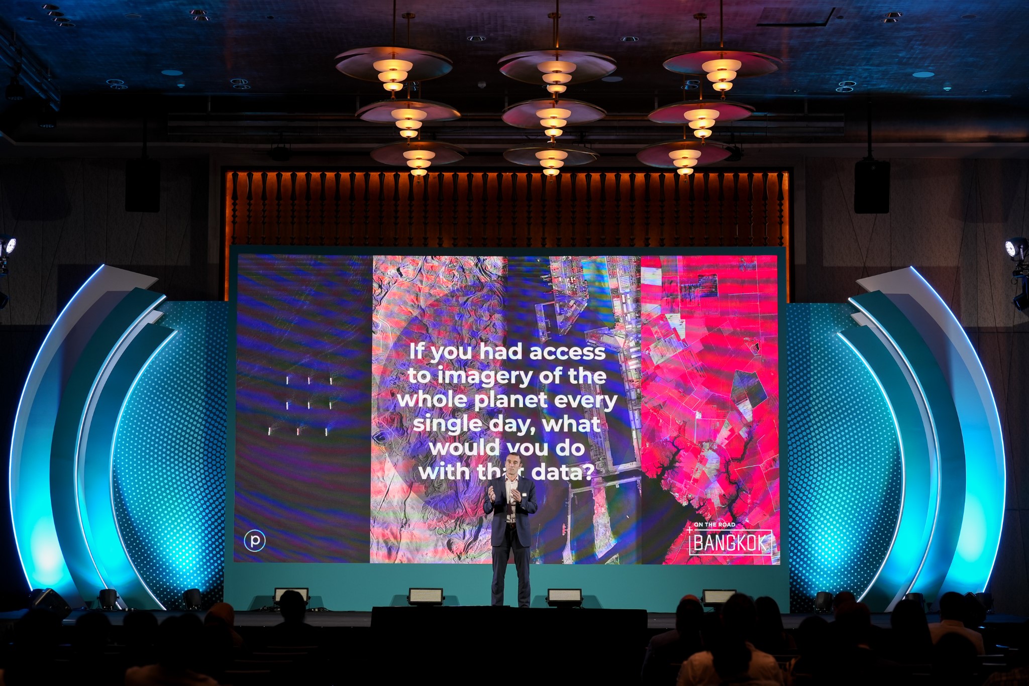
In this exclusive interview, Kevin Weil, President of Product & Business at Planet, shares insights into the mission, and the profound impact of integrating satellite imagery with cutting-edge AI.
Sustainability has been a major talking point for about a decade now, and Planet, as a strong advocate of sustainable practices, has been involved in numerous projects to further this cause. What are the current sustainability missions that Planet is focusing on?
We have more than 900 customers and partners, and a substantial portion of them are actively engaged in various sustainability initiatives.
One noteworthy program we have undertaken, and frequently discussed, is the NICFI program. Through this initiative, we collaborated with the government of Norway to create a comprehensive dataset encompassing all of the world’s tropical forests.
Our daily global satellite imaging capability enables us to generate this dataset, which covers the area between specified latitudes that define the world’s tropical forests.
Providing this data as a public good has enabled researchers to study and comprehend deforestation and various climate-related changes, ultimately contributing to their understanding of the sustainable economics of forest communities.
We now observe, from NICFI and other sources, the publication of peer-reviewed scientific papers every day that cite Planet data. This amounts to thousands of papers over the course of our business history, primarily because we have worked diligently to make our data accessible to researchers.
We believe that good things happen when we do so, as we witness the emergence of new use cases and innovative solutions.
We also have an ongoing mapping initiative aimed at creating a living atlas of the world’s renewable energy sources. This project is a collaborative effort with Microsoft and the Nature Conservancy. Essentially, we are generating a living map that encompasses all sustainable, large-scale wind or solar developments worldwide.
This initiative aims to make such data accessible and provide a ground truth for the locations of sustainable energy production. It enables users to delve into comparisons, such as how countries are progressing relative to one another, or the growth of individual states or provinces within countries. This initiative also allows for an analysis of wind versus solar development.
Recently, Planet’s satellite imagery was combined with Microsoft’s AI to assess damages in the Maui wildfires. Tell us more about the project?
This work initially began as a collaboration centered on Ukraine. Our joint objective was to conduct automated building damage assessments in the conflict zone.
Specifically, we focused on cities that had experienced occupation and, upon liberation, required substantial rebuilding efforts. We aimed to evaluate how effectively we could utilize our data and Microsoft’s AI to swiftly determine the extent of damage to buildings, road conditions, and access paths within specific areas.
By providing such information in an accessible format, we could gain insight into the resources needed for reconstruction and identify priority areas. This initial project spanned approximately one to two months.
As we neared completion of this work, the earthquake occurred in Turkey (Turkiye), prompting us to swiftly adapt our techniques. Within a matter of days, we managed to provide automated damage assessments for buildings across the earthquake-affected zone. This rapid response was crucial for assisting first responders in understanding the extent of damage, identifying navigable roads, and planning their actions effectively.
Subsequently, when wildfires struck Maui, we applied the same approach once again. With each iteration, we have improved our efficiency and response time. These experiences underscore the incredible potential of AI when combined with Planet’s imagery for real-time assessments and disaster response.
What are some other use cases to which this kind of integration can contribute?
Our partner, LiveEO, integrates Planet data with AI in a really exciting work around disaster management. Specifically, they focus on the inspection of linear features such as rail corridors and power lines to identify vegetative encroachment.
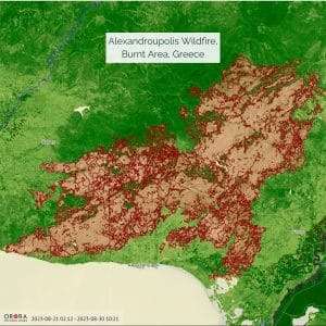
Often, some of the most significant wildfires are ignited when a tree falls onto a power line in the midst of a forest. Hence, it is crucial to automate the process of identifying trees that are tall enough and in close proximity to potentially hazardous positions along thousands of miles of power lines.
A similar need exists for rail lines, although it may not lead to forest fires; overgrown vegetation on rail lines can still result in significant delays.
Historically, this type of work has required periodic flights with airplanes or other costly and non-scalable methods. However, by utilizing daily satellite imagery in conjunction with AI, we can now efficiently pinpoint areas where attention is needed. This approach enhances safety, saves substantial government and taxpayer resources, and streamlines the overall process.
Planet has been preparing to launch the Tanager hyperspectral satellites. Tell us more about these satellites and the roles of Carbon Mapper and NASA in the mission?
This is a significant milestone for us because historically, we have exclusively launched optical satellites. However, with Tanager, we are launching hyperspectral satellites.
These satellites possess the capability to detect a wide range of substances that are imperceptible to the human eye. Specifically, it can identify chemical fingerprints of diverse materials and compounds, which serves as the primary objective.
The involvement of Carbon Mapper is pivotal because it enables the detection of carbon and methane emissions, both of which contribute to global warming and remain relatively unknown in terms of their precise sources.
These satellites will offer more than a broad assessment of carbon or methane emissions within a general area. They will have the capability to pinpoint specific sources of emissions, such as a leak in a particular pipe. This level of precision can enable us to identify and address emissions with great accuracy.
With governments increasingly making commitments to advance their sustainability efforts, this capability provides them with a means to acquire accurate and reliable information on their progress and areas where improvements are needed. It also serves as a tool for holding emitters accountable.
We are fortunate to have forged a partnership with NASA JPL, where they are essentially conducting a technology transfer of the hyperspectral sensor itself.
This sensor is the result of decades of their dedicated work, and it stands as an exquisite piece of technology. They have honed and perfected it over many years, but on airplanes. Our collaboration will deploy this sensor in space.
What does the roadmap ahead look like for Planet?
I’d like to highlight three key points. Firstly, we are actively developing new datasets and are committed to pushing the boundaries by creating innovative datasets that the world has never encountered before, akin to our achievements with PlanetScope and our Dove constellation.
We are in the process of upgrading our SkySat constellation, specifically the high-resolution tasking constellation, to Pelican. This upgrade will deliver substantial improvements across the board, offering higher resolution and reduced latency. We also introduced the hyperspectral constellation, Tanager.
The first satellites for both these constellations are scheduled for launch in the very near future. Therefore, we remain dedicated to advancing the frontier by creating novel datasets.
The second focus revolves around what we just discussed—making our data more user-friendly. This entails the creation of Planetary Variables and other derivatives that serve as simplified building blocks, facilitating ease of use.
Our objective is to expand the range of applications and systems that leverage AI in conjunction with our imagery. This enables us to provide answers to users without requiring them to possess advanced geospatial expertise. Ultimately, we aim to showcase the extensive possibilities that can be unlocked through the effective utilization of satellite imagery.
Thirdly, a significant aspect pertains to the platform and workflows. Our aim is to seamlessly integrate our space capabilities into GIS platforms that users commonly employ. We want to eliminate the need for organizations to construct custom infrastructure pipelines, which can be a hindrance to obtaining the answers they seek.
Our vision is to empower users by providing them with advanced capabilities through what essentially constitutes a geospatial cloud platform, a vision that stems from our acquisition of Sinergise and Sentinel Hub.
The more capabilities we offer, the faster users can arrive at solutions, and the more we contribute to the growth of this industry.