
The last day of the Geospatial World Forum 2023 started with multiple sessions running parallel on GKI Summit, Geo4SDGs, Hydrography & Maritime, Land & Property, Space, PNT, etc.
The session titled Land And Property: Emerging Technology Enabling Land Economy started with a detailed presentation by Abhinandan Arya, VP, Head of Technology – Solutions of Synspective on the topic ‘Land Monitoring with Earth Observation Technology’. He talked about the differences between Optical and SAR, on the basis of three basic concepts:
1. Perception
2. The effect of weather/time
3. Observation target
The land is dynamic and it needs continuous monitoring. He discussed about land displacement monitoring, and advancing alerting mechanisms for ground instability based on spatio-temporal saliency of InSAR displacements. He backed his talk with the example of crumbling homes in Joshimath, India.
He also shared the roadmap of Synspective, which aims to build the Learning World ecosystem with its analytics platform and SAR data provided near real-time to understand changes and damages cause by disasters anywhere in the world.
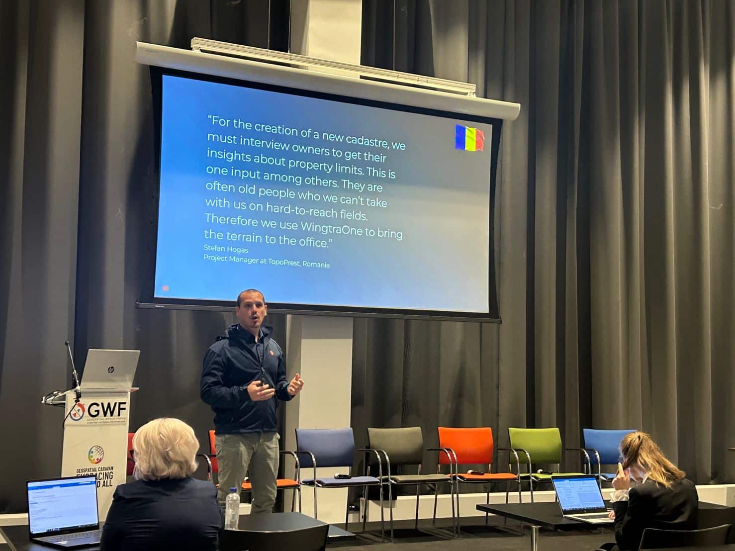
Land Rights Security Through Technology Adoption
The next session was on ‘Land Rights Security through Technology Adoption’ started with the presentation by Maria Ovdii, Head Geodesy, Mapping and Geoinformation Department | Agency for Land Relations and Cadastre. She presented short videos of Norweign celebrating sixteen years of capacity development and support to the Geospatial sector in the Republic of Moldova.
Golgi Alvarez, Founder & Editor, Geofumadas talked about the challenges faced by the land administration and the Digital Twin. He said, “The land administration concepts are not new, and the agreements for standards have been slow to develop. The greatest challenge faced by the land administration is the improvement of its processes. When modeling the real world, the priority should always be the needs of real citizens.”
Matthieu Lefebvre, Head of Sales & Business Development, Wingtra explained how WingtraOne works and its use cases in great detail through a presentation. He presented the technology solutions provided by Wingtra for different user industry sectors. He explained about the drones that are easy to use – VTOL (Vertical Take-off and Landing):
- Land in confined areas like boats or forest lanes
- Perform gentle and safe VTOL landings even on the most rocky grounds like open mines
- Do not damage the sensors or the plane
- Adjust the landing spot in changing environment
Luisa Bettili, Project Manager, e-geos, shared the case study on land and conflict. The project was World Bank – P128950 – Assessing the Nexus of land administration and Resilience to Disaster and Climate Risk. The objective of the project was to advise on land administration in Ukraine, in order to understand how land security in Ukraine is affected by ongoing conflict through the risk of land grabbing.


