Geospatial data and technology has the potential to revolutionize various sectors, with healthcare, social and sustainability taking a transformative leap.
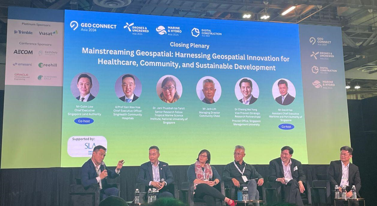
The closing panel at the Geo Connect Asia 2024 explored the strategies, challenges, and opportunities for making geospatial data and technology more mainstream and pervasive in these domains, ultimately enhancing the quality of life for citizens and promoting sustainable development.
Colin Low, Chief Executive, Singapore Land Authority (SLA) co-hosted the session and set the stage by explaining how geospatial can be used for betterment of the people. “It’s not only going deep with geospatial but using it as a social enabler in development, healthcare, education, and mapping.”
He said that gamifying geospatial through AR, VR, Metaverse, and training kids in an interactive way can demystify the whole concept of geospatial, enabling it to mainstream.
David Foo Chief Executive Maritime and Port Authority of Singapore addressed, “Geospatial has the power of unlocking location. We can gain a lot of insights and gain possibilities over the seas. We are building multi domain facilities.”
Dr Cheong Wei Yang Vice Provost Strategic Research Partnerships Provost Office, Singapore Management University said, “Quite a lot of work to date has been set up around gathering the information but it is only powerful when used by people affecting by it. The key is how to harness the people who live in the space and address their problems and tell them the solution.”
He said that sophisticated sensors placed in stationary items such as traffic lights, street poles, and other similar places might be beneficial, but “we have phones that carry whole systems of sensors and are easy to carry around. It’s a powerful tool and we can always tap this data. The only barrier remains the relevant use of the data at a grassroot level.”
Healthcare & Geospatial
“Potential use cases of geospatial in healthcare is really abundant. Use of geospatial methodoly in healthcare is not new. We’ve seen geography being extensively used to plan and predict healthcare calamities centuries ago. But fast forwarding to today, there is an even more compelling case for using its data in health,” said Assistant Prof Gan Wee Hoe Chief Executive Officer SingHealth Community Hospitals.
“It can help to look at public health issues, do outbreak investigation, and many more,” he added.
Prof Gan envisions Singapore to transition from a hospital centric healthcare culture to a more preventive structure, and he believes geospatial is going to be really important for that.
“Only 20% health outcomes are directed by medical contributions. The other 80% is determined by social determination of health (SODH). Globally, SODH pertains to nutritious diet, access to clean water, less pollution and similar healthier privileges. In Singapore we’re fortunate to have all that,” he stated.
“We need to demystify geospatial to enable its true form of mainstreaming,” he emphasised.
Social Inclusions
“We serve a heterogeneous set of clients. Our ultimate mission is to restore dignity to vulnerable society. It could be physical, monetary, people suffering from trauma, or mental health,” explained Jack Lim, Managing Director, Community Chest.
He said that technology in itself does not end up being the solution to many problems. “Some of the vulnerable segments we deal with single parents with special child. We’re working with employers to compute jobs for people who are struggling socially. We want to make jobs accessible and mapping of inclusive employers. This will be enabled and augmented with the help of geospatial.”
Marine Sustainability
Speaking about mainstreaming geospatial, Dr Jani Thuaibah Isa Tanzil Senior Research Fellow Tropical Marine Science Institute, National University of Singapore said, “The idea of mainstreaming is very well thought out. With geospatial data, what we do is mainly looking at it through the health of marine environment. Identifying hotspots of blue carbon, areas of high biodiversity. We do use geospatial data to research in marine hydro quality, pollution, endangered species tracking, and keeping sustainability in check.”
She then explained how geospatial data helps in monitoring water quality and keep the marine environment in check. “Layering of marine health and environment with the social side and resource management is going to important in Singapore where space is scarce.”