
MariaDB, the renowned open source database, has acquired CubeWerx, a geospatial solutions company for an undisclosed amount to add cloud-native, scalable geospatial capabilities that it will offer through its fully managed cloud service MariaDB SkySQL.
“We’re taking a unique, developer-centric approach to delivering geospatial capabilities that no other database vendor has taken,” says Jags Ramnarayan, VP and General Manager for SkySQL at MariaDB Corporation.
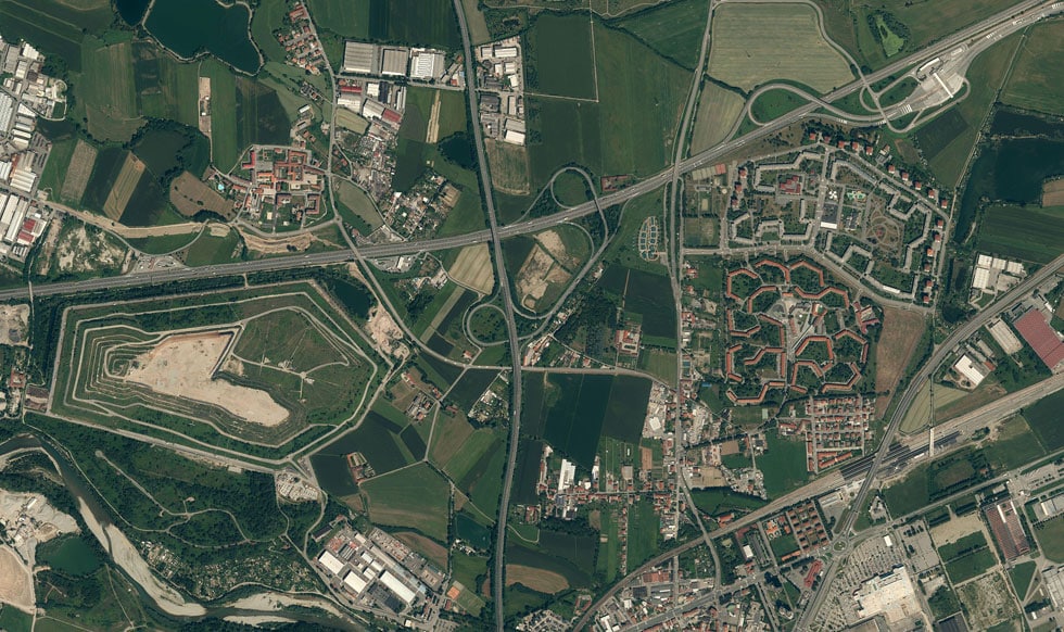
Geospatial databases are crucial today for providing the spatial coordinate and gaining actionable insights that are valuable across multiple sectors. As we buckle up for curtailing emissions with the help of pinpointed insights and undertake digital transformation, geospatial data is the key to interactive, transformative solutions and services that deliver value.
Geospatial API
In the past few years, geospatial application development has shifted from traditional interfacing to off-the-shelf geospatial library use and web APIs. This approach is easy-to-use and makes integration with applications very simple.
“Application development today is all about APIs. Developers only want to see REST endpoints. Thanks to the Open Geospatial Consortium (OGC), we now have specifications that cover nearly everything a geospatial developer might need to do. Virtually every web toolkit and desktop application on the market supports those specifications”, says Glenn Stowe, Product Manager, Geospatial, MariaDB.
With CubeWerx, MariaDB will provide geospatial the way developers use it through modern, open standard APIs. CubeWerx manages data in tiers for extreme scale and high performance.
“MariaDB’s vision on how to deliver geospatial capabilities aligns perfectly with what we’ve built at CubeWerx,” says Edric Keighan, co-founder at CubeWerx and VP for Geospatial Engineering at MariaDB Corporation.
Building a robust geospatial application is not as easy as it appears, and includes multiple technology layers.
“If you want to build a geospatial application from scratch today, the first thing you need to do is put together a technology stack. You start with a database that (hopefully) supports what you want to do, then add programming layers until what comes out the other end are the REST endpoints you want for your application”, explains Stowe.
“CubeWerx platform handles all the complexities of dealing with the data, at scale. It handles every type of geospatial data, including massive imagery collections. It includes spatial access control, analytics and more, and simply gives developers the endpoints. Developers can focus on their applications and get started immediately”, he adds.

Cutting-edge Advantage
While there’s no dearth of either analytics platforms or geospatial applications, Stowe is quite candid in expressing what makes MariaDB different in terms of value proposition to its users.
“There are other geospatial databases. And there are other technology stacks and platforms for building applications. But MariaDB is the first database company to think beyond the database when it comes to geospatial”, says Stowe.
“We provide not only the best in class technology for the storage and management of large geospatial data sets, but also the open, standards-based APIs that let developers use the data the way they prefer”.
“While other databases such as PostgreSQL and Oracle have added geospatial capabilities directly into the database, we are taking a modern cloud-native approach of managing virtually infinite amounts of geospatial data on low-cost, durable cloud storage and providing OGC standards-based REST APIs to access the data”, adds Ramnarayan.
He believes this approach will allow MariaDB to leapfrog the database world for geospatial application development.
Geospatial Tipping Point
“We are at the tipping point for geospatial to be a must-have dimension in building new applications”, says Lynne Schneider, Research Director, Location and Geospatial intelligence, IDC.
Stowe believes that howsoever predictable or obvious it seems, the future of geospatial is nothing but Cloud, as there’s simply no alternative to it when we talk about storing and processing enormous volumes of data.
With the ubiquity of mapping, navigation and the location-based services ranging from last-mile deliveries, ride hailing to booking accommodation, the platform mode as well as geospatial undergirds what we do.
“Geospatial has become key in virtually every industry, from manufacturing, defense and city planning, agriculture, surveillance and even insurance”. The widespread use and massive increase in applications also led to the evolution and technological enhancement of geospatial, with the addition of newer features and functionalities.
“Traditionally, geospatial has been built on top of relational databases. PostGIS on top of Postgres being the most popular. That works for simple applications but becomes problematic when you are working with millions of satellite imagery data and many layers of map data”, says Stowe.
He succinctly underlines the CubeWerx approach as that of blending the best of modern relational databases with cheap, reliable cloud storage with spatial processing on top.
“In the past, relatively few people were capable of building geospatial applications. Now people are waking up to the possibilities that geospatial affords and open standard API-driven approaches will let more people take advantage of these rich capabilities”, adds Schneider.
“With the acquisition of CubeWerx, MariaDB is stepping into a really great spot”.


