Geospatial technologies are monitoring and capturing information of the frigid Arctic blasts threatening more than half of the US population in the Christmas weekend of 2022. This extreme weather event is bringing in extreme cold, heavy snow and intense wind. The weather system, which may build into a “bomb cyclone,” is already disrupting travel and causing hazardous winter conditions. A front of cold air is flowing down from the Arctic, sending temperatures dipping hazardously on its way.
A severe weather system developing
This severe weather system is being developed by a frigid cold pool of air from the Arctic area being pushed down into the US by wobbling jet stream air currents. This moving body of cold air intensified as it moved into warmer and moister air ahead accelerating its storm potential and creating conditions for a ‘bomb cyclone’ to form. This kind of a destructive wind system forms a rapidly developing storm in which atmospheric pressure falls very quickly over 24 hours.
Whether this storm evolves into a bomb cyclone depends on how fast the pressure dips — but either way, the snowfall plus high winds will make for an intense round of winter weather this Christmas Eve.
Geospatial knowledge to provide accurate winter storm updates
President Biden shared in a White House briefing on this severe winter weather condition that the storm and resultant extreme cold weather is “dangerous and threatening. This is really a very serious weather alert here. And it goes from Oklahoma all the way to Wyoming, and Wyoming to Maine. And it’s of real consequence. So I encourage everyone — everyone, please heed the local warnings.” He advised everyone to “go to Weather.gov for more information.” This portal has GIS maps, satellite images and several relevant geospatial information to provide an accurate understanding of the storm situation.
All the geospatial information available now are bringing in useful weather monitoring information all over the affected areas. This weather data will continue to help all those affected to be well informed of the actual ground situation and take suitable actions accordingly.
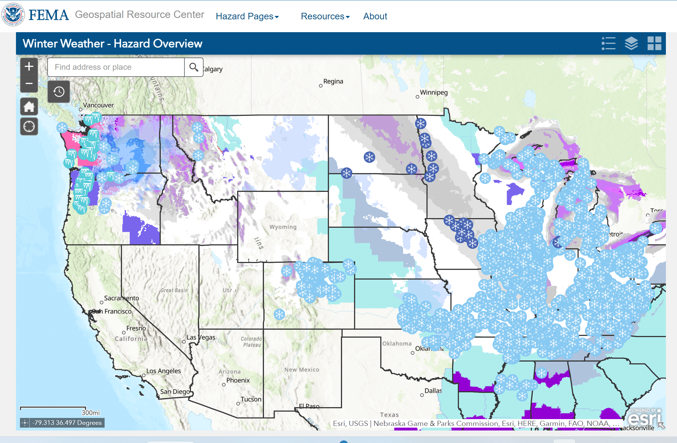
Another example is the Geospatial Resource Centre for Federal Emergency Management Agency (FEMA) offering FEMA GIS which supports the emergency management community with excellent geospatial information. This platform helps to monitor and adequately prepare for hazard challenges. These effective tools help communities to safeguard from, react to and mitigate against all hazards. The primary mission for the FEMA Enterprise GIS Services is administration, coordination, and dissemination of geographic information for FEMA and the Emergency Management Community.
Geospatial tools offer crisp perspectives on evolving weather patterns. The resultant map depictions offer informative visualizations which show the weather pattern developments in a manner that both scientists and the common man alike can comprehend. In turn, all involved stakeholders like the local governments, nonprofits and other organizations utilize what they understand from these geographic models to plan useful strategies and implement informed decisions.
Threats from the extreme weather conditions
Reportedly almost 325 million Americans are under winter weather warnings and advisories for heavy snow, frigid conditions and other winter weather hazards are stretching from the Pacific Northwest across the Plains and all the way South to the Gulf Coast.
Travel disruptions are being witnessed and this is not a good time as so many people are to travel to be with their families for the holiday festivities. Already almost 8,000 flights around the US were canceled and nearly 3,000 are facing delays. Several roads face closure too. For example roads were closed across Colorado from the town of Ault to the border with Wyoming, as Buckley Air Force Base, some 20 miles east of Denver reported a sharp plummet in temperatures from plummeting 46°F to 7°F in an hour.
Strong destructive winds have arrived with winds up to 45 mph expected as far as 1,000 miles away from the storm center. Major cities including Minneapolis, Chicago, Kansas City, St. Louis, Indianapolis, Cleveland, Columbus and Detroit are under winter storm warnings.
Power outages and road closures
Power outages have engulfed several places with more than 800,000 people having already lost power. Maximum outages have affected areas in New England and the Southeast US according to some reports. Predictions announce that people may continue to lose power over the Christmas weekend coming up amid the cold, due to downed trees and power lines, particularly in the Midwest, Ohio Valley and Northeast US areas. Some of the most extreme conditions is expected to be felt around the Great Lakes region.
Reports arriving in from Portland, Oregon, showed that the officials there have created five emergency shelters. Heavy snow laden weight has caused fallen trees and power lines there and have closed roads across the Portland metro area.
Greater Seattle area has suspended all bus service. The popular national food delivery service Door Dash has suspended delivery service to protect their delivery personnel taking into account the hazardous road conditions in parts of several US states, including Minnesota and Iowa.
Weather conditions to improve after the storm intensity weakens
NOAA’s National Prediction Centre has predicted improved weather conditions in the days following Christmas with temperatures expected to become moderate as temperatures are expected to gradually warm with seasonal to above-normal temperatures soon.
This forecast is offering a great source of hope to look forward to the end of this destructive storm condition soon.
Also Read: Map shows how Climate Change affects extreme weather around the world