The term ‘mobility’ conjures up many images, but at the root of them all is the need for the most optimum way to navigate from point A to point B. It may be on foot, or via a private vehicle, or a mass transport system. It could also be by road or rail, encompassing commuters as well as cargo. The key to mobility is ease, efficiency, safety, time, and cost constraints.
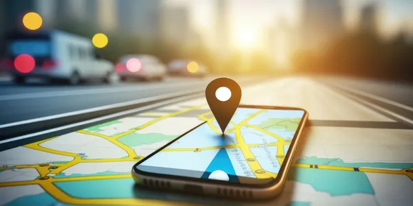
Maps and location, the two prerequisites for mobility today, are already available through GNSS-based apps and digital mapping services. The basic location information from GNSS such as the GPS is further refined in real-time with the help of satellite-based Augmentation Systems like US WAAS and India’s GAGAN to yield position accuracies of a metre or better.
While the SBAS is mainly for aircraft navigation, it is increasingly finding use in on-ground mission-critical applications such as ambulance routing as well. Maps have always been static objects and pose a problem for enhancing mobility. One of the drawback is that they are dated and do not cover new developments. Further, episodic events such as traffic jams, downtime for maintenance, and disaster-led disruptions are not covered. Crowd-sourcing has been the only possible remedy for such situations.
This is where the concept of high-definition (HD) maps is becoming very useful. HD maps are one of the tools for realizing Digital Twins for Cities. In the context of mobility, HD maps provide centimetre-level accuracy, which combined with SBAS can provide guidance at the traffic level. Autonomous vehicles have begun to use HD Maps as their basic data and by adding real-time feedback from their onboard sensors can provide the necessary dynamic map information which is a step beyond simple crowdsourcing. While these systems are presently available only on high-end automobiles, they do present a picture of upcoming mobility.
Simple GNSS-based location devices in-car navigation systems that use an augmented positioning method with about 10-metre accuracy will be replaced by SBAS enabled systems enabling under one-metre accuracy. HD maps will replace comparatively lower-resolution maps, and ensure that maps get updated near real-time, if not real-time. Given the dire need to curtail emissions and combat climate change, the way people commute will undergo a shift towards integrated, multi-modal mass transit systems.
Going forward, these will become the preferred mode of mobility, with the higher cost of autonomous vehicles distributed over the large number of passengers. Autonomous trains are already in operation at major airports, connecting terminals to the passenger check-in areas. Autonomous buses, trains, trams and trolleybuses will form the backbone of integrated mass transit systems. Future mobility will need out-of-the-box designs. Will there be fructification of technologies such as the Hyperloop promoted by Elon Musk? Or will we take to the air on flying cars and drones?
Disclaimer: Views Expressed are Author's Own. Geospatial World May or May Not Endorse it