GeoAI & Robotics Summit

June 16-17, 2026 / Pittsburgh, Pennsylvania Powering the Next Generation of Geospatially-Enabled Systems

Special Guests

View All Speakers

Introduction

The Inaugural GeoAI & Robotics Summit will convene senior executives, policymakers, technology leaders, and innovators for a premier gathering focused on the immense value of convergence across geospatial intelligence and robotics.

Guided by the theme “Powering the Next Generation of Geospatially-Enabled Systems,” the Summit will examine how geospatial technologies and robotics systems are redefining operational performance and helping to future proof robotics solutions.

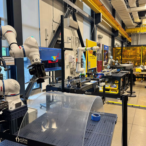
Pittsburgh—long known for its industrial legacy—has evolved into a global center of excellence in robotics and autonomous systems. Anchored by leading research institutions, major technology companies, and a dynamic startup ecosystem, the region provides an ideal backdrop for this high-level dialogue.

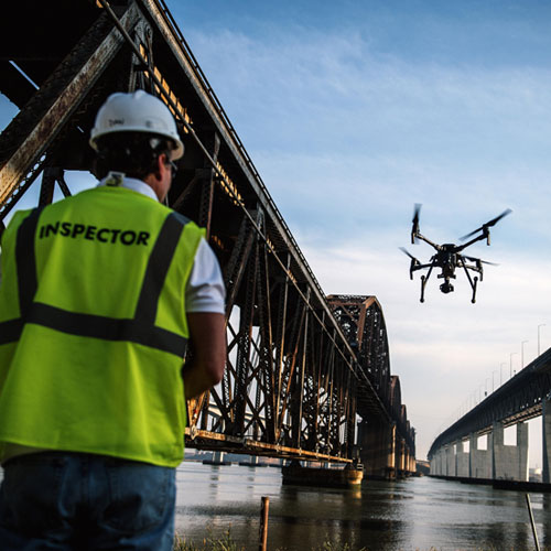
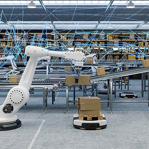
Robotics platforms operating across air, land, sea, and digital environments are transforming how geospatial data is captured, analyzed, and operationalized. At the same time, geospatial technologies—including spatial computing, digital twins, advanced positioning systems, and AI-driven analytics—are enabling robotics to execute increasingly complex, high-precision, and mission-critical tasks.

The program will explore how this convergence is advancing sectors such as infrastructure, national security, urban development, and environmental management, while identifying practical pathways for collaboration, deployment, and long-term impact. By convening leaders and professionals at this critical intersection, the Summit aims to catalyze partnerships, accelerate innovation, and help define the next chapter of geospatial-enabled robotics operations.

Program Agenda

Executive Roundtable

An invitation-only event that brings together industry leaders to focus on driving transformative progress in geo-enabled robotics systems across sectors, including national security, infrastructure development and monitoring, and disaster response

Plenary Discussions

Advancing Autonomous Systems for Government and Business Service Delivery

GeoAI, Robotics, and NextGen Geospatial Data Management

Partnering and Investing in Geo Enabled Robotics and Autonomous Operations

Ensuring Workforce Readiness

Transportation Autonomous Ops: Blueprint for Collaboration

Workshops

Scaling Robotics in Smart Infrastructure and Urban Planning/Operations

Operationalizing Geo-enabled Robotics Systems for Public Safety, National Security and Resilience

Life Sciences, Logistics, and the Indoor World

Objectives

The summit aims to
  • Foster collaboration between the geospatial industry and Pittsburgh’s vibrant robotics technology ecosystem.
  • Identify pathways for commercialization for emerging geo-enabled robotics technologies and outline strategies for scaling and commercializing solutions, bridging the gap between innovation and market readiness.
  • Highlight innovations in GeoAI for geospatially enabled robotics and autonomous technologies that are revolutionizing geospatial data capture, processing, and analysis, setting new industry benchmarks in sectors such as transport, food production, warehousing, and medical care.
  • Catalyze Public-Private Partnerships to globalize the adoption of GeoAI as an enabling framework for the robotics industry.
  • Showcase Pittsburgh region as a vibrant environment for innovation and business growth.

Outcomes

Further establish the Robotics and Geospatial Industries as leaders in supporting innovative AI and robotics technology advancement and integrations.

Accelerate cross-sector industry collaboration by connecting the robotics and AI technology firms and research institutions with the geospatial industry.

Facilitate policy dialogue on the ethical and operational challenges of geo-enabled robitics systems.

Build the groundwork for a broader engagement of the geospatial and robotics industries in the Pittsburgh region.

Who Should Attend

  • Robotics, AI, Autonomy Innovators.
  • Geospatial Technology Leaders driving spatial computing, digital twins, and advanced analytics adoption.
  • Public Sector Stakeholders focused on geospatial intelligence applications for a range of mission needs.
  • Investors & Venture Capital Partners scaling robotics technologies and geospatial innovation.
  • Remote Sensing, Mapping & Analytics Leaders and professionals advancing robotics capabilities in geospatial data and intelligence.
  • Research & Academia Experts advancing GeoAI, robotics, and autonomous systems.
Program Partners
Associate Sponsor
Co-Sponsors
Supporting Partners
Institutional Partner
Produced by

Mission

Through our Media, Conferences, Market Research and Consulting offerings, we raise awareness among various stakeholders around the world about the tremendous potential of geospatial technologies.