
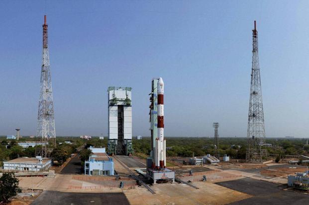
On April 28, 2016, Indian Regional Navigation Satellite, IRNSS-1G went into geosynchronous transfer orbit and by May 3 it has taken up its position in the Geostationary orbit at 129.5 degrees East. With this, the IRNSS constellation of seven satellites is in position. Since then, there has been an intriguing silence on the availability of the system. The initial euphoria about an Indian GPS has subsided. This may be a good time to take stock.
IRNSS constellation consists of three Geostationary Earth Orbit (GEO) spacecraft and four spacecraft in Geosynchronous orbit (GSO) inclined at 29 degrees to the equator. IRNSS will provide two types of services, namely, Standard Positioning Services (SPS) – provided to all users – and Restricted Services (RS), provided to authorized users.
Three satellites IRNSS-1C, 1F, and 1G at 5 deg inclination are called GEO satellites. IRNSS-1F is placed at 32 deg E, 1C at 83 Deg E and 1G at 129.5 deg E. The four GSO satellites, IRNSS-1A, B, D, and E are placed in inclined orbit with longitude crossover of equatorial plane at 55 deg E and 111.75 deg E. GSO satellites are placed in two planes with the planes being 180 deg apart. These seven satellites will cover a service area of 1500 Km around India with an SPS accuracy of 20 m or better.
The IRNSS satellites carry two types of payloads – navigation payload and CDMA payload. The navigation payload operating in L5-band, and S-band will transmit navigation service signals to the users. It also has a highly accurate Rubidium atomic clock. The ranging (CDMA) payload consists of a C-band transponder which facilitates accurate determination of the range of the satellite. It also carries Corner Cube Retro Reflectors (CCRR) for laser ranging.
Navigation satellites work on the principle of Trilateration. The position of an object is determined by its latitude, longitude, and height above Mean Sea Level. If at the time of measurement the instantaneous position of three satellites are known and the distance of the point of measurement from each of these three satellites is known then the latitude, longitude, and height of the point can be determined using the simple distance formula.
How does a GPS receiver determine its distance from each satellite?
It does so by comparing a code generated by a satellite with the same code generated internally in the receiver. The time difference between the two codes multiplied by the speed of light gives the distance. That requires a very stable signal source on the satellites which is provided by the Rubidium clock which is used to generate the code and the carrier signal for the code. Each satellite has a unique code hence the receiver can identify each satellite in its view. The carrier also contains the precise orbital parameters of the satellite which is updated regularly. The Rubidium clocks on the satellites are also synchronized regularly. The IRNSS satellite downlink signals are in L band and S band. The L-band signal cannot be received by standard GPS receivers as the L-band frequency of IRNSS is different from the standard GPS satellites. Therefore both the L and S band will require new receivers.
The different frequencies could work as a boon. Systems like GPS, GLONASS, Beidou, and Galileo working in the L-band are subject to atmospheric distortions. Therefore, they bank on the atmospheric model to assess frequency error and they have to update this model from time to time to assess the exact error. This effect is more in the L bands than in the S-band. In NAVIC, the actual delay is assessed by measuring the difference in delay of the S and L bands. Therefore NavIC is not dependent on any model to find the frequency error and is more accurate than GPS and other systems.
 In January 2017 the news emerged that all three Rubidium clocks, one main and two standby, had stopped working on IRNSS-1A. In fact, the failures were as early as June 2016. However, ISRO Chairman maintained that the service was still available with the remaining satellites. Signals from IRNSS-1A would be received but not used for position location. A degradation of the positioning accuracy is expected if data from IRNSS-1A is used. The clocks, made by a Swiss company, Spectracom, have also failed on Galileo satellites of the European GNSS system and on the Chinese Beidou system. It looks like a problem with the clocks rather than the satellite. ISRO is trying to restart the clocks on IRNSS-1A, but it is not an easy task. Meanwhile, ISRO is getting ready to build and launch IRNSS-1H later this year as a replacement for IRNSS-1A.
It is interesting to note that IRNSS-1H will be assembled by a private consortium of MSMEs, Alpha Design Systems who beat biggies like L&T and BEL. ISAC facilities will be used by 70 engineers from Alpha Systems under the supervision of ISRO engineers for IRNSS-1H. Other IRNSS-1 series of backup satellites could be assembled by Alpha independently.
The precise position of each satellite is determined through CDMA Ranging using the C-band ranging transponder and the Corner Cube Reflectors which reflect laser ranging signal transmitted from the Laser Ranging ground stations. There are 14 IRNSS Range and Integrity Monitoring Station, IRIMS, located in different parts of India and more are planned in countries outside India. The IRIMS are very precisely located. They receive signals from the IRNSS satellites and establish the integrity of the constellation. Data from the IRIMS, CDMA and Laser ranging stations are fed to the IRNSS Navigation Centre at Bylalu where the entire system is controlled and all orbital and timing updates are generated and fed back to the satellites.
Why are IRNSS satellites not in perfect geostationary orbits?
Since IRNSS is a national system it makes sense to have them in geostationary orbits so that they are always visible. However, this would limit the service area to only a part of India. By adopting GEO and GSO orbits the service area is extended from 40 degrees East to 140 degrees East and from 40 degrees North to 40 degrees South. More specifically this arrangement can give about 20 m accuracy for about 1500 Km around India and better on the Indian mainland. The choice of seven satellites ensures that any receiver in the service area will always see at least four satellites at any time. Even though 3 satellites are ideally enough to determine a 3-dimensional position, a fourth satellite is required to determine the bias between the satellite clocks and the receiver clock.
The advantage of NAVIC is that all seven satellites are always in view and at very high elevation angles. This makes it very useful for positioning in urban canyons where other systems fail because of signal shadows and multipath problems. As Dr Tapan Misra, Director, SAC says, “Chips in today’s mobile phones are GPS enabled. Since our signals are coming vertically from stationary reference, so in crowded place and narrow lanes, our NAVIC is going to work better than GPS”.
Why did India opt for such a system when other systems are already available like GPS, GLONASS and Galileo?
In fact, a GLONASS base station is planned for India to serve both military and civilian needs as GLONASS is compatible with NAVIC according to Group Captain Ajey Lele, Senior Research Fellow at the Institute for Defense Studies and Analyses, New Delhi. However, all these systems are controlled by other nations and their continuity of service for global users is not guaranteed. A location is not just for finding a pizza parlor nearest to you when you are hungry! It is of utmost importance for locating and tracking mobile assets like trucks, earth moving machinery, containers to name a few. Other mission critical areas are disaster management and most importantly C4ISR program of the Armed Forces.
The biggest immediate users for NAVIC will be the Armed Forces who will also have access to the very accurate Restricted Service signals on the L5 and S bands. As Dr Misra puts it, “There are two uses of navigation systems. NAVIC receivers are there for security, air navigation and important installations which are not price conscious. Good NAVIC receivers for such applications, working in both L and S bands, costing around Rs 50,000 are already available. These NAVIC receivers are going to be installed in aircraft soon. Progress is slow, but things are moving”. For commercial users, there are several other products which can be used for both navigation and asset tracking. Hardware and software for using IRNSS for other technical applications like Precise Timing and Mapping and Geodetic data capture are also available.
When will the Indian consumer get to use NAVIC?
According to Accord Software and Systems, a private company which is working with ISRO and AAI on the GAGAN project and now on the IRNSS user hardware, the easiest and fast way is to use an add-on IRNSS dongle to any smartphone having USB On-The-Go port and a software on the phone to view the dongle output. Dr Misra adds, “If you use both L and S bands, our accuracy is more than 5 meters. This has a better potential than a 20-meter accuracy GPS which is actually supplemented by GPRS information. But our NAVIC can give you the accuracy of GPRS and GPS combined, and that accuracy is not only for cities but every rural part of the country”.
Smartphones with NAVIC support inbuilt is some way off and will depend on how fast the system picks up in the commercial market. This is because an additional receiver and antenna are needed in the smartphone to pick up IRNSS signals which are in the L5 and S bands. Today’s smartphones in India use receiver chips that mainly support GPS. Some also support GLONASS and Beidou. All these work around the L1 band which has resulted in a quicker development of multi-constellation receivers for GPS, GLONASS and Beidou.
However, things are likely to change. Dr Misra says, “Market will look for a chip but the market is so price sensitive that investment in chip development is beyond the market’s capability as the chip is different from mobile phone assembly. In the absence of a chip development company, we thought we will develop our own chip and I am glad to share with you that we have already built a chip with 32 channel IRNSS receiver. This chip is now being tested and by the end of this year, we will be able to provide a blueprint of that chip. Market penetration will start slowly and once people will see the benefits, it will explode”.
Interestingly, GAGAN will not be using NAVIC. This is because AAI has to cater to international users whose aircraft are already equipped for using WAAS, EGNOS and MSAS. GAGAN has to maintain compatibility with these systems. However according to Dr Misra, “GAGAN usage is valid only up to 250 m height after which visual navigation has to take over for landing and takeoff. A new type of a technology that is called Inverse NAVIC will be positioned around airports and aircraft equipped with NAVIC receivers will locate their position with respect to the ground transmitters and auto landing below 250 meters will be possible. SAC has built the technology and are on the verge of field testing it. It’s very compact and we want to make it very cost effective. This new system will enable UAV operations very precisely. When you need an accuracy of one meter to operate UAVs then this system needs to be spread all across the city”.
Will NAVIC displace GAGAN?
Dr Misra thinks that at present they will work in co-operation, but if one technology progresses, another technology has to die over a time. Once the product becomes cheaper and receivers become small that can be even put in a drone then it can change a lot of things. Will NAVIC be shared like the recent South Asia satellite? Technically, it is possible but there has to be a demand from the neighboring countries who fall within the coverage area.
IRNSS, now NAVIC is a bold venture which is the hallmark of Made in India. The scientists and technologists have done their bit. It is for the industry to take off from here and make NAVIC a commercial success not only in India but in neighboring countries as well.
Parts of this article appeared on Governance Now in June 2016. The author would like to acknowledge with thanks the help received from Dr Tapan Misra, Director SAC, and Accord Software Systems in the preparation of this article.


