
Near Space Labs has announced the availability of Earth imagery at 10 cm per pixel resolution. For this the company will use its autonomous wind-powered high-altitude stratospheric platforms, called Swiftys.
“For the first time in the history of geospatial imagery, we have been able to successfully deploy and scale an imaging solution that only utilizes the stratosphere. That vantage point allows us to deliver high resolution, high frequency, nimbleness, and cost-effectiveness in a single product called the Swifty,” Rema Matevosyan, Near Space Labs CEO, told Geospatial World.
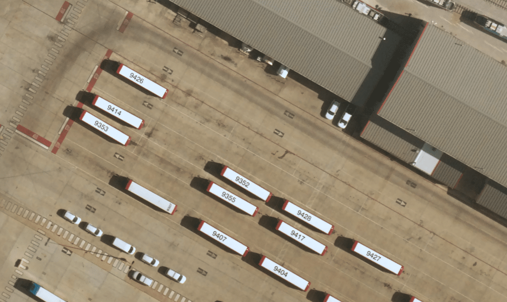
The Swifty is the lightest, most advanced stratospheric imaging robot ever to be built at scale. They make frequent flights in the stratosphere and capture 400–1,000 sq km of high-resolution imagery per flight, or the area of approximately 187,000 football fields.
Interestingly, this highly detailed imagery will be offered at the same affordable price as Near Space Labs’ 30 cm imagery, providing a 300 percent resolution increase for no additional charge. So far, the most cost-effective in the market at under $50 per sq km, the Near Space Labs move opens up access for many industries and use cases.
For instance, conservation groups can now afford high-resolution data. Similarly, the insurance industry is using its 10cm imagery, both from an underwriting and claims perspective. Governments and urban planners can help build smarter cities in many ways — optimizing traffic routes, monitoring land change for tax assessments, pre- and post-disaster analysis, and more.
Today’s news follows Brooklyn, New York-based Near Space Lab’s $13 million in Series A funding from investors, including Crosslink Capital, Leadout Capital, Toyota Ventures, and Wireframe Ventures. This investment helps accelerate the company’s geographic expansion, drive team growth, and further the development of new technologies to meet towering consumer demand heading into 2022.
The company currently has Swifty fleets in Arizona, California, and Texas, which it is upgrading to 10 cm imaging. It is also ramping up a plan for expansion in 2022, which would allow it to cover the top 100 most populous cities in the country, including Austin, Chicago, Dallas, Los Angeles, New York, and more.
The Swiftys collect optical imagery data as they fly over cities and other strategic areas. The technology is capable of detecting a variety of details from above, including building characteristics, road conditions, roofing details, vegetation, and wildlife – all the way down to a soccer ball on the ground.
In addition to widening the scope of coverage, it is also taking tasking requests to image custom areas of interest, available anywhere in the continental US, said Matevosyan.
The distribution model is bucketed into three different options. Near Space Labs will sell directly to its end-customers via a singular purchase or our new subscription model, reseller partners, or partners to provide joint technology solutions for their customers. An example of this would be using the Near Space raw imagery data in conjunction with another company’s analytics to provide insights on a specific problem, such as capturing weather conditions, mapping AV map routes, or training AI. The company also has an integration with Esri’s ArcGIS Pro, which customers can find on their marketplace.
Opening up use cases in the commercial market
Matevosyan highlighted that this offering is a truly commercial solution. “While satellites have commercial offerings, government clients are always prioritized over commercial clients – and for good reason. They need that information to keep our country safe. But that means that even the largest corporations and insurers are struggling to get their hands on crucial data,” she said.
“The insurance industry loses tens of billions of dollars per year because of natural forces. We have heard time and time again from our customers that being able to support their needs quickly and provide them with the most current information when a natural disaster hits is essential. This is data that will be used to make decisions about people’s livelihoods. If you have your home destroyed, you don’t want to wait months for a damage assessment of your property,” she added.
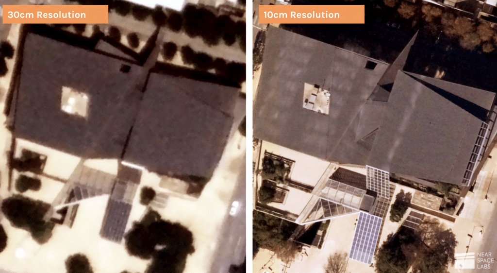
“By bringing 10 cm imagery down to an affordable price, more customers can afford highly detailed imagery that was previously out of reach due to the high cost. They can see a variety of details on the ground that aren’t visible at 30cm resolution, all the way down to a soccer ball on the ground, opening up many use cases across some of the most important industries in the world,” she added.
For instance, city planners can see potholes or road conditions and track urban sprawl to improve city and suburban development; or conservation groups can track wildlife populations and see vegetation details to monitor crop health; insurance companies can evaluate weather damage, determine whether a roof is made out of metal or wood, or underwrite remotely, or mobility and transportation companies can see road and highway conditions at scale to create better maps and build charging stations for autonomous and electric vehicles.
The Swifty fleet is also zero-emission; the hardware is designed for frequent re-use and minimal environmental impact, unlike a plane or a satellite, which emit massive amounts of greenhouse gases.
While the company is experiencing high demand for its technology, including the 10 cm imagery, Matevosyan said it has more big announcements in the pipeline for 2022. It expects a large influx of business in the coming months and is also looking to expand its team to help meet demand.


