Home 2024 August

Monthly Archives: August 2024

Lithuanian Drones on Frontline
Lithuanian Drones on Frontline

Exactly two and a half years ago, Russia invaded Ukraine. The war since then has seen countless deaths, heavy loss of critical properties on both sides and Russia’s aggressive moves of capturing Ukrainian territories and causing devastations around.

However, Ukraine is fighting a tough fight against Russia to claim its freedom, peace, and security. Many European countries are extending financial, military, and humanitarian support to Ukraine. Kiel Institute for the World Economy is maintaining a database titled “Ukraine Support Tracker,” which lists and quantifies the support flows by Western governments to Ukraine since February 2022.

According to the database, currently, Lithuania is among the top supporters of Ukraine globally in terms of the share of GDP, with bilateral aid to Ukraine equalling 1.5% of GDP. Russia’s full-scale invasion has forced around 1.6 million Ukrainian schoolchildren out of education.

Ukraine has also faced unprecedented damage to critical infrastructures throughout the country, and yet they do not want to wait till the war ends to start rebuilding. Ukraine is rebuilding itself with the help of aid from partners and other nations. Since 2022, Lithuania has been helping Ukraine in its recovery not only by supporting some of the reconstruction projects but also with the latest technology, gadgets, and equipment while the nation is dealing with an ongoing war.

Granta Autonomy’s Drones on the Battlefield

“The traditional battlefield is evolving, and Western armies require robust, reliable, and flexible solutions. Granta Autonomy is committed to ensuring our systems can be readily manufactured across Europe, reducing reliance on external sources,” said Gediminas Guoba, founder and CEO, Granta Autonomy.

Former military engineer Gediminas Guoba founded Granta Autonomy in 2014. As a reconnaissance operator, he said he is in a much better position to understand what is needed for reconnaissance missions, in what environment, what should be chased, what kind of information should be collected, and how to work with the system on the battlefield.

“The Environment is not going to be friendly. Sometimes, it is difficult to navigate, especially at night, but you need to provide information to your team and do your mission. The environment will be harsh, so your system must work, no matter what,” he added.

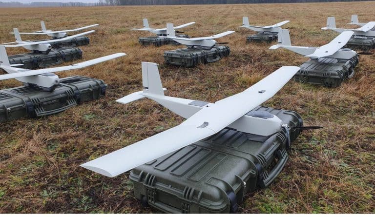
After Russia invaded Ukraine in February 2022, Vilnius-based Granta Autonomy started supplying its UAVs to the Ukrainian front. Today, the Ukrainian army operates a battery of Granta Autonomy UAVs funded by the Lithuanian and other European defence ministries. The company also provides its technology to NATO forces across Europe.

“Our team of military drone operators and engineers built their expertise into this design. It offers the industry’s best flight time, simple operation, and rugged durability, increasing efficiency, lowering costs, and offering unmatched reliability in complex, multi-faceted missions,” he adds. “We collaborate directly with soldiers in combat zones, testing our products and software in real-world situations.

This ensures our solutions excel in the harshest conditions.” Gediminas said, “We are developing air defence systems to counter other drones. We are also working on FDV drones and other types of drones.”

With his firsthand experience testing Granta’s cutting-edge lightweight surveillance and reconnaissance UAVs, micro gimbals, and digital communications software on the front lines of the Ukraine war, Gediminas believes his team’s technology will revolutionize how armed forces conduct complex reconnaissance missions. He sees Granta’s technology as a potential game-changer for bolstering NATO’s defences against Russian aggression across Europe.

Usage of Drones in Modern Warfare

Drones have become indispensable assets for gathering intelligence, tracking the movements of vehicles, soldiers, and terrorists, monitoring border areas for aggressions, and staying updated with the enemy’s moves, especially in contested and complex environments.

Real-time intelligence is the need of the hour to plan the next move or take swift measures, and drones are doing just that right. “As engineers, we started thinking about what we could do to help improve our country’s defence. We have already seen that drones make a huge difference on the battlefield.

We call them force multipliers, and that’s where our drone work started. In the future, we see more and more autonomy for our drones,” added Gediminas. “Our primary target while working on the front lines with Ukrainian soldiers was to understand what is going on there from a technological perspective and to understand how to improve our technology going forward to improve resilience to enemies’ different weapons, like jamming, counter-jamming, and other things.”

Drones provide real-time updates, and the data they collect can be analysed for post-mission analysis.

The Battlefield Over the Years

Gediminas described how the battlefield has changed, particularly during the last two years: “During the beginning of the full invasion of Ukraine, we saw mostly standard weapons like rocket launchers or tanks being used, and we saw the constant movement of vehicles and people.

The longest queue from the Russian side was almost 60km.” “And now just 10 kilometres separates the frontlines on both sides, but there are no vehicles, and no one is moving during the day because anyone who does move gets attacked by FPV drones. So drones play an important role on the battlefield, becoming far more advanced in destroying vehicles and targeting enemies.”

Granta Autonomy’s technology allows frontline soldiers to work in a completely challenged environment from a frequencies and radio-based perspective. Because GNSS and GPS signals get jammed, spoofed, and manipulated, “we have developed our Data Link technology, which is completely resilient to all kinds of jamming,” added Gediminas.

“We have also developed a technology that allows us to fly 40 kilometres away from the operator for over three hours and collect their information without needing a GPS signal. Still, all the time, we know where we are and what we are looking at; we can provide all the precise coordinates.”

Lessons from the War

Going forward, fewer humans will walk the battlefield, and we will see more drones working there. Drones are changing the tactical landscape, and tasks will be done online rather than on the battlefield. Gediminas suggested that the armed forces must be trained to develop skills and learn how to operate drones in challenging environments.

They must also be equipped with different kinds of drones, like reconnaissance or kamikaze drones, and taught how to service and utilize them. Opening academies for drone operators will also help the armed forces’ teams learn how to use drones because that won’t happen in one day, in a week, or a month: It’s a systematic process.

Verne Unveils Urban Mobility Service Driven by Mobileye

0
Verne Unveils Urban Mobility Service Driven by Mobileye

Verne, a redefined approach to urban autonomous mobility in cities, has been introduced.

A collaboration with Mobileye, a world leader in autonomy, enables Verne’s autonomous capabilities. The vehicle will be fully autonomous, with a system capable of driving in dynamic urban traffic.  

Founded by Mate Rimac and two of his closest colleagues and friends from Rimac Group – Marko Pejković, now CEO of Verne, and Adriano Mudri, the designer of Nevera and Chief Design Officer at Verne. 

For the past several years, the company has been cooperating with Mobileye. Mobileye’s advanced AD platform Mobileye Drive, will be integrated into the purpose-built Verne vehicle and together with a sophisticated sensor set of cameras, radar and lidar enable the automated driving capabilities.

The platform is designed to be highly flexible and scalable, to meet the demands of autonomous driving in a variety of locations, on different road types, under varying weather conditions and even taking local driving styles into account, within its operational design domains. All of this is crucial for Verne’s future plans. 

“Around the world, the promise and benefits of autonomous vehicles to road safety and accessibility have started to come into focus,” said Johann “JJ” Jungwirth, Executive Vice President, Autonomous Vehicles at Mobileye. “Verne’s innovative new vehicle platform and ecosystem reflect the potential autonomous mobility has to change our expectations of personal transportation. Only with a system like Mobileye Drive™, that’s built for scalability would something like this be possible, and we’re proud to work with Verne on this program.” 

Named after Jules Verne, the author who imagined humanity’s potential through amazing journeys, Verne was formerly known as P3 Mobility.

Minnesota Governor Tim Walz Champions GIS for Smarter Policy Making

Minnesota Governor Tim Walz Champions GIS for Smarter Policy Making
Minnesota Governor and VP Candidate Tim Walz Champions GIS Technology for Smarter Policy Making


Minnesota Governor and Democratic vice-presidential candidate Tim Walz speaks often about the importance of understanding the context of a location. As Governor, Walz has used GIS technology to simplify complex data into clear maps that help shape policies on issues like equity, sustainability, and economic growth.

Speaking in July at the Esri User Conference, Walz highlighted how crucial GIS technology and detailed maps are for leaders making decisions on climate change adaptation, public health, resilient infrastructure, educating future leaders, and promoting equity.

(This video originally appeared on Esri Blog and has been republished with due permission.)

Airbus & Astroscale UK Partner for In-Orbit Servicing

0
Airbus & Astroscale UK Partner for In-Orbit Servicing

Astroscale UK has signed an MoU with Airbus Defence and Space in the field of in-orbit servicing and space debris removal. The two U.K. subsidiaries will collaborate to address critical space challenges.

By combining their strengths, they aim to enhance space sustainability and extend satellite lifespan. A primary focus is advancing the U.K.’s in-orbit servicing and manufacturing industry, fostering a circular space economy.

Key objectives of the partnership include:

  • Space debris mitigation: Developing innovative techniques to identify, capture, and remove space debris. This is crucial for safeguarding ongoing and future space missions while preserving a sustainable space environment. The collaboration will leverage the Airbus VISPA robotic arm on future Astroscale missions.
  • In-orbit servicing: Creating technologies and solutions for maintaining, repairing, and upgrading satellites in orbit. This will extend satellite life, reduce space debris, and improve overall space operation efficiency.

“By partnering with Airbus, we are taking a major step forward in advancing the U.K.’s leadership in the in-orbit servicing and manufacturing industry. Our combined efforts will not only enhance the longevity and efficiency of space assets but also contribute to building a circular economy in space, where resources are reused and repurposed. This collaboration is crucial for addressing the challenges of space debris and ensuring a sustainable space environment for future generations,” Nick Shave, managing director of Astroscale UK said in a statement.

Dawn of a Critical Era for GeoInt

Dawn of a Critical Era for GeoInt

Exclusive conversation with Kathryn McMullan, Director, Australian Geospatial Intelligence Organization ( AGO) on changing GeoInt landscape, uncertainties in the Indo-Pacific, women leadership in the intel community, and more.

Tell us about the outlook and vision of AGO?

As part of Defence and as a member of Australia’s National Intelligence Community, AGO is contributing to the delivery of National Defence as enshrined in the National Defence Strategy (NDS).

This includes enabling all six capability effects outlined in the NDS: projection of force; holding a potential adversary’s forces at risk; protecting ADF forces and supporting critical infrastructure in Australia; sustaining protracted combat operations; maintaining persistent situational awareness in our primary area of military interest; and achieving decision advantage.

With an increasingly complex geopolitical environment demanding an integrated, focused force, AGO must continue to convert GEOINT into an integrated and future-focused capability that provides Australia with decision superiority.

Concurrently, AGO must also continue to work with partners within the Australian emergency response services, the mariner and hydrography communities and the broader geospatial and space sectors. Our services provide crucial geospatial insights that, through our stakeholders and partners, enhance Australia’s security and prosperity.

We inhabit a world defined by a lot of vulnerability, uncertainty, complexity, and entropy. Is there a need for countries to design new security architectures with spatial tech embedded at the core?

GEOINT and geospatial data are essential to delivering National Defence and, in turn, preserving regional stability. GEOINT provides critical intelligence insights, strategic warning, support to military operations and safety of navigation that will enable the integrated, focused force and ensure our collective security.

The concurrent increase in demand for geospatial data and rapid technological development presents significant opportunities for AGO to drive transformative change in GEOINT to address the challenges we face. Building strong partnerships across geospatial professions is fundamental to delivering this transformation.

The global defense and security landscape has transformed over the years with digitalization, connectivity, and an enormous profusion of data. Do we need to re-evaluate the role of geospatial intelligence in this scenario?

Geospatial data is critical to almost every industry – including mining, ocean conservation, and agriculture – and new technologies are providing unparalleled opportunities to collect and analyze data, further reinforcing the importance and ubiquity of geospatial expertise.

I believe we’ve entered a critical era for geospatial intelligence (GEOINT). Our increasingly interconnected world relies on precision and accuracy and the demand for GEOINT and geospatial data is growing rapidly. This environment presents new opportunities for AGO and our customers.

This evolving reality means we must continue to develop geospatial knowledge and practices to tackle emerging challenges in defense and security. Industry and academia will play an important role in harnessing new tradecraft and emerging technologies to enhance our security during a period of global uncertainty.

What would be the peculiar challenges posed by AI in ISR ( Intelligence, Surveillance, Reconnaissance)  and safeguarding national security?

As in so many other industries, AI presents both challenges and opportunities to our field. I am optimistic about the potential for AI to make the jobs of analysts and decision-makers easier and more efficient by streamlining routine tasks that once required significant time and resources to complete, particularly data collection and analysis.

I do not expect AI to undercut the need for human analysis in the GEOINT field, but rather to serve as a complementary tool allowing intelligence professionals more time to focus on strategic work.

That said, there will be an ongoing need to provide training and education programs to keep pace with advancements in AI to ensure analysts possess the skills and knowledge required to operate systems effectively and ethically.

Of course, this alludes to the need for effective and ethical governance around AI to ensure that decisions are based on trusted and assured data, which is of course highly relevant to safeguarding national security.

How can India and Australia boost collaboration in geospatial intelligence, especially in the context of Indo-Pacific maritime security?

India is a top-tier security partner for Australia and we share a deep strategic alignment. Through the Comprehensive Strategic Partnership, the Government is continuing to prioritize practical and tangible cooperation that directly contributes to Indo-Pacific stability.

This includes increasing the depth and complexity of the engagements between our Defence Forces and enhancing our shared maritime domain awareness. AGO’s Australian Hydrographic Office is building relationships with India through its respective hydrographic organizations to support this cooperation.

You are the first woman to head AGO. How has the journey been, and what would be your message to women in national security and intelligence?

I am the second woman to head AGO. Maria Fernandez was the first, leading DIGO/AGO from 2012 to 2015. Maria was also the first woman to head an Australian intelligence agency, a true trailblazer for women in national security.

Female leadership in national security and intelligence has been important in addressing contemporary security threats both in Australia and on a global scale.

We have seen great advancements in female representation – indeed, five of the ten National Intelligence Community agencies are currently led by women. But ultimately the best leadership and decision-making occurs when there are diverse experiences and views, and a healthy respect for different perspectives. Gender diversity is but one element in achieving that.

Brazil and Chile sign Agreement on Space Cooperation

0
Brazil and Chile sign Agreement on Space Cooperation

Chile and Brazil signed a Memorandum of Understanding on Cooperation in Space Activities for Peaceful Purposes, to promote joint programs and projects in space matters within the framework of the State during the visit of President Luiz Inácio Lula da Silva, as reported by the Chilean government through its Presidential Press page.

The agreement was signed by the Ministers of Science, Technology and Innovation of Brazil, Luciana Santos, and of Science, Technology, Knowledge and Innovation of Chile, Aisén Etcheverry, specifying the intention of both countries to cooperate in space activities by carrying out projects of common interest. Both countries will identify areas to develop joint programs and projects by their respective national policies on space policy.

Chilean President Gabriel Boric emphasized the importance of partnering with Brazil to accelerate Chile’s space program. He highlighted the opportunity to collaborate on research into climate change and other planetary issues.

Brazilian President Luiz Inácio Lula da Silva expressed pride in sharing Brazil’s space expertise with Chile. He emphasized the role of government in space development, criticizing private sector initiatives like Elon Musk’s focus on Mars colonization while neglecting Earth. Lula argued that space infrastructure is essential for addressing global challenges, particularly climate change.

The cooperation between Brazil and Chile marks a significant step forward for both countries in space exploration and aligns with a growing global focus on space-based solutions to Earth’s problems.

Women in Sustainability

0
Women in Sustainability


UK’s 2023 Net Zero Growth Plan set out an update to the existing strategies, focusing on the scale up and deployment of technologies for decarbonizing homes, power, industry and transport.

In an interview session with Geospatial World, Heather Buchanan, Director and Co-Founder of Bankers for Net Zero (B4NZ) speaks about the her work in sustainability sector, how strategic policies can bring net zero and much more. B4NZ is an initiative that brings together banks, businesses and regulators to enable them and their clients to accelerate the transition to net zero.

Geospatial Expertise Can Save the Fishing Industry

0
Geospatial Expertise Can Save the Fishing Industry
Sea boat and fishery 2022 OFQ3

There are certain moments in history when society only starts to change when businesses adjust their practices. One of these moments is happening right now. Many industries are accepting a harsh new reality: climate change is changing the way they must operate.

Industries can either adapt to these changes, or fail. Fisheries are no exception and using GIS may be the only way to save them.

Fisheries have been noticing aquatic species in places they would never have been expected. This means the places where fishermen are fishing and the areas being protected may not be ideal.

As a student, this is my experience learning how to navigate the world of scientists, business leaders, and government officials to help answer one important question.

Where did all the cod go?

Everything began when Roger Mann, a professor at the Virginia Institute for Marine Science (VIMS), approached the William & Mary Center for Geospatial Analysis (CGA), for geospatial assistance answering this question.

In order to accomplish his goal he wanted to use something he knew very little about, GIS. At the time, I was working in the CGA as an undergraduate researcher on a community-based collaboration around West Nile Virus and local mosquito monitoring.

Dr. Mann received a grant from National Science Foundation (NSF) known as an REU or  “Research Experiences for Undergraduates”  award to provide funding to a student to mentor in research methods with a focus on fisheries and climate change.

The project began with a simple objective: to determine if cod have stopped spawning in a protected spawning ground off the coast of Nantucket called the Great South Channel Habitat Management Area (GSC HMA).

With the rapid increase of ocean temperature over time, cod have likely started spawning further north, where the water is cooler. Meaning it’s likely that the protected area isn’t protecting cod anymore.

My initial NSF REU reward was simply to examine this one protected area and determine if the cod had moved and if the protected area should be moved as well.

The primary issue was, there was no data about the number of cod in this protected area. Species surveying is prohibited in the management area, since it is a form of fishing. I began by examining surveys in the surrounding geographic area for change over its lifetime, using NOAA’s DisMAP data.

This tabular data of around 25,000 points of species distributions was converted to a spatial distribution map of cod observations on the eastern coasts of the US and Canada over a period of 45 years.

Time based data is both a blessing and a curse. As you can imagine, 45 years worth of species distribution survey data can be overwhelming for any map reader. These surveys were collected twice a year (fall and spring) over that time.

To provide a better visualization of the distribution shifts, the data was broken down further into year-by-year data and I even tried grouping the data by 3 year and 5 year time frames.

Finally, I decided to use only the spring survey, a survey taken about a month after spawning season as a proxy for cod spawning grounds. Then this was placed into a time slider to show the loss of cod in the surrounding areas over time.

This geovisualization confirmed what we suspected, there has been northern movement of the cod distributions. With GIS, this suspected activity was now confirmed for the scientific community and the fisheries industry.

By connecting this project to global climate trends, I expanded the project exponentially. I had completed all this work, but these findings hinted at a very significant climate issue. I wanted to investigate the phenomena causing cod to move in the first place.

I took my data and looked at trends along the entire geography and determined that cod were moving north at a rapid rate. I suspected ocean temperature must be rising at an unprecedented rate to cause such an occurrence.

I then expanded the scope of the project to determine where the cod are going and what places should be protected, as the cod have moved so much since the habitat protection areas had been put in place.

In my new vision for the project, I would create a habitat suitability index using factors known to affect cod spawning. This way I could determine where cod are moving to and where to move protected areas, to protect the species more effectively.

However, I was bringing the geospatial expertise to the project and didn’t have a full marine science background.

I began researching the most important factors for cod spawning with the mentorship of Professor Mann.

Together we read through literature and determined the ideal habitat consisted of a complex bottom, shallow water, and moderate temperatures.  I found ideal datasets for each factor and brought them to Professor Mann and others in his lab.

We determined that substrate type (ocean floor composition), bathymetry (ocean depth), and temporally dynamic factors such as temperature were the most important variables. The spring cod surveys were then used as overlay points to both create time sliders and to analyze and identify which habitats were demonstrating the best suitability.

With this new goal and data, we wanted to be able to pinpoint the exact locations of cod spawning grounds and accurately predict future movement.

People get very excited about showing the effect of ocean warming/climate change on aquatic life behavior, but an accurate model must take into account all factors. Since spawning is so complex, I didn’t want to have tunnel visioned by the effect of climate change.

I needed to take into consideration the effects of the many important factors. These additional factors added insights to the complexity of cod spawning locations and demonstrated cod to spawn in geographic locations outside of their usual temperature range.

The accuracy of my suitability index comes from the inclusion of these factors combined with temperature, which is not how other research I was familiar with had approached this problem.

I knew the importance of my findings and I needed to be brave enough to speak out. I thought the hard part was over: we had done all the research and completed the geospatial analysis.

But the next step was to convince fishermen and their businesses to realize the effects of climate change on their industry. I didn’t expect anyone to care about my findings.

At this point all of the work I had done was behind a computer, but talking to people and businesses affected by this issue proved to be just as important as the research aspect.

This was the first time I had ever been viewed as an expert on something. No part of my education had prepared me to publicly criticize decades old government policies and business practices.

I realized that if I wasn’t going to advocate on behalf of my research, no one was going to do it for me. For every successful scientific discovery, there are likely many more that go unnoticed because they don’t have the resources or fear the backlash of identifying an issue with society.

I was determined to make sure my project had no chance of going unnoticed. I would rather have my work be disputed or debunked than to have not pointed out a potential problem in the first place.

Conferences give businesses in the industry a chance to learn from the world of science and scholarship.

It is in the best interest of businesses to know more about climate change and ocean warming.

But they need guidance from these scientists in order to make beneficial changes. In order to raise awareness, I presented in front of NSF’s SCEMFIS at their two annual conferences.

This is a group of scientists and industry members who focus on fisheries management and fund related research projects. I knew that if I could make the fishing industry aware of the problems, I could use their influence and knowledge to recommend policy changes and help reshape industry narratives around cod spawning and ocean warming.

As a sophomore in college, at the time, I would have the opportunity to present my work along with Marine Biology and Engineering Professors from around the country in front of businesses and government officials in the fishing industry.

Preparing for these events was stressful, but after about 4 months of work, I had my first presentation. Walking into a conference and seeing my name as the only undergraduate student with a presentation was nerve wracking.

As soon as I started, all the stress went away. I had grown to care so much about this issue and wanted to help the world understand the urgency of what I was addressing. During this Fall 2022 presentation, I discussed the issue of ocean warming with them and showed how it is causing mismanagement of cod stocks.

I explained that the drastic changes in ocean temperature have likely caused all species to change their habits and move to places with more suitable temperatures.

This means that right now we are probably protecting a lot of places where the targeted species don’t actually spawn and neglecting the places they do.

 I succeeded in calling attention to a problem.

The next step was to create something to solve it. NSF’s SCEMFIS board (composed of industry members) was compelled by this research. They recognized it would help preserve fishing stocks while also allowing them to fish for other species in currently closed, inaccurate protection zones. So, I began to work on a functional suitability index model.

In Spring of 2023, I presented for NSF’s SCEMFIS board again. This time, showing a finished product with a suitability index model that visualized the drastic changes in cod spawning suitability since 1959. Ultimately demonstrating that cod are likely to have moved completely away from the areas we protect, since the initial placements were done before the current rises in ocean temperature.

I wanted to continue building on this work, so I applied for a new grant

My long-term goal is to continue to expand the project to help with the protection of more species and continue to identify and predict problems that will arise as the oceans continue to rapidly warm.

After presenting for a third time to this board, I proposed that with funding beyond the REU I could expand the predictive ability of my model to determine future conflicts between ideal cod spawning protection zones and fishing hot spots for other species, allowing the industry and policy makers to prepare for these issues years in advance. My grant project proposal of $32,000.00 was funded at the end of my sophomore year.

Everyone has a role to play, and the only way we can begin making progress is if we start on the same team.

In order to solve any problem, you need to be able to navigate countless organizations, agencies, policies, and individual stakeholders. When examining problems impacted by climate change, we need to seek collaborations with industries, government officials and scholars of many backgrounds and expertise areas.

GIS experts are one of these groups. I’ve learned that using GIS to solve climate change issues can bring people together. It can take a controversial topic and make it informative and understandable for all of the affected parties. Fixing issues related to climate change can be frustrating.

In our world, cooperation on this topic does not come easily, nor does change. There are so many people from the government, industry, and academia on the same page about climate issues. GIS might just be the thing needed to bring them all together.

Generation Artemis: To Moon and Beyond

Generation Artemis: To Moon and Beyond

Generation Artemis

To Moon and Beyond

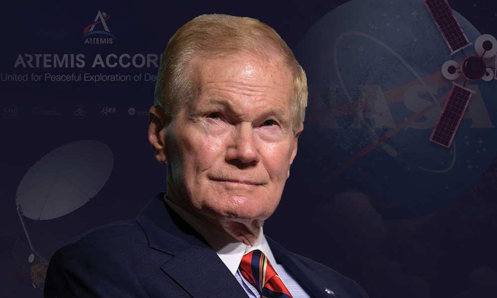
NASA Administrator Bill Nelson shares crucial insights on Indo-US cooperation, AI, space wars, new age of planetary exploration, and more.

From the days of the Apache sounding rockets in 1963, to NISAR, the world's biggest SAR satellite, Indo-US space cooperation has come a long way. What do you think is the future of this partnership?

Space shows us time and again that diplomacy is good for discovery, and discovery is good for diplomacy.
Our flagship mission with India, NISAR, will bring revolutionary data about the evolution and state of Earth’s crust, help scientists better understand our planet’s processes and changing climate, and aid future resource and hazard management. 

Our international partners – including India – are making remarkable discoveries on the Moon. It was just last year that India’s Chandrayaan-3 landed on the lunar surface, becoming the first nation to land at the South Pole of the Moon.

This mission inspired countless people in India and worldwide, providing key scientific data on the lunar South Pole, which is where the future NASA Artemis missions will land.

We are looking forward to continuing to work with India from Earth to the Moon and, eventually, on Mars, and we are excited about welcoming an Indian astronaut to the International Space Station (ISS).

I hope that China will join the U.S. in dissuading Russia from putting a nuclear weapon in space, which would put all of our astronauts at risk, including Russian Cosmonauts.

Artemis Accord reiterates the peaceful use of outer space as humanity's common province and aims to rekindle the spark of the Apollo spirit to go back to the moon. How can it serve as a symbol of hope and progress for countries that are newcomers to space?

The Artemis Accords define how we can remain true to, and implement our obligations under the Outer Space Treaty. They reflect a shared commitment to safe, responsible, and transparent behavior in space, to preserve and protect the outer space environment, and ensure a sustainable future in space for all.

India’s leadership in discussions of how to implement the Accords principles will be critical to success. It is also important for new-comers to space to join these discussions. India can help them understand the value of their participation.

Working together in space helps to bridge generations and nations. It builds a better future for all humanity.  This new generation – the Artemis Generation – will see humanity return to the Moon, where we will learn to live and work as we prepare for the first human missions to Mars.
Along with both new and existing partners will add new energy and capabilities to ensure the entire world can benefit from our journey of exploration and discovery. These achievements will benefit the Artemis Generation all around the globe.

While the 1967 Outer Space Treaty, ratified by more than 100 countries, explicitly prohibits deployment of weapons into outer space, the risk of a space conflict still looms. Do we need to amend the treaty or introduce new clauses to it as space weaponization is a looming threat?

The 1967 Outer Space Treaty already prohibits the establishment of military bases, installations and fortifications, the testing of any type of weapons and the conduct of military maneuvers on celestial bodies, including the Moon. It is very clear about the use outer space only for peaceful purposes.

But this is also why the Artemis Accords are so important – to establish a common set of principles for the civil exploration and use of outer space.

The circumstances today are vastly different than those in the 1960s. This time our goal is not just to go to the Moon, but to reach the Moon to learn so that we can go farther to Mars and beyond. NASA and the United States use space and science as a unifying force.

Space monitoring and solutions are critical for sustainability on Earth. Yet sustainability in space is equally crucial, and both are interlinked. How to emphasize this to drive concerted action and build meaningful, value-based alliances?

For decades, NASA has served as a proactive leader for responsible and sustainable space operations. As outlined in our new Space Sustainability Strategy released earlier this year, NASA is working on measuring and assessing space sustainability in Earth orbit.

We are identifying cost-effective ways to meet sustainability targets, incentivizing the adoption of sustainable practices through technology and policy development, and increasing efforts to share and receive information with the rest of the global space community.

From GPS, which is the backbone of the digital economy, to high-resolution agricultural and supply chain monitoring, and disaster and emergency risk mapping, the contribution of space to the world is invaluable. What do you think would be its role in the era of Generative AI and Industry 4.0?

We are living through a golden age of exploration – all of us. And that’s not just in terms of returning to the Moon and going to Mars.

NASA has over two dozen Earth-observing satellites and data from over 60 years of how our planet is changing.

It’s an exciting time, and I am looking forward to how NASA’s unique vantage point from space will help inform Generative AI and Industry 4.0.

Do you think we are at the crossroads of a New Space Race? And how different the current scenario is from the Cold War era?

The circumstances today are vastly different than those in the 1960s. This time our goal is not just to go to the Moon, but to reach the Moon to learn so that we can go farther to Mars and beyond. NASA and the United States use space and science as a unifying force.

This time, we are going to the South Pole because we know there’s ice there in the crevices of the rocks in the constant shadow or darkness.

And where there’s ice, you have water, which can be used to create rocket fuel. But there are limited areas that you can land on the South Pole.

So yes, we want to get there with the international community, for scientific research. NASA welcomes partnership between nations around the world, especially those who share the same values of transparency, peaceful exploration, the release of scientific data, and planning for the safe disposal of orbital debris.
On a related note, I hope that China will join the U.S. in dissuading Russia from putting a nuclear weapon in space, which would put all of our astronauts at risk, including Russian Cosmonauts.

As a Congressman, you trained with NASA and travelled to outer space in 1986. What is it that has always elicited your deep interest in space throughout your long illustrious career?

I often talk about President Kennedy’s speech at Rice University in 1962 where he quoted British explorer George Mallory, specifically his answer for why he dared to climb Mount Everest. Mallory’s response was: “Because it’s there.”

Humans are explorers by nature, it is in our DNA. And space is the final frontier. When I was orbiting the Earth, looking back at the planet from the unique vantage point of space, I did not see racial division. I did not see religious division. And I did not see political division.

I saw that we are all in this together, as citizens of Planet Earth. We go to space to improve life here on Earth, and the way to do it is together with international partners.

The New Age of Earth Observation

The New Age of Earth Observation

Satellites have long contributed to monitoring Earth from space. The implications of this technology have been so grave that it has cemented itself as a critical tool for most nations around the world. But there is still a lot to be desired.

Since the first Earth observation prototypes using Synthetic Aperture Radar (SAR) were developed, our ability to capture imagery and subsequently, our access to data and information about disaster-struck areas, conflict zones, and more, has been revolutionized.

But what is perhaps most exciting is the possibility that can be achieved with SAR. Despite representing a modest portion of the global space economy, the Earth observation (EO) sector has experienced exponential growth and according to Morgan Stanley Research, is estimated to skyrocket from a value of $4.4 billion to a staggering $25.273 billion by 2040.

This rampant growth, alongside the development of AI and machine learning technologies, and a commitment to collaborate and share information, is creating a fertile ground for pushing the boundaries of what SAR-powered EO is capable of.

Mission So Far

In recent years, facilitated by advancements in satellite imaging, remote sensing, and data analytics, SAR has revolutionised our ability to understand and monitor the dynamics of our planet. The increasing demand for accurate and timely environmental data coupled with the rise of commercial space ventures is empowering faster delivery of data to tackle global challenges such as climate change, natural resource management, and disaster response.

SAR satellites, unhindered by low visibility at night or adverse weather, offer a clear and comprehensive perspective of Earth’s surface and movements. SAR data contains information that contributes to the understanding of the shape and physical properties of the terrain and structures. Furthermore, SAR enables monitoring of various objects, from urban vehicles to disaster-prone buildings and maritime vessels at major ports.

This capability makes SAR satellites suited to time-series analysis, facilitating continuous monitoring across several applications on land and at sea. Advancements in design, computing and reduced launch costs have made small satellites more widely available. These compact alternatives, being more cost-effective and lighter, have made the deployment of multiple SAR satellites on a single payload possible, expanding the accessibility of space exploration.

This availability of small SAR satellite constellations enables near real-time global observations with unprecedented detail and high-resolution image clarity.

Towards Common Goal

The enhancement of EO technology is not merely a scientific endeavour: it’s a critical tool for informed decision-making across various sectors and applications. From monitoring environmental health and biodiversity to supporting national security initiatives, urban planning efforts, and disaster response operations, EO data provides invaluable insights that drive evidence-based decisions across the entire value chain.

Yet collaboration between government agencies, research institutions, industry stakeholders, and international organisations must be leveraged to accelerate technological innovation, data sharing, and capacity-building efforts. A data-driven approach and collective learning are of paramount importance for the creation of a better world for future generations.

Shared knowledge will result in standardized processes and abilities, unlocking a generation of innovative applications and use cases through open data. We have already seen the value of open-source SAR imagery to help track conflicts and disasters. Collective learning, drawing from diverse backgrounds and experiences also plays a critical role in the achievement of systematic innovation.

To this end, a data-driven approach is also imperative, along with the integration of academia with international entities like the United Nations and the World Bank to ensure a linear global progression in knowledge accumulation. International stakeholders can establish analytical platforms to facilitate learning, while companies can contribute through APIs and insights, fostering collaboration.

Synspective relies on the development of close partnerships with experts in construction, engineering consultancies, and insurance companies. We provide the analytic datasets, but our solutions are developed through discussions with these experts.

New Tech Landscape

There are unavoidable questions about the role that Artificial Intelligence (AI) will play in society. For EO at least, AI-powered algorithms and Machine Learning (ML) techniques enable automated analysis, pattern recognition, and predictive modelling, unlocking new possibilities for extracting actionable insights at scale.

Japan’s Highest Resolution 25cm SAR image

The combination of SAR satellite constellation with an AI-driven analytics platform can unlock the path toward a continuously learning world, enabling customers across industries to make data backed timely decisions. AI’s capacity to predict, analyse, and interpret vast amounts of data in real time is poised to revolutionise the field.

Despite the wealth of EO data available from satellites and ground-based sensors, the challenge lies in deciphering complex patterns, identifying relevant trends, and extracting intelligence on time. AI algorithms offer powerful tools for detecting anomalies and generating predictive analytics. By leveraging AI capabilities, EO practitioners can enhance data processing efficiency, improve decision-making accuracy, and unlock new applications across diverse sectors.

EO data serves as the backbone for geospatial analytics, enabling the creation of actionable insights. Generative AI, a cutting-edge technology, has the potential to revolutionise the geospatial industry with its capabilities to streamline processes, such as land cover mapping and 3D modelling, while also empowering predictive analytics for future scenarios.

The impact of improved SAR data processing has already been witnessed and can give us a preview of what might be achieved with AI. In 2011, during the Tōhoku earthquake in Japan, there wasn’t a sufficient amount of satellite data to provide immediate information for risk assessment and recovery activities.

The Noto Peninsula earthquake of 2024 highlighted SAR satellites as a crucial tool in effective natural disaster management. Other than the obvious path to enhance our capabilities by increasing the number of satellites providing data, and applying AI capabilities to reduce processing times, the solution lies in sharing live URLs of satellite data to help with disaster management efforts in the event of earthquakes, floods, or forest fires.

Managing Disasters

Within the next few years, we anticipate being able to predict damages from a disaster and have enough information to proactively prepare and minimise the impacts, while leveraging relevant data for the planning and construction of robust infrastructures, all thanks to AI capabilities.

By harnessing historical disaster data and real-time satellite imagery, AI-powered algorithms can generate predictive models that forecast potential hazards, assess vulnerability, and prioritize resource allocation.

Through ML techniques, AI systems can analyse satellite images to identify the damage, help establish disaster-resilient infrastructures, and support decision-making in crises. For example, accurate landslide risk assessments can be provided, highlighting potential risk areas. By integrating AI-driven solutions into disaster management workflows, stakeholders can mitigate risks, reduce response times, and enhance community resilience.

With four satellites combining SAR data with advanced machine learning currently in Low Earth Orbit (LEO), Synspective delivers data and analytical services across several industries. Its proprietary Land Displacement Monitoring (LDM) solution uses interferometric SAR (InSAR) analysis to monitor ground risks, particularly beneficial for reclaimed lands and mining sites.

Continuous monitoring with LDM can help track historical changes and find patterns using a cloud-based data platform. Notably, LDM’s subsidence detection utilizes a unique algorithm, providing early alerts for potential ground deformations, crucial in the prevention of disasters in facilities such as tailing dams.

A Better Future

Continued advancements in EO technologies are indispensable for addressing complex global challenges, including climate change research, natural resource management, and disaster risk reduction. The integration of AI capabilities catalyses sectoral development, enabling the rapid generation of actionable insights and data-driven decision-making.

By harnessing the synergy between EO and AI, societies can better understand, monitor, and manage the Earth’s dynamic systems, promoting sustainable development in an increasingly interconnected world.

Iván González Vallejo Joins Beyond Gravity as Chief Transformation & Strategy Officer

0
Iván González Vallejo Joins Beyond Gravity as Chief Transformation & Strategy Officer

Beyond Gravity announces the appointment of Iván González Vallejo as the new Chief Transformation & Strategy Officer and member of the Executive Board, effective 1 September.

As of 1 September, Iván González Vallejo will take on the role of Chief Transformation & Strategy Officer at Beyond Gravity, joining the Executive Board. He will lead the company’s Transformation & Strategy function, which includes IT, Portugal, Innovation, QMS & Processes, Change & Transformation, as well as Indirect Procurement.

In his role, Iván will also spearhead the implementation of Beyond Gravity’s EZYone transformation program, which aims to enhance the company’s operations and business efficiency.

“Iván’s career has been marked by significant achievements not only in strategic development but also in the successful implementation of complex transformation projects. His expertise will be crucial as we prepare Beyond Gravity for the next steps post-privatization and position our company as a scalable platform that goes beyond current capabilities. Iván’s passion for the space industry began during his studies. With his background in aviation, which has many parallels with space, he brings valuable insights on how to tackle profitable growth opportunities in a more and more commercialized environment. I look forward to welcoming him to Beyond Gravity and our Executive Board,” said CEO André Wall.

Proven Track Record in Strategic Planning, Transformation and Driving Profitability Most recently, Iván González Vallejo was Director of Strategy and Supply Chain at Iberia Maintenance, where he led the development of a 10-year strategic plan for an organization of 3,000 technicians and engineers.

The organization provides maintenance services to over 100 airlines globally, generating revenues of €1.2bn annually. He also managed Iberia Maintenance’s supply chain function, focusing on achieving a benchmark cost base and preserving cash through strategic material planning, vendor control, and logistics services.

His experience also includes managing the merger and redesign of sales functions for Iberia and British Airways at International Airlines Group (AIG). He holds an MBA from IESE Business School in Barcelona and completed an MBA exchange program at Wharton Business School. He has a background in aerospace engineering and a master’s degree in spacecraft and missile design from Universidad Politécnica de Madrid.

“I am thrilled to join Beyond Gravity and take on this exciting new role in the fascinating space industry. I look forward to working with the team to drive our transformation initiatives and achieve new heights of operational excellence,” says Iván González Vallejo.

EU-Hydro Upgrade for Copernicus Land Monitoring Service

0
EU-Hydro Upgrade for Copernicus Land Monitoring Service

The Copernicus Land Monitoring Service (CLMS) framework contract for upgrading the pan-European hydrological reference dataset EU-Hydro has now kicked off. The aim with the EU-Hydro suite of products is to provide a key reference suite for hydrological applications across Europe, while also still being a reference dataset for mapping within the Copernicus services.

Several new methodological approaches will be tested and implemented for the creation of the EU-Hydro suite of products, to have them ready for roll-out by mid-2025. The new EU-Hydro suite of products will be produced for all river basins in Europe. One of the main innovations will be the availability of raster layers — such as a hydrologically conditioned DEM, a flow direction map, and a flow accumulation map — derived from the state-of-the-art CopDEM 10m.

Other important additions will be the topologically consistent river network, water bodies and watersheds. The upgrades in EU-Hydro will also include a newly delineated, up-to-date coastline dataset, as well as a specific layer on artificial structures of high relevance for several key policy areas, such as nature restoration and climate adaptation. These will include barriers and protective structures, all topologically consistent with the river network.

As a reference dataset in the CLMS portfolio, EU-Hydro provides detailed insights into water resources. It combines data from various sources — including the Copernicus Digital Elevation Model (COP-DEM) and national hydrographic datasets from Member States, as well as space-based imagery — to deliver information on the physical characteristics and geographical distribution of Europe’s water bodies.

Besides its use as a reference dataset for many CLMS thematic products, the updated version of EU-Hydro will support a wide range of applications within the hydrological domain, such as water resource assessments, water quality evaluations, environmental protection strategies, hydrological risk assessments and climate changes studies. The need for it in terms of supporting society-related risk assessments is further emphasised by the rising frequency of natural disasters, such as droughts and floods.

With its high-quality, free and openly accessible data, EU-Hydro will help address these challenges and the urgent requirement for enhanced water resilience in Europe — as highlighted in this year’s edition of the EU Green Week. The work in the project will be carried out by an international consortium operating under the leadership of GAF and including Telespazio Ibérica, e-GEOS, DLR and Confluvio.

Muon Space Secures $56M Series B Funding

0
Muon Space Secures $56M Series B Funding
Muon Space to develop and deliver three next-generation satellites to further SNC’s Vindlér constellation, which will provide industry-leading RF collection and analytics functionality.

Muon Space announces the successful completion of a $56.7 million Series B funding round led by Activate Capital.

Acme Capital and existing investors Costanoa Ventures, Radical Ventures, and Congruent Ventures all joined the round. This equity financing accelerates the buildout of Muon’s Halo Platform and positions the company to scale the spectrum of capabilities it delivers to a growing customer base.

In a testament to its rapidly growing traction in the space technology sector, Muon Space has now secured over $100 million in committed customer contracts in 2024 for its Halo LEO satellites.

A key highlight of these contracts is a landmark agreement with SNC for the development and delivery of three next-generation satellites to further SNC’s Vindlér commercial RF technology. The first Muon satellite block is slated for launch in 2025.

SNC’s Vindlér constellation delivers industry-leading RF collection and analytics functionality. The additional satellites will significantly enhance the ability to simultaneously collect multiple signals of interest over an unprecedented range of the RF spectrum.

This will also increase total downlink volumes, thereby transforming current commercial possibilities and supporting an expanding array of mission sets.

“SNC teamed up with Muon Space for an advanced radio frequency sensing satellite capability and end-to-end mission solution,” said Tim Owings, Executive Vice President of SNC’s MST business area.

“Muon’s scalable design, instrument development, and operations support, coupled with our RF technology, diverse data sets, and analytic capabilities, will provide a new level of commercial possibilities starting in 2025.”

The partnership between Muon Space and SNC underscores the combined strengths of an industry leader in ELINT/tactical sensors and the innovative potential of New Space and agility of modular design in Muon’s Halo satellite technology.

This collaboration is set to redefine commercial RF solutions and deliver unparalleled value to various mission applications.

“Having an established industry leader like SNC select Muon Space for this mission really underlines our competitive edge,” said Gregory Smirin, President of Muon Space.

“Our end-to-end solution offers a significant advantage, providing SNC with a seamless and integrated approach from design to deployment and operations. This partnership validates our commitment to delivering comprehensive, cutting-edge constellation performance that stands out in an extremely competitive market.”

The Series B funding round underscores investor confidence in Muon Space’s innovative approach and market potential. With this capital raise, Muon Space plans to scale its operations, expand its product offerings, and continue to pioneer advancements in space-based sensing and analytics.

This funding will be instrumental in supporting the company’s growth and the execution of its strategic initiatives.

“Muon Space’s cutting-edge technology, phenomenal track record of execution, and multi-billion dollar market potential make it a highly compelling investment opportunity,” said Raj Atluru, Managing Partner of Activate Capital.

“With the industry’s best team and technology built around a compelling vision and huge opportunity, we believe Muon Space is positioned to define the next era of space infrastructure.”

“Our mission at Muon Space is to harness the power of space to deliver critical insights and data that drive meaningful change on Earth,” said Jonny Dyer, CEO of Muon Space.

“This funding and our growing list of top-tier strategic partners, like SNC, position us to accelerate our mission and make space-based intelligence accessible and impactful across a variety of sectors. We are dedicated to pushing the boundaries of what is possible in space to unlock a safer and more resilient world.”

ViaSat-3 F1 Satellite Enters Commercial Service

0
ViaSat-3 F1 Satellite Enters Commercial Service

Viasat announced that ViaSat-3 F1 (VS3 F1) has entered commercial service and is now available for aviation customers operating over North America, including routes servicing Hawaii.

This follows a period of testing and live trials, which took place during the first half of the calendar year (2024).

“This is exciting news for our aviation customers and the millions of passengers who use inflight Wi-Fi services powered by the Viasat network,” said Jimmy Dodd, President, Aviation segment at Viasat, Inc.

“Bringing ViaSat-3 F1 into commercial service for aviation customers will significantly enhance the passenger experience available over North America, including streaming content and staying in touch with the world when flying.”

“Today’s announcement is also a significant technical achievement for Viasat and signals the start of revenue generating services from the first of our three ground-breaking ViaSat-3 satellites,” added Craig Miller, President, Global Space Networks, Viasat, Inc.

“A further two ViaSat-3 satellites are currently in the late stages of production and testing, including the successful completion of thermal vacuum testing on ViaSat-3 F3 recently and the successful completion of mechanical environmental testing on ViaSat-3 F2.”

ViaSat-3 F1 experienced an antenna deployment anomaly following its launch in April 2023. However, extensive in-orbit testing demonstrated that all other systems on the satellite were operating at or beyond expectations.

And while the antenna deployment anomaly resulted in a significant reduction in overall capacity, the resiliency and high-performance specifications of the ViaSat-3 satellite system still allows the satellite to support high-speed broadband services for aviation customers over North America, where the satellite is deployed.

Safran Boosts Production of Advanced Satellite Propulsion Systems in US

0
Safran Boosts Production of Advanced Satellite Propulsion Systems in US
The PPS@X00 engine mounted on its plate.

Safran Electronics & Defense is building its US manufacturing capabilities for small satellite propulsion systems to meet the increasing commercial and defense demand.

This strategic initiative, announced during the 2024 Small Satellite Conference in Logan, Utah, will support the projected growth of the North American small satellite market, which is expected to reach more than $5 billion by 2030.

The “Made-in-the-USA” EPSX00 system will be manufactured by Safran Electronics & Defense through its US-based subsidiary, with first delivery in Q1 2026.

By establishing a new production facility in Colorado, Safran reaffirms its position as a trusted provider of satellite propulsion turnkey solutions for both American and global markets.

This initiative continues Safran’s long-standing commitment to investing in the US to provide critical solutions and best-in-class support to US commercial and government customers.

Strategically located, the new Colorado site will also host Safran’s U.S. team for satellite communications as well as space & ground domain awareness.

“Safran is committed to advancing our manufacturing capabilities to meet the dynamic needs of the U.S. small satellite market,” said Jean-Marie Bétermier, Space Global Business Unit Director, Safran Electronics & Defense.

“By targeting the global demand for electric propulsion in small satellites, we will address the challenge of increasingly stringent international regulations for sustainability and resilience around the world.”

“Our enhanced production efforts are poised to support these developments and foster innovation in satellite technology,” Bétermier added.

“Our advancements will also ensure greater spacecraft maneuverability to avoid collisions and facilitate the deorbiting of Low Earth Orbit (LEO) satellites at the end of their service life.”

Safran’s electric propulsion system, named EPSX00 which includes the PPSX00 thruster, solidifies its position as a leading provider of electric propulsion for small satellites.

The PPSX00, priced competitively to meet the specific requirements of the “New Space” market environment, boasts a total thrust time of up to 5,000 hours and a very high specific impulse, making it extremely versatile and adapted to all types of applications in LEO.

Firefly Aerospace Announces Second Multi-Launch Agreement with L3Harris

0
Firefly Aerospace Announces Second Multi-Launch Agreement with L3Harris
Alpha FLTA005 Launch; Credit: Firefly Aerospace / Sean Parker

Firefly Aerospace signed a multi-launch agreement with L3Harris Technologies for up to 20 launches on Firefly’s Alpha rocket, including two to four missions per year from 2027 to 2031 depending on customer needs.

The new agreement is in addition to Firefly’s existing multi-launch agreement with L3Harris for three Alpha missions in 2026.

“The Firefly team is proud to build on our existing relationship with L3Harris and serve as a long-term launch provider for their robust satellite systems,” said Peter Schumacher, Interim CEO at Firefly Aerospace.

“Firefly continues to see growing demand for Alpha’s responsive small-lift services, and we’re committed to providing a dedicated launch option that takes our customers directly to their preferred orbits.”

Under the agreement, Firefly’s Alpha rocket will launch L3Harris spacecraft into low-Earth orbit from Firefly’s SLC-2 launch site at the Vandenberg Space Force Base.

Alpha supports the responsive space needs of both government and commercial customers with the ability to provide direct, on-demand deliveries for satellites up to 1,030 kg.

Following the most recent Alpha launch for NASA, Firefly continues to accelerate vehicle production. The company’s latest facility expansion in Briggs, Texas, including a new automated fiber placement machine, allows the team to rapidly build and test Alpha’s carbon composite structures in a matter of days versus weeks.

Digital Domino Effect : Catastrophic Impact of Technology Failures

Digital Domino Effect : Catastrophic Impact of Technology Failures

One of the most frequently asked questions by anyone involved in cybersecurity and national security is what an actual cyber attack would look like and its effects. This question was answered when a faulty software deployment caused the largest IT outage in history and impacted organizations and lives around the globe from critical infrastructure to travel, healthcare and beyond.

The outage wasn’t a black swan event. A 2016 report by the Office of Cyber and Infrastructure Analysis of DHS was quite prescient and painted the picture of what could happen as a result of our digital dependencies. But it was worse than they predicted.

A sudden global outage crippled critical systems. In India, the economic fallout is still being measured. Airlines at major hubs like Bengaluru, Delhi, and Mumbai ground to a halt as they couldn’t check in passengers. The outage also impacted individuals and businesses reliant on Microsoft’s cloud services like Azure and Office 365, leaving them without access to crucial products.

The CrowdStrike outage highlights the risk of lack of resilience and the danger posed by over-reliance on single sources of technology and software, and it has become a blueprint for nation-state adversaries to recalibrate tactics, techniques, and procedures and cause devastating consequences. From a pure threat perspective, Maslow’s Hierarchy of Needs highlights that power and water—resources that directly affect community safety and security—remain most at risk of significant attack.

To bring a nation to its knees, going after power and water yields the most significant effect. This targeting is part of IPB—Intelligence Preparation of the Battlefield. Vulnerabilities and targets are identified and continuously updated so that, in the event of significant hostilities or war, an arsenal of cyber weapons can be used against vulnerable critical infrastructure to degrade and impact our ability to defend and protect the homeland and prosecute a war.

An attack against America and our critical infrastructure would unfold as we saw with the CrowdStrike outage: cascading failures that would trigger more interdependent system failures. The failures would overwhelm the ability to respond immediately, and the lack of response to vital systems would trigger additional failures.

Essential services would be offline (e.g., 9-1-1 or critical healthcare services). As with the CrowdStrike outage, the ability to recover would be directly affected by the cause of failure and prevent remote service restoration. When response teams have to take action physically, the length and breadth of the impact become magnified.

Responders would not be able to address issues at scale. Instead, the most devastating impact would be a 1:1 response—one problem and one responder. The inability to scale mitigation and response would extend the event exponentially.

This was foreshadowed in a CISA advisory about Volt Typhoon and the critical infrastructure sectors they already have a presence inside. Recent testimony by Christopher Wray, FBI Director, showed how Chinese government hackers were trying “…to find and prepare to destroy or degrade the civilian critical infrastructure that keeps us safe and prosperous.”

We saw a microcosm of how citizens would respond during the Colonial Pipeline ransomware attack. There was a run on gasoline because of a ‘perceived’ shortage of energy, not an actual one. The unrest only took hours to swell because of social media and incorrect reports of what happened.

All of this begs the question: How did this latest outage happen? Could it have been prevented? Could it happen to any IT vendor? And how do we learn from it and move forward?

This outage happened because speed was prioritized over stability and safety, and quality assurance was inadequate. The result was the release globally of a single file that brought a vast swath of the digital world to a screeching halt. If anyone wanted to know how dependent we are on technology and the risks that come with it, the outage brought those concerns front and centre.

There is a misconception circulating worthy of short story fiction that this could happen to any software vendor.  It is more the norm that software design, feature, and product updates are fully tested, staged and gradually rolled out globally to avoid points of failure causing more widespread issues.

The full effects of this outage have yet to be quantified. But you don’t need a statistics degree to know it’s bad when 9-1-1 goes down, critical operations in hospitals are severely affected, and air travel comes to the same kind of ground stop we had on 9/11.

This outage is a major opportunity to reset the proverbial wisdom that single large-scale vendors are the prudent choice in all circumstances. It offers a real-time case study for better preparation and vigilance to avoid such cascading failures in the future.

Accenture Acquires BOSLAN for Net-Zero Infrastructure

0
Accenture Acquires BOSLAN for Net-Zero Infrastructure

Accenture has acquired BOSLAN, a provider of management services for large infrastructure projects, headquartered in Bilbao, Spain. With BOSLAN, Accenture will reinvent how clients engineer and execute net-zero infrastructure projects.

By applying artificial intelligence (AI) and other digital technologies to asset lifecycle management, Accenture and the BOSLAN team will help clients optimize their project investments and become carbon-neutral faster.

BOSLAN helps its clients engineer and oversee the construction of infrastructure for the net-zero transition, such as on- and offshore wind farms, solar power plants, smart grids, electric vehicle charging infrastructure and hydrogen plants. It also supports the construction of data centres and critical infrastructure.

The services BOSLAN provides include feasibility studies, project planning, cost and quality control, contract negotiation and management, design reviews, equipment purchase assistance and field work supervision. The company’s clients are private and public sector organizations in the renewable energy, oil and gas, infrastructure, data centres and utilities industries.

With the acquisition of BOSLAN, Accenture continues to scale its services to help clients complete capital projects—large, long-term infrastructure projects—more predictably and efficiently. BOSLAN marks Accenture’s first capital projects acquisition in Europe, where spending on the clean-energy transition surged to $341 billion in 2023.

“European companies in the energy and utilities sector are leading the charge in transitioning to renewable energy and ensuring low-carbon emission power is competitive,” said Götz Erhardt, who leads Industry X in Europe, the Middle East and Africa at Accenture. “BOSLAN has helped pioneer many projects in this space. Their engineering and industry expertise will bolster our capabilities to help clients in Europe and globally realize their net zero ambitions. It will also grow our footprint as a global provider of infrastructure and capital projects services, including digital and AI solutions for asset lifecycle management, which are essential to the reinvention of infrastructure projects.”

Mercedes Oblanca, Iberia Market Unit Lead at Accenture, added: “Spain is at the forefront of the net-zero transition because of our country’s experience, knowledge and capabilities in this sector. We are delighted to welcome the professionals from BOSLAN to Accenture. Together, we will bring the power of data and AI to engineering to help our energy, industrial, and public and private infrastructure clients execute their energy transition infrastructure projects more efficiently, securely and predictably.”

Isaac Gómez, CEO of BOSLAN, commented: “As a long-standing partner to many of our clients, BOSLAN has been helping organizations continuously adopt new technologies for large-scale infrastructure projects and energy projects, such as offshore wind farms and hydrogen infrastructure, some of which have become milestones in the energy sector. By joining Accenture, we are expanding our services for clients with advanced technology solutions, advisory and transformation capabilities, and global reach.”

Terms of the transaction were not disclosed.

EtherealX Announces Successful Seed Funding Round

0
EtherealX Announces Successful Seed Funding Round

EtherealX, an Indian space technology start-up has announced its successful raise of $5 million to develop fully reusable medium-lift launch vehicles. YourNest led the round with further participation from BIG Global Investments JSC, Blue Hill Capital, Campus Fund, and Golden Sparrow Ventures.

The Indian company aims to build reusable rockets that can return both rocket stages to earth after flight to address issues of substantial transportation costs and considerable waiting periods during launches.

As a result, EtherealX is looking to develop its fully reusable medium-lift vehicle, which will offer absolute reusability to help reduce transportation costs and cut launch timeframes.

EtherealX will consequently evaluate its development through a technology demonstrator vehicle (TDV), which the company aims to launch in 2026.

Furthermore, the startup intends for a full orbital launch to around 400 kilometres with its initial vehicle, using the same engine type as the full-scale vehicle but in a smaller count: four engines on the upper stage and one in the booster stage. The TDV will be 35 meters tall and 2.5 meters wide with a 1.2-ton capacity.

Commenting on the funding, Manu J. Nair, CEO, said, “The funds from this round go towards the completion of our test facility, final tests and qualification of the 40kN engine for the upper stage, and for the manufacturing of the 925kN semi-cryogenic engine.”

In another interview, the CEO explained, “testing of our rocket engines, the semi-cryogenic reusable rocket engines. Primarily, the 40-kilonewton engine will be test-fired and the finishing of our engine test facility, as well as the manufacturing of our 925-kilonewton semi-cryogenic reusable rocket engine.”

Facing the Abyss

0
Facing the Abyss

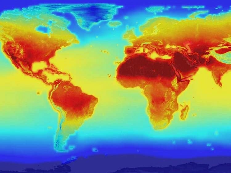
As we near the completion of the first quarter of the 21st century, the world is witnessing crisis after crisis. Climate Change is becoming a reality as the weather patterns are changing – the frequency of violent weather episodes is increasing, leading to extreme flooding, forest fires, cyclones, and other natural disasters.

Compounding these natural calamities are the two major wars that were supposed to end in weeks but are extending to months and years. The damage to life and property is humongous, while the geopolitical scenario is teetering at the abyss of Armageddon. However, there is still a flicker of hope that the world will recover its balance. Geospatial systems and applications will play a very large role in this redemption.

A fleet of EO satellites, both government-sponsored and privately owned, are at the command of nations to observe every centimetre of the lithosphere, biosphere, and atmosphere. A vast suite of analytical tools which now include AI are available to extract information from the vast amount of data, past and present, for further planning and decision-making.

Administrators are recognizing the value of such information and are integrating systems into their policy, planning, and execution. Agencies all over the world depend on Earth Observation systems and analytics to recover from disasters and manage relief and rehabilitation. analytics is now aided by Big Data, AI, and Deep Learning to model the future impacts of climate change and arrive at mitigatory and precautionary measures.

While geospatial systems are an integral part of the war machines of all nations, they are also useful for the relief and rehabilitation of the civilian population.

In future, when the hostilities end geospatial systems will be needed to rebuild the destroyed assets: power stations, airports, railways, roads, institutions and homes. Maybe some good may emerge as there could be better and more rational planning of these assets. But it should also be noted that construction activity also adds to climate change. Indeed, debris is not only on the ground. It affects the atmosphere and the local weather and climate.

Another debris that is becoming a problem is space debris which is growing as nations compete to have their own systems for EO, communications and PNT, not to mention the ever-present threat of weaponization of space. Tracking, reducing and perhaps later recovering space debris promises to be a major space activity in the future.

We are very familiar with the tools and technologies of these systems. Professionals have learnt to grapple with all the acronyms from GIS, GNSS, and SAR to GeoINT, CIVILINT, DT, AI ML, DL, QC and what have you. In this maze of technologies and acronyms a question must be asked: what is all this for?

This question has only one answer: ‘For all humankind’, and yet this element is missing from all discussions on applications of geospatial systems. If geospatial is to become an essential part of governance it must take into account the human element, nay, the human element should be the center of all planning.

Geospatial World Unveils High-Level Thought Leadership Report on the Evolution of National Mapping Agencies

0
Geospatial World Unveils High-Level Thought Leadership Report on the Evolution of National Mapping Agencies

Surveying and mapping, among the oldest scientific disciplines, have long been essential in understanding the Earth, defining boundaries, and managing land.

The cartographic legacy dates back to the medieval era with pioneering institutions such as Sweden’s ‘Lantmäteriet’ (1628) and the British East India Company’s ‘Survey of India’ (1767). These early National Mapping Agencies (NMAs) highlight cartography’s crucial role in military and administrative functions.

In the Fourth Industrial Age, the USD 532 billion [2023] geospatial industry continues this legacy with advanced tools for measuring, modeling, and managing natural resources.

The development of geospatial knowledge infrastructure, integrating data ecosystems, workflows, and tools, is becoming increasingly crucial to addressing the complexities and resilience challenges of global systems.

In alignment with its vision of ‘Advancing Knowledge for Sustainability,’ Geospatial World continues to expand and enhance its programs, focusing on advocacy, facilitation, and the adoption of space and geospatial technologies across various industries. On the occasion of the fourteenth session of the UNGGIM Plenary, Geospatial World is proud to present its latest high-level thought leadership report: “The Evolving Role of National Mapping Agencies – Transitioning to Geospatial Knowledge Infrastructure.”

This report highlights the crucial need for enhanced collaboration between NMAs and the industry, offering insights into how this partnership can reshape geospatial capabilities to foster economic growth, sustainable development, and capacity building.

Sanjay Kumar, CEO of Geospatial World, commented: “The transition to Geospatial Knowledge Infrastructure represents a pivotal moment for National Mapping Agencies and the entire geospatial industry. This high-level thought leadership report underscores the importance of evolving our data frameworks to enhance collaboration and drive sustainable development. By integrating advanced geospatial technologies within a cohesive digital ecosystem, we are not only advancing our capabilities but also contributing significantly to global resilience and growth.”

The thought leadership report details the transition from traditional Spatial Data Infrastructures (SDIs) to the more advanced Geospatial Knowledge Infrastructure (GKI).

This transformation is driven by the need to integrate geospatial data and applications within a broader digital ecosystem that includes governments, industries, and digital infrastructure. As geospatial technologies become integral to the global digital framework, GKI offers a visionary approach to leveraging geospatial data effectively.

Ananya Narain, Vice President–Consulting, Geospatial World, added: “The report highlights a crucial shift from traditional Spatial Data Infrastructures to the more sophisticated Geospatial Knowledge Infrastructure. This transformation is essential for harnessing the full potential of geospatial data in the Fourth Industrial Revolution. The insights provided emphasize the need for strengthened partnerships between National Mapping Agencies and the industry to foster innovation, efficiency, and sustainability in our geospatial practices.”

Geospatial World invites stakeholders, industry leaders, and interested parties to download the report and explore how GKI is poised to transform the future of geospatial capabilities.

Mainstreaming Nature-based Solutions for Resilient Cities

0
Mainstreaming Nature-based Solutions for Resilient Cities

The India Forum for Nature-based Solutions (NbS) held its inaugural annual summit today. Launched in 2022, this forum with partners – Council on Energy, Environment and Water, GIZ India, India Climate Collaborative, NIUA Climate Centre for Cities, The Nature Conservancy, Wetlands International South Asia, WWF India, and WRI India is a coalition of research, practice and finance organizations working to shape climate resilient cities and communities in India.

Giving the keynote address, Ms. Debashree Mukherjee, Secretary, Ministry of Jal Shakti, pointed out the need to broaden the scope for managing climate risks. She said, “Flood management is not just about stormwater management but also about managing water bodies and groundwater recharge potential, as well as steering knowledge among multiple stakeholders.”

One of the key highlights of the Summit was recognizing individuals and organizations involved in furthering NbS interventions across India. Rahul Kapoor, Joint Secretary, Ministry of Housing and Urban Affairs, Government of India, said, “The challenges for NbS implementation are similar to the challenges experienced across sectors. There’s a need to look at the existing regulatory and institutional frameworks that can bring together fragmented efforts, document them, and convey them to wider audiences.”

Dr. Krishna Vatsa, Member, National Disaster Management Authority, said, “NbS still needs to be defined better, with more components on bio-engineering to be explored. This would ensure the right kind of technical expertise to support NbS.”

Ms. Claudia Lopez, former Mayor of Bogotá, Harvard 2024 ALI Fellow and Advisor to WRI recommended building for proximity and integrating care-based mobility within city design. She said, “The size of the opportunity is directly correlated to the size of the challenge,” and advocated for more regional networks, and governments to support community-based interventions.  She added, “Land for trees and for greening is crucially important. It is not a luxury. Changing mindsets, and the redistribution of public space is critical. The stark disparity in access to public spaces needs to be narrowed.”

Jaya Dhindaw, Executive Director, Sustainable Cities, WRI India, encouraged wider ecosystem participation, saying, “The climate crisis will not only impact people’s health, productivity and livelihoods, but will also affect nature and biodiversity. Development models, based on blended grey, and green solutions hold promise and understanding and deploying them prudently is the need of the hour. Stakeholder partnerships that the India Forum is fostering will be key to driving policy, governance reforms and financing the uptake of such solutions at scale.”

Council on Energy, Environment and Water (CEEW), a Forum coalition partner, launched its report, ‘Accelerating Investments for the Nature-based Solutions in the Global South: A Unified Framework for Mapping and Estimating Benefits’, introducing a 3-step framework to support stakeholders towards accelerating much-needed investment in NbS.

The Forum partners released a joint statement on the occasion stating that more institutional partners and task force members are welcome to join the Forum and combine their strengths and resources to unlock urban NbS’ potential in achieving India’s climate goals.

The inaugural summit of the Forum saw over 100 public and private actors come together to build synergies and foster dialogue, across the ecosystem, to increase awareness on NbS.

The Summit engaged participants in discussions on decision-making tools and methods for choosing and evaluating solutions, unlocking investment and financial opportunities, and developing actionable strategies for cities that support adoption of NbS at scale.