Home 2024 June

Monthly Archives: June 2024

Dhruva Space Partners with Kinéis to Provide Space-based IoT Connectivity in India

0
Dhruva Space Partners with Kinéis to Provide Space-based IoT Connectivity in India

In a groundbreaking initiative to fortify global satellite connectivity, full-stack Space Engineering solutions provider Dhruva Space and France-based satellite operator global IoT connectivity provider Kinéis have strengthened their collaboration to introduce Kinéis IoT connectivity in India, and to launch a Kinéis IoT payload on Dhruva Space P-30 satellite.

This partnership is focused on Dhruva Space providing Kinéis IoT services in India along with developing new and innovative applications that can be supported by Kinéis’ 25-satellite constellation. This collaboration also comprises a joint satellite mission to augment the Space segment capacity for India.

The partnership will allow Kinéis and Dhruva Space to offer cost-effective, advanced and reliable IoT solutions as well as innovate and develop new applications and services tailored to the Indian market, driving technological advancement.

Dhruva Space has established a heritage in low data rate satellite communications capabilities with its P-DoT CubeSat platform and hybrid connectivity end-user terminal Bolt through the technology demonstration Thybolt mission in 2022. Later this year, Dhruva Space is slated to launch its first Hosted Payload mission utilising its P-30 nanosatellite platform, a modular and scalable satellite bus offering both hosted and dedicated mission capabilities. The platform is scalable for Earth Observations constellations, secure communications, and strategic use cases.

(from left to right) Julien Chevalier, Area Manager – India, Kinéis; Keyur Gandhi, Associate Director – Space Regulatory, Dhruva Space; Alexandre Tisserant, Chief Executive Officer, Kinéis; Sanjay Nekkanti, Chief Executive Officer & Co-founder, Dhruva Space; Assia Bahri, Head – Regulations and Spectrum Affairs, Kinéis, Michel Sarthou, Chief Technology Officer, Kinéis

The mission of the Kinéis IoT constellation is to connect any object anywhere in the world (including black points) and transmit useful low data to users in near real-time. Kinéis operates for optimisation in areas that today represent major challenges for mankind, its activities and its environment: prevention of natural risks (detection of forest fires, floods, drought, pollution, etc), agriculture, traceability of wild and farmed animals, monitoring of infrastructures and energy networks, monitoring of transport and logistics, monitoring of commercial and scientific maritime activities.

The applications are infinite and the benefits are considerable: risk reduction, anticipation of breakdowns, optimisation of activities, etc. Dhruva Space will provide these services in India, wherein significant efforts shall be placed towards experimentation and development of new and innovative applications that can be enabled by the Kinéis satellite network.

Dhruva Space and Kinéis’ partnership underscores the growing collaboration between Indian and French private Space companies. The full-scale global commercial service availability of Kinéis IoT will commence following the complete deployment of Kinéis’ constellation in early 2025, and will be supported by development and large-scale manufacturing for end-user terminals by Dhruva Space for India.

Sanjay Nekkanti, Chief Executive Officer, Dhruva Space, states, “Our existing partnership with Kinéis has been built on a foundation of mutual confidence and trust. By enhancing this collaboration, we are poised to deliver innovative IoT services that will drive digital transformation and open new opportunities for businesses and communities throughout the country. Together, Kinéis and Dhruva Space are committed to passing on the benefits of Space-Tech advancements for novel use-case development across India.”

Alexandre Tisserant, Chief Executive Officer, Kinéis, said: “This technological and commercial partnership with Dhruva Space is a concrete expression of the relationship of trust established with Kinéis and reflects the joint drive to provide high-performance spatial IoT services for the Indian market. The applications of Kinéis connectivity are infinite (environment, agriculture, monitoring of energy networks, commercial maritime activities), and our commercial services will bring considerable benefits to Indian public and private players.”

This agreement signed and officialised along the lines of Kinéis’ recent No Time Toulouse launch of the first 5 of a planned 25-nanosatellite constellation, reflects the ongoing commitment of both companies to push the boundaries of Space technology and to provide cutting-edge solutions.

Hydrosat Announces the Launch of First High-Res Thermal Imagery Commercial Satellite

0
Hydrosat Announces the Launch of First High-Res Thermal Imagery Commercial Satellite

Hydrosat, the climate tech company leveraging thermal imagery to measure water stress in agriculture and mitigate the effects of climate change, announced the upcoming launch of its first satellite, VanZyl-1, scheduled for early July on SpaceX’s Transporter-11.

This satellite will showcase Hydrosat’s proprietary, first-of-its-kind custom imagers, to accelerate the delivery of global high-resolution thermal imaging technology and provide a critical dataset to further enhance agricultural and climate models.

For the first time, a commercial satellite will include high-resolution thermal imagery and insights spanning the entire Earth – including land and water – revolutionizing the way growers and government agencies evaluate and respond to agricultural, environmental, and climate challenges.

“With the escalating threat of droughts and water scarcity worldwide, access to reliable data is essential to understanding water utilization and sustaining agricultural productivity,” said Pieter Fossel, co-founder and CEO of Hydrosat. “As the global food system faces mounting pressure, businesses and governments are increasingly seeking better data to manage risks in real-time. The launch of VanZyl-1 represents a pivotal advancement in accelerating the delivery of high-quality data that fuels climate applications, providing invaluable insights to tackle pressing environmental issues.”

“With the launch of VanZyl-1, Hydrosat will pioneer the first commercial high-resolution thermal infrared mission to provide comprehensive global coverage. This marks a significant milestone in combating the effects of climate change by ushering in a new era in thermal imaging technology,” said Scott Soenen, Hydrosat’s Chief Technology Officer. “Hydrosat’s technology will enable the detection and monitoring of events more frequently and at higher resolution, further advancing the precision of our insights. The VanZyl-1 satellite is just the beginning; our future constellation will complement other government missions such as Landsat, enabling the capture of daily thermal infrared imagery of the planet.”


Simera Sense Opens Optical Payload Development Hub in Toulouse, to Extends its Global Reach

0
Simera Sense Opens Optical Payload Development Hub in Toulouse, to Extends its Global Reach

Simera Sense

Simera Sense, the frontrunner in end-to-end optical solutions for smaller satellites with headquarters in Belgium, is strengthening its global presence by opening an office in Toulouse, France. This move is a testament to its growth strategy, bolstered by the €13.5 million funding secured in an investment round earlier this year.

The company already has 19 optical payloads in space and another 43 delivered and ready for launch to customers worldwide. Many of these clients are European-based, including Loft Orbital, Prométhée Earth Intelligence, AAC Clyde Space, Open Cosmos, OHB Systems AG, and many others. This rapid growth and demand for Simera Sense’s optical payloads necessitate expanding its development and production capacity.

Toulouse, strategically selected for its position within the aerospace ecosystem, will be the home of the new facility. This facility, an R&D engineering and production hub, will not only service the existing client pool in France and the rest of Europe but also contribute to developing High- to Very High-resolution optical payloads for Earth Observation.

France, renowned for its space program and expertise in space manufacturing, offers a rich talent pool that Simera Sense recognizes and aims to tap into for its continued success.

Furthermore, the new Simera Sense France engineering facility is a testament to our commitment to the French NewSpace ecosystem, contributing through job creation and the development of expertise in space-based optical payloads.

“Simera Sense is recruiting for several positions at its Toulouse office, including senior and junior roles. Join us to be part of a dynamic team in the NewSpace ecosystem!” said Kammy Brun,  Managing Director of Simera Sense France. “We look forward to building a solid team with expertise and experience in optics, thermal systems engineering, embedded software engineering and AIT (Assembly, Integration and Testing). Our core team will comprise 4 to 6 members by Q4 this year, and we have multiple job openings, including senior project manager, senior systems engineers, public relations & bid managers, and several PhD vacancies. The team is expected to double in size by 2025 and triple by the following year.”

Charlotte Voisin, Business Development Manager for Aeronautics & Space at Invest in Toulouse, stated, “We are delighted that Simera Sense is opening a subsidiary in Toulouse, the European Capital of Space. Since 2019, I have supported the Simera team by facilitating connections with our ecosystem, potential customers, and key institutions. This nearly five-year effort has been fruitful, as Simera Sense has successfully developed commercial products and grown from a start-up to a scale-up with the opening of their French subsidiary. This new R&D and engineering centre will serve both European and global customers, thanks to the collaborative efforts of Aerospace Valley, ADOCC, Business France, and Toulouse’s economic development agency.”

Precisely Data Integrity Suite Has New Cloud Services and Flexible Deployment Options

0
Precisely Data Integrity Suite Has New Cloud Services and Flexible Deployment Options
Photo by: Business Wire

Precisely, the global leader in data integrity, today announced availability of the Spatial Analytics and Data Enrichment services for its leading Precisely Data Integrity Suite, as well as the release of a new private API for mainframe replication.

The new offerings allow customers to use cloud-native spatial APIs to produce more scalable and performant spatial apps, enrich data with critical third-party datasets that add context and reveal new insights for location data, and access more flexible deployment options for mainframe replication.

With these additions, the Data Integrity Suite now delivers a complete set of capabilities that seamlessly connect through its Data Integrity Foundation. Featuring a shared data catalog, machine-learning-powered intelligence and hybrid execution agents to run workloads in any data environment, the Data Integrity Foundation is key to accessing the most critical capabilities needed for trusted, AI-ready data. This includes Data Integration, Data Observability, Data Governance, Data Quality, Geo Addressing, Spatial Analytics, and Data Enrichment.

Discover the power of business-centric spatial analytics

Every organization’s data has a location element that can be leveraged for deeper insights, but first, the right tools are required to uncover its value. With the Data Integrity Suite Spatial Analytics service, customers can discover patterns, trends, and relationships between location-based datasets and easily share valuable findings through enriched business processes, maps, and out-of-the-box reports to accelerate revenue growth.

With these new capabilities, organizations across industries are empowered to:

  • Leverage enhanced location-based context for more accurate risk assessment, optimized resource allocation, and improved property-related performance evaluation
  • Find the right audience for new services and produce more accurate, targeted, and timely customer offers with advanced location analytics
  • Design custom applications via access to a diverse set of APIs

Maximize data potential with easy enrichment

By appending trusted and relevant third-party datasets, companies can transform their self-generated data into complete, consistent, and reliable business assets that lead to more accurate predictions, fuel trustworthy models, and empower innovation. However, combining first-party data from internal sources with third-party data is typically a complex and time-consuming process.

With the Precisely Data Integrity Suite Data Enrichment service, customers can:

  • Save time and resources by quickly enriching data with reliable datasets that are easy to use and require little to no preparation
  • Enhance the value, accuracy, and completeness of business data by appending relevant context from curated datasets
  • Identify trends, patterns, and anomalies that might not be apparent with first-party data alone

Unlock the value of mainframe data in private environments

A new Private Mainframe Replication API, part of the Data Integrity Suite Data Integration service, provides a container-based solution for mainframe replication. It gives users the freedom to move data according to their needs, whether the target environment is a private data center, an on-premises system, or a hybrid environment.

This is particularly significant for businesses in highly regulated industries, such as financial services, banking, and insurance, which can face stringent deployment requirements. The new offering allows users to meet internal and external deployment needs while accessing valuable mainframe data for advanced analytics, AI, and other critical business initiatives.

“Customers can now access a complete range of data integrity capabilities in the way that works best for their business, allowing them to quickly and easily fuel their organization with highly trusted data,” said Chris Hall, Chief Product Officer at Precisely. “We are proud to lead the way in delivering a converged data integrity solution that uniquely combines everything from data integration to spatial analytics and data enrichment – critical elements for ensuring reliable AI and advanced analytics outcomes.”

Dryad Networks and Kinéis Partner for Satellite-Enabled Wildfire Early Detection

0
Dryad Networks and Kinéis Partner for Satellite-Enabled Wildfire Early Detection
Firefighter extinguishing wildfire with fire truck

Dryad Networks, a leader in ultra-early wildfire detection and forest monitoring, today announced a strategic partnership with Kinéis, a French satellite operator and global connectivity provider for the Internet of Things (IoT).

This collaboration will integrate Kinéis’s direct-to-satellite capabilities into Dryad’s next-generation Silvanet wildfire sensors, opening up groundbreaking new deployment possibilities.

Dryad’s solar-powered gas sensors, equipped with AI, monitor and detect early signs of wildfires by analyzing air quality and identifying unique gas patterns indicative of fires. When integrated with Kinéis’ satellite constellation, this network will overcome terrestrial limitations, ensuring near real-time global connectivity.

This synergy enables the early detection of wildfires even in remote areas without terrestrial network coverage, sending critical alerts to authorities via Kinéis’ 25 satellites, thus greatly enhancing emergency response capabilities and aiding in the preservation of natural areas and protection of critical infrastructure.

Protecting Critical Linear Infrastructure

Power line and rail companies face unique wildfire risks due to their linear assets spanning vast, remote areas. Previously, deploying comprehensive sensor coverage in these scenarios could be challenging due to limitations in terrestrial network coverage. Dryad’s integration of Kineis’s satellite technology addresses this challenge, enabling a simplified and cost-efficient direct sensor-to-satellite communication for unparalleled wildfire detection and prevention along critical corridors.

In particular, installations for linear infrastructure such as powerlines or railways, or in difficult terrain such as mountainous regions will benefit from direct-to-satellite connectivity. With a significantly simplified installation, Silvanet wildfire sensors will become even more cost-effective.

Direct-to-satellite connectivity ensures continuous, reliable detection in remote areas, crucial for wildfire mitigation efforts. When deployed in combination with the Silvanet LoRaWAN Mesh Gateways, which provide additional capabilities, Kinéis’ space IoT connectivity will guarantee uninterrupted service even if terrestrial connectivity is disrupted or sensors are placed outside of the range of gateways. Dryad and Kinéis aim to deploy hundreds of thousands of these IoT terminals worldwide over the next three years.

A Shared Vision For Environmental Protection

Both Dryad and Kinéis have established themselves as leaders in the IoT landscape. Kinéis offers extensive expertise in satellite-based IoT solutions, providing critical insights for environmental protection and ecosystem management, including early fire detection. Meanwhile, Dryad Networks is rapidly expanding its presence in the field of wildfire detection with its innovative sensor network technology.

The companies’ technologies are built on compatible satellite IoT protocols, ensuring seamless integration. Leveraging Semtech’s advanced chipsets, which combine terrestrial LoRaWAN and Kinéis’s satellite connectivity into a single solution, this integration ensures users can deploy products with both terrestrial LPWAN and satellite connectivity. The first products based on this integration are expected to be available before the end of the year.

Carsten Brinkschulte, CEO of Dryad Networks said, ‘‘We are excited to collaborate with Kinéis, as this partnership not only broadens our technological capabilities but also aligns with our mission to provide comprehensive wildfire protection. Integrating Kinéis’s satellite technology with our Silvanet sensors adds a vital layer to our detection ecosystem, especially for linear infrastructure, while reinforcing our commitment to the LoRaWAN mesh networks.’’

Alexandre Tisserant, CEO of Kinéis said, “Dryad Networks is at the forefront of ultra-early fire detection, making them the ideal partner for this expansion. By combining our satellite capabilities with Dryad’s innovative sensors, we are creating a truly global, adaptable solution to fight the growing threat of wildfires all over the world.”

This French-German partnership underscores the global drive for advanced wildfire prevention. Dryad Networks and Kinéis are committed to providing customers with the most robust, flexible, and reliable wildfire detection solutions available.

New Era of Space Mobility

0
New Era of Space Mobility

To discuss the topic “New Era of Space Mobility”, and the prospects of private players in the European Space market, Geospatial World discussed with the CEO and Co-founder of IENAI SPACE, Dr. Daniel Perez Grande.

Spain-based IENAI SPACE is a five-year-old startup, which has recently raised 3.9 million euros after the successful in-orbit demonstration of ATHENA.

Pixxel Signs 350th iDEX Contract for Miniaturised Multi-Payload Satellites

0
Pixxel Signs 350th iDEX Contract for Miniaturised Multi-Payload Satellites

Pixxel announced that it has officially signed the landmark 350th iDEX contract with the Ministry of Defence at a ceremony in New Delhi.

Awarded as the first-ever iDEX Prime (Space) Satellite Grant under the Mission DefSpace Challenge, this contract empowers Pixxel to develop miniaturized multi-payload satellites for the Indian Air Force.

The contract was signed between Awais Ahmed, CEO of Pixxel, and Shri Anurag Bajpai, Additional Secretary (Defence Production) and CEO of IDEX-DIO, in the presence of Defence Secretary Shri Giridhar Aramane, the Vice Chiefs of the Armed Forces, and other officials of the Ministry of Defence.

Awais Ahmed, Founder and CEO of Pixxel, expressed his gratitude and excitement: “The iDEX Prime Space grant received by Pixxel is the first-of-its-kind grant for satellites. The official signing of the contract today is a testament to Pixxel’s dedication to advancing space technology in the country and reflects the government’s confidence in our satellite manufacturing capabilities. We are honoured to receive this support and look forward to utilising it to develop cutting-edge multi-payload satellites that push the boundaries of space exploration.”

Received as part of the SPARK grants by iDEX, this contract will initiate Pixxel’s efforts to develop small satellites of up to 150 kg for Electro-Optical, Infrared, Synthetic Aperture Radar, and Hyperspectral purposes.

The 350th contract will enable innovation in space electronics, allowing for faster and more economical deployment, ease of manufacturing, scalability, adaptability, and less environmental impact.

The SPARK grants are offered to startups selected through the iDEX (Prime) and DISC initiatives to empower Indian innovators and entrepreneurs to deliver technologically advanced solutions in India.

Pixxel emerged as the grant winner among many companies due to its pioneering technology in hyperspectral satellite manufacturing.

As Pixxel sets out to launch six commercial-grade hyperspectral satellites, ‘Fireflies’, this year, the company remains committed to harnessing its indigenous expertise and the power of hyperspectral satellites for a sustainable future.

Building on its expertise, Pixxel now offers high-performance, cost-effective satellite manufacturing solutions, empowering clients to drive meaningful change with space data.

Cloud’s Impact on Geospatial Insights

Cloud’s Impact on Geospatial Insights

The Geospatial Sector is going through a transformation with Cloud Computing at the heart of the change. The power, scalability and accessibility of Cloud Computing were the highlights of the panel chaired by Dr VS Hegde, Chairman cum Managing Director, Antix Corporation and Scientific Secretary ISRO.

He emphasized on shifting focus to “downstream” activities in the space economy. This means utilizing geospatial data to create meaningful applications and services that benefit society. Cloud technology, he noted, is essential for this transition, providing the infrastructure for storing, processing, and analysing the huge swarth of data generated by satellites.

He said, “Building Satellites, Launching Satellites… it is all upstream activity which is a part of 12-15 % of the overall space economy. So it is downstream that decides the space activities where space and all applicable data are used. We need to focus on downstream possibility which makes use of the cloud technology.”

Cloud, the Geospatial Game Changer

Phil Cooper, Geospatial Technical Business Development Lead, AWS EMEA, highlighted the “titanic shift” to the cloud in the geospatial sector.

He said “The sheer volume of data involved, from satellite imagery to environmental sensors, demands the scalable and flexible solutions that cloud platforms offer. AWS, for instance, stores a staggering 160 petabytes of open geospatial data. ”

The Landsat program is the longest-running enterprise for the acquisition of satellite imagery of Earth which according to Phil has been severely underutilized.

From Geointelligence to Sustainable Agriculture

The applications of cloud-powered geospatial technology are vast and varied. In GeoIntelligence and security, cloud computing enables real-time monitoring and analysis of critical situations.

Divya Sharma, Vice President, Satsure, a company focused on agricultural solutions, shared how cloud technology is democratizing access to data, enabling them to develop crop monitoring tools that benefit low-income farmers and enhance food security.

She said, “At Satsure, We are trying to solve low-income farmer inclusion. As 70 per cent of the population is involved with Agriculture, this is a large-scale problem we tackle.

“Availability of data and democratization of data (which AWS has brought in) has helped with this crop monitoring in agriculture. We monitor the entire lifecycle of the different stages of Agriculture. If we have this open data, structured and organized we can use it. We can have much more Intel in developing models like climate change.”

Naresh Palaiya, CTO of Tathya.Earth, highlighted the use of cloud-based deep learning algorithms to extract insights from satellite imagery.

This allows for the identification of economic trends and patterns that were previously difficult to discern. The cloud, in essence, is a catalyst for innovation in the geospatial domain.

While the potential of cloud technology is undeniable, challenges remain. Data storage, while vastly improved by cloud solutions, is still a concern. Additionally, the sheer complexity of geospatial data can pose challenges for analysis and interpretation.

However, LLM models in AI and ML running on cloud infrastructure are helping to address these hurdles.

The future of geospatial tech is irrefutably intertwined with the cloud. As data volumes continue to grow and analysis becomes more complex, the cloud will provide to be very integral.

India’s Space Sector Embraces a Transformative Era

India’s Space Sector Embraces a Transformative Era


The Indian Space Congress 2024 began with an exciting inaugural session, setting the tone on India’s growing prominence in the global space landscape. Dr Subba Rao, President of SIA-India, highlighted the ambition for India to become a central player in the global space ecosystem. He said, “The Indian ecosystem is going to be integrated into the global supply chain, to bring the benefit of space to all. We aim to make India the hub of global satellite manufacturing, forging way ahead to a Viksit Bharat by 2047.

This vision aligns with a broader push to use space technology for development across sectors like telecommunications, disaster management, and more.

Innovation with Multi-Orbit Strategy

The evolution of the Satellite industry has been very incremental in India. A multi-orbit satellite strategy uses a network of satellites in different orbits to provide a range of solutions for different applications. This strategy aims to match the right application to the right orbit.

Deepk Mathur, Executive Vice President, SES Satellites emphasized the need for both reliability and disruptive innovation. He stressed the importance of a multi-orbit strategy to address diverse applications, stating:

“Multi-Orbit Strategy will serve more applications than ever. The progress that’s been in the last 2 years outweighs the 28 years of development prior. There needs to be space based connectivity to bridge digital divide, enable future mobility, extend cloud to edge, fast track earth observation data sets and manage risk in conflict and disaster”.

Mathur also stressed the importance of localized solutions and collaboration to foster a robust supply chain ecosystem within India.

Satellite Technology’s Role in the Space Sector’s Growth

Several trends fuel the growth of the Indian Space Sector. Rainer Horn, Managing Partner from Novaspace identified four key trends driving this growth. These include having an Expanding pool of investors, Affordable access to space, Defence and security concerns and Growing demand for space-based applications.

These trends, coupled with regulatory developments and advancements in LEO broadband and IoT, are creating a fertile ground for innovation and investment.

AVM Rahul Bhasin, ACS (OPS) Space, Air Hqr added on the point of the importance of integrating space situational awareness with air situational awareness. He said, “There is a need for international cooperation in this domain to ensure the safety and security of space assets.”

Anil Kumar Lahoti, Chairman of TRAI, highlighted the role of satellite technology in providing high-speed broadband services and expanding connectivity to rural and untouched areas. He noted the potential of satellite technology in disaster management, sustainable development, and achieving Sustainable Development Goals.

Future of India’s Space Startups

The space sector has been a significant success story for Indian startups where tech players develop solutions to make India self-sufficient. Dr. Pawan Goenka, Chairman of InSpace, highlighted the rapid growth of India’s space start-up ecosystem.

He said, “There are now over 200 startups in the Indian space sector now. In the last 12 months, lot of developments have happened in the space sector with both the government and private sector. We are working on two areas, one is the whole regulatory, authorization area where we are making good progress and the other is driving Indian Space economy. These two tracks, scientific exploitation where ISRO is leading the way and all the space startups is in deep tech and are at an inflexion point.

Somanath, Secretary of DoS and Chairman of ISRO addressed the challenges and opportunities transitioning towards greater private sector participation in the Indian Space Sector.

He said, “The Journey of India’s Space Actors has not been an easy one. From governmental to private, new actors must emerge. Within ISRO & DOS, we must chart the future. The gap between civilian space and strategic space is becoming narrower. Access to space must become cheaper. Exploration inspires this generation and future generations, but we need to develop the technology for it.”

He raised points on bringing down the cost of access to space, the emergence of constellations for communication, and the need to inspire future generations through space exploration.

GW Bulletin: Geospatial News of the Day-26th June

0
GW Bulletin: Geospatial News of the Day-26th June

Today’s news cover,Posspole and Karnataka Maritime Board Sign MoU for Maritime Ecosystem Development, Airbus takes a charge of nearly $1 billion on space programs,Waymo makes autonomous ride-hailing service available to all in San Francisco, NASA, SpaceX Launch NOAA’s Latest Weather Satellite, HERE Technologies Launches Fleet Optimization Package, Bowman Selected to Provide Orthoimagery Services for the State of Oregon, ITU and WATRA unite to enhance ICT infrastructure mapping, Techtree Innovation-Seoul Collaborate on Hyper-Realistic Digital Twin Project, Pixxel Signs Contract to Develop Miniaturised Multi-Payload Satellites

Space Machines, NSIL Sign Launch Historic Deal for Optimus on SSLV

0
Space Machines, NSIL Sign Launch Historic Deal for Optimus on SSLV

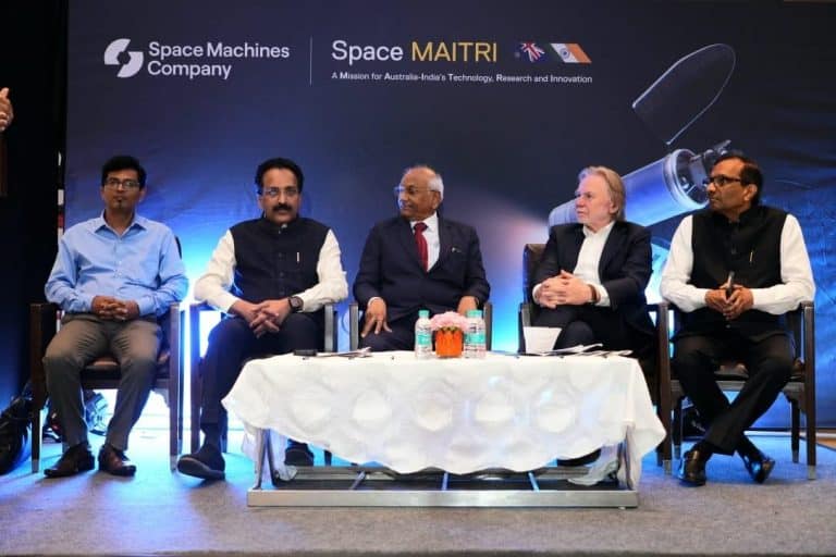
Space Machines Company, an Australian-Indian in-space servicing firm, has signed a landmark Launch Service Agreement with NewSpace India Limited (NSIL), a Govt. of India company under the Department of Space and the commercial arm of the Indian Space Research Organisation (ISRO).

This pioneering collaboration sets the stage for the launch of Space Machines Company’s second Optimus spacecraft weighing 450kg, the largest Australian-designed and built spacecraft so far. Slated for a dedicated launch aboard NSIL’s Small Satellite Launch Vehicle (SSLV) in 2026, this mission will mark a defining moment for both nations in the area of space collaboration.

This mission, named Space MAITRI मै ी (Mission for Australia-India’s Technology, Research and Innovation), marks a significant milestone in the strategic partnership between Australia and India in the space domain, fostering closer ties between commercial, institutional, and governmental space organisations from both nations.

By focusing on debris management and sustainability, the mission aligns with the core values and objectives of both countries, promoting responsible space operations and mitigating the growing threat of space debris.

At the India Space Congress 2024 held in Delhi, Rajat Kulshrestha, CEO and Co-Founder of Space Machines Company, and Mr Radhakrishnan Durairaj, Chairman and Managing Director of NSIL, formally announced the signing of the Launch Service Agreement.

“This collaboration with Space Machines Company exemplifies the spirit of international cooperation in space and highlights the strategic partnership between Australia and India,” said Mr Radhakrishnan Durairaj, NSIL Chairman and Managing Director. “As a Launch service provider for the Optimus spacecraft, we are not only fostering the growth of our respective space industries but also contributing to the sustainable exploration and utilisation of space.”

In April 2024, Space Machines Company announced that the Space MAITRI project had received an $8.5 million grant from the Australian Government through the Australian Space Agency’s International Space Investment India Projects (ISI India Projects) program.

“The Space MAITRI mission and our collaboration with NewSpace India Limited represents a significant leap forward for Australia’s space industry. By combining our innovative spacecraft capabilities with India’s proven launch expertise, we are not only strengthening the ties between our nations’ space sectors but also demonstrating our shared commitment to sustainable space operations,” said Rajat Kulshrestha, CEO and Co-Founder of Space Machines Company.

The Space MAITRI mission involves several Australian and Indian partner companies collaborating with Space Machines Company, including Ananth Technologies, Digantara, The University of Adelaide, The University of Sydney, The University of Technology Sydney, LeoLabs, Advanced Navigation, and the Australian Strategic Policy Institute (ASPI).

“It is terrific to see this historic launch agreement signed here today between Space Machines and NewSpace India Limited. Australia and India are important strategic and natural partners in the space sector; an inherently global industry,” said Mr Philip Green OAM, Australian High Commissioner to India.

“We share an understanding of the importance of space to support progress here on earth, and Australian companies are well prepared to support joint projects with India for critical space-related products and services. From Australia’s geographical location and world-leading technologies to our R&D, human and talent capital, Australia has much to offer when it comes to space.”

Head of the Australian Space Agency, Enrico Palermo, said the agreement is an important step towards enhancing Australia’s space heritage and strengthening our relationship with India.

“This formal agreement and mission will leverage our countries’ respective capabilities and unique strengths to make space activities more sustainable.”

“Like India, Australia’s commercial space sector is rapidly growing, and we are producing innovative space technologies that benefit life on Earth. The mission will inspire future explorers and further enhance international cooperation in this critical domain,” said Mr Palermo.

The mission underscores Space Machines Company’s unwavering commitment to fostering sustainable space operations. With the rapid proliferation of satellites launched by various entities, the ever-growing cloud of space debris encircling Earth poses an escalating threat to future space endeavours and astronaut safety.

Through this groundbreaking collaboration, Space Machines Company, NSIL, and mission partners will spearhead the development of solutions to mitigate space debris, raise global awareness, and revolutionise in-space services, ensuring the long-term sustainability of space.

India Space Congress Unites 300+ Organizations and 30 Countries

0
India Space Congress Unites 300+ Organizations and 30 Countries

The 3rd Annual India Space Congress (ISC) 2024, a three-day event dedicated to elevating India’s space capabilities through international collaboration commenced today.

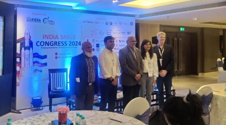
Organized by SIA-India, the conference brought together a diverse array of engaging discussions and exhibitions under the theme ‘Space Innovation: Bridging Boundaries and Transforming Tomorrow,’ held at The Lalit, New Delhi.

The first day of the conference and exposition received an overwhelming response from the global space industry. More than 300 organisations participated with close to 200 speakers.

Highlights for day 1 included the sharing of a strategic MoU between Mount Tech Growth Fund- Kavachh (MGF-Kavachh) and SIA-India, and the release of the whitepaper “Bridging the Digital Divide in India via Satellite” by SIA India by none other than the three chairmen, of ISRO, TRAI and INSPACe.

ISC 2024 began with enthusiastic participation from space legends, innovators, disruptors, global delegates, and rising stars in the space industry.

The event featured special addresses from esteemed dignitaries, including Shri S Somanath, Secretary DoS and Chairman, ISRO; H E Mr. Philip Green OAM, High Commissioner of Australia to India; Dr. Pawan Kumar Goenka, Chairman, IN-SPACe; Shri Anil Kumar Lahoti, Chairman, TRAI; Air Vice Marshal Rahul Bhasin, ACAS (Ops) Space, Air HQ on behalf of Air Marshal Amar Preet Singh PVSM, AVSM; Mr. Rainer Horn, Managing Partner, Novaspace; and Mr. Deepak Mathur, Executive Vice President, SES.

The day concluded with participation from over 700 delegates and 300 organizations from 30 countries.

Key remarks from the day included:

Somanath, Chairman of ISRO: “ISRO has created significant space capability and talent in the country. It’s time for new actors to scale India’s space operations. Bringing down the cost of access to space is a global trend, and India must also look at it. Space can never be solely for business and economy; it must inspire generations to innovate for humanity.” He also mentioned the upcoming launch of the GSAT-20 is a high-throughput Ka-band Satellite, with > 50gbps high bandwidth connectivity capacity.

Dr Pawan Kumar Goenka: “All space startups in India are deep-tech and exploring new frontiers. We have more than 200 startups, and this number will rise post-FDI policy. He also boasted about the enthusiasm of the private sector and how the investments are looking highly positive with the  private space sector in India receiving $135 million in investment last year alone.”

Mr Anil Kumar Lahoti: “Satellite technology is experiencing revolutionary growth and will play a vital role in enhancing connectivity in remote areas.”

H E Philip Green OAM, High Commissioner of Australia to India: “We now describe India as a top-tier strategic partner in space, alongside the USA and Japan. Australia’s unique geography and competencies in robotics, composites, and rare earth materials position us as a valuable partner for India.”

AVM Bhasin: “Air and space operations cannot be segregated and conducted in isolation. The future involves evolving the Indian Air Force into a force capable of seamless operations in air and space domains.”

Dr Deepak Mathur, SES: “We are moving from arithmetic progression to geometric progression of progress, from being risk-averse to full throttle. The space industry is ripe for bridging the digital divide, with over 10,000 space firms globally.”

Rainer Horn, Novaspace: “India has put itself on the global map for space and is now a serious global player. We anticipate a 60% growth in Indian space investments over the next 10 years.”

Dr Subba Rao: “The Indian ecosystem is integrating into the global supply chain to bring the benefits of space to all, aiming to make India the hub of global satellite manufacturing.”

The inaugural day featured diverse sessions on policy innovations, space sustainability, and cutting-edge technologies like mega-constellations and satellite IoT ecosystems. These sessions explored critical intersections between space and biology, engineering advancements, and legal frameworks shaping space missions. Key discussions on international collaboration, defence applications, and next-gen satellite networks highlighted the space sector’s strategic advantages and economic opportunities.

The day also included country sessions focused on Switzerland and Italy’s space sectors and their opportunities for Indian companies, along with a session on the Global Space Coalition: Uniting Nations for a Shared Future in Space, emphasizing the importance of global cooperation.

Norway and Germany Collaborate on Space Launches

0
Norway and Germany Collaborate on Space Launches

Norway and Germany have signed a joint declaration to facilitate German satellite launches from Andøya Spaceport. Andøya Spaceport entered into a multi-year agreement with German Isar Aerospace, which will use the base to launch satellites into space with the Spectrum launch vehicle. Isar Aerospace are preparing the launch pad for launch and expects to carry out its first launch during the second half of 2024.

Norway and Germany have signed international conventions regulating the countries’ space activities. It follows from these conventions that the countries have obligations relating to, among other things, the registration of objects launched into space, financial responsibility in the event of accidents, etc. However, to clarify these responsibilities, Norway and Germany also negotiated a joint declaration: “Joint Declaration of Common Understanding on the imminent launches of German launchers from Andøya Spaceport”, signed by Minister of Industry Cecilie Myrseth and Germany’s ambassador to Norway, Detlef Wächter.

Speaking on the collaboration, Minister Cecilie Myrseth said, “This declaration is an important piece that needs to be in place before German Isar Aerospace can launch its first satellite from Andøya, which could also be the first satellite launch from Europe ever. When German rockets and satellites launch from Norwegian soil, it is important to clarify which country is responsible.”

The Minister also added, ” The declaration we have signed today ensures that the Norwegian and German authorities have a common understanding of the distribution of responsibilities under international law. Andøya can become central to European space activity in the coming years. The favorable geographical location and a world-class competence environment make Andøya Spaceport a suitable place to launch satellites.”

Cyclomedia Strengthens Presence and Services in Poland with Smart Factor

0
Cyclomedia Strengthens Presence and Services in Poland with Smart Factor

Cyclomedia, a world leader in providing highly accurate 360° street-level visual data, enhanced by AI-powered analytics, has announced the acquisition of Smart Factor, a leading provider of road and tax asset inventory services in Poland. This strategic acquisition aligns with Cyclomedia’s mission to expand its footprint and product offerings in rapidly developing markets.

Investing in technology and footprint to benefit customers and partners

Customers and partners of both companies will experience numerous benefits from this acquisition. Smart Factor’s clients will have access to enhanced Cyclomedia technology, which will improve the accuracy and efficiency of asset inventories. Cyclomedia’s clients will benefit from expanded data capturing in Poland, offering more data along with data insight products. Additionally, the combined expertise of Cyclomedia and Smart Factor will allow for innovative solutions in road and tax asset inventory projects, significantly improving global service offerings.

Accelerating international growth 

This acquisition is a part of Cyclomedia’s broader strategy to accelerate international growth. By integrating Smart Factor’s capabilities, Cyclomedia aims to strengthen its presence in Poland and broaden its offering in Europe and the United States.

Serge Lupas, CEO of Cyclomedia: “We are excited to welcome Smart Factor to Cyclomedia. This acquisition marks a significant milestone in our strategy to expand into new markets, enhance our service offerings and improve the scalability of our company. Poland is a rapidly growing market with immense potential, and Smart Factor’s strong position in road and tax asset inventories will be a valuable addition to our capabilities.”

Tomasz Turczynowicz, CEO of Smart Factor: “Joining forces with Cyclomedia is a tremendous opportunity for Smart Factor. With the backing of a market leader, we can offer our clients even better products and services. The scale and speed of delivery will improve significantly, benefiting all our customers and partners.”

Industry Collaboration Key for Customer Benefit and Growth

Industry Collaboration Key for Customer Benefit and Growth

In an interview with Geospatial World, John-Isaac Clark, Head of Product, Array Labs spoke about affordable launch costs, and the future of the Space industry, as well as the impact of advanced technologies in driving the value in the market.

Polish Space Agency’s Space Exploration Plans

0
Polish Space Agency’s Space Exploration Plans
Polish Space Agency's Space Exploration Plans

In an exciting discussion with Professor Grzegorz Wrochna, the President of the Polish Space Agency (POLSA), Geospatial World’s Senior Assistant Editor Nibedita Mohanta delved into Poland’s ambitious space exploration plans.

The discussion touched upon how POLSA is leading the charge in expanding earth observation capabilities with a planned constellation of at least four satellites for civil use set to launch in 2027 and two additional satellites for defense and security scheduled for 2028.

Also about the critical role of space agencies in managing space programs, promoting scientific and technological research, and shaping future explorations.

GW Bulletin: Geospatial News of the Day-25th June

0
GW Bulletin: Geospatial News of the Day-25th June

Today’s news cover, Korea’s Daewoo Returns to India, Launches Advanced Automotive Batteries, Florida Family Sues NASA for $80K as Space Debris Falls on Home, Genesys Unveils India’s first AI-Powered Navigation Map For Auto & Mobility Sectors, Meta Expands AI Startup Program in Europe, India, Bangladesh to Pursue Collaboration in Space Technology, Oceanography, BlackRock Launches Five Climate Transition ETFs in Europe, Stellantis Partners with China’s CATL, Leapmotor on Europe EVs, STAR.VISION Announces Key Partnerships to Propel AI Research in Space Technology, Tata Communications Raises $250 Million Sustainability-Linked Loans, Ansys Joins Intel Foundry’s United States Military, Aerospace, and Government Alliance.

EOS-X SPACE to Begin Flights out of Earth from Spain and Abu Dhabi in 2025

0
EOS-X SPACE to Begin Flights out of Earth from Spain and Abu Dhabi in 2025

EOS-X SPACE is set to begin operating flights to the stratosphere from Spain and Abu Dhabi in 2025. Kemel Kharbachi, the company’s founder and CEO, says the team is finalizing the development of the spaceship capsules alongside the necessary validation tests, which are planned together with military pilots, and in collaboration with the National Institute for Aerospace Technology (INTA).

The goal of the dubbed first European space exploration company is to operate flights from its headquarters in Seville, Spain as well as in Abu Dhabi around the third quarter of 2025. They first introduced the project in September 2020.

Spaceship capsules tied to helium balloon during space flights

Before touching on the space flights’ progress, have a look into EOS-X SPACE’s spaceship capsules, first. These pressurized capsules can accommodate up to eight people, including the pilot. There’s a dubbed ‘non-polluting’ helium balloon tied on the top of the capsule, lifting the vessel away from the Earth.

The space flight takes off at sunrise before dawn, and the travel time may take around two hours to reach the cruising altitude of 30 and 35 kilometers. Once they reach the limits of the stratosphere, which is an altitude of around 40,000 meters, the space travelers can enjoy the space landscape for around two hours. After that, the helium balloon brings them back to Earth in a soft landing through numerous leg support below the vessel.

Eos-X Space to fly from Spain and Abu Dhabi

Outside the spaceship capsules, geometric and sloping body forms allow for panoramic windows. In fact, the company says each passenger can have their own window to look at so they can savor the view outside. Inside the spaceship capsule, they can find ergonomic seats, a control panel where information about the space flight is displayed, a bathroom, and adjustable mood lighting.  As of publishing the story, EOS-X Space says its space flights are priced between 150,000 and 200,000 EUR per space passenger traveling from Spain and Abu Dhabi.

Hopping into the spaceship capsule isn’t the only perks included in the price. In Spain, passengers are to be given access to the SpaceHub Complex in La Isla de la Cartuja in Seville where immersive experiences will be developed, the company states. On top of this, they are accommodated in a luxury hotel in the province of Seville where the ticket buyers can enjoy treatments and experiences offered and as part of space tourism experience. Details are yet to be revealed for the company’s plans and offers for those who are flying from Abu Dhabi.

Skynopy Raises $3.1M to Simplify Satellite Connectivity

0
Skynopy Raises $3.1M to Simplify Satellite Connectivity

Skynopy, a Paris-based space startup specializing in satellite connectivity, announced that its fundraising of $3.1 million closed in only three weeks, just months after its creation. 

The company aims to bring the simplicity of mobile phone connectivity to low-orbit satellites and constellation sector. 

Skynopy aims to solve the complexity that all satellite operators currently face when downloading a picture or video taken by a satellite.

The start-up offers a seamless, simplified, worldwide service for satellite operators to connect their satellites (send commands and receive data) using its hybrid network of ground antennas.  

This “as-a-service” approach allows operators to focus on their missions without worrying about the technical details of connectivity or the costly internal infrastructure of ground antennas, providing smooth communication with their satellites, similar to a mobile phone experience. 

Pierre Bertrand, CEO of Skynopy, stated, “The ground segment, and specifically ground stations, is the third pillar of any space infrastructure, alongside the launch vehicle and the satellites. Today, industrial players and public policies have tended to underestimate this essential pillar, which is crucial for data creation and retrieval, representing up to 20 per cent of a mission’s cost. Skynopy aims to solve this deadlock and offer a true innovation in the business model. In this context, this funding round marks a major milestone for Skynopy and the development of the first seamless satellite connectivity service, meeting the growing needs of the space industry,” Pierre Bertrand, CEO of Skynopy, said in a statement.

Investors in this round include Heartcore Capital, Kima Ventures, Better Angle, and BPI France. The funds raised will enable Skynopy to accelerate the commercial deployment of its “as-a-service” ground station offering and allow Skynopy to structure its teams through new recruitment.

LiveEO Raises €25Mn to Leverage AI-powered Satellite Data

0
LiveEO Raises €25Mn to Leverage AI-powered Satellite Data

Satellite data

LiveEO, a global leader using high-resolution satellite data and AI to transform raw satellite data into automated actionable insights to help companies manage their climate risks and resilience – has raised €25 million in a Series B funding round led by NordicNinja and DeepTech & Climate Fonds (DTCF).

This investment will accelerate the development of LiveEO’s cutting-edge solutions, and expand its team and capabilities.

Founded in 2018, LiveEO is on a mission to transform vast amounts of satellite data into actionable insights. Such data can monitor the effects of climate change, spot evolving vegetation patterns, identify system movements, and more. Yet because it’s fragmented, raw and sourced from multiple satellites, it’s difficult for industries to understand and integrate.

Not to mention the inaccuracies that can come from open-source solutions, coupled with the frequency and severity of climate-related events creating a critical need for advanced solutions, with the Earth Observation market predicted to be worth $14.6 billion by 2034, up from $6.8 billion in 2024.

Satellite data

LiveEO’s platform is serving this need demonstrated in the company tripling its growth since last year. It uses cutting-edge satellite technology – including multispectral and Synthetic Aperture Radar (SAR) to deliver high-resolution, analytics – with advanced AI to convert the incredible trove of EO data into usable formats and timely, actionable insights.

It can help businesses detect and respond to extreme weather events and deforestation in near real-time, and monitor and manage environmental risks that affect infrastructure, such as vegetation encroachment on power lines or ground deformation near railways. Also, it can help companies reduce their carbon footprint, remain compliant in the face of ever-evolving regulations and increase their climate resilience.

LiveEO’s platform is trusted by Europe’s largest railway operator, Deutsche Bahn to safeguard its assets, has helped a Nigerian pipeline operator tackle oil theft and reduce million-dollar losses and helped to curb illegal logging in Moldova. Yet all industries stand to benefit from LiveEO’s ability to monitor vast or remote areas simply, quickly and reliably, with partners including Accenture, AWS and SAP and customers including EON, Iberdrola and Network Rail.

Daniel Seidel, co-founder and co-CEO of LiveEO, said: “Our mission at LiveEO is to harness the power of satellite data to protect our planet and make industries more sustainable. The new funding will accelerate this mission and enable us to continue helping businesses worldwide face the growing list of climate, environmental, technological and regulatory risks.”

“We see EU deforestation regulation (EUDR) as creating the first mass market with millions of users for EO analytics, besides weather and we’re providing a solution that scales automatically in TradeAware. This is not just for the benefit of our customers’ bottom lines but for the benefit of all of mankind and our planet.”

Building on momentum

Its latest TradeAware solution helps companies comply with the EU Deforestation Regulation (EUDR). By using highly accurate satellite data to monitor deforestation risks in supply chains, companies importing commodities like cocoa, coffee, rubber, and timber can make sure their products are sourced responsibly and legally, preventing environmental harm and avoiding fines.

This compliance is critical and TradeAware makes it easy for businesses, particularly those with over 250 employees who must be compliant before the end of 2024, to meet these regulations and protect the environment with a high degree of precision.

LiveEO’s workforce has grown to around 130 international employees following recent growth. The recent €25 million funding takes the total raised by the Berlin-based firm to €51.6 million. NordicNinja and DTCF join existing investors MMC Ventures, Dieter von Holtzbrinck Ventures (DvH Ventures), Helen Ventures, Matterwave, motu ventures, Segenia Capital, Hannover Digital Investments and more on LiveEO’s impressive cap table.

Rainer Sternfeld, Partner at NordicNinja said: “NordicNinja is delighted to be supporting Daniel, Sven and the LiveEO team with this investment. As an entrepreneur and founder myself, I’ve spent a decade in Silicon Valley and Europe working on building data platforms and developer ecosystems for Earth Observation, renewable energy, and the oceans, and understand the challenges and opportunities in this space deeply.”

“The LiveEO team’s advanced use of satellite data and problem-solving AI algorithms offer businesses the precise, actionable insights needed to effectively manage and mitigate climate-related risks, which are only increasing in frequency and severity. We believe LiveEO is uniquely positioned to help companies navigate the challenges posed by climate change and drive a more sustainable future for all.”

Dr. Elisabeth Schrey, Partner at DCTF said: “As investor dedicated to propelling the growth of groundbreaking technology companies across Europe, we are particularly excited about LiveEO’s innovative approach to transforming earth observation. LiveEO stands out with its excellent team of technologists and its platform that incorporates cutting-edge artificial intelligence and data engineering capabilities. This strong foundation enables LiveEO to offer critical tools that pave the way for sustainable automation across industries.”

Genesys Launches AI Navigation Map for Auto, Mobility Industries

0
Genesys Launches AI Navigation Map for Auto, Mobility Industries

Genesys International announced the launch of an Artificial Intelligence-powered navigation map, tailored specifically for the automotive and mobility sectors.

The company has claimed that it is the country’s first AI-powered navigation map tailored specifically for the automotive and mobility sectors.

According to the exchange filing, this innovative solution marks a pivotal moment in the evolution of the Indian automobile industry, introducing a new era of personalized driving experiences and sophisticated location intelligence.

According to a press release, the newly unveiled map by Genesys encompasses the largest navigable road network in India, spanning an impressive 8.3 million kilometres and including over 30 million points of interest (POIs).

This extensive coverage guarantees that drivers across the country can access precise and dependable navigation, significantly enhancing their overall driving experience.

Alongside the AI-powered navigation map, Genesys has introduced five cutting-edge products aimed at revolutionising the automotive and mobility industries.

Navigation with Augmented Reality (AR) integrates real-time data from the vehicle’s dashcam and cameras, providing augmented reality overlays that guide drivers intuitively. AR technology enhances situational awareness by projecting navigation instructions and critical information directly onto the driver’s view.

Utilising advanced AI, the product offers intelligent route planning and real-time adjustments. It features voice-activated assistance for seamless interaction, making navigation more intuitive and reducing driver distraction.

Advanced Driver Assistance Systems (ADAS) with Intelligent Speed Assistance (ISA)- compliant with Euro NCAP standards, the system includes advanced safety features like Lane Departure Warning and Traffic Sign Recognition.

The ISA helps ensure compliance with speed limits, enhancing road safety and comfort for drivers.

Integrated into the car’s connected companion app, the marketplace allows car owners to purchase a variety of products and services directly from their vehicle. This not only adds convenience but also opens new revenue streams for Genesys and its partners.

Usage-Based Insurance (UBI) tracks driving behaviors to offer lower premiums for safer driving. By incentivizing safe driving practices, UBI benefits both drivers and insurance providers.

Sajid Malik, Chairman and Managing Director of Genesys International, expressed the company’s vision and said, “With the launch of India’s first AI-powered navigation map by Genesys, we are set to completely revamp the way the Indian geospatial sector operates. With features like Intelligent Speed Assistance (ISA) and Advanced Driver Assistance Systems (ADAS), we are setting new benchmarks for safety and convenience on Indian roads. These technologies will alert drivers to speed limits, recognize traffic signs, assist with lane-keeping, and offer adaptive cruise control.”

He added, “Coupled with this AI-powered map, our 3D Digital Twin shall allow us to produce HD maps that detail every aspect of the road environment, from elevation and road curvatures to lane markings and road signs. This level of detail is crucial for the safe operation of autonomous vehicles, addressing challenges such as poor visibility, urban canyons, and GPS-deprived zones. Looking ahead, we see a future where our maps will play a critical role in the transition to autonomous and electric vehicles.”

GW Bulletin: Geospatial News of the Day-24th June

0
GW Bulletin: Geospatial News of the Day-24th June

Today’s news cover, ISRO Successfully Completes Autonomous Landing Experiment of Reusable Launch Vehicle, Spanish Space Tech Company FOSSA Systems Raises €6.3 Million for its IoT Satellite Constellation, EOS-X SPACE to Begin Out of Earth Flights From Spain and Abu Dhabi in 2025, African Development Fund Approves $10 million From the Global Agriculture and Food Security Program, China And France Launch Satellite In SVOM Space Mission, NHAI Signs MoU with IIIT Delhi to Enhance Road Safety Using AI, MapmyIndia Launches AI Analytics & Consulting Company ClarityX, Johnnette Technologies Delivers India’s First Fixed Wing Stealth Drones, Ansys Debuts ConceptEV to Boost Electric Vehicle Drive Range, and much more.