A two-day intensive ‘Geospatial Knowledge Infrastructure Summit’ will refine the concept of Geospatial Knowledge Infrastructure (GKI), demonstrate the geospatial adoption in defined sectors, project the value proposition of geospatial knowledge in the sectors, and appraise the readiness for transition to GKI. It will delve upon the following key questions that arise today:
How does the 4th Industrial Revolution help in solving global challenges?
How does the convergence of the geospatial and 4IR technology enable the transition to a knowledge economy?
Are sectoral users ready to scale up their geospatial adoption?
What are the paradigm shifts required to enmesh geospatial within the wider digital and sectoral infrastructure?
Objective
To project the value proposition of Geospatial Knowledge Infrastructure across multiple user industry sectors
To identify the user industry readiness to solve global challenges using GKI
To demonstrate the geospatial knowledge workflows across multiple sectors
To evolve multi stakeholder partnership models for enabling collaborative GKI workflows
To refine the GKI concept.
Who to Attend
National Geospatial Agencies
Government Geospatial and Digital Policymakers
Geospatial Industry
4IR Technology Companies
Digital, Analytics, and Knowledge Businesses
Users from Key Economic Sectors (Government and Private)
Academia and Research
Global Development Organizations
Civil Society Organizations
Agenda
0700 - 0745HALL - 1Opening Session: Why GKI? Advancing Collaborative Workflows and Processes for User Industries
Director - Geospatial knowledge Infrastructure, Geospatial World
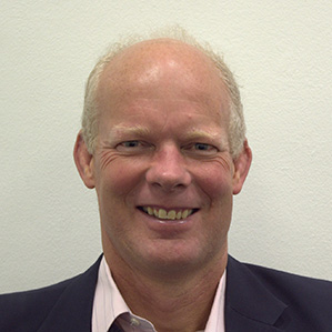
John Kedar
Strategic Advisor - Geospatial Infrastructure, Geospatial World
Dean Angelides
Corporate Director, International at Esri
Nadine Alameh
CEO, open Geospatial Consortium, USA
1055 - 1100Closing Remarks of the Day
Jointly Organized by
Partners
Energy Partner
About the Event
The Fourth Industrial Revolution is the cusp of data, analytics and
real-time presentation to allow human and machine customers to make decisions
and improve the efficiency of their processes. It is changing the world and
the geospatial sector must change with it. New technologies, varied data
sources and divergent user demand will require a next-generation
geospatial infrastructure that embraces automation, dynamicity and real-time
delivery of knowledge. The next-gen infrastructure,
The Geospatial Knowledge Infrastructure (GKI), along with
digital developments and industry innovations will enable governments to
make decisions at scale and determine the type of interventions required
for different programs, it will help businesses make strategic decisions
and plan resource allocation intelligently.
We are starting to open up geospatial data in nations and the globally endorsed
United Nations Integrated Geospatial Information Framework aims to help all
nations prosper from geospatial information. And it is being used globally.
However, it is a framework not an infrastructure and we need to build on the
benefits it brings to build the next generation geospatial infrastructure.
The question arises:
What is the growth trajectory of Geospatial Knowledge?
How does 4th Industrial Revolution technology, including connectivity,
AI, Big Data analytics, cloud computing, Web 3.0, robotics and automation,
space, enhanced positioning, ubiquitous sensors, and drones influence
Geospatial adoption across user segments?
Are governments and businesses ready to scale up their geospatial
adoption for supporting diversified programs, business outcomes and
development goals?
How can geospatial agencies able to take up the opportunities of 4th
Industrial Revolution technologies, and with partnerships deliver the
data and geospatial knowledge to fuel our innate desire to ‘know’
and to do so ‘now’.
What are the paradigm shifts required to enable this critical element
of the knowledge infrastructure and how do we enmesh it within the
wider digital infrastructure?
And thus, what is the geospatial infrastructure of the future?
Geospatial Media along with the like-minded organization presents a
two-day intensive “GKI Summit” with the theme “Mapping our way to 4IR”.
It will uncover the concept of Geospatial Knowledge Infrastructure (GKI) and
the evolving role of all stakeholders in powering the future of ‘knowledge on demand’.
Join our Geospatial Knowledge Infrastructure Summit, a two-day online event
with progressive ideas from global changemakers and the most inspiring
thinkers considering what the geospatial knowledge infrastructure comprises
and the challenges in delivering it.
Joe FrancicaSenior Director Geospatial Strategy, Korem, USA
Joe Francica is the senior director of geospatial strategy with Korem, a privately held company offering a diversified portfolio of geospatial solutions and systems integration. With over 40 years’ experience in GIS, he has worked in private industry, start-ups and government organizations as both a manager of teams as well as a research data scientist. He founded Directions Magazine’s Location Intelligence (LI) Conference convened between 2004-2014, and has published and broadcast over 500 articles and podcasts on location intelligence as well as contributing to three books. Francica founded GEO Huntsville, a 501c6 non-profit, to support geospatial technology business and workforce development and serving Huntsville, Alabama. He is also the president of an affiliate organization, Exemplar City® that was formed as a 501c3 non-profit organization for educational training to help cities to develop a model called Blueprint for Safety® for technology deployment of geospatial, energy, and cybersecurity solutions to support smart and resilient applications.
Brandon PalinDirector of Public Sector & International Development, Ecopia AI, Canada
Brandon Palin is Director of Public Sector & International Development at Ecopia AI. A geospatial data company that leverages groundbreaking advancements in artificial intelligence to convert high-resolution imagery of our earth into HD Vector Maps. These datasets are embedded into critical applications around the world, providing foundational information for critical decision-making, improving the welfare of societies, efficiency of economies, and health of environments. His main responsibilities are to lead the development of Ecopia’s global solutions in developing markets and oversee North American federal and state clients. Brandon holds a Master of Science in International Business from the Richard Ivey School of Business in Toronto, Canada, and a CEMS Master in International Management from the University of St. Gallen, Switzerland.
Dr. Craig Pinhorne-Smy (F.R.G.S.)Director of Public Sector & International Development, Ecopia AI, Canada
Dr. Craig Pinhorne-Smy (F.R.G.S.) is Director of Engineering and Data Science at Rezatec, a leader in Geospatial AI. Craig’s role is to manage the development of Rezatec's technology platform and drive the geo-spatial product team’s strategy and development output, across multiple sectors, including Agri, Forestry and Water. Prior to working at Rezatec, Craig spent over 25 years working in academia, data/ software development and data solutions across various SMEs and a global top 100 software company, having graduated with a PhD in Geo-Spatial Modelling.
Pierrick Poulenas is the CEO & Co-Founder of Picterra, the leading provider of geospatial machine software. In 2010, he launched his career at Altran Benelux. Working as a project manager across departments (IT, telecom, transportation, and aeronautics), he went on to earn a certificate in Entrepreneurship from EPFL. Before founding Picterra in 2016, he managed business development for several engineering consultancies. He also holds a Masters's Degree in Business Administration from the Institute of Political Studies in Toulouse.
Manfred Dr. KrischkeCo-Founder, CEO at cloudeo AG, Germany
Dr. Manfred Krischke is Founder and CEO of CloudEO an innovative cloud-based collaboration platform and marketplace for Geo-services. Besides holding other Board positions, he is Chairman of the Supervisory Board of Mynaric AG in Germany.
In 2011 he led the consortium to buy the assets of RapidEye (5 satellites constellation) out of the insolvency and was interim CEO for the restructured company.
He originally founded RapidEye in 1998 and was its CEO until 2004.
He was the Managing Director of Intermap GmbH and VP at Intermap Corp for six years.
Manfred Krischke has been a Senior Advisor to Spacetec Capital Partners. Before that he consulted several companies and spent 8 month at Guildford consulting Surrey Satellite Technologies.
He started his career at Kayser-Threde GmbH, Munich (today OHB), where he was Business Development Manager for Navigation, Communication, Small Satellites and Manned Space Transportation.
He was awarded a PhD in Aerospace Engineering from the Technical University of Munich. In 1991 he received the Wernher-von-Braun Award of the Deutsche Aerospace (today Airbus) for the best visionary diploma thesis in Germany, which he wrote during his studies at the Harvard-Smithsonian Center for Astrophysics, Cambridge.
Volker BuscherChief Data Officer, Arup, United Kingdom
Delivering Arup’s data strategy with an ecosystem of partners and developing the firm’s data infrastructure and innovation platforms.
Acting on emerging technology trends. Identifying changes in knowledge, culture and practices.
Defining social usefulness for data in the built environment including climate change.
A track record since 2014 for creating and leading global Arup digital services, digital products and digital skills networks. He is one of 53 Arup Fellows (out of a global staff of 16,000). This accolade honours those who have significantly contributed to the firm’s reputation for excellence in innovation and design and designates him as a leader with the role of ensuring this continues.
Results driven non executive Director on advisory boards including: Icebreaker One, Smart London Board, Cambridge Centre for Smart Infrastructure and Construction, the Smart Cities Forum advising UK Ministers for Cities and Technology.
Thought leadership and key note talks covering global work in the digital built environment. Course Director of Arup University masters level course in Smart Cities, Machine Learning and Artificial Intelligence.
Co-chair for the Arup Foundations “Digital Cities for Change (DC2)” programme at Cambridge University, industrial supervisor for doctorates and international reviewer for research programs.
Leif GranholmBIM Ambassador, Trimble, Finland
Leif has been involved with the development of BIM and GeoSpatial related software since 1979, when he joined Tekla as Programmer, then IT Manager, Sales Representative, Senior
Consultant, Technology Director and Director for both Public Infra and Energy/Utilities Business Areas.
He has also worked as Managing Director for the Swedish Subsidiary and been responsible for Tekla’s construction industry business in the Nordic and the Baltic countries.
Currently Leif works in Trimble technology and represents Trimble in buildingSMART, OGC, ISO, CEN and others. He's task is to promote and advocate application of open standards both within Trimble and in the general market and to participate in developing open standards and Trimble products.
Gerben TiemensArchitect Geo – IT and BIM at Royal Schiphol Group, Netherlands
Gerben Tiemens, Geo-IT Solutions Architect for Amsterdam Airport Schiphol / Schiphol Group. I am now 20 years part of the Geo-Spatial world and did a Master in Geo-Science. After my study, I worked 10 years as consultant/developer/architect at a broad range of Geospatial-information using organisations in the Netherlands. Now I am 6 years Architect at Schiphol Group. I work together with my colleague architects to enhance the architecture for enabling geospatial information within the domains of Assetmanagement and Real Estate, but also in the organisation wide data and information Enterpise Architecture. We cover several concepts of Geospatial-Information within our digital landscape, GIS, BIM and CAD and use it in traditional maps, dashboards and designs for every type of stakeholder (from passenger to maintenance engineer and decision makers), but also do research on how to use geospatial knowledge and information in VR, Digital Twin and Big Data analytics. A big part of our spatial information covers indoor building and assets, but also we have a lot of event-based information with location.
Amr RaafatVice President of VDC & Technology, Windover Construction
Construction leader and expert in the industry’s leading-edge technologies with more than 20 years of experience combining architectural, construction, and engineering expertise.
Amr received the global 2019 Innovator of the Year award at the Autodesk AEC Excellence Awards.
Amr leads Windover’s Virtual Design and Construction team and the IDEA™ Innovation platform providing 4D animations, BIM coordination, laser scanning, drone mapping, virtual and mixed reality, digital prefabrication, robotics, automation, and 3D printing to enhance planning, change management, scheduling, site logistics, and safety throughout all construction phases. Working collaboratively with clients and project teams. Amr received his Master's Degrees in Architecture from the Boston Architectural College.
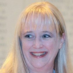
Maarit KahilaCEO, Maptionnaire by Mapita Oy, Finland
Maarit Kahila-Tani has her background in planning geography from University of Helsinki and urban planning from Aalto University. Her research focused on new methods for enabling and encouraging wider public participation. In her dissertation, she studied the opportunities for urban planners to take advantage of map-based PPGIS tools like Maptionnaire to get ideas and insights from residents. (Short link: mpt.link/maarit_dissertation)
Currently she is the CEO and co-founder of Mapita, the company behind Maptionnaire. She continues to work in the domain of community engagement tools for urban planners and city developers. Maptionnaire is a powerful community engagement tool that helps urban planners and city developers to create map-based tools to get ideas and insights from residents – thus enabling and encouraging public participation. Currently Maptionnaire is a global SaaS service used in over 40 countries.
Henrik Aagaard JohansonCEO, Akilay Aps, Denmark
Henrik Aagaard Johanson is the founder of the newly established company AKiLAY, a practice-oriented consultancy agency. In AKiLAY he helps companies, organisations and public-private partnerships with strategic digital business development focusing on adopting digital knowledge infrastructure in smart city, IoT and data projects in practice. One recent project is 5G recommendations for cities in the Copenhagen region based on 5G and geospatial initiatives and usage in other cities across the world. For the past two decades he has worked with digital development in the public sector. As a smart city program manager, he has contributed to building up the smart city area in the Copenhagen Region. For many years he worked on telecommunications infrastructure initiatives in the National IT and Telecommunications Agency, a Danish agency under the Ministry of Science, Technology and Innovation. Following, he worked on policy initiatives for digital business growth, Big Data, and IoT in the Danish Business Authority. He represented Denmark as a national expert in an OECD working group on digital economy and also a EU working group on digital infrastructure. In the summer of 2021, he completed a master's degree in IT management from the IT University in Copenhagen specialising in digital IT-architectural methods in relation to smart city and IoT projects.
Richard SliuzasProf Urban Planning, ITC, University of Twente, Netherlands
Richard Sliuzas is Professor of urban planning for disaster risk reduction at the Faculty of Geo-information Science and Earth Observation, University of Twente, the Netherlands. His research and teaching focus on urban risk reduction strategies and urban informality. Research methods include aerial and satellite-based data acquisition systems, spatio-temporal analysis and land use and land cover modelling, planning and decision support systems, community mapping and participation. He has worked extensively in sub-Saharan Africa, Asia, South-East Asia and Latin America.
Kshitij PurwarFounder and CTO, Blue Sky Analytics, India
Kshitij is the Founder and CTO of Blue Sky Analytics, a Climate-Tech start-up using satellite data and AI to build environmental monitoring and climate-risk assessment products.
He is a college dropout with over eight years of product and software development experience. A self-taught Full Stack developer, he joined Hiver, an early-stage tech startup, as a core engineer after dropping out in the 3rd semester of his electronics & communication degree.
In 2018, working with his sister Abhilasha, Kshitij founded Blue Sky Analytics to help fight climate change with data. At Blue Sky, he leads a team of young developers and data scientists to analyze terabytes of data to deliver sophisticated environmental datasets; and build “SpaceTime”, a data visualisation platform to support open source & collaboration for Climate Action.
Mark ThomasManaging Director & Founder, Serviceworks group Ltd., New Zealand
Mark is an entrepreneur and smart cities expert. He leads Serviceworks which specialises in smart mobility, city digitisation and citizen technology opportunities. He is a regular international speaker and media commentator on these issues. He has worked extensively throughout the Asia-Pacific and was based in Singapore prior to Covid-19. He was also an elected member of Australasia's largest local authority and the world’s 3rd most livable city, Auckland New Zealand, for six years. Mark received the Leadership Award for Outstanding Contribution towards building Smart Cities, the Asia Smart Cities Excellence Award and is one the Most Recommended Smart Cities Solutions Provided to Watch in 2021. He is part of the Top 50 Most Impactful Smart Cities Leaders. He is Chair of the ASEAN New Zealand Business Council and on the boards of the Smart Cities’ Asia Advisory Board and the Committee for Auckland. He chairs the Auckland Night Shelter Trust and is a member of the Australia New Zealand Smart Cities Council Future of Place Taskforce. He co-authored the Urban Mobility Taskforce’s Mobility Now. Connecting Communities: Smarter, Sooner, Safer. Mark is an experienced director and has held governance roles across a range of private, public and not-for-profit organisations. He is usually based between Auckland, New Zealand and Singapore
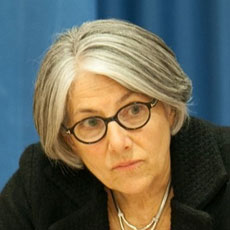
Dr. Carole NakhleCEO, Crystol Energy, England, UK
Dr Carole Nakhle is the Founder and CEO of multi-award winning Crystol Energy, an advisory, research and training company based in London.
With a unique breadth of experience spanning different stakeholders in the energy industry all around the world, Dr Nakhle has worked with major energy companies (Eni and Statoil) at the executive level, governments and policy makers (including Special Parliamentary Advisor in the UK), international organisations (Commonwealth Secretariat, IMF, UN and World Bank), academic institutions and specialized think tanks on a global scale.
She is active on the Governing Board of the Natural Resource Governance Institute, and Advisory Boards of the Middle East Institute and Payne Institute at the Colorado School of Mines. She is a program advisor to the Washington based International Tax and Investment Centre and lead Energy Expert with the Geopolitical Intelligence Services. She is also involved in the OECD Policy Dialogue on Natural Resource-based Development and has contributed to the development of the organization’s Principles for Durable Extractive Contracts.
Dr Nakhle has lectured at leading academic institutions including: the Blavatnik School of Government at Oxford University, University of Surrey in the UK, the Graduate Institute in Switzerland, European University Institute in Italy, Saint Joseph University in Lebanon, the National Defense University in the USA and NATO Strategic Direction South Hub in Naples.
She founded the not-for-profit organisation ‘Access for Women in Energy’ in 2007, with the aim of supporting the development of women in the energy sector. She has also championed the development of similar initiatives in Ghana, Tunisia and the UAE, where she sits on ADIPEC’s Advisory Board for Inclusion and Diversity.
Her views on energy matters are highly regarded, with numerous articles in academic journals, newspapers and magazines to her credit. Dr Nakhle is an avid commentator on energy and geopolitics in the international media and major conferences and industry gatherings, in many countries. She has published two widely acclaimed books: Petroleum Taxation: Sharing the Wealth and Out of the Energy Labyrinth (co-authored with Lord David Howell, former Secretary of State for Energy in the UK).
In 2021, she was selected CEO of the Year 2021 in the UK by CEO Monthly Magazine. A year earlier, she was awarded the prestigious Fellowship of the Energy Institute and has featured on the Energy Council’s list of Top Female Executives in the global energy industry. In 2017, she received the Honorary Professional Recognition Award from the Tunisian Minister of Energy, Mines & Renewable Energy. Dr Nakhle has also been appointed Global Chair for Energy Power of the G100.
Mr. Aurangzeb QureshiSenior Energy Analyst, International Energy Forum
Mr. Aurangzeb Qureshi is a senior energy analyst at the International Energy Forum (IEF) where he manages and leads the delivery of IEF publications including the IEF Monthly Comparative Analysis. He has written extensively on orderly energy transitions, sustainable pathways, and energy security. His most recent reports include strategies to scale Carbon Capture, Use, and Storage, the role of hydrogen in sustainable growth, and recovery strategies towards emissions reductions and affordable access. He also provides support to the IEA-IEF-OPEC Trilateral events, IEF Ministerials, and other dialogue events. Prior to joining the IEF, Aurangzeb was working at the Department of Energy for the Government Alberta as a senior policy analyst with a focus on international energy policy and market access.
Abhilasha PurwarFounder & CEO, Blue Sky Analytics
Abhilasha is the Founder and CEO of Blue Sky Analytics, a Climate-Tech start-up using satellite data and AI to build environmental monitoring and climate-risk assessment products. She is a Fulbright scholar, Yale and IIT alum with over eight years of work experience in private equity, big data analytics, product development and environmental policy.
She began her career as a Research Associate at J-PAL, working on air pollution regulation with the Ministry of Environment, India. After her Masters in Environmental Management from Yale, she went on to work on building flexible solar cells in Dublin, kickstarting solar products and asset financing startup at PEG Africa and clean energy investing as an Associate at GoldenSet Capital.
Upon her return to India, Abhilasha founded Blue Sky Analytics in 2018 as she believes that “data has the capacity to change an entire ecosystem". She deems Blue Sky as a focal point of enabling global climate action with high quality, accessible environmental data.
Martin KuppersEnergy Modeller, International Energy Agency (IEA), Paris
Martin is part of the modelling team for the industry sector and geospatial expert for energy access topics within the World Energy Outlook team. Prior to his arrival at the IEA, he worked for more than three years in the central energy system modelling team of Siemens, where he was involved in several internal and external consulting projects. In parallel, he has been working on his doctorate on data-driven modelling approaches including the automated preparation of models using geospatial energy data. He holds a PhD in Electrical Engineering from the Technical University Darmstadt, Germany.
Anthony BakerFounder & CEO, Satellite Vu, London, UK
Anthony Baker is the CEO of Satellite Vu an earth observation company specializing in providing actionable insights from satellites to address global challenges such as climate change by detecting where we are wasting energy; data that also brings insights to business to make better commercial decisions. Satellite Vu intends to launch a small constellation of infrared satellites to monitor the temperature of any building on the planet in near real time to determine valuable insights into economic activity, energy efficiency and carbon footprint.
He has over 20 years’ experience in innovative satellite companies with roles in both commercial and government organisations. He has held roles as first CEO at Es’hailSat – The Qatar Satellite Company, Vice President at SES of Luxembourg, and employed at AsiaSat in Hong Kong, NATO in the Netherlands and OFCOM in London.
Carsten RonsdorfStrategic Proposition, Ordnance Survey, UK
Carsten Ronsdorf is a geospatial data interoperability expert and Strategic Propositions Manager at Ordnance Survey (OS). He leads the implementation of the National Energy Systems Map (proof of concept) for the Energy Networks Association. Carsten is an expert in geospatial data standards and interoperability as well as geospatial technology and represents OS at several national and international interest groups and standard bodies.
Tomaz PetekGeneral Manager, Surveying and Mapping Authority, Republic of Slovenia
Public sector specialist with extensive experience in geodetic authority, geoinformation, land cadaster, spatial data infrastructure and governmental reform. Regulatory work on state geodetic projects and spatial data infrastructure project. Development of geoinformation infrastructure in Republic of Slovenia and management of regional geodetic authority.
Acting as general manager at Surveying and Mapping Authority of the Republic of Slovenia and chair of UN GGIM Europe executive committee. During professional carrier working on several positions related with topographic and cartographic system in Slovenia and as director of Ljubljana regional cadastral Authority. Actively involved in many activities of EuroGeographics and UN GGIM Europa. Member of EuroGeographics Management Board from 2011 – 2014. Involved also in several national and international projects related with land registration and spatial data management and in the INSPIRE implementation at the national level. In period from 2007 until 2029 acting as Slovenian representatives in INSPIRE permanent committee and the national contact point in Slovenia for coordination of INSPIRE implementation with the European Commission. Involved in preparation phase of World Bank Real Estate Registration Project in Slovenia which aims to improve the efficiency and effectiveness of real estate administration systems in Slovenia. In the period from 2002 to 2020 President of Slovenian state border commission with Italy, Austria and Hungary. Member of the Slovenian Association of Surveyors from 1993 and member of executive board of Association from 2002 to 2015.
Craig SandySurveyor-General of Victoria Chair Surveyors Registration Board of Victoria
Mr Sandy, a licensed surveyor, is the Surveyor-General of Victoria, and Chair of the Surveyors Registration Board of Victoria, as such is the primary government authority on surveying and the cadastre.
The Surveyor-General fulfils a range of statutory roles and responsibilities dealing with land and property boundaries.
Mr Sandy is also a member of the following Commissions and Committees in Victoria:
Registrar of Geographic Names
Victorian Electoral Boundaries Commission
Federal Redistribution Committee for Victoria
Intergovernmental Committee on Surveying and Mapping - Chair
Council of Reciprocating Surveyors Board of Australia and New Zealand – former Chair
Mr Sandy has a focus on engaging with the surveying profession to develop strategies for meeting the challenges that the current digital environment is creating.
In 2020, he was awarded the Asia Pacific Spatial Excellence Award for Spatial Professional of the Year for 2019 for his work in modernisation of the cadastre and in raising awareness for mental health issues in our profession.
Mr Sandy is the former Surveyor-General for the Northern Territory of Australia, the only person to have held this title in more than one Australian jurisdiction.
Jill S. Urban-KarrExecutive Director - Consulting Services/landfolio Solutions, Trimble, Inc., USA
Jill Urban-Karr is the Executive Director of the Consulting Services/landfolio Solutions team for the Land Administration Solutions Group of Trimble, Inc. She works with entities and teams from around the world to establish innovative, sustainable and effective tenure solutions that leverage diverse technologies, and international best practices while incorporating the local requirements and capacities of each project.
Mrs. Urban-Karr began her career in the development and implementation of GIS and geospatial solutions in the public sector. She is a senior manager with over 25-years of experience in land registration, cadastre and real estate market modernization in both the public and private business sectors. Specifically, she has engaged collaboratively in the design and development of strategic initiatives that leverage a holistic approach to achieving the goals and priorities of the client. This includes the identification and integration of financial modeling and resourcing, technologies and tools, business process analysis and re-engineering, success metrics and monitoring, stakeholder consultation and capacity building. All of these elements come together to provide an integrated solution, from the field to the office to the customer/citizen/investor. Jill leverages contacts throughout various sectors (industry, universities, local experts, et.al.) to identify and bring on board the “best fit” team to fulfill the requirements, drive innovation and effectively engage with all stakeholders across all socio-economic sectors.
She is currently a member and past-Chairman of the College of Geosciences Dean's Advisory Council at Texas A&M University.
Brent JonesGlobal Manager, Land Records/Cadastre at Esri, USA
Brent Jones oversees Esri’s worldwide strategic planning, business development, and marketing activities for land records, cadastre, surveying, and land administration. As a recognized innovator, Jones specializes in modernizing existing land administration systems and designing new GIS-based cadastral management systems for small and large governments globally. He is president-elect of URISA; past president of the Geospatial Information and Technology Association; and a current member of the United Nations Committee of Experts on Global Geospatial Information Management, sitting on the Expert Group on Land Administration and Management. Esri creates systems that drive all components of land and cadastral administration.
Liz MorenoHead of Department, National Land Registry Service, Paraguay
Liz is an architect from the National University of Asunción and a Lawyer from the Autonomous University of Asunción - Paraguay (Medal of honor).
She is an international expert in Real Estate Cadastre, international expert in Appraisals, international expert in Advanced Multipurpose Cadastre and has a master’s degree in Multipurpose Cadastre, from the University of Jaen - Spain.
She has more than +17 year of professional experience in the public sector, working for the National Land Registry Service of the Ministry of Finance of Paraguay (Public Institution), and currently holds the position of Head of Department of Special Regimes where she manages the graphic and alphanumeric incorporation of real estate due to subdivision into the National Cadastre of the Country.
One of her biggest accomplishments was to create a general regulation on the procedure for the incorporation of real estate to the Cadastre (Resolution SNC N° 785/2019). She is a reference on the subject and gives training to municipal officials, professional notaries, and geographers throughout the country.
More about her:
Currently studying a master’s degree in legal sciences in the Autonomous University of Asunción - Paraguay.
Other work experience: she was a consultant in the Municipal Finance Project carried out by the NGO Alter Vida and USAID. And prior to that, she was a Geoprocessing Technician at the Municipal GIS (Geographic Information Systems) Unit of the Municipality of Asunción for many years
She has done a course on Appraisal and Urban Finance and Local Tax (Certificate of Mention of Merit) by the International Center for Land Policy Studies and Training in the City of Taoyuan, Taiwan, Republic of China supported by the Lincoln Institute of Land Policy Inc., U.S.A.
She has done a course on Fundamentals of the Land Market and Land Use Policies (Lincoln Institute, Mass).
She has done a course "Valuation of Assets" by CAEMPRO - Paraguayan Association of Architects.
She is a Professor in the Diploma in Multipurpose Cadastre at the Universidad del Pacifico, and in postgraduate courses in Cadastral Law at the René Cassin Research Center.
She has been a National Lecturer on issues of Land Use, Multipurpose Cadastre, Real Estate Appraisal, House subdivision, and Cadastral Law.
Eunice OffeiLand Administration Officer, Land Commission, Ghana
Eunice Offei is Senior Land Administration Officer with the Lands Commission in Ghana. She has over 10 years experience in property/asset Valuation, Land Management and Land Governance. She holds an MSc in Land Administration from the Faculty of Geo - Information Science and Earth Observation (ITC), University of Twente, a BSc in Land Economy from the Kwame Nkrumah University of Science and Technology, Ghana. Eunice is a member of the Ghana Institution of Surveyors and International Facility Management Association.
Victor KhooDirector - Survey & Geomatics Division, Singapore Land Authority
Dr. Victor Khoo is the Director for Survey and Geomatics Division at the Singapore Land Authority (SLA). He received his PhD and Master of Engineering degree from Nanyang Technological University (NTU), Singapore. He obtained his Bachelor degree in Land Surveying from the University Technology of Malaysia (UTM). Victor is a Professional Surveyor, registered under the purview of Land Surveyors Act, Singapore.
Prior to joining SLA in 2002, he was involved in research and collaboration work for 8 years, in the Centre for Remote Imaging, Sensing and Processing (CRISP), NUS and School of Civil and Environmental Engineering, NTU; focused in the areas of Satellite Remote Sensing and Global Navigation Satellite System (GNSS).
In SLA, Victor led diverse geospatial and mapping related initiatives and projects for agencies and industry. These included the setting up of Singapore’s National Spatial Data Infrastructure (NSDI), the establishment of national positioning infrastructure (the SiReNT), the digital transformation in cadastral survey, and the 3D national mapping program. He also initiated the Digital Underground project in 2017, to develop a holistic ecosystem for the mapping of underground utility networks. Currently, he is driving the development of Singapore Digital Twin which involved a program to modernise 3D national mapping; development of new datasets, data models and standards; new 3D data management; and the collaboration for applied research in smart cities applications. His other areas of interest include Cadastral Survey and GNSS positioning.
Rohit MehtaSr. Director, Product Analytics & Functional Safety,HERE Technologies, Greater Chicago Area, USA
Responsible for Product Quality Statistics at HERE Technologies, which includes Data Science, Data Analytics, and Product Analytics. In this role, Rohit's Product Quality and Functional Safety for HERE Map Content, while keeping a close eye on how HERE product measures customer use cases. He and his team developed leading-edge methods for testing High Definition maps for autonomous vehicle operation set organization-wide functional safety standards. As a result of this experience, Rohit brings in a seasoned perspective on how to manage the customer experience for a product that has multiple use cases.
Anamika DasVice President, Product Management, GW-Events, Geospatial World
Anamika Das has over 22+ years of geospatial industry experience with 10 years of market research and consulting wherein she was involved in market analytics, strategic consulting and developing high impact and creative solutions related to market assessment, gap analysis and transformation and transition in the maturity curve. She has worked for clients addressing their complex business challenges and advising on go-to market strategy. She has developed, managed and executed projects for both commercial and government clients to improve organizational effectiveness and drive business performance. She has been an effective manager focussed on motivating and coaching others in an effort to build high performing teams. She has worked on projects related to transformation strategy, geospatial infrastructure development and national strategy wherein used data analytics and visualization for inclusion trends; led visioning workshop, roundtables and panels to understand the direction and shaped findings into actionable recommendations. Key to all was management of project timelines and scope.
Hamed AlemohammadChief Data Scientist & Executive Director, Radiant Earth Foundation, Greater Boston
Dr. Hamed Alemohammad is the Chief Data Scientist and Executive Director at Radiant Earth Foundation, leading the development of Radiant MLHub- the open repository for geospatial training data and models. He has extensive expertise in machine learning and remote sensing as well as building and managing technical teams. Hamed serves on the Technical Advisory Boards of Lacuna Fund and Enabling Crop Analytics At Scale (a Bill and Melinda Gates Foundation initiative). He also serves on the AGU’s technical committee on remote sensing. Prior to joining Radiant Earth, he was a Research Scientist at Columbia University. Hamed received his PhD from MIT in 2014.
Joseph SeppiSr. Vice President, Woolpert
Joe Seppi leads Woolpert’s Geospatial Sector, which serves U.S. and international clients. He has 32 years of industry experience in geospatial data collection, photogrammetric mapping, geospatial database design and spatial analysis. Joe is a hands-on leader who is directly involved in the delivery of Woolpert's services for key projects. As sector leader, he has profit and loss responsibility for worldwide sector operations, and he assists leadership in corporate strategic planning and decision-making.
Lucas BublitzSenior Consultant Autonomous Mobility, P3 automotive GmbH, Germany
Lucas Bublitz studied Industrial Engineering at the Untersity of applied science in Munich (B.Eng) and the Technical University Darmstadt (M.Sc). Since 2020 Lucas works on his Phd thesis about "ensuring safety and security within AD system by providing an integrated process and compliance framework. Next to his academic research he works since 2018 at the technology consulting company P3 in the area of autonomous mobility as an senior consultant for the product and process compliance of L3 and L4 applications. Therefore his expertise focus on the implementation of the UN ECE regulations (155/156/157) for L3/L4 application within OEMs.
Nicolas WernerData Scientist, BASF, Germany
Nicolas is a data scientist and product developer who is passionate about sustainability and innovation. In his current role at the digital farming branch of BASF, he is leading the development of novel digital solutions to measure and improve sustainability within agricultural value chains by leveraging data, machine learning and innovative hardware solutions. Prior to this, Nicolas was working at Toll Collect, where he was responsible for the management of the company’s geospatial data, as well as for developing novel business processes and analytical frameworks. Nicolas holds a master’s degree in Geosciences from University of Potsdam and is currently living in Cologne, Germany.
Rafael L. A. OliveiraLogistics Specialist, Delivery Hero, Germany
Experienced in multiple disciplines, marketing media effectiveness, pricing strategy, location intelligence and logistics. Master in Advanced Analytics - Big Data at the Warsaw School of Economics. Today part of Delivery Hero logistics performance team.
Kati PackalénHead of Customer Experience, Post Nord Oy, Finaland
For the past decade, Kati has had the opportunity to get a close view of the logistics industry’s entire sales lifecycle starting from telesales to heading entire sales department and customer service. This path has enabled Kati to develop a wide understanding of different types of customers and with that, an ability to drive a continuous development within the rapidly evolving logistics business, from customer point of view.
During the past four years Kati has been developing and implementing the customer experience strategy in Finland. September 2021 Kati’s responsibilities expanded to other experience areas, including Employee Experience, under the title: “Head of Brand Experience”.
Despite the fact that Kati’s career has been mainly sales-driven, some hints on what’s to come could have been seen already at the beginning of 21st century when Kati completed her MBA studies in New York with Thesis work evolved around customer satisfaction.
I was born 54 years ago as son of a retail couple. After high school I studied Human Geography in Utrecht and took a master’s degree in Geographical Information Systems. I started my career as a GIS software developer working for the NATO and the Dutch Ministry of Defence a.o. In 1997 I started at Locatus as a project manager, working for retailers, project developers and investors. My current position is Director Research in which I advise retailers in their network planning and investors in their investment strategy.
Frank FerroDirector Insights, PostNL, Netherlands
Frank heads up the Business unit Insights, that holds 140 people, who are driven by the idea that with business knowledge, statistical model skills, data awareness and tech savviness we can make PostNL a smarter working company. We have a Data scientist team with that perform projects within 4 domains within PostNL namely Logistics, Human Resources , Finance and Commerce.
The Data scientists perform their projects on an AWS Data Analytics Platform that is managed by a team of Data engineers. This Data Analytics Platform is built on serverless services so that costs and performance are very well controlled and flexible.
Data science and BI are useless with poor data quality, so we have a team that is responsible for Master data and transaction data quality.
Experienced in multiple disciplines, marketing media effectiveness, pricing strategy, location intelligence and logistics. Master in Advanced Analytics - Big Data at the Warsaw School of Economics. Today part of Delivery Hero logistics performance team
Mr. Pradip Khatiwada is the Founder and Executive Director at Youth Innovation Lab, a not-for-profit that works to bring science to people and policy through innovation, and an elected Chair at UINSPIRE Alliance. After the 2015 Nepal earthquake, he was appointed the National Coordinator for the National Volunteering Program. Pradip is also recognized for his leadership on the anti- plastic bag movement, especially as a fervent advocate in the recently implemented plastic bag ban.
Pradip leads the technical development of Nepal’s bipadportal.gov.np and the official COVID-19 portal. Pradip was recently elected as General Secretary of Nepal-US Alumni Network (NUSAN). He is alumus of the International Visitor Leadership Program (IVLP), 2017 on the topic Youth Inspiring Leadership and Civic Participation.
Ryan LloydHead of Research & Development, Geollect Limited, UK
Dr Ryan Lloyd is Head of Research and Development at Geollect, a commercial Geospatial Intelligence company. Ryan is responsible for the end-to-end development of proprietary Geollect products and helps to define Geollect’s technical vision and strategic development work.
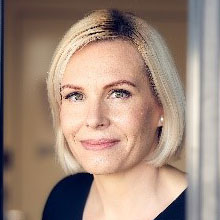
Ulla Kronborg MazzoliChief Advisor, Agency for Data Supply and Efficiency, Denmark
Ulla is Chief Advisor for the Danish Agency for Data Supply and Efficiency where she works with digital government, data infrastructure, data driven innovation and value creation. Is lead on the Agencies transformation work on data ecosystem and digital platform, involving development of new business models. She is the national INSPIRE Contact Point and Danish representative in several EU expert groups. Ulla holds a Master of Science in Geography and a diploma degree in Leadership and Management. She is the chair of the Danish Association for Geographic Information´s International Committee.
Valrie GrantFounder & Chairwoman, GeoTech Vision
Valrie Grant is a serial entrepreneur and Strategy consultant. She is the Founder and Chairwoman of GeoTechVision, a knowledge services company built into an international reliable and quality provider of a range of customized services and data-driven solutions to governments, NGOs and corporate entities. Valrie is a lifelong learner, who is passionate about Technology and Entrepreneurship and relishes every opportunity to mentor women entrepreneurs and young people. Her latest initiative is EduTechAid which seeks to respond to the inequality of access to digital tools in education and empower youths. She has served on several national, regional and international Boards and Committees such as the World Geospatial Industry Council (WGIC) and the United Nations Global Geospatial Information Management (UN-GGIM): Americas Private Sector Network. Valrie is a 2020 WE Empower UN Sustainability Development Goals Challenge Awardee. Most recently she authored the book “ Every Day is Day One : Maintaining the Startup Culture and Mindset”.
She holds a BSc. in Geology from the University of West Indies and a MSc. in Geographic Information Systems (GIS) and the Environment from the Manchester Metropolitan University, and an MBA from Florida Institute of Technology.
Michael GallagherSr. Strategic Advisor, World Wide Technology, St. Louis, USA
Michael is a Sr. Strategic Advisor with World Wide Technology (WWT), headquartered in St. Louis, MO. His focus is both State and Local Government, as well as Federal Government clients.
Prior to WWT, he was a Managing Director and Client Account Leader within Accenture's Health and Public Service practice. He also was the Office Managing Director of the St. Louis Office for the past 12 years.
Clients Michael has served span a diverse group, including Centene, Express Scripts, Ascension Health, Boston Scientific, UnitedHealth Group, Johnson & Johnson, Anheuser-Busch, CVSHealth, Radiometer Medical, Abbot Laboratories, City of St. Louis, and the State of Missouri. Of particular focus of late is client work related to Cloud, GIS, and broadband strategy and access.
In addition to working in the Tax Division of Arthur Andersen & Co., and AT&T Bell Laboratories in his early career, he holds a BA from Marquette University and a Masters Health Science from Washington University in St. Louis.
Jason SouthernSr. Strategic Advisor, World Wide Technology, St. Louis, USA
Jason leads NVIDIA’s Enterprise Software and Visualisation business across EMEA, drawing on 25 years of experience of deploying Enterprise technologies. Prior to working in the Enterprise Jason is a classically trained Electrical and Electronic Engineer who spent the first decade of his career as an Engineer in the Royal Navy. Passionate about using innovative technology to improve and enhance the world today he regularly applies that Engineering foundation to the new challenges of modern information workflows.
Mark NoortDirector / Owner - HCP international, Amsterdam
Mark Noort is director/owner of HCP international. His passion is to help achieve successful application of solutions in the fields of agriculture, water, climate and environment, based on innovative technology, with emphasis on Earth observation. His current work focusses mainly on remote sensing and in situ observations for agriculture and water in Africa, Asia and Australia. He has more than 30 years of experience in working for both the public and private sector in an international environment. He is a graduate of Wageningen University in the Netherlands.
Kendrick FaisonPresident/CEO, Spatial GIS, USA
Kendrick O. Faison is the President/CEO for SpatialGIS. Mr. Faison is no stranger to the Maryland GIS Community. He has served in many capacities managing local, state and federal GIS programs. Mr. Faison started his GIS career at the National Geospatial-Intelligence Agency (NGA) as an Imagery Analyst. He later moved over to the National Security Agency (NSA) supporting Booz Allen Hamilton. In 2007, Mr. Faison, managed the GIS Office for the City of Laurel where he stood as the first enterprise GIS system for the city. He would get his introduction into emergency management working for the Baltimore City Mayor’s Office for Emergency Management as the GIS/IT manager. During both positions, Kendrick served and participated in MSGIC.
Mr. Faison would then go on to work for Esi Acquisitions, Inc, Creators of “WebEOC” and serve as Federal Regional Manager. Before starting SpatialGIS, Kendrick served as the National Geospatial-Intelligence Lead for the Federal Emergency Management Agency (FEMA) where he served as the GIS lead during Hurricane Sandy.
Mr. Faison holds two Bachelor’s Degrees: Bachelors of Arts in History and Bachelors of Arts in Geography from Fayetteville State University, Fayetteville, North Carolina and a Masters of Geosciences from Murray State University, Murray Kentucky.
Albert H. Anoubon MomoVice President & Executive Director, Emerging Market and Funded Projects, Trimble, USA
Albert H. Anoubon Momo is the Vice President and Executive Director of Trimble's Emerging Markets and Funded Projects. In this role, he is at the forefront of Trimble’s international expansion, pursuing projects financed by multilateral development banks, intergovernmental organizations, bilateral development organizations, export credit agencies, private companies, and local governments in emerging countries. Albert also serves as the Chair of the Trimble Foundation, which is a non-profit, donor-advised fund to support Trimble’s philanthropic efforts. Before joining Trimble, Albert was Management and Program Analyst at the United States Agency for International Development (USAID), Senior Business Development Manager at DigitalGlobe (formerly GeoEye), Senior Scientist at Bechtel, Senior System Engineer at Rockwell Collins, and Senior Software and GIS Engineer at the National Oceanic and Atmospheric Administration (NOAA). He holds multiple higher degrees from Johns Hopkins University (USA), University of Maryland at College Park (USA), and Ecole Polytechnique de Yaoundé (Cameroon).
Dr Zaffar Sadiq Mohamed-GhouseExecutive Director - Strategic Consulting & International Relations, Spatial Vision
Dr Zaffar Sadiq Mohamed-Ghouse is an award-winning Geomatics Engineer and IT professional with 23 years of experience developing geospatial strategies for local-national-international government and private organisations and is also recognised as one of the spatial leaders in Australia and Globally. He has rich experience and an excellent track record of serving on Not-for-Profit Boards in Geospatial domains in Australia and Globally. Zaffar is an Executive Board Member of the World Geospatial Industry Council and a lead member of the AI/ML Policy committee. He served the steering committee of the global AI/ML policy from a Geospatial Industry perspective. He is also a Board Member of UNGGIM Private Sector and Geospatial Societies. In Australia, Zaffar has served the peak professional national body for surveying and geospatial for 10 years as Board Director and Chair of the Board and is also a steering committee member of the Australian Spatial and Space 2030 Roadmap committee. He has expertise in strategic consulting studies, policy development, research management, client management, business development, project management, design, development and management of spatial data infrastructure, software engineering, review data framework policies, develop spatial analyses techniques and technology, including GIS applications development for major clients in Australia, New Zealand, Malaysia, Saudi Arabia, Indonesia and India. He has led several Multi-Million Dollar National Mapping projects for State and Federal governments in Australia, Malaysia, Saudi Arabia and India. Zaffar is actively engaged with United Nations Global Geospatial Information Management (UNGGIM) - Geospatial Societies, Private Sector & Academic Network and actively participated in the UNGGIM Integrated Geospatial Information Framework (IGIF) consultation from Private Sector and Geospatial Societies perspective. Zaffar recently completed the World Bank Group (OLC) course on Strengthening Geospatial Information Management: Using the Integrated Geospatial Information Framework.
Dr. Derek ClarkeDirector, AIC Mindful Pty Ltd, South Africa
Dr Derek Clarke works as an Advisor to the World Geospatial Industry Council and as an independent Consultant in geospatial information management. He previously served as head of the national mapping organisation in South Africa for 21 years. He is registered as a Professional Land Surveyor and a Professional GIScience Practitioner in South Africa.
Derek holds a B.Sc degree in Surveying, Diploma in Datametrics, Masters degree in Public Admin (Executive Management) (cum laude) and a PhD in the field of development planning and geo-spatial information. He is also qualified as a professional integral coach. He has over 40 years of experience in the fields of geospatial information management and geomatics. Derek has served on a number of professional and management bodies both nationally and internationally and has been very involved in regional and international initiatives, such as the Integrated Geospatial Information Framework and the Mapping Africa for Africa initiative.
Steven LuitjensChairman of the Board, Geonovum, Netherlands
Steven Luitjens is Chairman of the Board of Geonovum. He is program director and strategy advisor, operating from the Dutch Ministry of the Interior and Kingdom Relations, The Hague. Within that same ministry, Steven was general director of the Logius agency (2006-2015), responsible for the generic digital infrastructure of the Dutch government, and policy director of the Information Society and Government Department (2015-2018).
Philipp GrimmCEO at Integrated Geospatial Innovations
Philipp Grimm is one of the general managers of IGI in Kreuztal, Germany. Together with his brother he is managing the family business since April 2015. Philipp holds a M.Sc. in business information systems from the University of Siegen, Germany.
Tara CordyackDirector, Sales-The Americas, NextBillion.ai, USA
Tara is a geographer at heart and her love of maps has led her to a 25 year career in the geospatial industry. She's been lucky enough to work across a wide spectrum of organizations like Esri, DigitalGlobe, Mapbox and now NextBillionAI, as both leader and an individual contributor. Her favorite thing to do is to help customers, partners and colleagues connect the dots on how the use of location technology can not only solve tough challenges but open up new possibilities for a brighter future.
Unni Krishnan NairDigital Transformation / IT business partner lead, Bayer Crop Science, India
Unnikrishnan Nair is the Regional Head of Digital Transformation and IT in Bayer Crop Science Asia Pacific. In this role he is focused on transforming internal business processes as well as delivering solutions to address farmers needs using technological capabilities.
During his professional journey, he has worked in Asia, Europe, North America for many years focusing on enterprise transformation across various functions in large Multi-National companies.
Currently he is focused on creating most optimal digital agronomic solutions for global Small Holder Farmers to improve their livelihoods. He works very closely with the start-up eco-system players in APAC to nurture new innovations.
Unni is an Alumni of INSEAD and has a Master’s degree in Computer Applications from University of Pune, India
Rhoswen HoathProduct Manager, National Mapping Services Development, Ordnance Survey
Rhoswen leads on transport for Ordnance Survey, the national mapping agency of Great Britain. Ordnance Survey partners with governments and businesses to solve problems that require the collection, curation and analysis of Geospatial Data. As a GovCo, Ordnance Survey delivers solutions to problems shared by national and local transport authorities, along with CAV manufacturers and fleet operators. Rhoswen focuses on mobility innovation, working on a range of research and development projects including Operational Design Domain approval, real-time data exchange and simulation tools for vehicle safety.
Frank PichelCo-founder & Chief Program Officer, Cadasta Foundation, USA
Frank Pichel is the co-founder and Chief Program Officer at Cadasta Foundation. He is a land administration specialist with experience designing, managing, and implementing land-related projects with a technology focus around the globe. He has worked both with the private sector in implementing programs while based in West Africa, as well as designing and managing programs as part of the Land Tenure and Property Rights Office for the US Agency for International Development (USAID).
Kevin SpryOwner, GeoG2 Solutions, Inc., USA
Kevin, received his BS degree in Ag Business Management from Cal Poly SLO in 1967.
Kevin spent his early years on the family farm in Selma, California, and was fortunate to move to San Luis Obispo in 1960. He continued to be active in farming on the Central Coast. After College Kevin began his professional career as a buyer in the fresh produce industry and later moved on to positions in production, marketing, and business development with companies including Bud Antle/Dole Vegetable, Salyer American, Lee Brands, Green Giant, and Dresick Farms.
In 1995 he began his ventures into remote sensing, digital imagery and precision farming with companies including Lockheed, International Imaging Systems, Crop Image, and Airtime Aviation. In 2008 started GeoG2 Solutions and has been involved in the ongoing development of the camera system, flight operations, post processing of the imagery, and marketing the products and services of GeoG2.
 National Geospatial Agencies
 Government Geospatial and Digital Policymakers
 Geospatial Industry
 4IR Technology Companies
 Digital, Analytics, and Knowledge Businesses
 Users from Key Economic Sectors (Government and Private)
 Academia and Research
 Global Development Organizations
 Civil Society Organizations