Speakers

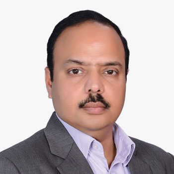
Avinash M.V.
Senior Vice President
DSM SOFT PVT LTD
Avinash is a Civil Engineer and a GIS Professional. He has been with DSM Soft for 24 years and has served the across various functions within the organisation. Currently he heads the sales and marketing function of DSM Soft, and manages key customer accounts worldwide. Avinash brings hands-on and all round experience in cadastre modernization, data processing, software development and business development in
promoting services and products of DSM Soft.

Dean Angelides
Corporate Director
Esri

Gary Dunow
Executive Vice President
United States Geospatial Intelligence Foundation
Gary Dunow joined USGIF in 2023 and serves as Vice President for Strategic Development. In this role, he focuses on guiding the Foundation's issue-focused working groups and expanding thought leadership initiatives, with a particular emphasis on strategic investment across the GEOINT enterprise. Additionally, he is working to bolster the Foundation's presence in the global GEOINT enterprise by growing and strengthening relationships with international counterparts. Prior to this role, Mr. Dunow served over 37 years in the Intelligence Community and Department of Defense. His experience includes a strong mix of operations, policy, and support work across the Global Geospatial Enterprise. He culminated his federal service as the Associate Director for Enterprise and a member of the Executive Committee at the National Geospatial-Intelligence Agency. In this role he was responsible for all aspects of partnership programs, GEOINT requirements development, and Functional Management for the GEOINT discipline. His other roles included leading the Directorates of Analysis, International Affairs, Global Support, and Talent Development at NGA. Mr. Dunow received numerous civil service and military awards throughout his career to include the Presidential Rank Award, DoD Superior Service Medal, and the Defense Meritorious Service Medal. He is a graduate of the Syracuse National Security Fellows Program and the Defense Department CAPSTONE Program.

Greg Scott
Executive Director, SDG Data Alliance
PVBLIC Foundation
Greg Scott is the Executive Director of the SDG Data Alliance at the PVBLIC Foundation, bringing over 30 years of experience in the geospatial and data sectors. In this role, he leads efforts to advance the use of data and geospatial strategies in support of the United Nations Sustainable Development Goals (SDGs), with a focus on fostering collaboration and innovation across governments, international organizations, and the private sector. Dr. Scott is recognized for his leadership in global data initiatives, including his recent work presenting the SIDS Global Data Hub at the SIDS4 Conference and his participation in major workshops and forums dedicated to sustainable development and geospatial strategies. His career reflects a commitment to leveraging data for resilient futures and inclusive progress, particularly in regions such as Small Island Developing States (SIDS) and landlocked developing countries. With a distinguished reputation in the international geospatial community, Greg Scott continues to drive impactful solutions and partnerships that empower data-driven decision-making for sustainable development worldwide.

Hajime Zama
General Manager
PASCO CORPORATION
Hajime Zama is the General Manager, Business Development Department, Satellite Business Division of PASCO CORPORATION. Currently he is responsible for the satellite data utilization and value-added geospatial service expansion domestically and internationally. He joined the company in 1997 and worked for the marketing and sales activities of surveying and mapping, international project developments and geospatial information providing services. He was also in charge for 6 years in the subsidiary of PASCO do Brazil.

Prof. John. P. Wilson
USC Professor and Founding Director
Spatial Sciences Institute, University of Southern California
John P. Wilson, Ph.D., is Professor of Spatial Sciences and Sociology at the University of Southern California (USC) and the founding director of USC's Spatial Sciences Institute. He also holds adjunct appointments in the USC School of Architecture, the Keck School of Medicine's Department of Population and Public Health Sciences, and the Viterbi School of Engineering. Dr. Wilson's research focuses on modeling environmental systems using geographic information systems (GIS), spatial analysis, fieldwork, and computer modeling. His work is highly interdisciplinary, exploring the relationships between society, environment, and human health. He is widely published, having edited influential volumes such as Terrain Analysis: Principles and Applications, Handbook of Geographic Information Science, and Environmental Applications of Digital Terrain Modeling. A recognized leader in geographic information science, Dr. Wilson founded the journal Transactions in GIS in 1996 and continues to serve as its Editor-in-Chief. He has served on the editorial boards of several major journals and has played key roles in the University Consortium for Geographic Information Science (UCGIS), including as President and as leader of the GIS&T Body of Knowledge 2.0 project. Dr. Wilson's achievements have been honored with awards such as the UCGIS Lifetime Achievement in GIScience Education Award, election as a UCGIS Fellow, and the Albert S. Raubenheimer Outstanding Faculty Award at USC. He has held visiting appointments at leading institutions worldwide and earned his Ph.D. in Geography from the University of Toronto, as well as degrees in geography and law from the University of Canterbury. Dr. Wilson's career is marked by his commitment to advancing spatial sciences and fostering interdisciplinary collaboration.

Kaname Ikeda
President
RESTEC (Remote Sensing Technology Center)
Having graduated from Tokyo University, joined the Science and Technology Agency in 1968 and served there as Director-General for Nuclear Safety from 1996 to 1998,Director-General for R&D from 1998 to 2000 and Deputy Minister for Science and Technology from 2000 to 2001.In 2001 joined the NASDA(now JAXA) as an Executive-Director till 2003,and served as Ambassador of Japan to Croatia from 2003 to 2006.Then become Director-General for ITER International project in November 2005 and established the ITER Organization under ITER Treaty among EU, Japan, Russia, United States of America, China, Korea and India and brought the construction of ITER in full-swing by Summer in 2010.Having resigned from the ITER, in April 2011 joined the RESTEC of Japan and became President in June 2012.

Len Kne
U-Spatial Director
University of Minnesota
Len Kne, GISP, is the Director of U-Spatial at the University of Minnesota, where he leads a nationally recognized program supporting spatial research and the application of geospatial technologies across a wide range of disciplines. With over two decades of experience, Len has worked in higher education, government, construction, and non-profit sectors, bringing a practical and collaborative approach to the advancement of geographic information systems (GIS) and spatial data science. Len holds both a Bachelor of Science in Recreation Resource Management and a Master of Geographic Information Science from the University of Minnesota. As a faculty member in the Master of Geographic Information Science program, he teaches courses on project management, spatial databases, and technology-focused graduate seminars, helping to train the next generation of geospatial professionals. At U-Spatial, Len is dedicated to fostering a vibrant community of spatial thinkers by providing leadership, resources, and training for researchers and students. He has played a pivotal role in building U-Spatial into a hub for interdisciplinary collaboration, supporting projects that range from environmental analysis and urban planning to public health and digital humanities. His expertise in project management and spatial data infrastructure has helped numerous research teams leverage geospatial technologies for innovative solutions. Len is also active in the broader geospatial community, serving on advisory boards and participating in national conversations about the future of spatial science. His work reflects a deep commitment to expanding the use of GIS and spatial analysis to address complex societal challenges and to empowering others through education and collaboration.

Naruo Kanemoto
CEO
Space Shift
Naruo Kanemoto is the founder and CEO of Space Shift, Inc., one of Japan's pioneering multinational space business consulting firms. Under his leadership, Space Shift focuses on developing advanced software for satellite data processing, harnessing artificial intelligence and machine learning, fields in which Naruo has conducted foundational research since his college years Throughout his career, Naruo has specialized in helping organizations worldwide redefine product and service strategies, develop and execute market entry plans, and unlock new or enhanced revenue streams. His expertise lies in transforming innovative ideas into actionable business models that drive growth and create new opportunities. Since September 2013, Naruo has also served as Vice President of Business Development and Founding Partner at Elysium Space Inc., a company offering celestial memorial services to honor and celebrate the lives of loved ones. Naruo Kanemoto continues to be a leader in the evolving space industry, dedicated to expanding the commercial and societal potential of space technologies.

Naveen Chittilapilly
Co Founder & CTO
Augsense Lab

Dr Pakorn Apaphant
Executive Director
GISTDA

Lt. Col Rohit Malhotra
CEO
Spatial Logix

Ronda Schrenk
Chief Executive Officer
United States Geospatial Intelligence Foundation
Ronda Schrenk is the Chief Executive Officer for the United States Geospatial Intelligence Foundation and leads the Foundation in its mission to promote the geospatial intelligence tradecraft and develop a stronger GEOINT community among government, industry, academia, professional organizations and individuals whose mission focus is the development and application of geospatial intelligence to address national security objectives. In this role, Ms. Schrenk sets the strategic direction for the Foundation to effectively enable each aspect of mission accomplishment. Previously serving as the Vice President of Programs of the Foundation, she led the content development for all events and programs, serving as the primary spokesperson for the Foundation. Ms. Schrenk is a recognized leader in the field of Geospatial Intelligence and has been on the leading edge of the geospatial intelligence tradecraft for most of her career, including 25+ years in a variety of leadership and analytic positions at the National Geospatial-Intelligence Agency (NGA), the National Security Agency (NSA), the Central Intelligence Agency (CIA), private industry, non-profit, and even academia. Before joining USGIF, Ms. Schrenk was the Senior Fellow for Public-Private Partnerships at the Intelligence and National Security Alliance (INSA). In this role, she advised the president on challenges the Intelligence Community faced and coordinated activities such as INSA's councils on Technology and Innovation, Acquisition Management, and Intelligence Champions (workforce of the future). As a career GEOINT professional, she has served in a variety of analytic leadership positions at NGA, including Mission Requirements Program Manager of NGA's Mission Talent Alignment office, Chief of the Counterterrorism Airborne Analysis Center, and Chief of the Time Dominant Operations Center, and while on a joint duty assignment to NSA, Deputy Chief of the International Affairs and Policy Office.

Shinichi Sobue
ALOS-2 Mission Manager
JAXA
Shin-ichi Sobue got a master degree of engineering from Toyohashi university of Technology in Japan in 1989 and got a philosophical doctor of engineering from Kennedy-Western University in USA in 2000. His major is image data analysis of earth observation data. He joined JAXA in 1989 and had been work for earth observation satellite ground system development and data research management. From January 2017 to 2021, he served Advanced Land Observing Satellite-2 (ALOS-2) project manager. From 2022, he serves deputy chief officer of Earth Observation missions and ALOS-2 mission manager in JAXA. He also plays a role of co-chair of APRSAF SAFE initiative, co-lead of GEO GEOGLAM Asia-RiCE team and ISPRS commission I workgroup 1 co-chair.

Soumya Misra
Founder & CEO
SISIR Radar
Soumya Misra drives strategy, operations, product development, and market expansion to foster growth and innovation at Sisir Radar. He brings deep expertise in hardware architecture, system miniaturisation, and advanced image processing. He has designed GPUs at Intel and led smartphone design at Creo (a Sequoia-funded startup, later acquired by Hike). He was selected as one of India's Top 50 mobile designers by the Government of India and has also published multiple research papers in the field of nanoelectronics.

Sreeramam G V
Chief Executive Officer
NeoGeoinfo Technologies Pvt. Ltd.
Sreeramam G V is the Founder and Chief Executive Officer of NeoGeoInfo Technologies Pvt. Ltd., a leading geospatial solutions company based in Gurgaon, India. With over two decades of experience in the geospatial and GIS industry, he has played a pivotal role in advancing geospatial analytics, urban development solutions, and capacity building within the sector. Before founding NeoGeoInfo in 2019, Sreeramam served as Chief Operations Officer at Geoinfosys Technologies for over 12 years, where he gained extensive expertise in managing large-scale geospatial projects and driving operational excellence. Under his leadership, NeoGeoInfo has been recognized as one of India's top GIS service providers, delivering innovative solutions for urban governance, infrastructure, and utility management. Sreeramam holds a Bachelor of Engineering in Civil Engineering from Birla Institute of Technology and Science, Pilani. He is known for his commitment to industry best practices, training, and capacity building, and is a frequent keynote speaker at major geospatial conferences and forums. His vision and leadership continue to shape the growth of geospatial technologies in India and beyond.

Syed Monirul Hasan
Assistant Surveyor General
Survey of Bangladesh

Tran Anh Tuan
Head of the Department of Surveying, Mapping Technology, and Geospatial Information
Vietnam

Y. G. Gnanathilaka
Surveyor General
Sri lanka Survey Dept.