


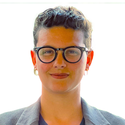
“Being recognized as a rising star has given me the confidence to lead the ESIP Cloud Computing Cluster and to join the Pangeo Steering Committee and NOAA Data Access and Archive Requirements Working Group. As a member of Development Seed, NASA and these groups, I recognize a responsibility to listen to the geospatial community and share the experiences and best practices with the other groups I am a part of.”
Aimee Barciauskas Data Engineer, Development Seed, USA
“After the recognition, I was motivated to learn more about Geospatial technologies and I enrolled for a masters degree after I saw the calibre of other individuals that were nominated. I also started working as a GIS Technician in order to improve on my skills and align my career path with GIS and data science.”
Tommy Charles YouthMappers Regional Ambassador & National Coordinator, OpenStreetMap Sierra Leone
"The recognition has in part opened up global conversations and opportunities to keep working and brainstorming on diverse health related issues powered by geospatial technologies."
Peter M. Macharia Postdoc-Spatial Epidemiologist, KEMRI Wellcome Trust Research Programme, Kenya and Lancaster University, UK
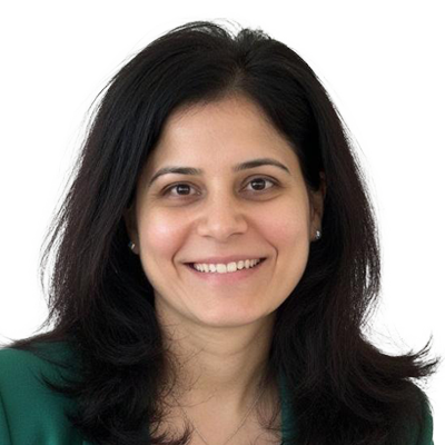
“Being recognized as a Rising Star in 2022 has provided credibility to my career as a consultant. The recognition provided a platform for networking, but also has provided external validation and proof of my skills, leadership, and capacity. I am thankful for being a Geospatial World Rising Star.”
Juliana McMillan-Wilhoit Network Strategy Analyst, Ahold Delhaze USA
“The Rising Stars award brought me a lot of new contacts in the Geospatial community and encouraged me in the future direction of my work.”
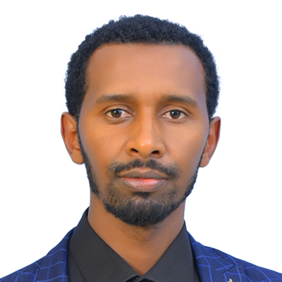
Jakub Karas Director UAS, UpVision & President, UAV Alliance Czech Republic
"Being honored in a historically male-dominated industry showed me that my voice and contributions are welcomed and celebrated! It provided exciting opportunities to network with amazing people and build invaluable connections that have enriched both my personal and professional growth. Becoming a public role model enabled young female professionals to reach out for mentorship and guidance, and it's been extremely rewarding to empower the next generation of female leaders in Africa."
Clara Mundia Director, Women+ in Geospatial, Kenya
"Receiving the Geospatial World Rising Star award has boosted my confidence in what I can accomplish when I set my mind to a goal. It has given me the zeal to go for more. As an early career professional, it has empowered me to gain recognition and credibility in both my workplace and the industry overall."
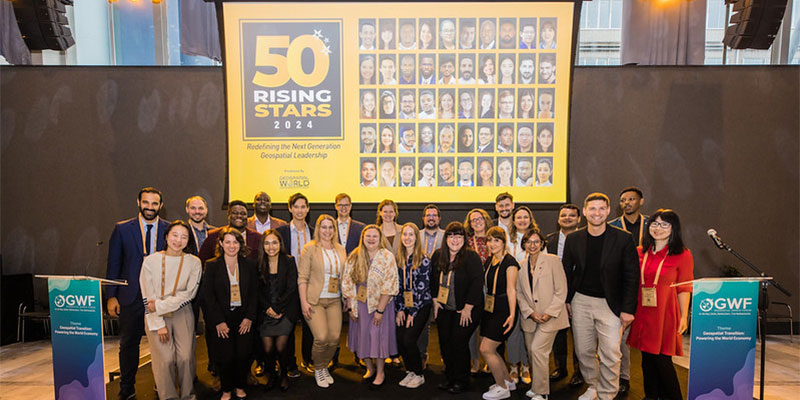
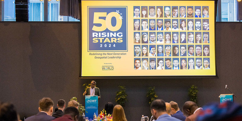
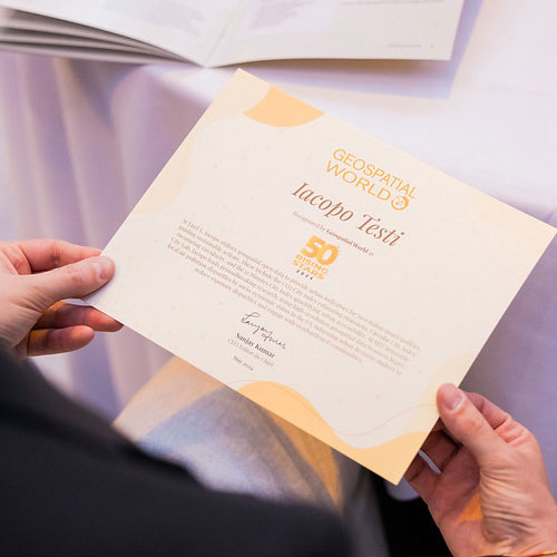
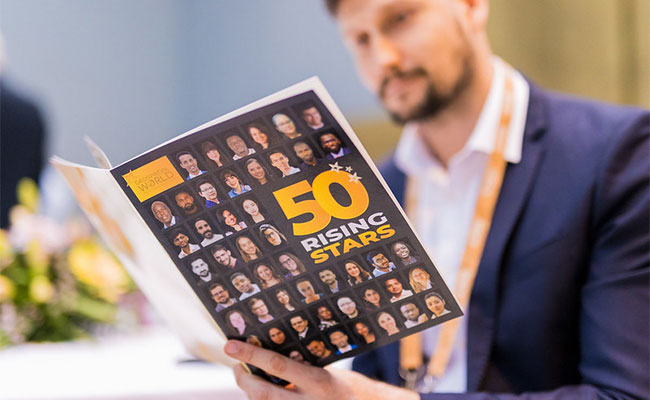
Olive Mandalasi Engineering Surveyor, Pamodzi Consulting, MalawiLaunched in 2021, the Geospatial World Rising Stars initiative aims to showcase the remarkable achievements of individuals under the age of 40. These individuals are proactive and passionate about demonstrating the value of geospatial technology to society, the environment, and businesses. With 200 Rising Stars recognized to date, the Geospatial World’s annual list of Rising Stars is the most diverse and inclusive in the industry, a testament to our commitment to acknowledging talent from all corners of the globe and in all sectors.
The vision behind "Rising Stars" is to create a legacy that highlights the contributions of young professionals who are making significant impacts in geospatial fields. Through this platform, Geospatial World aims to build a community of forward-thinking individuals who can collaborate, share ideas, and push the boundaries of what is possible with geospatial technology. The "Rising Stars" recognition is not just an accolade but a step towards ensuring the continued growth and evolution of the geospatial industry, with a focus on nurturing talent and innovation for the future.
We focus on the millennial and Gen Z professionals as they grasp well- the role of data, automation, and connectivity, but first, they are change-makers and digital natives. Their ability to put into play these emerging technologies such as AI, machine learning, and big data analytics will be important in reimagining how geospatial information is collected, analysed, and used in different sectors.


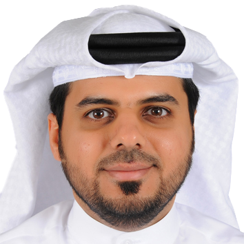
Leading Bahrain’s cadastral survey digital transformation, Abdulrahman contributed to the country’s first 3D property registration, developed the National Guide for Gated Communities, and spearhead the National Cadastral Database. His work enhances land management, decisionmaking, and sustainable development through accurate and accessible geospatial data.

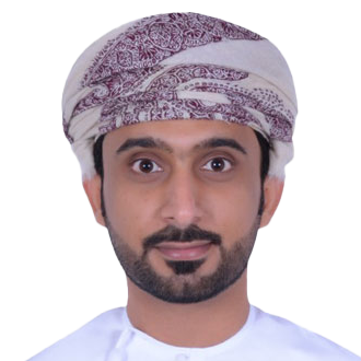
Adithya played a key role in developing Dhruva’s ISOCS mission operations software and AstraView virtual constellation product, advancing space operations and geospatial solutions. ISOCS enables precise spacecraft control, while AstraView supports disaster management and environmental monitoring. His leadership has expanded space technology applications across commercial and government sectors.
Ahmed Al Fazari leads a high-performing GIS team at OPAZ, managing critical projects across economic, free, and industrial zones. His expertise is especially distinguished in the design and management of enterprise geospatial databases and the development of GIS dashboards that deliver real-time, data-driven insights for decision-makers.

Aiman Nabilah binti Noor Azmi specializes in smart agriculture, particularly oil palm plantations. With expertise in geospatial technology, AI, and drone applications, she contributes to automation utilization in tree counting and environmental monitoring. She is also a certified drone pilot and is acquainted with advanced mapping techniques.

Akshay, a GeoInformatics expert and founder of GISKernel, has prioritized innovation within geospatial since 2018. Notably, SpatioSynth, the firm’s novel application, integrates Earth Observation and GIS data for disaster management and agriculture. He has steadily solidified GISKernel’s role in the current industry, positioning his company amongst key players.

Ali has played a pivotal role in shaping Saudi Arabia’s geospatial landscape, leading national policy development and building robust spatial data infrastructure. With expertise in project management and strategic planning, he has achieved and implemented efficient, data-driven solutions that facilitates resource management, national infrastructure, and decision-making across various sectors.
Amanuel Kumsa Bojer is a leader in geospatial science, leveraging AI, remote sensing, and spatial data to address environmental and societal challenges. By incorporating AI-driven models and high-resolution satellite imagery, his research has enhanced the accuracy of predictions and provided actionable insights for policymakers and stakeholders to mitigate climate impacts effectively.

Amy Manefield, Head of Data Operations at the UK Geospatial Commission, plays a key role in the National Underground Asset Register (NUAR). She leads efforts to standardize and integrate buried asset data from over 600 organizations, ensuring interoperability and alignment with the OGC MUDDI standard.

Angela Omamuyovwi Anyakora is a leader in Surveying and Geo-Informatics, driving sustainability and inclusion in the geospatial industry. As Vice Chair of FIG Young Surveyors and Chair of Generational Sustainability, she aims to empower young professionals and advance climate resilience through geospatial solutions and impactful global initiatives.

Dr. Anudeep Sure, a satellite and aerial remote sensing specialist, has expertise in geoinformatics and agricultural applications. He earned his PhD from IIT Kanpur, where he researched soil moisture modeling using machine learning. In the corporate sector, he develops geospatial models for agriculture, climate, and risk assessment. Proficient in GIS, remote sensing, and hydrology models, he received the 2023 Individual Excellence Award and mentors scholars in R&D and industry.

Ayushi Mishra, a Forbes 30 Under 30 honoree, co-founded DronaMaps, leading AI-driven drone analytics for infrastructure, urban planning, and disaster management. Managing the Drone Analytics Monitoring System (DAMS) for India’s highway monitoring, she integrates geospatial technology at scale. Through DAMS and other innovations, she is setting new benchmarks for leveraging technology to address critical global challenges.

Dr. Anna Puttonen holds a Ph.D. in Photogrammetry and Laser Scanning. Throughout her career, Anna has received numerous prestigious awards, including the ISPRS Prize for Best Paper by a Young Author and the KUWI Research Grant. Her expertise spans 3D data processing, remote sensing, and geospatial technologies, with a strong academic and professional background in advancing laser scanning applications.

Dr. Ayushi Vijhani, Assistant Professor at TERI School of Advanced Studies, has uplifted geospatial education by integrating geoinformatics with data science. She has introduced innovative programs, expanded the scope of geospatial for students through interdisciplinary learning. Passionate about hydrological Modelling, climate change effects in the Himalayan River basins, she has actively contributed towards policy briefs, strategy papers and technical reports.

Benjamin Schleider, Founder and CTO of GeoBit AI, has created a Chat-to-Map system and AI-enhanced GIS, integrating natural language processing, Geospatial AI, and a geospatial search engine to automate satellite imagery analysis. His novel and smart innovations are evolving geospatial data interaction, and enhancing accessibility, precision, and utility across industries.

Dr. Cervantes De Blois supports Presidential Special Envoys and policymakers. Notably, she has recently won prestigious honours and awards for her expertise in addressing complex environmental challenges ranging from impact of climate change on conflict and migration to spatial modeling from both qualitative and quantitative datasets.

Catherine is a GIS Change Management Consultant and educator at Monroe Community College and Rochester Institute of Technology. She promotes MCC’s GIST programs, tutors students, and has worked on GIS projects in Colombia, India, Bangladesh, and Rwanda. President-Elect of the New York State GIS Association, she keynoted the 2024 GIS/SIG Conference and won two GIS awards.
Devika leads Geospatial Data Science at Harvard University, advancing High-Performance Computing and Cloud technologies. She developed TSGI, a UN-recognized well-being metric, a K-NN method for voter segregation analysis, and RINX for raster data processing. A believer of open and accessible science, she mentors researchers and aims to increase geospatial knowledge.

Elmira Orynbassarova, Director of the Geomatics Innovation Center at Satbayev University, is a leader in geospatial sciences with 12 years of experience. She has spearheaded state-funded projects, international collaborations, and geospatial education initiatives, earning recognition as Kazakhstan’s “Best University Lecturer” for her contributions to the field.

Euclides Paulo, GIS Coordinator, specializes in geospatial automation, ArcGIS Utility Networks, and interdisciplinary collaboration. He developed the Utility Network Validation Form, presented at GIS-Pro 2024, and contributed to climate-driven migration analysis with the Inter-American Development Bank. A URISA honoree and GIS-E advocate, he advances GIS accessibility for underserved communities.

Eric Anderson, is passionate about geospatial intelligence, advancing energy and maritime analytics. He developed Hyperion, a cutting-edge system for monitoring fracking levels and energy forecasting. The company’s maritime intelligence platform- Theia tackling illegal fishing, sanctions violations, and covert paramilitary activities. His innovation greatly impacts the future of global intelligence and sustainability.

Elsy is Honduras’ lead geospatial analyst for national strategic planning and is currently formulating national geospatial data policy. Alongside, she is a major developer of the National Territorial Information System (SINIT), is secretary to the Interagency Geospatial Data Commission and supports municipalities use geospatial technologies and data. Elsy is committed to making development across Honduran society.

Dr. Enkhjargal Natsagdorj, Director of Spatial Data Analysis at the Centre for Policy Research and Analysis, is a leader in GIS and remote sensing with 15 years of experience. A key figure in Mongolia’s geospatial community, she overlooks projects on capital city government using geospatial data analysis. She is a board member of two communities.

Geoff Smith, founder of Australian Spatial Analytics, is an inclusivity champion, acknowledging and appreciating neurodiversity in the workforce by aligning autistic talent with geospatial sector demands. His social enterprise provides paid training, creating careers for autistic individuals. ASA now employs 150+ people, partnering with 40+ organizations, showcasing neurodiverse strengths in Australia’s digital economy.

Dr. Gengchen Mai, Assistant Professor at UT Austin and adjunct at UGA Geography, specializes in Geospatial dat integrated with AI, Geo-Foundation Models, and Geographic Knowledge Graphs. A leading Geospatial AI researcher, he has published in top AI/GIScience journals and conferences. A three-time AAG dissertation award winner, he also received the WGDC Global Young Scientist Award.

Helen is a geospatial analyst and cartographer specializing in data visualization. As CARTO’s Geospatial Advocate, she leads technical marketing and customer enablement, making geospatial technology accessible and engaging. Beyond CARTO, she promotes geospatial through speaking engagements, social media, and her blog, inspiring the next generation of geospatial professionals.
Dr. Hemlata is a geospatial expert specializing in disaster risk management and climate resilience. She has led transformative projects, including the South Asia Flash Flood Guidance System, enhancing early warning systems across multiple countries. Passionate about innovation, she integrates GIS and Earth observation to build climate resilience and disaster preparedness globally.

Hessa AlHammadi is a proactive GIS leader, managing the Smart Makani project with her team, it involves an AI-powered mapping system which is now adopted by 21 government entities. She is skilled in knowledge transfer, system unification, enhancing spatial analysis and data accuracy. Her commitment to training and mentorship sets a laudable standard within her organisation.

Dr. Hao Chen leads the Australian Urban Health Indicators (AusUrb-HI) project, integrating spatial health, socio-economic, and environmental data to address urban health inequities. His perseverance lead to overcoming ethical and logistical challenges to securely analyzing fine-grained datasets, creating a new approach for spatially detailed insights in public health decision-making across Australia.

Isaxon, project coordinator for Zimbabwe’s GNSS modernization, led the establishment of 19 Continuously Operating Reference Stations (CORS). A certified drone pilot, he has also expertise in precision aerial crop spraying. Currently, he is pursuing an MPhil in GIS and Remote Sensing, specializing in GeoAI for yield prediction in precision agriculture.

Ivani is a GIS expert with 12+ years of experience, has contributed to geospatial innovations in renewable energy, both solar and wind. He has implemented GIS solutions and analytics for renewable energy projects worldwide. His expertise includes adapting GIS methodologies to a wide range of technical and cultural contexts, delivering tailored solutions for complex challenges around the global energy transition.

Irina is a GIS specialist with 15+ years of experience, pioneering digital twins of cities in Kazakhstan, including Astana. She developed a 3D mapping methodology for underground utility networks and now leads aerodrome territory protection at the Aviation Administration of Kazakhstan, ensuring aircraft flight safety through advanced geospatial solutions.

Jordan is a researcher at the University of Liège, specializing in UAS applications for agriculture and environmental monitoring. His work with LiDAR, multispectral, and hyperspectral sensors deal with crop modeling and water stress detection. A NASA DEVELOP alumnus, he is passionate about knowledge sharing and advancing remote sensing technologies.

Jara is a geospatial engineer with over a decade in the space industry, specializing in EO-based solutions and future space missions planning for agriculture and environmental applications. Additionally, as the Founder of GEO4US, she aims aiming to democratize space and geospatial technology by expanding capacitybuilding programs across underserved communities worldwide.

Kelsey Herndon is a NASA and USAID SERVIR scientist. Her expertise lies in Earth observation for climate resilience across Africa, Asia, and the Americas. Also an Associate Lead for Ecosystem & Carbon Management, she promotes geospatial accessibility and has co-authored the SERVIR SAR Handbook. She aims to leverage geospatial data to empower global communities and support future scientists.

Khrystyna Bezborodova is an expert on AI-based feature extraction across photogrammetry, scanning, and mobile mapping. Her contributions enhance survey and construction workflows, improve worksite safety and efficiency. By integrating AI-driven reality capture, she reduces field data collection time and exposure to hazards, achieving pavement and roadway asset management standards.

Nejc Dougan, CTO of Flai, merges geodesy with AI, innovating within geospatial processing. He also is, currently a PhD candidate exploring deep learning for LiDAR automation, bridging academia and industry. Recognized as a 2024 Young Geospatial Professional to Watch, he is on a mission towards achieving AI-powered aerial laser scanning and geospatial automation.

Mickey is a Land Surveyor currently practicing in Hong Kong, with over 10 years of experience in land surveying and geospatial data management. Through a combination of technological innovation integrated with new approaches he has embraced distinctive strategies to projects throughout the urban development cycle.

Olamiposi Caleb Fagunloye is a geospatial innovator with a Master’s in Geography and GIS certification. He increased Atlanta’s green transportation adoption by 50% using ArcGIS Dashboards and supports global initiatives with the World Bank. A URISA Young Professional of the Year and Vanguard Cabinet member, he advances GIS, drones, and machine learning for sustainable development and accessibility.

Oge is a geospatial and drone industry specialist. She has created opportunities, introduced diversity in this field by playing a key role in developing geospatial departments in Nigeria’s top drone companies and advocating for women in tech. In her current role based out Germany, she contributes to space-based geospatial technologies, with the goal of making a global impact in the industry.

Philipp Amon has an exceptional expertise in laser scanning technology with over 15 years of experience in TLS, MLS, ALS, and ULS. As Business Division Manager for Unmanned Laser Scanning at RIEGL, he drives innovation in UAV LiDAR solutions. He believes in integrating flexible, lightweight LiDAR payloads to enhance coverage and efficiency in the laser scanning industry.

Rushanka is a Senior Advisor for Earth Observation and Remote Sensing at England’s Environment Agency, responsible for the integration of space technology and environmental sustainability. An alumna of the Royal Agricultural University Leadership program, she serves on the board of the International Space University and facilitates the UN SDGs through global initiatives.
Dr. Rafaela Tiengo is an outstanding researcher in nature conservation, focusing on climate change and nature-based solutions. A skilled science communicator, she shares geospatial insights through her newsletter and podcast, making complex topics easy & accessible. Her work connects interdisciplinary ideas, advancing understanding and accessibility for STEM outreach.

Shagun Garg has an expertise in flood monitoring, urban resilience, and Nature-based Solutions. His work in flood detection for arid regions and subsidence research provides crucial insights for disaster response and urban planning. As a Helmholtz AI fellow at GFZ Potsdam, Shagun uses satellite imagery to evaluate wetland and river restoration, quantifying their benefits in reducing risks.
Suhas co-founded Aereo to advance geospatial mapping with drone technology. He led innovations like PPK-grade survey drones and Aereo Cloud, earning him eight patents to date. Under his leadership, Aereo has mapped land across India, improving land administration and impacting millions. His work and dedication have earned the company recognition in geospatial technology.

Susanne Knorr is improving the EV charging industry with an AI and spatial data-driven site selection tool. Her Place Intelligence Tool helps local authorities reduce investment risks, accelerate infrastructure rollout, and cut mobility-driven CO2 emissions. The tool sets new standards for public-private partnerships on sustainable mobility across the UK.
Syed Ahmad Fadhli overlooks innovative research in urban resilience, climate adaptation, and smart cities. He has expertise across BIM-GIS and machine learning to advance digital twins and 3D city modeling, driving sustainable urban planning and disaster management solutions. His research and vision contribute to the empowerment of urban planners and citizens.

Dr. Sergey Sukhanov is recognised for his ability to leverage AI, satellite technologies, and geographic information systems (GIS) for advanced remote sensing, real-time analytics, and satellite data applications. He has has integrated AI-driven algorithms, led development of platforms and contributed to improving the resolution and accuracy of remote sensing technologies.

Sapiens Ndatabaye is an advocate for using geospatial technology to save lives during disasters. He mapped Ebola in Goma to ensuring aid reached the most vulnerable in Sudan, and his work has always been towards making a difference. He founded the World Disaster Center to create tools that predict and track disasters and is now working on drones and IoT to stop them before they happen.
Dr. V S S Kiran, Founder and CEO of Garudalytics, strives to accentuate geospatial analytics. In a span of two years, he expanded his company from two to 30 team members, delivering 50+ enterprise projects. An expert and looked upon figure in remote sensing and geospatial AI, he mentors students and advises academic institutions and is involved in CSR initiatives.

Yumi Casualina Nafe has effectively implemented GIS solutions for disaster risks and developmental challenges. In collaboration with SDG Data Alliance, she is establishing Tonga’s SDG Data Hub for measuring sustainable development and SDG indicators. As the head of the Tonga GIS unit, she is recognized due to her efforts towards shaping sustainable development and with her work influencing GIS adoption across the Pacific.