

Geospatial industry today craves the infusion of youth into its ranks.
The young professionals that represent Millennial and Generation Z voices.
The bright young minds that help reimagine geospatial in a complex digital environment.
Young leaders that represent our industry’s future.
Started in 2021, the Geospatial World 50 Rising Stars is an initiative to highlight the outstanding accomplishments of young individuals who are proactive and passionate about the value of geospatial technology to the society, the environment and the economy. The Geospatial World 50 Rising Stars will have global representations with acute focus on diversity, equality and inclusivity.
Here’s the list of 50 Rising Stars to look out for in 2023

Adam Grewenda
Vice PresidentArchiTube, A Dawood Company
Poland
From working for his uncle’s Poland land surveying company at age 10 to founding his own 3D building information modeling (BIM) company 10 years ago at age 29, Adam believed that a geospatial career was his destiny. Now Vice President on the board of ArchiTube—his Czestochowa, Poland, digital transformation firm acquired by US-based Dawood Engineering in 2021—Adam leads a team of more than 20 surveyors, geographic information systems (GIS) professionals, and BIM specialists. An international speaker with an entrepreneurial mindset recognized for his community activism, humanitarian support, and Ukranian war relief efforts—Adam delivers geospatial solutions to diverse markets throughout Europe, Asia, and North America.
Through Adam’s efforts, ArchiTube extends Dawood’s planning, architectural, engineering, and construction reach in the heritage, industrial, inventory management, logistics, movie and entertainment, retail, transportation, and utility space. Adam makes it easy for his clients to use geospatial technology to identify and resolve conflicts—such as when his team surveyed and measured a World War II-era German work camp and scanned parts of a nearby forest to geo-locate graves and properly honor the deceased. He also modeled a 200,000 square-meter European shopping center. In 2022, Adam achieved ArchiTube’s Esri international partner affiliate status.

Adamu Bala
Lecturer, Department of GeomaticsAhmadu Bello University
Nigeria
Adamu is a Lecturer in the Department of Geomatics at Ahmadu Bello University, and Ph.D. Student at China University of Geosciences, Wuhan, China. He is a Registered Surveyor, an Examiner with the Surveyors Council of Nigeria, and a member of the Nigerian Institution of Surveyors, FIG Young Surveyors Network, National Association of Surveying & Geoinformatics Lecturers.
Adamu won the FIG Survey Review Biennial Prize 2022 for the best peer-reviewed paper presented at the 2022 FIG Congress in Warsaw. He has published 15 journal papers, 22 conference papers, and 2 magazine articles. He is the Chief Editor of the Geoinformatics Forum - a maiden Edition of Northern Surveyors Forum magazine.
Adamu has won many awards and scholarships including the 2022 Chinese Government Scholarship for Ph.D. in Surveying and Mapping; the 2022 distinguished Young Surveyor Award; the 2022 Young Surveyors` Academic Scholar with Excellence Award; 2021 Netherland`s Orange Knowledge Programs scholarship; Leica Geosystems` 2021 Certificate of an Outstanding Achievement; 2019 National Map Making Competition Merit Certificate; and 2021 Award of Excellence for Societal development. Furthermore, he is the National Secretary of the Young Surveyors Network, and likes volunteering activities and meeting new professional colleagues.

Alex Sweeney
Senior Geospatial Data AnalystLocana
USA
Alex is dedicated to utilizing geospatial data to communicate, and enable people, communities, and organizations to make climate smart decisions. She has spent nearly a decade in the geospatial industry, beginning her career at the NASA DEVELOP National Program as the Assistant Center Lead where she conducted environmental remote sensing work focusing on agriculture, drought, and flood detection. In this role, she received the DEVELOPer of the Term Fall 2014 for her work analyzing flood detection products. After NASA, she became a science writer for the World Bank, and later analyzed climate data and weather observations to help build a historical understanding of Western U.S. climate for Portland State University. She joined Locana in 2018, and today serves as a Senior Geospatial Data Analyst. In this role, she collaborates with colleagues to develop technologies and services that help customers adapt and improve resiliency to climate change.
Alex received her M.A. in Climate and Society from Columbia University in 2013. In 2011, for her local volunteer work, as well as for her AmeriCorps service, she received The President’s Volunteer Service Award. She received her BS (Magna Cum Laude) in Earth and Space Exploration in 2009 from Arizona State University.

Alina Sushchyk
Head of the International Cooperation DivisionStateGeoCadastre
Ukraine
At a time of intense hardship for Ukraine, following Russia's invasion, Alina has worked hard to progress the aims of StateGeoCadastre internationally and has become the global face of the organisation. She faces daily risk working in Kiev as it, and its power infrastructure, are bombed daily.
Promoted in 2022, she is responsible for bilateral cooperation, interaction with international organizations, technical cooperation projects initiation and their implementation. It is, however, her cooperation with Kartverket, the Norwegian Mapping Agency that has proved most notable. With Norwegian funding and support, StateGeoCadastre has created digital geospatial data coverage of much of Ukraine, developing the country's geospatial industry in the process. Ukraine has also used the United Nations Integrated Geospatial Information Framework to build a country-level action plan for geospatial, with Alina focusing on its future implementation.
Alina represents the young people of her nation; resolute in adversity and innovative when resources are scarce. She has placed StateGeoCadastre firmly on the world stage and helped the organization plan a better future.
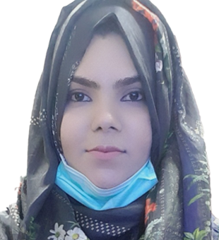
Alisha Shahid
GIS AssistantMott Macdonald
Pakistan
Alisha Shahid is a young remote sensing and GIS expert in the master planning of urban centers in Pakistan. She is observing the growth trends and current conditions of cities using GIS and RS techniques, which aid in offering the best possible planning solutions. She collects the geospatial data, offers a variety of spatial analyses, and produces maps with improved visualization that empower her as a town planner. Her main focus is on using geospatial and remote sensing methods to track how humans affect both natural and man-made environments and use that information to inform better decisions. Alisha Shahid was one of the panelists to talk about young women in geographic information systems and Earth observations in GEO Week 2022, held in Accra, Ghana.

Amarsh Chaturvedi
Director, Software DevelopmentTranserve Technologies
India
Amarsh came up with the concept of vector data processing in the cloud using micro-services, and he quickly and successfully created it. His concept of developing a single platform for location intelligence and spatial data drive to support decision-making across the web and mobile devices has been granted patent protection. The integrated strategy will bring location intelligence to the average person in day-to-day life, aid in improving business processes in a variety of industries, including BFSI, advertising, real estate, FMCG, logistics, and e-commerce, and create business intelligence products that are powered by location analytics.

Amelia Napier
Head of Public Sector Data Access PolicyUK Geospatial Commission
United Kingdom
Since arriving fresh to the geospatial world in 2018, Amelia has used her dedication and drive to empower public sector bodies to deliver better citizen outcomes through better use of geospatial data.
Whilst at the UK Geospatial Commission, she has covered several key roles in managing critical public sector contracts that offer access to foundational geospatial data. Amelia led a team to create a Dynamic Purchasing System for Space and Geospatial Services, enabling new opportunities for public sector organizations, market suppliers and innovators to leverage cutting edge geospatial data.
In her current role as Head of Public Sector Data Access Policy, Amelia is developing policy around emerging geospatial technologies which will unlock greater value across public services. This high impact work involves her engaging extensively to identify barriers hindering geospatial technology use and the opportunities of using commercial approaches to enable multiple stakeholders to address them.
Most recently Amelia has lent her skills to developing a new collective model of public procurement of Earth Observation data. This is a UK-first, taking a cost-efficient approach to opening access to EO data for government organizations.
Amelia has been instrumental in ensuring that the UK government is an intelligent use of location data.
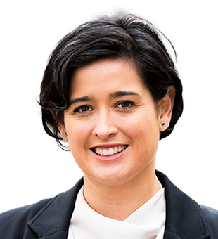
Andrea Krupa
PresidentPhotoSat
Canada
In 2021, Andrea was appointed President of PhotoSat, a Vancouver-based technology company that produces geospatial data from satellite imagery. With a global clientele of engineers and geologists, PhotoSat forms a unique link between the satellite technology industry and the resource development sector.
Andrea is a socially savvy mom of three – approachable, skilled in communication, and entirely averse to micromanagement. Because of these talents, the company – under Andrea’s leadership – has continued to innovate, adapt, and grow, despite two years of economic uncertainty seen during the global pandemic.
In her time as General Manager and now President, she has strategically built a multi-disciplinary team of skilled professionals and fostered a culture of trust, transparency, and collaboration where employees thrive personally and professionally. On the business side, she has driven operational efficiency, supported new research and design, and formed new partnerships with emerging and existing satellite technology providers.
The global demand for satellite-based data insights is on the rise. Andrea is committed to supporting the company’s continued innovation and growth as a leading satellite-technology company.

Antara Dasgupta
Research and Technology AssociateLuxembourg Institute of Science and Technology
Luxembourg
Antara is currently a Research and Technology Associate at the Luxembourg Institute of Science and Technology, where she leads the assimilation of EO data and physics-based models for improved forecasting and estimation of natural resources. Previously, as a postdoc at the University of Osnabrück, Germany, she explored the role of deep learning in hydroinformatics and remote sensing to bolster global flood forecasting capabilities. As the Senior Radar Scientist at Cloud to Street, US, she evaluated commercial radar satellites for flood monitoring and developed radar-based flood mapping algorithms.
In 2020, she earned a dually-badged Ph.D. in Civil Engineering from the Indian Institute of Technology Bombay and Monash University, earning the best thesis award from both institutes. She won the Postgraduate Student of the Year Award for Australia and New Zealand in 2021 for her contributions to geospatial sciences, awarded by the Surveying and Spatial Sciences Institute. Recognized as one of the Rising Stars of Asia – Women in Engineering by the Asian Dean's Forum, Antara is a strong advocate of diversity and inclusion in the geospatial sector. AD co-leads the Twitter initiative Sisters of SAR and is a mentor with African Women in GIS to support young professionals from Africa.

Anzhelika Kamza
Geoscientific System and Data OfficerRio Tinto Exploration
Kazakhstan
Anzhelika Kamza studied at the Satbayev University, specializing in "Geodesy and Cartography" for her bachelor, master’s and PhD degrees. Professionally, she has held various positions, including topographer, GIS specialist, leader GIS, and head of GIS and DB department. At present, Anzhelika works in Rio Tinto Exploration Kazakhstan LLP, where she successfully combined practical activities and sciences, being involved in writing scientific papers and projects.
Anzhelika participated in the study of the seabed of the Kazakhstan Sector Caspian Sea, and was responsible for projects in the Kashagan oil field. She developed databases and mapping during geological projects, as well as on geodynamic monitoring projects. She’s a member of international conferences, author of scientific publications, published in scientific journals in Bulgaria, Russia and China. As part of the PhD program, Anzhelika completed a research internship at the Michigan Technological University (USA, Michigan, Houghton) in the "Scientific Center for the Study of the Great Lakes", where she received positive recommendations and characteristics. Anzhelika was also involved in developing educational program "Remote methods Earth exploration" for the specialty "Geology and exploration mineral deposits". She works as a part-time lecturer at Satbayev University. She was the organizer of GIS Day conference in KZ, Almaty in 2022.

Babatunde Aremu
FounderThe Geospatial Hub
Nigeria
Babatunde was the best graduating student from the Department of Surveying and Geoinformatics at Obafemi Awolowo University in 2020.
He built and self-financed The Geospatial Hub, a platform for learning GIS skills, where he takes the most complicated GIS concepts and breaks them down so anyone can understand them. The Hub started from YouTube videos to free webinars and now to highly affordable online courses. The learning content caters to beginners, intermediates and professionals. The Hub has reached over 1,000 learners worldwide.
Currently, Babatunde is in Spain for a Master's Degree program studying geospatial technologies. He hopes to use the knowledge, experience and connections he obtains to improve how The Geospatial Hub caters to bridging the knowledge gap encountered by geospatial students in Africa.
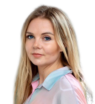
Brooke Hatcher
Geospatial Data LeadNew Light Technologies
USA
As a Senior Geospatial Analyst with New Light Technologies, Brooke leads research and development of geospatial solutions for the homeland security and disaster response communities. Since 2018, Brooke has supported FEMA applying advanced analytical methods to develop maps, models, data services, and web-based applications to support a range of missions vital to the safety and health of vulnerable populations across the nation.
Brooke has been instrumental in developing AI/ML tools to assess remotely-sensed imagery to detect natural hazards and assess and predict impacts to communities. This work has involved development of novel models to identify and prioritize risk and isolated communities used to guide response operations for the Office of Response and Recovery.
Additionally, Brooke has designed and deployed interactive web-based decision support tools for visualizing and reporting real-time geospatial analytics and information used by the interagency community to facilitate socially equitable response and recovery to major disasters.
Brooke is an active contributor to industry events and professional associations and in 2022 was selected to serve as a member of URISA’s Vanguard Cabinet, an advisory board of young geospatial professionals who create and promote programs to advance professional development opportunities.

Caroline Gevaert
Assistant ProfessorUniversity of Twente
The Netherlands
Caroline brings inclusive, responsible GeoAI to sustainable development from two angles. On the one hand she is an accomplished researcher: the youngest member of the Dutch Young Academy of Sciences, one of the 15 global experts selected to review the UN Global Sustainable Development Report 2023, and a leading expert on Responsible AI for sustainable development. She has scientific publications with >90 co-authors from almost 40 organizations in over 21 countries; and has presented at conferences in five continents, including three presentations at the first UN-GGIM World Congress in China.
Caroline influences the Geospatial Industry by consulting for the World Bank. Through this role she advises on how to use drones, AI, Earth Observation, citizen science, and participatory mapping for disaster risk management and development projects. Example projects include: the Resilience Academy – a partnership between universities in Tanzania and Finland to work together to develop tailored local solutions for resilience; Ramani Huria – a largescale participatory mapping program where hundreds of Tanzanian students mapped the city of Dar es Salaam and put it on OpenStreetMap; using drones to get accurate terrain models for flood mapping; and recommendations on Responsible AI for Disaster Risk Management.
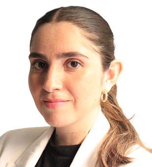
Catalina Tapia Johnson
Spatial Data Infrastructure AnalystMinistry of National Assets
Chile
Catalina has worked at the Executive Secretariat of the Spatial Data Infrastructure of Chile since 2014. She works on issues related to geospatial information management, mainly in matters related to Geographic Information Systems and Geographic Information Standards. She is very influential in developing geospatial infrastructures in Chile and in the Americas.
Catalina actively participated in the development of 10 thematic working tables for the standardization of Chile geospatial information. She co-directs the multi-sectoral emergency and disaster management group, working actively to support decision making in crisis. Her leadership stands out in other ways too, training geospatial professionals across Chile in a range of subjects.
Internationally, Catalina is well respected and collaborates in the Working Group on Geospatial Data Infrastructure of the Americas of UN-GGIM: Americas. She has published an ISPRS document "The Spatial Data Infrastructure of the Americas" and presented at the UN WGIC in 2022.
Currently, Catalina leads regional coordination of SDI Chile, supporting regional coordinators in strengthening the SDI implementation in each region of Chile. This work is very important for the effective implementation of the national SDI. It is unusual that this be trusted to such a junior member of staff, demonstrating her leadership and professionalism

Cristian Araneda
CEOGeoAdvisors
Chile
Cristian began working in Geomarketing 15 years ago at Mapcity Geo, a Chilean company providing geo-referencing services. Mapcity was later bought by the Equifax Corporation, thanks to the growth that Cristian brought in its geography and mapping capability. Now, Cristian runs his own company to continue growing location intelligence capability, not only in Chile, but in Latin America as a region. Cristian was the Executive Secretary of the National Territorial Information System of Chile.

Erin Hull
Marketing and Business ManagerElaine Ball Ltd
United Kingdom
Working on the 'Get Kids into Survey' initiative, Erin helps to produce geospatial resources with the help of industry sponsors. These resources are free and available worldwide. As well as accompanying resources such as coloring sheets, homework projects and the recent release 'GeoSquad Comic Book'. Targeted at ages 8-12, the aim is to make children aware of the geospatial industry and the exciting roles within it. Erin works hard communicating with the industry to help push these resources out, plus the importance of teaching kids this information. So far accumulating over 100 Brand Ambassadors, they are in action all over the world helping to implement this initiative as well.

Ernest Opoku-Kwarteng
IT/GIS ManagerAfarinick Company Limited
Ghana
Ernest is the founder of the Geospatial Developers group on LinkedIn, Telegram, and YouTube. He organizes a mentorship program on geospatial technology where he teaches thousands of geospatial professionals worldwide on Telegram for free. Ernest has built various national systems under the Centre for Remote Sensing and Geographic Information Services (CERSGIS) in Ghana, including the Small Scale Mining Monitoring Portal (http://ssmportal.cersgis.org/), and the Basic Sanitation Information System (http://basis.sanitationghana.org/).
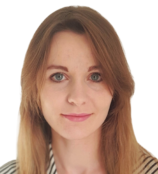
Ewa Grabska-Szwagrzyk
Research AssistantJagiellonian University
Poland
Ewa is, in her activities, combining cutting-edge academic research with popularization and promotion of knowledge about remote sensing and earth observation.
In Academia, Ewa is conducting work on implementing machine learning in satellite images analysis. She has managed to conduct the first national-scale classification of tree species with the use of Sentinel-2 satellite imagery, which has been already presented at scientific conferences and distribution and dissemination of which is being undertaken right now.
During her various classes with students, Ewa introduces a lot of coding and machine learning exercises, promoting the use of such tools among the non-technical students, such as geographers.
In parallel to her research and teaching work, Ewa is leading two most widely read fan pages on the topic of remote sensing and earth observation in Poland, named “Polska z Sentinela” (Poland from Sentinel) and “Z orbity” (From the orbit). On those websites, she presents the beauty of Polish and global landscapes, seen from space, combining it with description and explanation of the observed phenomena and facilitating discussion on important environmental topics.
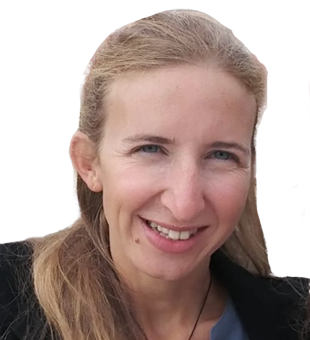
Francesca Noardo
Innovation Project ManagerOpen Geospatial Consortium
Belgium
Francesca is one of the few female international expert in integrating GIS and BIM using open standards. She has developed a different perspective on (3D) spatial data integration by strictly relating to use cases’ requirements and working with strongly inter-disciplinary teams (EU MSC project). She collaborates with construction and BIM community, opening a direct dialogue with the geospatial science. She works on getting real time data to monitor assets and performances as energy consumption – a unique position in using geospatial technology for UN Sustainable Development goal on sustainable cities & communities.
Francesca was awarded the highly competitive Montalcini Italian position, although she chose to follow in her current OGC position, offering the opportunity to have a higher international impact on Open standards and Open science. She leads EUnet4DBP, a multidisciplinary and multisectoral international collaboration (80+organizations, 30 countries) around the digitalization of building permits. She is co-chair of the ISPRS-WGIV/1 Spatial Data Representation and Interoperability.

Francis Andorful
Founder & PresidentWhere Geospatial
Ghana
Francis is the founder of Where Geospatial, a non-profit organization that seeks to utilize geospatial technologies to aid development. He has introduced the celebration of Remote Sensing Day in African countries and developed the Where Geospatial Data Pipeline (WGDP), a framework for identifying, obtaining, and maintaining spatial data. As the acting head of the Geospatial Data and Resource department at Where Geospatial, he also led the design and implementation of a Spatial Data Infrastructure for Africa, which attracted over 250 volunteers from around the world to help maintain the infrastructure. Francis also writes about the integration of geospatial technologies into other workflows.

Glenne Blyth
Managing DirectorRIEGL Australia
Australia
Glenne stepped into the position of Managing Director of RIEGL Australia in autumn 2018, operating to support local customers and distribution partners in the AUS/NZ region as a provider of cutting-edge technology in airborne, mobile, terrestrial, industrial, and unmanned laser scanning solutions.
Glenne has been hard at work establishing RIEGL Australia in the industry. Projects that customers are utilizing RIEGL LiDAR for include: the creation of a digital twin of Tasmania, mapping waterways for environmental research on the effects of global warming, vegetation & land mapping for forestry research, digitizing the transport network as well as creating a digital twin of the power distribution network in the state of New South Wales, and through a distribution partner RIEGL scanners are now being used throughout all of Australia.
Glenne is an effective leader who moves the needle forward in innovation and is extremely customer focused, doing everything in his power to provide world class products and support to Australia’s LiDAR Market.

Gwendolin Seidner
Coordinator, International Projects and InitiativesFederal Agency for Cartography and Geodesy
Germany
A Master of Engineering graduate specializing in GeoInfomation, Gwendolin started her career as a Geospatial technician at Boeing and has subsequently moved into her current role as Coordinator for international Projects and Initiatives at BKG, with a focus on SDG's and a sustainable geospatial information management.
Gwendolin has led BKG's work on creation of Germany's IGIF Country Level Action Plan, the first to be published in Europe. Utilizing a mix of materials from the UN-GGIM Secretariat and the World Bank, the team tailored the approach to fit the German context including the identification of critical champions within both Federal and Regional governments. The support of these champions enabled Gwendolin to bring key stakeholders and get them around the table to carry out a capability assessment, undertake a gap analysis, and to compare this to other nations. In doing so, Gwendolin and team were able to build consensus for a range of actions that will build Germany's geospatial capability and develop global competitive advantage, and which are now in the process of being implemented.

Hannah Dormido
Graphics Reporter and CartographerThe Washington Post
USA
Hannah is an award-winning graphics reporter and cartographer at The Washington Post. She is the current Vice President Elect for the North American Cartographic Information Society (NACIS), serving the four-year presidential track. Hannah is the winner of the Asia Award for Excellence in Explanatory Reporting (2017). Before joining The Post, Hannah worked as a data visualization journalist at Bloomberg News in Hong Kong and has led the Asia graphics team at the Financial Times.
Hannah is known for "Dormi-dots", the unique hand-drawn mapping style she developed which uses dots and circles. Aside from giving back to the mapping community through her work at NACIS, she is also passionate about humanitarian action through cartography and open source software for geospatial.
Her works have received distinction from different award winning bodies including a Pulitzer Prize Finalist in National Reporting (2022), Society for News Design Award of Excellence in Information Graphics (2021), Malofiej 28 Silver Medal for Breaking News Graphics Coverage of Hong Kong Protests, (2020) Society of Publishers in Asia Award for Excellence for Reporting Breaking News (2020), and AAJA-Asia Digital Journalism Award AAJA- Asia (2017).
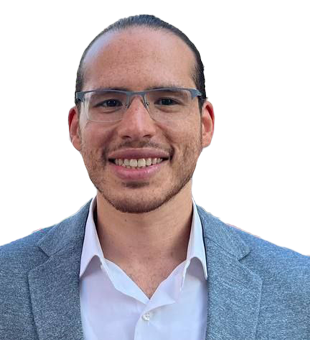
Hesham Gamal Gaafar
Digital Twin & GIS ManagerGleeds
Egypt
Hesham dedicates his career to helping the AECO sector leverage geospatial technologies to develop its processes. Recently, he was listed as AEC GIS Hero by ESRI, and Autodesk has recognized him as BIM Hero in the BIM Coordinators Summit 2022. Hesham is certified as BIM Informed professional by the British Research Establishment. He is investing his programming skills to build digital twin systems to help achieve data-driven design sustainability for the built environment.
Hesham is known for pioneering the integration of GIS with BIM and other technologies like IoT, cloud computing, digital realities and business intelligence to enhance project’s processes. In addition to participating in multiple mega projects in the Middle East and overseas, he focuses on information sharing through various online and offline channels. His master’s degree research focuses on the use of geo-statistics and data analysis in preconstruction studies.

Jay Doorga
LecturerUniversité des Mascareignes
Mauritius
Jay has over 15 publications and 315 citations in high impact factor journals (Elsevier; Springer) on geospatial studies worldwide. His recent breakthrough work on the roadmap that would enable Africa phase out fossil fuel reliance at strategically identified geospatial solar and wind hotspots got featured in Forbes, University of Oxford’s main website, Daily Maverick, and ESI Africa. He recently published a book in Springer (entitled Geospatial Optimization of Solar Energy, ISBN: 978-3-030-95213-6) to help countries, worldwide, including Hawaii, India, Mauritius, and Rodrigues, exploit their solar resource potentials through geospatial tools and techniques.
Besides his interest in the promotion of clean energy in the continent, Jay has also carried impactful GIS-based published researches on climate change and the identification of flood risk areas in highly vulnerable regions, including Mauritius with collaborators from the University of Oxford (UK), University of District Columbia (USA), and University of Mauritius, which resulted in a series of recommendations formulated to the Government. His works in the geospatial field have led him to be invited to deliver guest lectures on geospatial analysis, worldwide, notably at the University of Oxford and the upcoming African Economic Conference.
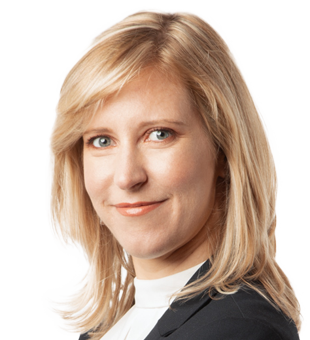
Julia Wagemann
Independent ConsultantJulia Wagemann Consulting
Germany
Julia is a strategy and IT consultant in the geospatial field. Her work is in the intersection of data providers and users aiming to make large volumes of Earth Observation (EO) and climate data better accessible and used.
Since 2019, she has trained more than 1600 EO and climate data practitioners and developed more than 100 educational workflows on data access, handling, analysis as well as Machine Learning.
Julia initiated and scaled the innovation program ‘ECMWF Summer of Weather Code’ from a pilot to an established annually recurring program by developing a compelling vision and fostering strategic partnerships.
She initiated, co-founded and grew the professional network ‘Women+ in Geospatial’ into a 4600 member strong global community by developing a vision, inspiring and motivating others and initiating several activities, e.g. a speakers database and a webinar series for career development.
In 2022, Julia finished her PhD in which she started a new research field aiming at better understanding user requirements and training needs of Big Earth data and cloud-based services. She managed to finalize the PhD in four years while working full time during most of this period.

Kaz Smith
GIS ConsultantEagle Technology Group
New Zealand
Kaz has shown outstanding motivation and leadership in the 5 years she has been in the geospatial industry. She is involved with many professional groups in New Zealand such as Emerging Spatial Professionals (secretary) and Women in Spatial (member). Kaz is helping develop the NZ Geospatial Industry Salary Survey for 2023 which aims to bring salary transparency to the industry.
Outside of work, she has also volunteered her time building a GIS system for Manaaki Ruahine, a conservation group aimed to eradicate pests in the Ruahine Mountain Range in hopes that kiwi birds can return to their native habitat. Her skills and passion are well noted in the industry, and she consistently produces excellent outcomes.
Originally from the United States, Kaz has shown resilience moving to a new country and embracing the kiwi culture, most notably when she completed Te Araroa, a 5-month hike from the top of New Zealand to the bottom. She is a very well-rounded individual and will no doubt be an asset to the geospatial industry for years to come.

Kimberley Worthy
Principal ConsultantSpatial Vision
Australia
Kimberley is an accomplished geospatial professional and senior leader, with diverse consulting experience achieved across 17 years in Africa, Asia, Australia, Middle East, New Zealand, South America and the United Kingdom.
She successfully delivered numerous major projects while leading and mentoring staff. Highlights include the delivery of spatial strategy and policy training to senior government representatives in Tanzania, and capacity building initiatives promoting the use of spatial data and earth observation technology to improve citizen services in Vietnam.
Kimberley is passionate about the application of geospatial to promote sustainable development, contributing to SDG’s in areas of spatial policy, GI strategies, geomaturity assessments, smart city services, spatial data infrastructure and technology. She has championed the effective utilization of GI technology in Dubai by introducing world-leading smart city sites to executives, directly resulting in data standards and policy formalized by decree.
Giving back, Kimberley is a mentor and role-model for young women in early-career stage. She has spearheaded a geospatial Pacific skills exchange program, which sees young people learn skills directly related to solving relevant problems across areas of climate change. Kimberley also provides advice as Board Member for a not-for-profit public data trust that supports sustainable growth and resiliency.
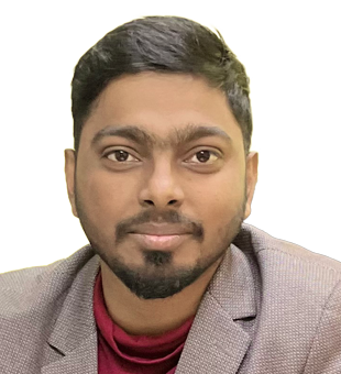
Kunal Rao Maddu
Founder and CEOGREd Foundation
India
Kunal is a budding entrepreneur and holds MSc in Geography from Andhra University. He is the Founder and CEO of GREd, a sustainable GIS Capacity building foundation. Initially started as ACEGIS technologies in 2019 and changed its name to the Geospatial research and education foundation, the GREd foundation has reached out to 2000+ students across the North Eastern Part of India, which is devoid of good education. The Foundation has close to 20 Graduate Students from various programs, and the students thus far have been placed in 10 prominent organizations. Kunal’s mission is to bridge the gap between education and employability by providing GIS education at affordable costs. GREd foundation has been associated with Charitable programs, the most prominent being its association with the Period Society of Assam.

Manabendra Saharia
Assistant Professor, Department of Civil EngineeringIndian Institute of Technology Delhi
India
Manabendra’s physics- and data-driven modeling of hydrometeorological hazards makes extensive and innovative uses of geospatial data and had led to solutions for sustainably managing our water resources. Some of his contributions can be summarized as developing and mapping a new metric of flash flood severity called flashiness which has been widely adopted, first geospatial database of floods in India called the India Flood Inventory (IFI), using geospatial data for large sample flood characterization and erosion studies, and high-resolution radar precipitation data to understand the impact of rainfall organization on flash floods. Exploiting machine learning for hydrologic predictions is another one of his contributions.
Manabendra was one of the first to develop a sophisticated Time Lagged Neural Networks (TLRNs)-based model for Brahmaputra which combined the advantages of dynamic neural network, integration of geomorphologic information, and adaptation of a semi-distributed modelling approach. Furthermore, he has developed the INDRA Reporter, a comprehensive suite of citizen science tools which uses active and passive crowdsourcing of natural disaster data to develop novel geospatial datasets. Overall, he has made innovative contributions in using geospatial technology for characterizing, modeling, and understanding floods, especially in combining them with land surface models and machine learning frameworks.
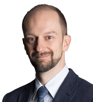
Marc Muick
Project Lead, Application EngineerVexcel Imaging
Austria
Marc holds a Master’s degree in Geospatial Technologies from the Technical University of Graz. He was hired by the Vexcel Application team in 2013. During his 10 year career in Vexcel, his working areas changed and evolved – from geometric and radiometric quality control of large format aerial mapping UltraCams, to managing the optimization of image quality related topics, as well as radiometric and geometric calibration workflows.
His expertise in image quality also benefits the Vexcel Data Program (VDP), the largest aerial imagery data program in the world. Marc developed the radiometric standard operating procedure that is used for all imagery collected worldwide and ensures a uniform appearance of all VDP data.
In addition, Marc was involved in the creation of Vexcel's proprietary Adaptive Motion Compensation (AMC), presented in a scientific paper at the ISPRS conference in Nice 2022. He created the first trials and was later responsible for the final quality control of the data.
In addition to internal impulses for professional development, Marc also participated in a European exchange program (MSCA project VOLTA), contributing to Vexcel's innovative strength today and in the future.

Matteo Emanuelli
Manager Future SAR ProgramsAirbus Defence and Space
Germany
Matteo leads the lobbying and technical effort (at international and in the ITU environment) to protect the specific SAR bandwidth (10.0 - 10.4 GHz) used for VHR acquisitions (<25cm) from interests of 5G industry. The technical studies have proven sharing of the frequencies between SAR and 5G is not possible.
In his role, Matteo coordinates messages and actions to raise awareness about the socio-economic benefits of SAR to increase the international support towards Earth Observation and prevent 5G industry to gain access into the bandwidth which would critically harm SAR endeavors for commercial and defense-related applications.
Matteo works towards enabling Airbus to continue its radar data services even after the demise of TerraSAR-X and TanDEM-X. As such, he works with small satellites partners to define sustainable business models to provide high-quality data.
Matteo supported a number of near real-time (NRT) operational maritime monitoring use cases enabled by coordination with "new space" actors. e.g. monitoring sea ice at northern latitude and illegal/pirate activities in West Africa.
He strongly believes the future of Earth Observation relies with fusion and coordination of different sensors along the whole spectrum. In order to achieve this vision in a meaningful and financially sustainable way, is to federate and orchestrate sensors (in space, in the sky or in-situ) to provide the right set of the data from which the information can be derived.

Matthew Ricketts
Data Improvement and Development LeadOrdnance Survey
United Kingdom
Matthew joined Ordnance Survey through the graduate program and has rapidly progressed his career. He has risen through various consultancy and advisory roles to now leading Data Improvement and Development where he is innovating OS’ core data management processes to ensure National Mapping Services meets the needs of customers.
Matthew is passionate about location insights for locating people and places and how it can be used to improve citizen services and save lives. Throughout his career, he has been on various secondments across Government:
In Wales, he developed a repeatable, open-source methodology for calculating citizen access to services for the Index of Multiple Deprivation, increasing the granularity of statistics for better decision making.
During the pandemic, Matthew led on geospatial at DHSC’s Joint Biosecurity Centre, overseeing development of automated mapping pipelines for senior briefings, advocated the adoption of the UPRN and higher accuracy location data to improve contact tracing to contain the virus.
Most recently, he led the mapping for emergencies capability, providing technical consultancy to the national security and resilience sector enabling use of location data in emergency response and established the geospatial capability of the Cabinet Office’s Situation Centre.

Munsung Koh
Land Administration SpecialistLX
Republic of Korea
Munsung aspires to bridge the gap between developing countries and Korea in the field of land administration/cadaster through his direct participation in multiple project implementation and knowledge sharing activities.
He successfully designed and implemented the International Meeting for the Advancement of Geospatial Information Cooperation (IMAGIC) under Smart Geo Expo by the Ministry of Land, Infrastructure and Transport, Korea in 2015 and 2016 and he still remains as advisor to IMAGIC. IMAGIC is intended to share knowledge and discuss cooperative activities between Korea and invitees (appx. 10+ countries, annually).
He also successfully served as land administration specialist in the World Bank, especially for developing land administration projects in Ethiopia (pipeline) and Tanzania (Land Tenure Improvement Project; P164906) during 2019-2021. He is still continuing similar projects in these countries.
Currently, he proactively assists the chairman for UN-GGIM AP Working Group 2 (Cadastre and Land Management) by arranging programs and moderating meetings.

Neena Priyanka
Product Manager - Location IntelligencePrecisely
India
During 14+ years in the geospatial industry, Neena has certainly made her mark. She recently played a vital role in the award of a new patent for Geocoding Positional Accuracy, helping with idea development and taking the lead in writing the application. This is an industry development of huge importance - helping to identify how close a geocode is to a likely real-world position, vastly improving location accuracy. This significantly impacts businesses relying upon analysis of precisely located assets on the earth's surface to make critical decisions.
Neena is academically accomplished, with several certifications to her name, including; a PhD in Geospatial Technologies, a Post-Graduate Degree in Machine Learning, and an Executive MBA in International Business from the Indian Institute of Foreign Trade. She also recently began a Master's Degree in Data Science, specialising in AI/ML.
On top of this, Neena is generous with her time and knowledge, being an active member of the geospatial community - regularly speaking at conferences, on webinars, and authoring white papers. She is also a proud advocate for Diversity & Inclusion, recently becoming co-leader of the Precisely Women in Technology group, and is an active fundraiser for Girls Who Code.
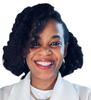
Njeri Murage
Lead GIS SpecialistConflict Armament Research
Kenya
Njeri participated in designing, building and deploying of the First Kenyan University Nanosatellite Percussor flight (1KUN’s-PF) by University of Sapienza and UNOOSA under the Kibo-cube program. As an avid advocate for capacity building in the space sector, she joined the Space Generation Advisory Council and helped organize the 2nd African Space Generation Workshop in Mauritius, and presented on Space Education in Africa at The UN Symposium on Basic Space Technology, South Africa.
Passionate about paying forward, Njeri co-founded Women in GIS Kenya (WiGISKe) with the aim of creating a community of visionary women in GIS to bridge the gender divide and use the technology to address gender issues. As the Creative and Technical director of WiGISKe she has led GIS knowledge transfer workshops and trainings to university students, provided mentorship and organized Geospatial events for networking and career building.
Njeri currently leads the GIS department at Conflict Armament Research where she uses geospatial technology as a tool for peacekeeping by better understanding arms trade in conflict regions and the supply chain of small arms and light weapons. She uses GIS technology to transform primary evidence-based data into knowledge that is crucial for curbing proliferation of illicit movement of weapons across the globe.

Olive Mandalasi
Engineering SurveyorPamodzi Consulting
Malawi
Olive is an Engineering Surveyor who uses drones, GPS, and a range of other tools to collect geospatial data for mapping on different engineering works in Malawi. She currently volunteers for African Women in GIS (AWiGIS) as Southern African Zone Coordinator and as a Social Media Manager for Africa Geospatial Podcast.
As a geospatialist, she has learned how different entities of the geospatial industry come together to contribute towards a holistic approach of creating solutions to problems that affect communities. The volunteering roles have provided her with opportunity to act as a channel for disseminating information about the geospatial industry to different individuals’ (in some cases maximizing on women).
Olive aspires to be a mentor to motivate students in secondary schools to venture into geospatial industry. She is also working to improve her knowledge on the drone technology to become a drone pilot specialist in the field.
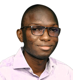
Patrick Ouedraogo
IT SpecialistGeographical Institute of Burkina
Burkina Faso
Patrick is an accomplished IT specialist in the country's national mapping agency, Institut Géographique du Burkina (IGB), which has led the work and holds the relationship for the SDG Data Alliance.
Patrick leads the technical team that is implementing the SDG Data Hub, a cloud based solution that enables Burkina Faso's policy makers to understand performance against Sustainable Development Goal (SDG) indicators and targets geographically within the country, thereby assisting in better decisions amidst significant resource pressures. This will ensure more people benefit from the United Nation Vision 2030 and its SDGs.
Burkina Faso has prepared a Country-level Action Plan to improve its geospatial information management, one of the first countries to do this itself, using the United Nations Integrated Geospatial Information Framework and supported by the SDG Data Alliance.
As the lead country implementing an SDG Data Hub, Patrick contributed his knowledge into developing the solution and the SDG Data Alliance processes to support implementation. He has also collaborated with stakeholders across government to ensure a supported working technical solution.

Pranav Bajaj
Co-FounderMedulance Healthcare
India
At an early age of 26, Pranav decided to start his professional journey in one of the most critical industries in India i.e. Emergency Healthcare. Pranav launched a private ambulance service along with his co-founder and three members from a small-co working space located at Shahpur Jat, New Delhi in 2016. Today, his team is operational in 60 cities with a fleet of 7500 ambulances in India and has a workforce of 400 drivers, paramedics and 60 employees.
To make the sector organized, Pranav adopted a hybrid model of technology & on-ground services. He envisioned a mobile application that can book and track ambulances with skilled front-line staff. An app for ambulance booking had a clear objective to help patients with real-time on-demand GPS enabled ambulances.
Pranav’s vision to build a Healthcare SuperApp for organizations to cater to all the possible emergency requirements at a touch of a button along with access to a bundle of other healthcare services like quality healthcare at home, emergency medicines, tele-consultations will be a reality soon.
Pranav believes in building a skilled workforce. Within the company, he has ensured free access to quality training for all its drivers and paramedics such as First-aid training, courses and certifications, patient handling, use of technology, personal grooming and safety protocols.

Rachel R. Marquez
Principal GIS AnalystCounty of Los Angeles - Internal Services Department
USA
Rachel Rodriguez Marquez manages the County of Los Angeles’ County-wide Address Management System (CAMS) Program. CAMS is the single authoritative source for physical (situs) addresses information aggregated from the 88 incorporated jurisdictions. CAMS, when used in tandem with other essential County data systems, helps support the health, safety, and welfare of those who live and work in the County of Los Angeles.
Rachel participates in the California Geographic Information Association’s Community Council, where she serves as a resource within the State of California to support other counties' development of similar address repositories.
Rachel volunteers with URISA and serves many roles, both within the International URISA Organization and the California Chapter of URISA. She served 2018-2020 Vanguard Cabinet of Young GIS Professionals and Chaired during the 2019 term. She is a member of the URISA Next Generation 9-1-1 Task Force since 2018. Rachel transformed the separate California Chapters into a unified California Chapter of URISA and has served on the board since 2020. Rachel is President-elect in 2023 and transition to leading the chapter in 2024.
Rachel mentors several young professionals and is dedicated to expanding the leadership role of young professionals and women in the geospatial profession.

Shaily Gandhi
Deputy Head, Center for Applied GeomaticsCEPT Research and Development Foundation
India
Shaily is a GIS expert with 10 years of experience. She has completed her Ph.D. from CEPT University in 2018 in Geospatial Technology, and expertise in bridging the gap between GIS & governance. She has got her Master’s degree in Geoinformatics from Symbiosis, Pune in 2012.
Recently, she was appointed as the Program Chair for the M.Tech program in Geomatics (MGeo), at the Faculty of Technology. She brings a wonderful blend between academics and practice.
Shaily is an executive committee member for the Committee on Data of the International Science Council (ISC) and Joint Secretary of ISRS, Ahmedabad Chapter. She is an active member of IEEE, ISG, and ISRS societies. She has contributes important research projects as Data scientist and GIS expert with different centers at CRDF. She works closely on projects with GIDB, ISRO, GIZ, CODATA, DST, Gati Shakti and Nagoya. She has curated 3 podcast series on applications of Spatial Data.
Shaily is keen on exploring the implementation of GIS and data science in the domain of Urban Analytics. Her core interest lies in exploring spatial technology for better decision making along with defining spatial data standards for data interoperability for building future cities. As Deputy Center Head, CAG, CRDF, Shaily brings extensive experience to bear on GIS and data science.

Sri Krishna Hari
Head of GISBeans.ai
USA
Krishna is the Head of GIS at Beans.ai, a geospatial location intelligence company based out of California. He leads the GIS divisions in creating 3D sub address level digital twins with indoor routing networks for Apartments, MDUs and complex addresses across the US.
His work allows geocoding services to locate sub-addresses like apartments to be identified in 3D space precisely and routing services to provide detailed turn by turn directions indoors in 3D leading up to the units. Many applications have emerged nationwide based on this data that has never existed before. Search time trying to identify the correct building an apartment belongs to, the building’s entrance, elevator, staircase, etc. have been effectively eliminated. Public safety, food and grocery delivery companies save valuable time every single visit. Cutting edge applications in telecom, real estate, logistics sectors are being developed based on this data.
For his work in creating this large scale 3D multi modal indoor routing networks Krishna and his team have received the ESRI’s top creative content award and the map gallery people’s choice award. Krishna was also recognized by xyHt magazine’s list of 23 young professionals to watch in 2023.

Stella Chelangat Mutai
Geospatial ConsultantUN World Food Programme
Italy
Stella was selected as recipient of the GEO individual excellence award for 2021 for her exemplary work in promoting the use of Earth Observation (EO) data and tools to deliver meaningful impact across Africa.
Stella is one of the Top 15 Women Leading the Machine Learning for Earth Observation Community (ML4EO) (2020–2021). She was recognized because of her efforts in use of machine learning and earth observation for enhancing capacity in food security in attaining sustainable development goals.
She is also Farming by Satellite Winner of Special Africa Prize—“Digital Earth Africa and Earth Observation in Monitoring Coffee Farming in Kenya” (2020). Stella foreshowed innovation, capacity and great desire to see the field of earth observation harness improvement of farmers assess planting/harvesting seasons and crop health/growth; aimed at increasing their yield.
Stella currently works for United Nations at World Food Programme as a Geospatial Consultant under the Emergency, Monitoring and Evaluation department covering regional bureau of Southern and Eastern Africa. Her main role is in supporting the use of Earth observation and geospatial technology in humanitarian aid response and provide support with spatial analysis on natural hazards, environmental degradation and other datasets through the development and implementation of Earth Observation (EO) based solutions.

Stephen Lepone
DirectorInfrastructure Ontario
Canada
Stephen has played a central role in a $4 billion broadband initiative for the Province of Ontario that brings high-speed internet to underserved communities, the Accelerated High-Speed Internet Program (AHSIP). The program was designed with innovations that were only possible through dedicated and creative leadership by Stephen.
Specifically, Stephen led the development of the Broadband One Window, a first-of-its-kind, online geospatial collaboration platform, bringing together 60 utilities, 444 municipalities, natural gas distributors and internet service providers. A series of milestones had to be met, including standing up the platform, making sense of available geospatial data and designing a series of project service areas in the platform to hold a reverse auction procurement. The reverse auction is estimated to have saved more than $1 billion so far. Next, Stephen led the team that launched the platform for partner organizations to share data, monitor progress and risks, develop deployment plans and request permit approvals in time for the program launch.
Thanks to these successes, the platform is the first geospatial tool to be compelled via legislation for ISPs, municipalities and utilities to expedite broadband deployment and the program is on track to meet its 2025 timeline.

Tatiana Pará M. de Freitas
Professor and ResearcherFederal Institute of Education, Science and Technology of Pará (IFPA)
Brazil
Founder of the MENINAS DA GEO project, Tatiana trained around 800 women from rural and traditional communities the use of Geotechnologies in forest management in the state of Pará in the Amazon in the year 2021 and 2022. Her research work focuses on burning and deforestation in the Amazon, apart from teaching young people about sustainability issues.
Tatiana is an open-source software enthusiast, conducting free QGIS training for over 10 years. She is the founding member of The Open Source Geospatial Foundation - OSGEO. Tatiana also coordinates a chapter of YouthMappres - Girls da Geo, the first in the Brazilian Amazon, which has around 15 young people mapping OpenStreetMap monthly.
In the area of sustainability, Tatiana mentors an ENACTUS team at IFPA CASTANHAL. She’s currently studying for a PhD in Geodetic Sciences at UFPR in the Cartography and GIS research line.
A mother of two children, Tatiana fights, daily, to remain in the professional and technological space in the face of the imposed difficulties.

Vilimone Koiroko Raqona
Senior Geospatial OfficerMinistry of Lands and Mineral Resources
Fiji
Vilimone worked with the Ministry of Health and Medical services in Fiji during the COVID-19 response in Fiji from 2020 to 2021 in the Planning and Information pillar of the Incident Management team (IMT).
He played a very important role during the COVID-19 response in Fiji contributing to information provided to our heads of government for decision making. He looked after the team whose responsibility was the mapping of positive COVID-19 cases, demarcating the borders of lockdown areas from set up to closure for cordoning off and food ration purposes; areas of interest where majority of cases would be localized including work areas and communities; and vaccination coverage areas to determine areas that required more attention because of poor coverage.
Vilimone aspires to help raise the standard of GIS in Fiji and to notify government the power of GIS so that it can be utilized more effectively and efficiently in government agencies.

Wayne Hudson
Geospatial Imagery LecturerRoyal School of Military Survey, Royal Engineers, British Army
United Kingdom
Wayne has been a Geographic Technician in the British Army Royal Engineers for 20+ years and is an impactful geospatial leader in UK Defence. Through a varied and successful career, including tours to Iraq (2004), Kosovo (2005) and Afghanistan (2011), Hudson has provided mapping support to deployed battalions in Iraq & Afghanistan, to the Home Office and to Police in Northern Ireland, acted as a Brigade Geospatial Consultant and as an instructor at the Royal School of Military Survey (RSMS).
In 2019 Wayne was supported by the Army to complete an MSc in Applied GIS and Remote Sensing at the University of Southampton. Promoted to Staff Seargent, Wayne is now leading the Geospatial Imagery Department at RSMS. His impact is tangible throughout the Defence Geospatial community as 250+ soldier trainees have benefited directly from his enthusiasm and expertise.
Significantly, Wayne champions excellence in teaching scientific literary to non-specialists on the internationally recognised officers' MSc in Geospatial Intelligence at RSMS and taught and supervised 60+ MSc students. In 2021 his team were runner-up for the UK cross-Government award for Operational Delivery in Geography.

Wei Luo
Assistant Professor, Geography DepartmentNational University of Singapore
Singapore
Wei leads the GeoSpatialX research lab at National University of Singapore. He used to be a research fellow at Harvard Medical School. He develops novel human assisted GeoAI tools to address the most critical challenges facing the world including epidemiology, supply chain, energy crisis, food security, and climate change. He has developed a series of big data analytical models and geovisual analytics tools to support near real-time prediction and decision making for crisis management (i.e., disease prediction and control, water security, supply chain prediction and disruption) for public policy-making, government, and environment-related industry consulting.
His contributions in geovisual analytics help him win 2019 Waldo-Tobler Young Researcher Award from Austrian Academy of Sciences’ Commission of GIScience. His research has been covered by top media outlets such as: CCTV. He co-founded GeoHealth Hub to bring top health scientists and enterprisers around the world for interdisciplinary collaboration and innovation. His research team will continue to engage with communities, stakeholders, and industrial partners to make the real-world impact research and commercial products.

Yasmeen Al Hashmi
Director, Spatial Data DivisionAbu Dhabi Department of Municipalities and Transport (DMT)
UAE
Yasmeen leads a team of specialists in spatial information at DMT, managing the organization’s and its affiliates’ spatial data. Her leadership and expertise play a critical role in the creation of Abu Dhabi Digital Twin as part of the Smart Makani system and the 3D model of the Abu Dhabi Emirate. She has been awarded several awards for advancing Spatial Information in Abu Dhabi and the United Arab Emirates.

Yongze Song
Associate ProfessorCurtin University
Australia
Yongze leads a Geospatial Analysis and AI team and developed more than 15 new geospatial models and 8 open-source software with over 100,000 downloads globally for understanding geographical and spatial data. The developed new models and software demonstrate both academic and industrial impacts globally.
He is a recipient of more than ten awards at international and national levels, such as the Global Top 10 Young Scientist Award and the Australian National Location Data First Prize. He is a Fellow of the Royal Geographical Society (RGS), UK, and a Committee Member of the International Association for Mathematical Geosciences (IAMG). He is an Editorial Board Member of 7 reputable international peer-reviewed journals, including GIScience & Remote Sensing, iScience (Cell Press), Annals of GIS, Remote Sensing, Geo-spatial Information Science, etc.
He serves as a Chair or Program Committee Member for international conferences held in over 10 countries, including Australia, the United Kingdom, Egypt, Norway, China, France, the United States, Canada, Iran, Vanuatu, and Greece. He was invited to present more than 40 research seminars at universities (e.g., Harvard University, Australian National University, National University of Singapore, Peking University, etc.) and industries globally.