Freelance Writer
Maxar Technologies is all set to unlock a new dimension of information about the planet with the addition of Vricon’s unique 3D capabilities to its portfolio. Now, with all of Maxar’s 110-petabyte imagery archive powering Vricon, there is expected to be faster, scalable production of 3D models with global availability.
On July 1, the Space infrastructure and Earth Observation major completed the acquisition of Vricon, previously a 50-50 joint venture with Saab, for approximately $115 million net of cash.
“Maxar has long been a leading provider of information about the changing planet, but that information has been limited to x and y-axis mostly. Now, having Vricon fully part of Maxar adds the third dimension, a very critical part of our vision of creating a global, living, breathing reference of the changing planet,” says Jeff Culwell, Senior Vice President and Chief Product Officer, Maxar.
“The two companies largely serve similar customers and therefore, there is a great opportunity to fully deploy the Vricon products across the entire Maxar go-to-market team, carry those products further into markets that we are already in and expand into newer markets,” he adds.
For a long time now, Maxar has had this vision of creating “The Digital Globe”.
“Of course, one of our predecessor companies was called DigitalGlobe, but this is really about creating a highly accurate global representation of the Earth. The planet is three dimensional, so with this acquisition we are moving forward in our vision of representing all three dimensions,” Culwell explains.
Having Vricon fully part of Maxar adds the third dimension, a very critical part of our vision of creating a global, living, breathing reference of the changing planet

3D maps have become a foundational source of information for a range of visual and analytical applications. Decision-makers in governments as well as a wide variety of industries need precise 3D information to understand where and how to deploy resources. However, traditional sources of 3D information have been ineffective due to their limits in geographic scale, accuracy and currency.
“3D is such a critical component and will only become more important for our ability to describe the Earth and its features, the people on this planet and their behaviors, and derive understanding about it. And most of it really comes down to accuracy,” says Isaac Zaworski, Senior Director, 3D Products, Maxar.
Further, an accurate global representation of the Earth provides the critical reference foundation for integrating any other data source. For instance, one can take sensor data off of a drone — which often have low geo-location accuracy — and register that precisely to a particular 3D reference on Earth. A common reference foundation makes integration of other datasets easier, therefore making Machine Learning tools compute faster and create more accurate outputs, delivering the real-world solution customers need.
“A lot of our use cases require a much greater level of absolute positional accuracy. We needed that accuracy in three dimensions to more fully serve those customer missions,” Zaworski adds.
Vricon was formed in 2015 with 50-50 investment from Maxar (then DigitalGlobe) and Saab, foreseeing that 3D was a critical component for geospatial technology moving forward. Back then, it was an opportunity to bring together the massive Earth Observation dataset of DigitalGlobe and Saab’s 3D image processing technology.
“In the past five years we focused in a very narrow way, very much like a startup, on the really hard problems — how do you bring together this technology and this massive quantity of data and also take that capability to a global scale,” says Zaworski, who was the first U.S. member of the Vricon team, having joined before the joint venture was officially formed. “Over the years, we got to this point where just being a consumer of Maxar’s data wasn’t enough for Vricon. This acquisition allows us to bring the Vricon technology stack that we have been nurturing and maturing for the last five years and productize it to a point where it really does scale by using all of Maxar’s imagery library.”
“There is increasing application of 3D data across industries and we have seen some of the incredible potential that comes from it. Therefore, wanting to continue our position as a leader in commercial Earth Intelligence, we felt complete acquisition of Vricon was a great opportunity to continue shaping the industry and accelerate things we have been working on,” Culwell adds.
Maxar is also upbeat about its new WorldView Legion satellites fueling the capabilities to create updated 3D models of the entire Earth at an unprecedented speed. The WorldView Legion satellites, initially six in number, will be launched in 2021 in batches of two and four. The new satellites have the ability to capture 5 million sq km of imagery a day, at 29 cm resolution and better than 5-meter accuracy. With WorldView Legion joining the rest of the Maxar constellation, the company will have the opportunity to collect imagery of some regions on Earth up to 15 times a day.
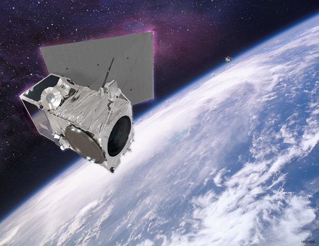
“Once our WorldView Legion satellites are in orbit, not only will they have multiple intraday revisit opportunities, but also the agility in the overall coverage such that within hours we can collect sufficient meaningful amounts of data at different angles. This will enable us to provide an updated 3D model of a given area on an operational timeline,” Culwell explains. The enhanced ability to get access to these 3D models on demand helps decision-makers gain insights into the ground-level situation after an event has occurred, and then use that information for planning.
That the WorldView Legion satellites will provide a higher quantity of imagery at 29 cm resolution brings the value of the global reference foundation closer to the customer needs in many cases.
Further, the massive increase in the volume of high-resolution data being collected will also add to Maxar’s existing imagery dataset. “We can then strategically start thinking about how to process that content in ways that are optimized to find answers to very precise problems where accuracy and the third dimension are critical,” adds Zaworski.
Vricon’s core business has been heavily focused on defense and intelligence, which relate to Earth Observation, terrain mobility analysis, and synthetic environments, although in the past couple of years, it has seen a significant growth and emergence of some enterprise-level commercial markets such as the telecommunications industry, for instance, for 5G infrastructure planning and management. The company has experienced an increasing appetite from some customers for more intelligence coming out of the data via advanced Machine Learning and Deep Learning toolsets, and workflows built on top of that content, which can enable their in-house analysts to come up with timely and accurate answers to big problems.
“One of the most exciting places where we see traction in the defense side of the world is a push toward authoritative synthetic environments,” says Zaworski, who was earlier heading the business unit at Vricon that specifically served U.S. government customers.
Traditional training programs included large and expensive live training scenarios and virtual simulations for soldiers. The environment created was similar to what soldiers would operate in, but it was too cost prohibitive to make that data actually representative of the real world. “Now with the emergence of commercial virtual reality and augmented reality technologies and advances in rendering, we are getting to a point where, from a training standpoint, there is a recognized need to be able to combine true virtual training scenarios that are representative of the real world that soldiers would be operating in and Vricon’s 3D capabilities can provide that,” he elaborates.
The company feels once there is a huge market for synthetic environments coming out of the training world — where the geo-typical fake data of yesteryears is transitioning into real, geo-specific, authoritative data — it would then dovetail into a whole new set of requirements coming out of the autonomy domain.
That is one of the market spaces where Vricon won a prime contract with the U.S. Army last year. The program, called One World Terrain, was the first big bet on creating a true geo-specific authoritative virtual world. Vricon has been working on the project for a year now and has helped that functionality grow beyond the immediate focus of initial synthetic training environment, wherein it is looking outwards towards a huge portfolio of command and control and autonomy use cases.
According to Zaworski, from here, one can draw parallels with the commercial market where the same kind of autonomy problems are becoming acute by the day. For instance, with every partially autonomous vehicle that ends up on the streets, the need for very accurate priori data to power everything — from cars to drones to all other different sensor systems that are going to power those – grows.
“I think the autonomy application is the super exciting one and it had been one that Maxar had been getting in to,” Culwell adds.
This acquisition allows us to bring the Vricon technology stack that we have been nurturing and maturing for the last five years and productize it to a point where it really does scale by using all of Maxar’s imagery library

Interestingly, the core technology developed by Saab which Vricon is using was originally based on airborne imagery. The One World Terrain contract with the U.S. Army is now allowing Vricon to dig into the issue of incorporating drone and aerial data into global, satellite derived 3D models. “Under that project, we can take imagery from low-altitude, commercial off-the-shelf drones as well as airborne collections, LiDAR and other sources, to create workflows that automatically register that content into the consistent satellite imagery foundation,” explains Zaworski.
The level of 3D resolution that Vricon is able to achieve from satellite data gives it sufficient detail to do an accurate registration of ultra-high-resolution data coming from drones or airborne sources. The focus is on building a completely automated workflow that doesn’t require human intervention for integrating different kinds of data from a variety of sources. In the case of the U.S. Army, data is pulled from about half a dozen programs that have different drones collecting data in different ways. A single workflow takes all of that content, normalizes and fuses it together with the 3D foundation from the satellites, achieving consistent accuracy, fidelity and timeliness throughout the product.
“There are more companies in the market building drones or collecting data with drones than we could ever hope to count. And it will only be getting bigger. So, the value proposition that we are looking at is defining how you bring all those datasets together into a single reference frame and provide the context,” says Zaworski.
COVID-19 has accelerated the demand for more precise 3D modeling of the Earth and infrastructure to answer queries such as where exactly are the health facilities, where are the outbreak clusters, where is a market, which route is open, where are our supply chains located, etc.
Zaworski agrees that when it comes to the third dimension, the industry as a whole has been found lacking in incorporating data to that level of fidelity, but not for want of trying or for the lack of requirements. “A lot of perspective that is coming out of the COVID-19 crisis is that our understanding of the world that we live in, and inherently interact with, can be fragmented and limiting in a lot of ways,” he elaborates.
For instance, there have been tremendous advancements in terrestrial LiDAR driven by the autonomous vehicle market over the last 10 years. While the sensor technology advanced our ability to collect precise information of the world around us at scale and at relatively affordable cost, we are still lacking in the ability to connect those datasets together into a holistic view. And it is even more true when one looks at indoor and subterranean data — there is a whole world underneath us that is even harder to map.
“We need to understand that the planet is living and changing. What is exciting about a concept like ‘The Digital Globe’ is that it addresses the challenge of not only collecting the data, but also the ability to organize it into a coherent view of our planet at human scale,” wraps up Zaworski.
© Geospatial Media and Communications. All Rights Reserved.