In geospatial technologies, remote sensing is used to collect information of Earth’s surface by assessing the reflected and radiated energy from a distance. The technology has transformed the way scientists study the planet.
Remote sensing is widely used in various fields including agriculture, land use mapping and monitoring, disaster management, climate monitoring, urban planning, weather forecasting, forest mapping, water management, mining, and so on.
Some of these applications include:
Land Use Mapping and Monitoring
Land use data represents how the landscape is being used for conservation, development, and agriculture. Remote sensing is used to map the land use pattern of large areas and monitor changes that occur over a particular period of time.

The satellite images provide a clear view of the land and help to determine the area which can be used for what purposes. This information is then used by regional planners and administrators to make policies for regional development.
Agriculture
One of the prime applications of remote sensing can be seen in agriculture. It is used in crop identification, production forecasting, damage and progress assessment, soil mapping and moisture estimation, and agriculture water resource mapping. With satellite images, researchers can identify which area is damaged or where actions need to be taken.

Weather Forecasting
Remote sensing is extensively used to study weather patterns, precipitation, and changes in temperature. It helps to determine the draught and rain patterns in a particular area.

The extensive amount of data collected through remote sensing allows experts to calculate and estimate future weather patterns. With this information, policymakers can make policies to mitigate the impact of climate change and ensure the sustainability of natural resources.
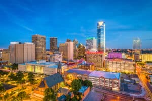
Urban Planning
Urban planning involves both the development of lands and innovations happening on a site. In urban planning, remote sensing is crucially important for the collection and analysis of data. It is used in exploring regional planning, policies, and strategies.

Experts use remote sensing data to identify urban population growth patterns, analyze overcrowded areas, and make plans for infrastructure development such as public facilities, buildings, and roads.
Forest Mapping
Remote sensing is widely used in supporting forestry management and conservation. With remote sensing technology, the forest area could be easily identified and mapped. It helps to present a clear view of most minute areas where the sun cannot reach, and provide detailed spectral mapping. It is also used to map large forest areas where environmental issues are more severe, such as wildfires.

ALSO READ: Remote Sensing and Its Evolution