Transforming Healthcare with Geospatial and AI

Machine Learning and data mining aided by high powered computing form the foundation of GeoAI, with geospatial science also offering the tools and technologies that help experts to visualize, understand and develop predictive models for real-world phenomena according to specific locations. Authorities and health experts are increasingly relying on GeoAI to tackle the COVID-19 pandemic.

Picture of By Anusuya Datta
By Anusuya Datta

Freelance Writer

On December 30, 2019, BlueDot, a Canada-based Artificial Intelligence startup, sent out an alert to its clients about a cluster of “unusual pneumonia” cases being reported around a wet market in Wuhan, China.

BlueDot was reporting on what would come to be known as the COVID-19 pandemic in due course. It would be a good ten days before the World Health Organization finally made a formal announcement on January 9, 2020 about the emergence of a Novel Coronavirus in China. Since then, the virus has affected 216 countries around the world, infecting millions of people.

BlueDot, which claims to protect people around the world from infectious diseases with human and Artificial Intelligence, uses a what is known as GeoAI in technical parlance.

What is GeoAI?

Artificial Intelligence is a broad term that describes the ability of a machine to learn a task or workflow. So, Geospatial AI, or GeoAI, simply refines the scope of that learning to spatially oriented tasks, explains Dr Este Geraghty, Chief Medical Officer, Esri.

Machine Learning and data mining, aided by high powered computing, form the foundation of GeoAI, with geospatial science also offering the tools and technologies (right from sensors capturing location data to GIS or Location Intelligence systems) that help experts to visualize, understand and analyze real-world phenomena according to particular locations.

Info.gif

GeoAI is increasingly being used to model and capture the environment around us, linking locations in which we live and work, or people/elements we interact with, to explore their potential role in influencing health outcomes. There is also extensive research into GeoAI being used for hypothesis generation, conducting new data linkages and predicting disease occurrence. Evaluation of hypotheticals helps people answer questions like “what if” — What if there were no stay at home orders? What if we open restaurants? What if we open public transport? This facilitates the evaluation of potential policy decisions.

For instance, if one could take patterns such as the direction of COVID-19 outbreak in an area, and then correlate that with other datasets such as air travel, public transportation or cities with high population density, and put it all on a predictive model along with local environment such as humidity or temperature, there could be some models that could come out of it, which could help local authorities to tackle the problem more specifically.

According to Luis Sanz, CEO, CARTO, innovative statistical methods and computational tools can be used for public health surveillance including spatio-temporal models for disease risk prediction, cluster detection, and travel-related spread of disease. This work can inform strategic policy in reducing the burden of diseases.

Location analytics provide useful tools to model behaviors and inform actions. “From maps that analyze the genetic profile of the virus as it spreads from place to place, to AI techniques that make sense of human movement data, we can enhance our understanding of viral transmission, determine if public health recommendations are being followed and predict whether travel bans and other measures will quell the spread of disease,” adds Dr Geraghty.

“Increasingly geospatial data is being included in more complex models used to inform early warning systems, model disease transmission and evaluate impacts of public health interventions,” points out Dr Kristine Belesova, Deputy Director, Centre on Climate Change and Planetary Health, London School of Hygiene and Tropical Medicine

For instance, the Centre uses advanced modeling techniques to link data on infectious diseases with climate and other environmental changes and develop early warning systems driven by Earth Observation data. Other examples include identifying spatial and environmental risk factors for infectious diseases by applying geo-statistical and Machine Learning approaches, using aerial (drone) and satellite-based Remote Sensing data to assess how ecological and environmental changes impact infectious disease transmission. 

“We are in uncharted territory as a microscopic virus is now disrupting our entire planet. The COVID-19 pandemic has revealed the need to implement systems that proactively manage infectious disease risks which, in our rapidly changing world, are increasing in frequency, scale and impact,” says Dr Kamran Khan, Founder & CEO, BlueDot, and an infectious disease specialist.

GeoAI to tackle COVID-19

We all know contract tracing has emerged as one of the primary methods in COVID-19 response. What many don’t know is what all can be done with the data collected. Tracking mobile phone of users allows health authorities to collect all personal data including location. Thus, the authorities can quickly find suspected patients and close contacts through data retrospective analysis, and quarantine and cut off the source of infection in time, explains Zhang Yaqing, Technical Director, Platform Center, SuperMap, which was involved in the COVID-19 response operations in China.

Health professionals already deal with an overwhelming amount of data, especially in case of a widespread epidemic. This includes medical history and laboratory test results for each patient. Adding the spatial component on top of these enables experts to analyze and predict who are the people that should be tested or quarantined, or the pattern of the disease in a particular area, or where the next wave will come. Authorities across the world are using GeoAI applications to identify hotspots, prevent the disease from spreading and flatten the curve, which is paramount to preventing healthcare infrastructure from collapsing. It is also being used to plan for and provide medical expertise and supplies at hotspots. In many countries, analysis of such data is being made publicly available so that citizens can avoid areas with high infection rates.

Geo AI for classification, clustering and prediction

There are broadly three key areas of focus for geospatial AI which surround the concepts of classification, clustering and prediction. Classification is about detecting objects or changes in an environment. “For COVID-19 we have a good example with the social distancing information that is being obtained from cellphone data (aggregated and anonymized) and shows a change in human mobility patterns compared to pre-COVID-19 time periods,” points out Dr Geraghty.

1.png
2.png
3.png

Clustering is about analytical models that find statistical patterns in data, such as hotspots of COVID-19 cases. Prediction allows analysts to build forecast scenarios on what may happen next. A great example of AI for prediction is the various hospital surge models being used to anticipate where and when hospitals may be overwhelmed by COVID-19 cases. Those models can be run using different assumptions about the level of social distancing being practiced within a locality.

In China, in the initial days when the virus was spreading, tech major Baidu leveraged AI-powered mapping systems to identify the flow of travel across high-risk areas using Baidu Maps Migration Big Data Platform to provide epidemiologists real-time insights into the virus spread to speed up local preparedness and response efforts.

In Taiwan, the government collected mobile data to identify cruise ship passengers who were potentially infected. The geospatial data layer obtained from telecommunications companies were then added to identify and make public potential high-risk areas.

“A lot of research institutes or even companies have been using data modeling to get insights into how the disease is spreading and in case of companies how it affects their businesses,” says Gladys Kong, CEO, UberMedia, a Location Intelligence player with an innovative mobile DSP featuring Machine Learning powered optimization.

One of UberMedia’s partners in the COVID-19 response work — a research institute — looked at people’s movement and the distance traveled from home. As more and more cities begin to reopen, this can track how the numbers are changing and help prepare for a second wave. Further, based on predictive modeling, retailers and restaurants can figure out how to forecast their sales, how much staff they need and also some inventory, explains Kong.

However, many such models currently in use do not generalize well across large geographic areas, since they depend on uniformity — on the assumption of variables such as health factors, population density and mobility.

GeoDS Lab at University of Wisconsin, Madison used Country-to-US Counties flow data from March 2019 to show thousands of trips generated in the US. The team modeled this data back in March 2020 to predict a rapid growth of infection cases across the US

Spring travels from China and Japan in March 2019

Spring travels from China and Japan in March 2019 zoomed in

Role of social media in GeoAI

Advancements in AI have also seen a growing interest in real-time syndromic surveillance based on social media data. In fact, a common theme across GeoAI applications is the use of novel sources of spatial Big Data, such as social media, electronic health records, satellite Remote Sensing and personal sensors (like Fitbits) to advance the science of public health (especially in the context of ‘smart healthy cities’) and potentially precision medicine, creating opportunities to comprehensively answer questions tackled in these fields as well as opportunities to answer new, emerging questions, explains International Journal of Health Geographics.

Deep Learning algorithms can be applied to Twitter data to detect disease outbreaks and then to build up and display information, including relevant news articles, to provide situational awareness. In the US, this has demonstrated an ability to detect symptoms for influenza-like illness, which were then confirmed from the CDC Morbidity and Mortality Weekly Reports (MMWR). There is further research onto improve on this surveillance system to incorporate disease-specific information (e.g., mode of transmission) to enhance disease forecasting accuracy.

For COVID-19 response too, AI-powered data analytics can be used to pull insights from online behavior such as Internet search queries and social media conversations to identify signals from a specific population in a particular location. An interesting example of this is how Boston Children’s Hospital used an automated HealthMap system that scans online news and social media reports for early warning signs of outbreaks. This initial alert spurred more detailed reports from other agencies, including a warning from the Program for Monitoring Emerging Diseases (ProMed), a well-known volunteer-led organization, just half an hour after the first warning.  HealthMap brings together disparate data sources, including online news aggregators, eyewitness reports, etc., which keeps on updating 24/7, with an automated process, monitoring, organizing, integrating and visualizing online information about emerging diseases, facilitating early detection of global public health threats.

In Canada, the Public Health Agency of Canada (PHAC) as well as the Department of National Defence is using BlueDot’s Insights software to track and assess risk from global and domestic infectious disease outbreaks, including COVID-19. BlueDot’s Insights tool uses AI to scan over 100,000 articles per day in 65 languages, searching for official and unofficial news of infectious disease outbreaks. The platform performs these Big Data analytics every 15 minutes around the clock. A team of subject matter experts then reviews the outputs before publishing on the Insights dashboard. The Insights platform then assesses the risk of spread to locations of interest around the world using data on local and global air travel patterns that draw from over 4 billion flight itineraries per year.

HealthMap brings together disparate data sources, including online news aggregators, eyewitness reports, expert-curated discussions and validated official reports, to achieve a comprehensive view of the current global state of infectious diseases

GeoAI to map psychological connect to health

There is a psychological connect to health and social media data analysis too. Li Yunxia, Account Director, Platform Center, SuperMap, explains when a major epidemic comes, the impact of panic on the society may exceed the disease itself. “To this end, it is necessary to track and evaluate the spatial spread of social emotions by analyzing massive social media data. For instance, when facing an epidemic, public behavior might be irrational, highly infectious, and conformable. It is required to build a knowledge base of epidemic-related emotions and to dig out the dynamic evolution of public opinion in time, space and semantics aspects from social media.”

By using Internet search or social media data as a source, public topic categories related to the epidemic can be obtained by topic models and Machine Learning methods, which helps us to characterize the changes in public sentiments. These outcomes then contribute to the reveal of the temporal, spatial and semantic distribution characteristics and evolution patterns of public topic views under the COVID-19, he adds.

So far, the digital footprints on Internet web searches and social media remain largely inaccessible to researchers and governments. If opened, this data could support not only in monitoring, surveillance and contact tracing, but also in running AI-based Big Data analytics for prediction and prevention. For COVID-19 response, Facebook has started providing mobility datasets of its users directly to researchers upon request to help analysis of population movement and patterns. Google also opened some of its search queries such as mobility reports, even as its Search and Maps divisions continue to release new data and tools to help small businesses pivot their operations during the pandemic.

The smart way forward

As cities become more connected and smarter, they are gathering, generating and consuming huge data, a major amount of which could be related to health and environment. GeoAI can play a key role in making sense of this data through intelligent, location-based Big Data analytics. IoT sensors and devices deployed in modern cities represent novel and alternative sources of generating geo-tagged Big Data.

Nikhil Kumar, Country Head – India, HERE Technologies, points to the emergence of wearables and connected devices in the past few years that are capable of collecting individual health information such as heart rate or sleeping patterns, etc. “Integrating this data into GIS could help healthcare workers uncover long-term geographic trends in health of certain demographics, thus opening new realms of healthcare research and insights not previously attainable.”

Spatial energetics is an emerging field that focuses on mining dynamic, high-resolution measures of temporally matched location and behavior data through GPS, accelerometry, and GIS. However, there remains significant conceptual, technical, analytical, and ethical challenges stemming from the complex data streams that spatial energetics research generates, notes the US National Center for Biotechnology Information.

Further, information from ride sharing services such as Uber and Lyft etc can also be a novel source of data to add to this Big Data pool. As to how big this data is could be gauged from the fact that as of 2019, there were roughly 75 million active Uber riders across the world. Location is a key aspect of ride sharing as it relates to pick-ups and drops — giving insights into mobility data. Such information can be used to address queries related to spread of the virus in case of a pandemic. In normal situations, mobility data can also give insights into accident rate or injuries. Further, food delivery services, e.g. UberEats, Zomato etc., may also provide interesting insights into its potential role in promoting sedentary behaviors and childhood obesity.

COVID-19 has very firmly established the need for geospatial and location information and technologies in health sector. However, there is more that could be done with the use of GeoAI. But this can be only possible with collaborations, since it is difficult for governments, policy-makers and other leaders to sort through all of the new companies, initiative and solutions available out there. There is also a greater need to modernize and standardize our data systems in a way that allows for data sharing when needed, such as local governments and hospitals moving relevant data up the chain to provide a national picture, emphasizes Dr Geraghty. One clear and simple lesson is that public health has long been underfunded. The world needs a modern, well-funded, data-driven public health system to enable faster and optimally effective response.

As Dr Khan of BlueDot says, “It is with enhanced preparedness that we can get ahead of these threats to create a healthier, safer and more prosperous world.” 

The downstream effect would also protect economies.

AI in EHR

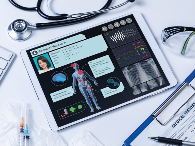
Optimization of EHR, or Electronic Health Record, is crucial at a time where health systems are under immense pressure. US based Epic, an EHR software company, was one of the first ones to make updates to its system and come up with a plan for how it can help its customers. To let providers at different organizations know about potential exposure risks, community members were encouraged to share travel screening documentation and infection status information with both Epic and non-Epic organizations through the Care Everywhere platform, Epic’s interoperability network. It also updated its travel screening criteria as far back as January. It also tracked patients who weren’t been screened for travel to regions where COVID-19 was spreading quickly. Organizations could also use reports to monitor the isolation status of confirmed or suspected cases, review and identify infection trends over time, and follow-up with discharged patients. A number of hospitals in the US are using Epic’s AI based system to predict which patient will become critically ill, or if a ventilator would be next available. Though under normal circumstances, hospitals would take time to test the tool on hundreds of patients before implementing but COVID-19 is not giving them that luxury.

When Big G failed

Way back in 2008, Google had tried its hand at Flu Trends by aggregating Google Search queries with the help of AI, before quietly burying it in 2015. The idea behind Google Flu Trends was that by monitoring millions of users’ health tracking behaviors online, the large number of Google search queries gathered can be analyzed to reveal if there is the presence of flu-like illness in a population. Google Flu Trends compared these findings to a historic baseline level of influenza activity for its corresponding region and then reports the activity level as either minimal, low, moderate, high, or intense. The initial reports stated that the predictions were 97% accurate when compared with CDC data. However, then subsequent reports asserted that the predictions were sometimes very inaccurate, especially around 2011-2013, when it consistently overestimated flu prevalence. For one interval in the 2012-2013 flu season, it predicted twice as many doctors’ visits as the CDC recorded.