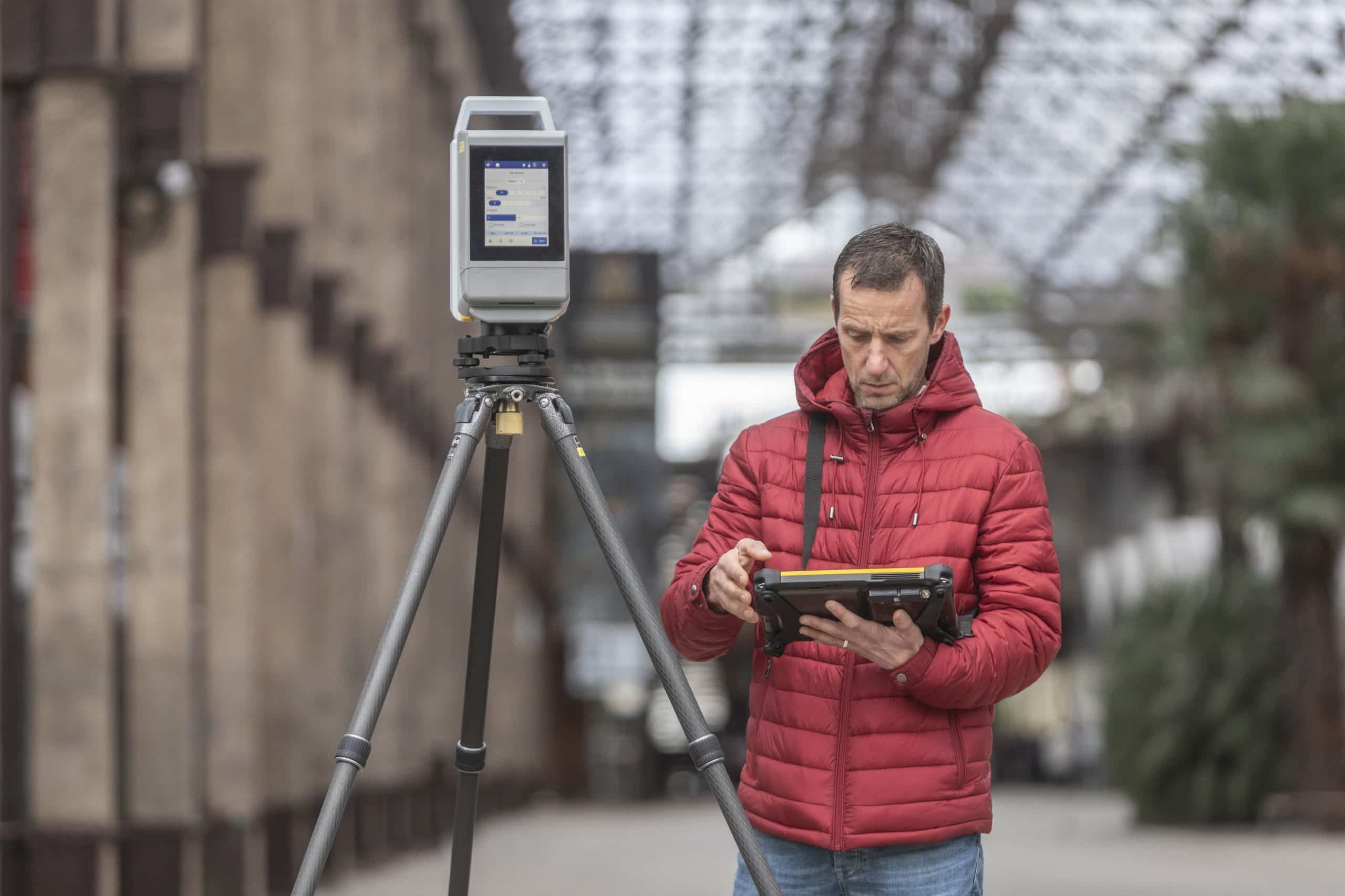
Surveying involves on-point details of scanning and developing complex yet high quality images with ease but the task is not easy to perform, which is why Trimble has introduced Trimble X12 3D laser scanning system. The Trimble X12 is a high-end 3D laser scanner with superior speed, accuracy, and range and image quality for demanding scanning projects.
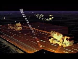
It scans complex industrial facilities for modeling and revamping designs as well as takes high resolution area scans for more detail on points of interest and capture inaccessible areas even from a safe distance.
The Trimble X12 system enables accessible high-end 3D laser scanning with superior speed, accuracy, range and incredible image clarity for all scanning applications. It scans up to 2.2 million ultra-accurate points per second and view the results enhanced with astonishingly vivid panoramic images. Experience pure ease and total confidence in the field with Trimble perspective’s seamless workflows and automatic in-field registration. With the Trimble X12 and Trimble Perspective field software, you get a dependable instrument and comprehensive workflows to validate scan projects in the field.
“The Trimble X12 puts the most advanced 3D scan and image capture within reach for a variety of skill levels,” said Jacek Pietruczanis, business area director for Scanning and Mobile Mapping, Trimble Geospatial. “The system enables advanced scanning professionals to improve their productivity with top-of-the-line performance and efficiency gains, while those new to scanning can easily unlock this advanced capability with the touch of a button.”

Features
It provides high-resolution, accurate point cloud data. It scans up to 2.18 million points per second with a range of 365 meters. Its range noise is of 0.2 mm and density of 0.6 mm at 10 meters.
It delivers sharp, clean image acquisition. It lets the user experience colorization of point cloud data with parallax free images. Its smart light, LED spotlights of 700 lumen improve image acquisition in poor light conditions and even in completely dark environments.
It has quick, flexible point cloud capture. It serves full dome scans as fast as 23 seconds, complemented with the ability to quickly and efficiently scan areas of interest at high quality settings with a minimum scan range of 0.3 meters, allowing the user to capture more detail in tight spaces.
ALSO READ: Trimble DA2 and R Series GNSS Systems to the Rescue of Water Utility Project in Tamil Nadu
It has automatic in-field registration, refinement, reports and exports with Trimble Perspective on the T10x tablet. It has comprehensive and user friendly OnBoard interface.
Operation
The scanner can be operated remotely with a controller running the Trimble Perspective field software or with its on-board user interface.
Trimble recommends operating the scanner with the Perspective software for a more intuitive user experience. Automatic in-field registration and better project visibility help ensure the project is complete before leaving the field. The Perspective software also provides data redundancy with automatic transfer of data to the controller and storage on the scanners onboard SSD. If you choose to operate with the Perspective software, connect a controller to the scanner with Wi-Fi or with the provided ethernet cable.
The scanner on-board user interface is available for experienced users that prefer to use the touch screen display to operate the scanner. This workflow requires users to register scans in the office with target based, plane-based, or cloud-to-cloud registration techniques.
Applications
The Trimble X12 quickly captures features for land title surveys, buildings, roads, intersections, site improvements, encroaching elements and complex structures. It can also be used to document and highlight features or items of interest using annotations. It can be used to assign labels to each scan to create logical scan groups and annotations with pictures while scanning the next station.
Historic preservation projects require great detail to inspect or monitor surface deterioration as well as high-resolution imagery for documentation, analysis and restoration. It helps in retaining important details and digitally preserve fragile artifacts for re-creation.
With the Trimble X12, one can create as-built documentation for drawings or models for bridges, tunnels, dams and other civil infrastructure with a range that allows for operation from a safe distance, while the area scan feature provides high-resolution data on areas of interest.
ALSO READ: Moving up a notch on data processing and analysis
Besides, it can also be used in capturing crime scene information in forensics, makes it possible to safely and effectively create as-built models for scan-to-BIM and renovations and provides clarity for adaptive reuse, building extensions and inspection of facades and elevations. It can also be used to scan underground mines and quarries for deformation monitoring and stockpile volume calculations and to create as-built for new construction, renovation, and optimization while surveying shipbuilding.