Indian farmers are greatly dependent on the vagaries of nature. Any calamity adversely affects their finances. With over 58% of the population engaged in agriculture, securing farmers’ income and insuring them against seasonal crop losses is a key priority as well as a social need.
Farmers deal with a great deal of uncertainty at all stages of cultivation. Crop insurance, aided by technology solutions, help them manage weather related risks and forestall heavy losses.
The Beginings
For nearly a century, crop insurance has been discussed in India as an important tool of risk management. By and large, most of these attempts never materialized and the adequate spread of risks could not be secured since the areas covered were too small.
One of the earliest endeavours related to crop insurance in India was led by J S Chakravarthi in erstwhile Mysore State. Between 1912 and 1920, he worked on the rainfall index as a mechanism to compensate for crop losses, publishing technical papers and books on how the index could be used to guarantee payouts to farmers
In Independent India, the Pilot Crop Insurance Scheme (PCIS), initiated in 1979 by Professor V. M. Dandekar, was a systematic attempt to cover a wide range of crops including cereals, millets, oilseeds, cotton, potato, gram and barley. Professor Dandekar is often regarded as the ‘Father of Crop Insurance in India’.
Role Of GIS
The government led NAIS (National Agricultural Insurance Scheme), the flagship insurance scheme, is currently implemented by 25 States and two Union Territories and annually insures close to 25 million farmers cultivating crops on over 35 million hectares. More than 50 different crops are covered under the scheme at present, including almost all the food crops grown in the country Acute geospatial data greatly helps advance this scheme, benefiting vast stakeholders all across.
“Despite the NAIS being in existence for 23 years, less than one-fifth of the farmers in the country are insured, with a few notable exceptions such as Rajasthan, where approximately half of the farmers or holdings are insured, and in states like Andhra Pradesh, Gujarat, Karnataka, Madhya Pradesh, and Orissa, about one-fourth of the farmers are insured under the scheme,” says Vandana Chawla, Deputy Manager at AIC (Agriculture Insurance Company of India).
“Unfortunately, the scheme has not proven to be a significant risk mitigation tool for farmers in many regions, as crop insurance statistics indicate a clear bias towards a few regions and crops,” she adds.
The emergence of GIS has been a boon for achieving desired growth rates, and India has effectively utilized it in various areas for sustainable agricultural development and management. These areas include cropping system analysis, agro-ecological zonation, quantitative assessment of soil carbon dynamics and land productivity, soil erosion inventory, integrated agricultural drought assessment and management, and the Integrated Mission for Sustainable Development (IMSD).
GIS can provide data analytics for crop valuation and soil degradation. This can offer information, education, and awareness programs for farmers and other stakeholders about climate change and its impact on the sector. Land use can be implemented at the grassroots level or by introducing the western model of corporate farming.
Agricultural expertise can be leveraged for proper crop patterns aligned with land use. IT applications can be developed for supply chain management, with the beneficiary being the farmer. Data analytics can be used to align crop valuation with quality parameters, and national and global demand.
This is achieved through Data Collection by first identifying the location map of the region. Then the Land Use information can be obtained from the Nagar Nigam office which is the local governing body responsible for managing the civic services in an area and can provide valuable insights into the types of land use in the study area. Then the exact location coordinates of various features in the study area are obtained using GPS devices such as I Finder or H2O GPS Receiver.
This information can be used to create accurate maps and to identify the location of different features in the study area. Further on, the road network information is identified, which relays the information related to the road network in the study area, including the location, length, width and condition of the roads. A field survey is done, collecting data onsite by visiting the field area. This is enabled by interviewing the farmers, conducting manual surveys and photographing the study area with the help of drones to gather information.
Proper Planning
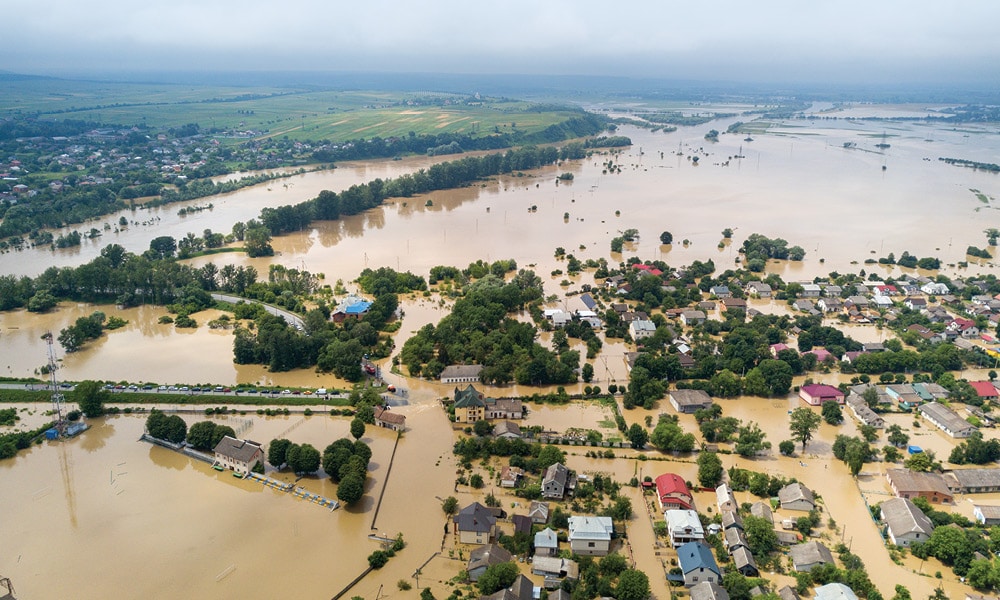
One of the major challenges for farmers is that the cropping pattern needs to be planned in a way that ensures profitability. Water availability of water for irrigation, and soil degradation due to intensive farming practices are growing concerns. Climate change with an increased frequency of extreme weather events such as droughts, and floods is another environmental challenge. Infrastructure is another obstacle, as many farmers lack access to basic amenities such as irrigation, electricity, storage facilities, and raw materials such as seeds.
This impedes the productivity of farmers and makes it difficult for them to store and transport their produce. Improper land use due to the traditional land holding pattern is another predicament because of the huge fragmentation of land, reducing the profitability of farming. Lastly, skill development for the farmers and availability of labor are significant challenges as the robust young population moves away from farming, leaving the ageing workforce in the rural areas.
Geo Fixes
While the problems that plague may be many, the implementation of information technology and geographical information systems can address these issues. Information technology can herald e-Governance into farming, providing a range of services to farmers, insurers, bankers and other stakeholders in this sector.
Web portals at all levels can aid farmers by providing them eServices, along with monitoring and tracking application for fund utilization. Information technology can facilitate awareness programs for agriculture sector stakeholders, and GIS can provide analytics for planning irrigation networks across. A portal can be developed as a dashboard to track various infrastructures for particular areas and help local authorities make informed decisions. Farmers can access these services through eGovernance programs.
Schemes such as the Pradhan Mantri Fasal Bima Yojana (PMFBY) and the Weather Based Crop Insurance Scheme (WBCIS), have been designed to cater to the diverse needs of farmers and to promote the adoption of improved agricultural practices. They provide coverage for a wide range of crops and are available at affordable premiums. These crop insurance schemes financially protect Indian Farmers.
Innovative Initiatives
A new initiative, launched by the government in Rajasthan is allowing farmers to self-evaluate the damage caused to their crops by natural disasters and report it to the revenue authorities for release of adequate compensation. An online process is being developed through a mobile phone application for this purpose.
Currently, the Revenue Department undertakes this exercise through a process called ‘girdavari,’ wherein a village level official records the crop loss and enters the necessary information in the documents, including the details of the owner of agricultural land, source of irrigation, and name of the cultivator. Based on this report, the State government decides on the compensation amount in each district.
According to state Revenue Minister Ramlal Jat, this new online system will bring transparency to the complete process and will benefit agriculturists during the harvesting of rabi crops.
Initiatives like the above are the need of the hour, and India must leverage technology, data, and location based analytics for decision support. Agro geointelligence or the use of location information, geospatial data and data acquisition through drones makes managing crop life cycles highly effective. There is an urgent need for the commodification of GIS technologies so that a large section of farmers can access them easily.