The Second United Nations World Geospatial Information Congress (UNWGIC) 2022 is going to officially start from 11th October, however the side events have started from today.
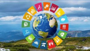
In his address, Stefan Schweinfest, Director UN Statistics Division, said that SDGs is not just a document but it is a proper action plan to engage with each other, work together and bring solutions for a better world. “All the projects are truly incredible and great examples for localizing the SDGs. Rather than competition, the purpose of this session is to interact with each other, make friends and discuss how to take the ideas forward in the future so that you can be a UN representative for SDGs,” he added.
Generation Alpha in localizing the SDGs
With the theme of “Geo-enabling the Global Village: No one should be left behind,” the congress started with sessions like Geo-enabling the Global Village with Generations Z and Alpha, which showcased the involvement of Generation Alpha in localizing the SDGs at the school level. 19 urban and rural schools from across India through a team of two students each will present their use of geospatial data in understanding a local issue and its use in planning and implementing a change project in the community-truly localizing the implementation of the SDGs through spatial thinking! This event was organized by the Bharati Vidyapeeth (Deemed to be University) Institute of Environment Education and Research, Pune, in collaboration with the Department of Science and Technology, Government of India Official.

The young teams focused on SDGs of zero hunger, gender equality, decent work and economic growth, sustainable cities and communities, responsible consumption and production, climate action, and life on land. The event could show the way to localize the implementation of the SDGs through geospatial thinking.
Also Read: Students showcase their spatial thinking in localizing SDGs at the 2nd UN-WGIC
Bridging the gap of academia and geospatial industry with research, education and training
The next session titled “Bridging academia and industry in Geospatial Research, Education and Training”, provided a forum to debate on the issues, challenges, and opportunities concerning the collaboration between academic/research communities and industry/private sectors, in the context of the development of global geospatial information and the promotion of its use to address key global challenges, especially to understand the need of advertising and communicating the value of geospatial skills, identify the major geospatial industry skill gap, and to discuss and deliberate the opportunities and expectations to build the best workforce for geospatial industry. The side event will feature presentations from academia, research community, industry sectors, students, and young professionals, and mostly important dialogue among them and will help the collaboration between these two sectors of the society.

Professor. Georg Gartner, Vienna University of Technology; Professor. Abbas Rajabifard, University of Melbourne; Jayachandra Ravi, Doctoral Student, Nirma University; shared their thoughts and discussed that the way forward is moving from sustainable to productivity and regenerative.
They highlighted that, “We see significant challenges and opportunities. Challenges be it climate related or infrastructure. Therefore, as a result of Covid there were economic challenges that posed problems in resource allocation. Access to right set of information is the key and for that we need a conducive ecosystem.
Digital Twin is an enabler, and we also have location information. A process-based approach to achieve SDGs, from identifying risks, developing plan and taking action is needed because there’s lot of interdependency and complexity.”
“We need to put humans at the center of our understanding of a sustainable world. It’s not enough to produce data, we need to go one step further to underpin decision-making via it.”