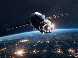
Geospatial technology plays an important role in promoting sustainable development. It refers to the use of geographic information and technologies, such as satellite imagery, Geographic Information System (GIS), and Global Navigation Satellite System (GNSS)/ Global Positioning System (GPS), to collect, analyze, and visualize data related to the earth’s surface so as to analyze and visualize spatial patterns, trends, and relationships.
One of the main advantages of geospatial technology is its ability to help policymakers and planners make informed decisions about land use, resource management, and infrastructure development. By mapping and analyzing data on parameters such as population density, land cover, and natural resources, geospatial technology can provide insights into the potential impacts of development projects on the environment, economy, and society.
In addition, geospatial technology can help to optimize resource allocation and improve the efficiency of public services. One key aspect of sustainable development is the efficient use of resources. For example, by analyzing patterns of traffic flow and population density, planners can determine the most effective locations for public transportation routes and facilities.
Identifying Risks
Geospatial technology can be used to identify areas that are at high risk for natural disasters such as floods or earthquakes, and to develop strategies for mitigating those risks. It can also be used to identify areas that are vulnerable to climate change and to develop plans for adapting to and mitigating those impacts. In fact, it is essential for the effective management of natural disasters and emergencies.
By providing real-time information on the location and severity of events, such as floods, earthquakes, and hurricanes, geospatial technology can help emergency responders and relief organizations coordinate their efforts and provide timely assistance to those in need. There are multiple location-based services (LBSs) available and need to be enhanced and prepared with such objectives.
With the contribution of ML, the potential capabilities of geospatial to support sustainable development have gone beyond human expectations.
Another important aspect of sustainable development is the need to reduce greenhouse gas emissions and mitigate the impacts of climate change. Herein, the technology can help by providing accurate and detailed information on forest cover and other land uses, which can help identify areas where carbon sequestration and other climate mitigation strategies can be implemented.
Embedding future technologies
With the contribution of machine learning methods and algorithms, the potential and capabilities of geospatial technology to support sustainable development have gone beyond human expecta- tions. Given the cost effectiveness pertaining to data acquisition on a variety of spatial-temporal scales and information richness, the modes to analyze, process and visualize the scenarios provide a deeper understanding of the relationships among the pillars of sustainable development.
The progress of the technology also lies in the critical factors of accountability, transparency, and tractability, which are reinforced through geo-enabling projects and thus gaining widespread influence. Though there will always be a need for newer methods and datasets, the geospatial technology strongly provides the platform to integrate and use them.
Overall, geospatial technology is a valuable tool for promoting sustainable development by enabling policymakers and planners to make informed, evidence based decisions that consider the long term impacts on the environment, economy, and society. By leveraging the power of geospatial data and mapping, one can work towards a more sustainable and equitable future for all.
ALSO READ: Geospatial will facilitate sustainable development
(Professor P K Joshi is the Chairperson, Special Center for Disaster Research (SCDR) and Professor, School of Environmental Sciences(SES), JNU, Delhi.The views expressed in the article are the personal opinions of the author.)
Disclaimer: Views Expressed are Author's Own. Geospatial World May or May Not Endorse it


