The International Council for Local Environmental Initiatives (ICLEI) Action Fund 2.0, announced the launch of two groundbreaking projects in Dortmund, Germany. With grant funds from Google, the initiatives aim to utilize innovative techniques and data-driven approaches to bolster the city’s resilience to extreme heat and enhance energy efficiency in buildings and urban Environments Improving Urban Climate Resilience.
Recognizing the risks posed by rising temperatures to human health, well-being, and the usability of public spaces, the project will leverage a state-of-the-art bio-meteorological sensor network and develop a now-casting service for monitoring thermal comfort throughout the city.
By providing real-time information, the project will guide on-ground actions and services for smarter urban climate planning.
This pioneering approach aims to integrate thermal comfort data within Dortmund’s smart city ecosystem, enabling tailored data-driven services that meet the municipality’s needs and improve the well-being of its citizens.
Professor Benjamin Bechtel, Head of the Bochum Urban Climate Lab, expressed his excitement about the collaboration, “Adapting cities to climate change is one of the most critical challenges for humanity in the coming decades. We are excited to work with a pioneering city in both climate adaptation and smart city solutions to jointly develop data-driven tools and services that can help both the administration and the citizens cope with extreme heat.”
Mapping Urban Heat Stress and Energy Efficiency
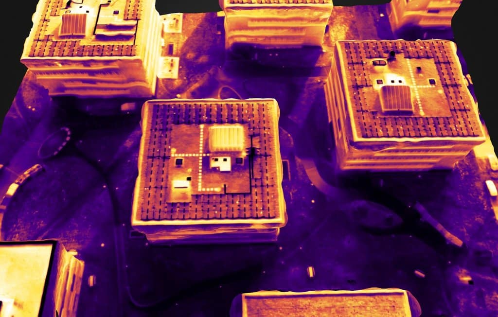
The Climate Adaptation through Thermographic Campaign and Heat Mapping (CATCH4D) project, led by the Research Institute for Regional and Urban Development (ILS), aims to create a comprehensive 3D thermal model of Dortmund.
Leveraging advanced laser scanning, thermographic, and Earth observation techniques, the project will evaluate building energy efficiency and urban heat stress.
By incorporating Google Earth Engine data and socio-economic information, the CATCH4D project aims to identify areas with energy-poor households and residents vulnerable to heat stress. The resulting data analytics will contribute to the implementation of sustainable and climate-oriented initiatives in Dortmund.
Moreover, the project aims to directly benefit local citizens by providing support to energy-poor households through legal advice and funding for housing modernization. Additionally, green and blue infrastructures will be installed to mitigate heat stress in the identified areas.
Dr. Shaojuan Xu, principal investigator of the project, emphasized the objective of making energy efficiency and climate resilience tangible and accessible.
“The 3D heat map will visually represent energy efficiency in an intuitive manner, facilitating faster decision-making. The project’s data analytics will also be made available to stakeholders, promoting sustainable development,” said Dr. Xu.
Collaboration for Successful Climate Goals
Thomas Westphal, Dortmund Mayor, expressed his enthusiasm for the selection of two projects from Dortmund and highlighted the significance of collaboration between science, the municipality, and citizens in achieving successful climate goals. “The projects use innovative techniques to collect and merge current climate data with existing data. This process ensures that targeted measures for climate impact adaptation and energy consulting can be developed. The municipality supports the teams in the analysis and will consolidate the results in the city’s actions,” Mayor Westphal stated.


