
To provide Central Assistance to States for major/medium irrigation projects, the Government of India launched the Accelerated Irrigation Benefits Program (AIBP) in 1996-97. The project was developed to accelerate the implementation of an advanced-stage irrigation plan by providing financial benefits.

Since 1996, a total of 297 major and medium irrigation projects have been undertaken by the central government under AIBP.
This includes 99 priority projects that were undertaken by the government in 2016-17 under the Pradhan Mantri Krishi Sinchayee Yojana – Accelerated Irrigation Benefits Program (PMKSY-AIBP).

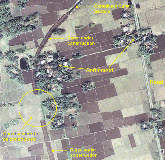
The responsibility of monitoring these projects was given to the Central Water Commission (CWC), Ministry of Jal Shakti. For a long time, the monitoring process was done manually – by visiting the field, talking to authorities and other stakeholders, and developing a report physically.
This often held up the factual status of the project and provided insufficient data. However, with the introduction of Geospatial Technology, a new dimension of monitoring opened.
Disclaimer: These case studies have been extracted from the Integrated Geospatial Information Framework report.


