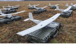
If there’s one thing that defines the Nextcore team, it’s their passion to continually improve the technology of UAV LiDAR in order to make cost-effective and reliable equipment that is safe and easy to use. Realizing that increasing altitude could offer significant benefits in UAV surveys, Nextcore embarked on designing and building a UAV with a high-performance LiDAR and navigation system payload that could deliver a survey-grade dataset from 80 m altitude. This became the RN80 project.
Typical UAV LiDAR surveying is performed at ~40 m AGL. This altitude commonly presents collision risks with terrain and vegetation and imposes limits where the topography changes dramatically, such as voids that increase AGL beyond acceptable limits. Higher altitude surveying, therefore, offers obvious advantages, but also deeply challenges LiDAR sensors and the inertial navigation system (INS). Any mismatch in operational performance and accuracy between these inevitably degrades survey quality and severely limits the use of the system.
Nextcore set about developing a viable solution that could maintain a point cloud density of 200~500 points per m2 from an initial target altitude of 70 m. This equates to generating LiDAR point cloud data at millions of points per second. Achieving this required a GNSS-INS that provided suitably precise geo-referencing data. Because survey data is derived from a source that is in constant motion in 3D space, the capability of the GNSS-INS is paramount in producing a digital twin of value and is critical to mission success.
Nextcore’s previous RN50 UAV-LiDAR could survey at a maximum of 50 m AGL, which although high, remains at risk of collisions with vegetation and power lines. The team set the primary goal to increase the survey altitude to 80 m AGL. Higher altitude surveying was also desirable for several Nextcore clients that were surveying difficult terrains in Japan and Malaysia – they needed the ability to fly their survey drones higher.
Operation at 80 m altitude not only reduces the risk of collisions, it also enables surveyors to cover larger areas in the same amount of time, greatly improving the efficiency of the solution. This ambitious target, however, did also introduce some concerns.
“The problem with flying a UAV LiDAR payload higher off the ground is the higher you fly, the more inaccuracies you build into the LiDAR dataset.” says Ashley Cox, COO, and Co-Founder at Nextcore.
Tom Simmons, Technical Officer at Nextcore adds that a major challenge of higher altitude surveying is the accuracy and reliability of the IMU (inertial measurement unit) in use, saying “You’re really relying on your IMU accuracy at that point, and any inaccuracy you have got in your IMU will be reflected in your LiDAR. It will lead to a decrease in accuracy and it won’t be usable data in surveying metrics.”
Solution
Nextcore had previously used the Advanced Navigation Spatial Dual GNSS-INS in their RN50 UAV-LiDAR units and was very pleased with the results and reliability. With the RN80 UAV-LiDAR, however, Nextcore wanted to try and improve the navigation system to suit the performance challenges of operating at altitudes over 50% higher than their previous system.
After testing and evaluating various INSs from different manufacturers, Nexcore coupled its LiDAR with the Advanced Navigation MEMs-based Certus Evo GNSS-INS, which provides near FOG performance and has a gyroscope drift rate (bias instability) of 0.2 degrees per hour. This combination yielded exceptional results that allowed them to vastly extend the altitude ceiling to 120 m whilst retaining consistent, accurate survey data.
Certus Evo was chosen because of:
- High accuracy, which became increasingly important in reducing angular errors introduced by higher altitude surveying.
- Easy integration into Nextcore’s existing systems and requires no additional engineering over the previous Spatial Dual INS.
- Cost-effective and available in OEM format for payload minimization, allowing Nextcore to offer better value to customers.
“After doing some test flights, the Certus Evo met all of our requirements for the RN80 project. This allowed us to leverage off the Spatial Dual integration and apply the Certus Evo as a drop-in replacement for that system. It’s also a very cost-effective sensor and a competitively priced product.” comments Simmons.

Payload minimization was also a critical aspect for the INS, as surveyors are always seeking longer flying times. This can only be achieved with a lighter payload technology stack. The team used the ruggedized housing version of the Certus Evo for additional strength and weather resistance, whilst remaining an efficient payload setup.
“The industry is constantly seeking lighter payloads for longer flight times and to fit on smaller, safer UAVs. Regulatory restrictions challenge the industry to meet certain specifications and the same is true for UAV LiDAR. We hit a ceiling. We need to be able to improve on that, although what we’re achieving now is a real game changer.” Cox says.
Result
“When we had done our calculations, we expected to be able to fly 80 metres above ground level.” says Cox. Instead, the Certus Evo performed so well that it enabled Nextcore to produce a UAV-LiDAR that can deliver survey-grade point cloud datasets at up to 120 m AGL. The 120 m altitude exceeded their initial goal by a further 50% and provides a solution that more than doubles the altitude of the previous RN50.
Higher altitudes tend to increase the LiDAR swath width. The typical swath width at ~50 m altitude is ~120 m, depending on the actual altitude and the resulting angle of incidence of LiDAR towards the edges of the swath. At 120 m, a reliable swath width of 180 m was achieved. This is a 50% increase over the previous, equating to approximately 33% fewer flight lines to survey a given area – a notable boost for productivity and efficiency to surveyors.

The Certus Evo-equipped UAV-LiDAR then became the RN100. The RN100 allows Nextcore’s customers to fly far higher than previously and with increased safety, whilst surveying larger areas in the same flight times and achieving survey-grade outcomes.
The resulting survey material contains LiDAR point cloud data and the geo-referencing data from the INS. All data processing is performed post-flight to ensure the highest possible accuracy. PPK is used for the correction of GNSS-INS position, roll, pitch, yaw, and heading data.
The processed INS data is then combined with the processed point cloud data to provide an absolute position to the point cloud. This system realized consistent 30~40 mm precision at 120 m AGL. Nextcore has integrated the LiDAR and INS processing platforms to automate the synthesis of data sets to reduce survey completion time. Depending on size and complexity, this solution can process survey data into a customer-ready 3D map within 30 minutes of mission completion.
“Integrating the Certus Evo into our product line has allowed us to offer a higher-end solution to our clients at a very affordable price. This has opened up new markets for us internationally and domestically.” concludes Simmons.