With a major shift in global geopolitics in the last few years, the significance of modern-day technology in gathering accurate and actionable intelligence has increased significantly. An example of this is satellite imagery, which provides the power of visualization in real time. For years, satellite imagery has been used by the geo-intelligence (GEOINT) community to gather relevant data. The exponential increase in its availability in the recent past has made it a powerful tool for intelligence gathering.
In September 2020, following a mysterious explosion at Iran’s Natanz nuclear complex, Ali Akbar Salehi, head of the Atomic Energy Organization of Iran, announced the construction of a new underground nuclear facility. The announcement triggered a race among GEOINT analysts to uncover the whereabouts of the new facility.
According to experts, the global, daily visibility offered by satellite imagery is having an impact on the behavior of countries, especially with regard to high-interest activities, which could be viewed as security threats by other nations.
Geo-intelligence analysts routinely study and analyze numerous activities related to security risks. But how do they analyze activities that are performed covertly?
Following the explosion at the Natanz nuclear complex, Dr. Jeffrey Lewis and his team from the Middlebury Institute of International Studies at Monterey (MIIS) were keen to learn more about the development of the new plant. MIIS specializes in analyzing pressing geopolitical issues, such as the development of nuclear capabilities in regions of high interest.
In addition to using open source intelligence, the institute relies on satellite imagery to understand patterns of life and detect and monitor ongoing changes on the ground. To gain a full understanding of the development of the construction, high frequency, high-resolution tasking imagery was required.
Planet’s solutions for the defense and intelligence sector offer unique capabilities, such as “always-on monitoring”, with rapid tasking to provide visibility into global events at the speed in which they develop. Daily cadence of Planet imagery helps to understand patterns and identify deviations from normal activity.
As soon as the announcement of a new nuclear facility was made, using daily satellite imagery from Planet’s Dove constellation, Dr. Lewis’ team tracked early indicators of construction near Natanz. After obtaining the first indication of anomalies with PlanetScope, Dr. Lewis used Planet SkySat for a high resolution image of the suspected construction. The SkySat image showed a new construction area to the left of Natanz. It appeared that new roads were being built into the mountains, potentially for an underground facility.
This is an excellent example of the power of tip and cue workflows in defense and intelligence. Both Planet’s medium- and high-resolution constellations played a key role in monitoring and reporting on changes at the site.
High cadence satellite imagery can play a crucial role in providing greater transparency into happenings around the world. In this case, Planet data helped identify the location of the new facility in the initial days of the construction. This meant comprehensive monitoring without any room for speculation.
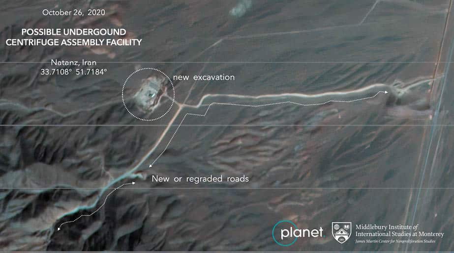
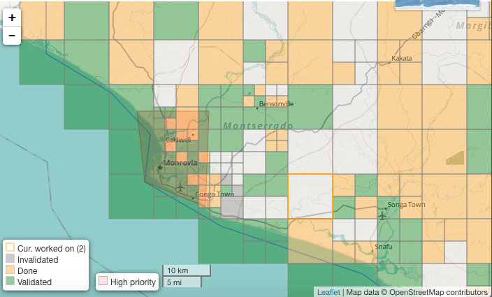
To fight the worst Ebola outbreak in history, the American Red Cross is attempting to get ahead of the virus by creating the most detailed maps of rural towns and villages so officials can track the deadly virus as it spreads
GetMapping has supplied aerial photos having a spatial resolution of 12.5 cm which covers an area of 575 sq km on land
© Geospatial Media and Communications. All Rights Reserved.