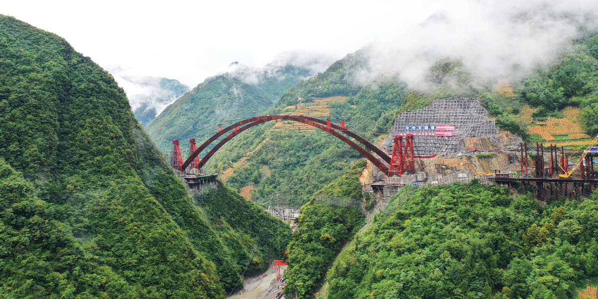
The Liaozi Grand Bridge belongs to the National Expressway G69 in China, also known as the Chengkai Expressway, located in Liaozi Township in Chengkou County, where the terrain is steep and complicated.
The Chengkai Expressway is a super project with a total length of 129.3 km, a bridge-to-tunnel ratio of 81%, and a total investment of 23.4 billion RMB. After its opening, Chongqing will achieve expressway access to every county, which is of great significance in assisting rural revitalization in the area.
The Liaozi Grand Bridge is one of the iconic projects on Chengkai Expressway. The total length of the bridge is 330.812m, crossing the Qianhe Gorge, it is a typical bridge in mountainous and hilly areas.
The main bridge is a medium- bearing steel box arch bridge with a calculated span of 252m, which is the first non-coating high-performance weather-resistant steel box arch bridge in China, and for the first time, it adopts the single arch rib which requires aerial horizontal and vertical composite rotation construction.
In this project, China Railway Changjiang Transport Design Group Co., Ltd. is mainly responsible for digital design and 3D construction simulation.
Challenge
The Liaozi Grand Bridge is located in the Qinling Mountain Canyon area. Due to the steep terrain, it is difficult to build temporary construction roads and bring materials and machinery to the site.
Both sides of the bridge arch abutment on the steep terrain, poor traffic conditions. The bridge deck is 127 meters away from the river surface, and the highest part of the arch ribs is 186 meters away from the river, which is equivalent to the height of a 60-storey building, making the construction difficult.
Solution
ContextCapture was used to process the UAV aerial survey data to establish a high-precision 3D real-world model, create a terrain model of the bridge site, present different surfaces in the form of contour lines or triangulation grids, and create effective elevation with slope analyses.
The efficiency and accuracy of the work is substantially improved by using high-precision orthophotos, point clouds or live scanning to generate a realistic terrain model of the bridge site and the project construction at various times during the construction process.
In MicroStation, the bridge model is fused with the real model, and at the same time, the terrain in the real model is modified according to the excavation and filling information, so that the two are integrated, and the fused model can be used for the layout of the bridge scheme, the roaming display of the bridge, the observation of the approach slopes, and the construction simulation based on the real view, which are all the basic data for the operation behind.
Outcome
In this project, UAV mapping technology was used to capture complex terrain (mountainous areas with high slopes) accurately and quickly, and to create a digital model of the ground surface. By combining this with geological survey data and BIM, a geological model was constructed.
The integrated terrain and geological model was applied to bridge alignment, bridge location selection, bridge layout, etc., which visually represented the project site, improved the efficiency of design optimization, and reduced travel time to and from the site by approximately 25 days.
The use of Bentley parametric modelling shortened the bridge design time by 300 hours, saving 1.5 million RMB in design costs; the new workflow combined with the use of Bentley technology, facilitated the completion of the design project 35 days ahead of schedule.
By establishing virtual simulation via MicroStation, it was discovered in advance that there would be collisions with the mountain during the rotation construction.
In actual construction, the vertical rotation angle of the arch rib was increased to avoid collision. Problems can be detected earlier than traditional design, effectively ensuring the success of the rotation construction. The savings in management costs and risk losses are about 20 million RMB, which brings huge economic and social benefits.


