
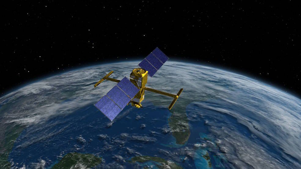
The International Surface Water and Ocean Topography (SWOT) mission, known as SWOT has been very recently launched. This is an important milestone as it is the first mission aiming to survey nearly all of the water on Earth’s surface. The SWOT spacecraft launched atop a SpaceX rocket from Space Launch Complex 4E at Vandenberg Space Force Base in California on December 16.
The satellite’s instruments will collect detailed data on both freshwater and ocean features in high definition. This pioneer mission is a joint effort between NASA and the French Space Agency Centre National d’Études Spatiales (CNES). This space initiative also includes contributions from the Canadian Space Agency (CSA) and the United Kingdom Space Agency (UKSA).
The SWOT mission agenda
Surveying water on more than 90% of the world’s surface and measuring the height of water in freshwater bodies as well as the oceans is included in the agenda of the SWOT mission.
Scientists would gain enormous data from the SWOT satellite to analyze the ocean topography in greater detail. Better understanding of the impact of coastal circulation on various marine aspects like water quality, energy transfers, and oceanic life is expected from this mission. Greater accuracy in ocean-atmosphere modelling may be achieved with the data inputs available from the SWOT output.
Simultaneously the hydrology mission will closely investigate the adjustments of water storage in humid areas, lakes and reservoirs, river flow rates and the water level in continental bodies of water. SWOT is geared to provide data on more than 95% of the world’s lakes larger than 15 acres (62,500 square meters) and rivers wider than 330 feet (100 meters) across. This is a great opportunity for freshwater researchers who currently have reliable measurements for only a few thousand lakes around the world. Now that number will expand into the millions.
Climate Change affecting earth’s water bodies
Climate change and its impacts are not only felt on land. Its effect are imprinted on — lakes, rivers, oceans and seas around the continent too. Since the share of water covering the Earth is much greater than land covering the Earth’s surface, it is no surprise that the warming of the oceans has accounted for significant percentage of the warming of the planet. Resultant impacts like change in water temperature and circulation with increasing temperatures are also melting polar ice caps. As a result more freshwater is entering the oceans, changing the currents further.
Overall climate change is ushering in extreme weather events like floods and droughts and significant impacts on marine species. There is a growing need to expand the availability of accurate monitoring tools for the changes in place for the earth’s water bodies. Indeed this need is the call of the day to provide the best ways to offer forecasting and mitigating action plans for resultant extreme weather events.
Satellite perspectives of water research
Earth scientists, researchers and relevant stakeholders can acquire and implement Earth observation data meaningfully in maintaining the quality and availability of water as an essential natural resource.
New perspectives continue to unfold in environmental measurement through remote sensing, satellite data, and other Earth observations. Steadily remotely sensed data are being used in water policy and related decision making. Undoubtedly there is accelerating use of satellite data in water management in present times.
SWOT data to help wide areas of application
“SWOT will provide vital information, given the urgent challenges posed by climate change and sea level rise,” said Laurie Leshin, NASA’s Jet Propulsion Laboratory (JPL) director at the official announcement of the SWOT satellite launch. “That SWOT will fill gaps in our knowledge and inform future action is the direct result of commitment, innovation, and collaboration going back many years. We’re excited to get SWOT science underway.”
The wide array of data to be acquired from SWOT measurements promises to be a wonderful resource for relevant stakeholders like researchers and policymakers. Enhanced initiatives for working on river flood projection modelling as well as meticulous monitoring of drought effects on lakes may be achieved with the support of a greater repository of accurate data.
SWOT in action
“We’re eager to see SWOT in action,” said Karen St. Germain, NASA Earth Science Division director at the official announcement. “This satellite embodies how we are improving life on Earth through science and technological innovations. The data that innovation will provide is essential to better understanding how Earth’s air, water, and ecosystems interact – and how people can thrive on our changing planet.” SWOT is the first satellite mission that will observe nearly all water on Earth’s surface, measuring the height of water in the planet’s lakes, rivers, reservoirs, and the ocean.
We can expect to transform our view of water on Earth with the SWOT satellite in orbit now.
Also Read: How satellite imagery is crucial for monitoring climate change


