
Global trends and developments affect the lives of people across the world. Some of the global megatrends such as urbanization, climate change, technology advancements, cybersecurity, new ecosystems of collaboration, and migration are deeply shaping the current world as well as some extent of the upcoming future. At the same time, they provide tremendous opportunities in land administration. The role of megatrends in land administration was discussed in a symposium session on Land Administration at the Business Centre of Amersfoort, Netherland on 11 May 2022. The session was moderated by Derek Clarke, Advisor, World Geospatial Industry Council. Brent Jones, Global Manager, Cadastre, Esri was the keynote speaker of the meeting.
Participants of this panel were Jones Ofori-Boadu, Deputy Executive Secretary, Lands Commission, Ghana, Paula Dijkstra, Director, Kadaster International, Sonmoni Borah, IAS, Joint Secretary (LR), Department of Land Resources, Ministry of Rural Development, India, Dr. Simon Musaeus, D.B.A., VP Business Development, Geospatial Content Solutions (GCS), Hexagon, and Amy Coughenour Betancourt, CEO, CADASTA Foundation.
In a two-hour long discussion, all seven panelists discussed land administration opportunities provided by these megatrends.
Major initiatives are being taken by the land administration sector to leverage digitalization. Geospatial technology is transforming the land administration sector from technical, organizational, legal, and financial perspectives.
“Land administration is not only cadastral work but is it is more than that,” said Brent Jones, Global Manager, Cadastre/Land Records, Esri in his keynote address. “Understanding land administration through tenure rights, value, planning, and management is going to make sense and how our current set of technology respond to challenges” he further said.
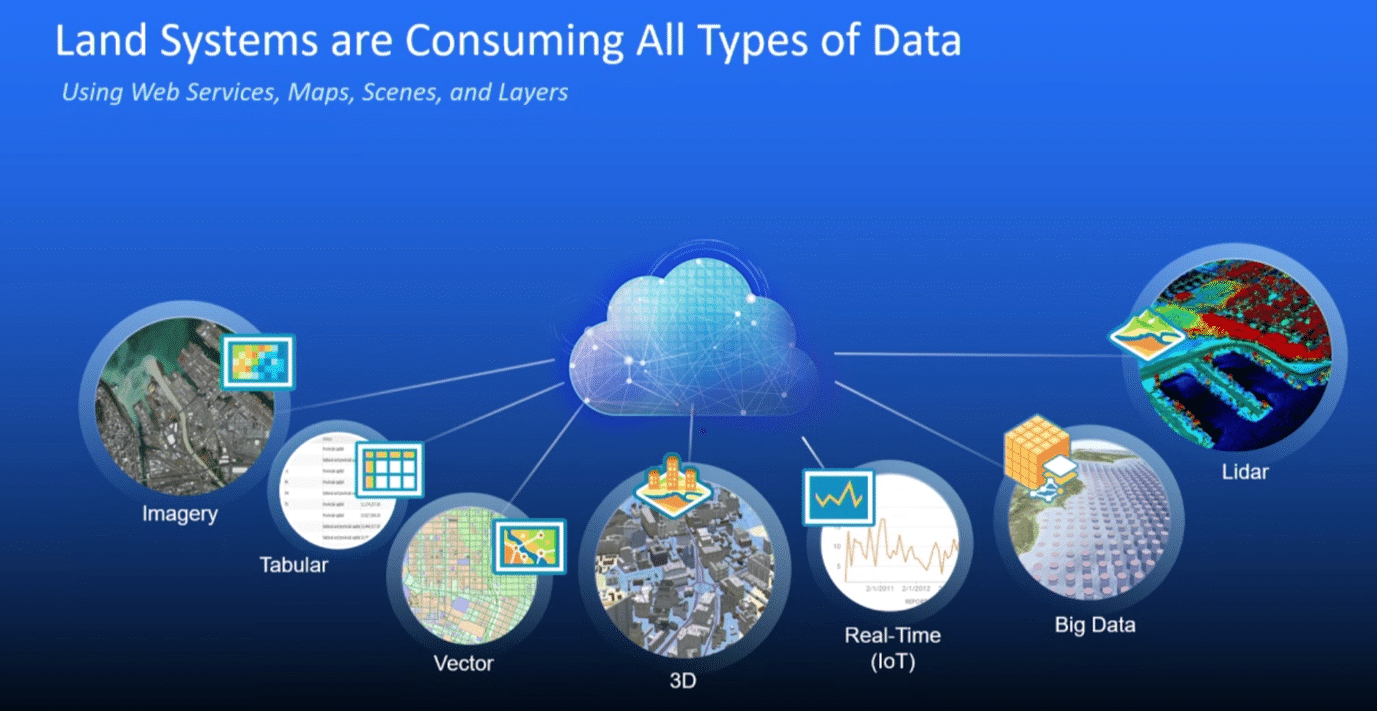
Through his presentation, he mentioned a list of technology and their enabling role in land administration such as GIS/LIS leverage technology advancement, Web maps, and online ready to use the content.

To sustain fast rising economy tag, India has taken up land record modernization work at the forefront to make India an economic powerhouse of USD 5 trillion Gross Domestic Product (GDP) by 2025. India’s current GDP is over $3 trillion. But India’s current land administration system is convoluted and creates an impending. It can be understood from this fact that India’s Two-thirds of total civil cases in the court are related to the land dispute which affected 2.5 million hectares of land and it further affected 7.7 million people.
“For achieving the ambitious target, we need to tap the land market to enable a business-friendly environment,” said Sonmoni Borah, IAS, Joint Secretary (LR), Department of Land Resources, Ministry of Rural Development, India.
In India, most of the social welfare schemes are connected to the land record of the beneficiaries. But the complex nature of land records (different languages, terminology, sizes, and measurements) put a break on reaching out to real beneficiaries. In India, the land dispute is also very high.
“So that’s why we choose to go for digitalization of land records to help our people to get services,” says Borah.
Land reform is not only a government task. It must collaborate with civil society and the community for its success.
“Role of civil society and community need to be recognized in Land administration,” said Amy Coughenour Betancourt, CEO, CADASTA Foundation.
Mrs. Coughenour cited examples from Brazil where geospatial technology was used in the collection of data with the support of local community members which helped in issuing 1400 land titles to women in peri-urban areas in Bonito, Brazil.
“In partners with activists, women, local government, community leaders, and notary office, Municipality leads geospatial and demographic data with tech support from EF and Cadasta and issued titles. Collection of data sped from two months to two hours” she said.
© Geospatial Media and Communications. All Rights Reserved.
