
When there are tensions between a rapidly ascending power and an entrenched one, the confrontation for hegemony is likely to descend into a full blown war. This is known as the Thucydides Trap. Asia and the region around South China Sea is a potential hotspot for such a clash. In order to mitigate it and restore the balance of power, a broad-based collaboration, information sharing, real-time monitoring, and technology solutions are necessary.
Quad – the group of USA, India, Australia and Japan – aims to strengthen trade, defense and logistic cooperation in the Indian Ocean, South East Asia, Pacific and provide a counterpoise to Beijing’s bid for supremacy. It is ramping up collaboration across domains and enhancing the use of space and satellite technology that’s crucial today for monitoring irregularities that often go unnoticed.
China’s violations of international waters isn’t just a geopolitical risk, but also endangers maritime sustainability, ecology, and the livelihood of communities dependent on fishing. In large parts of the world that are bearing the brunt of extreme weather events as well as poverty, food shortage, and ecological degradation, this is exacerbating a multipronged crisis of instability and chaos.
As per global estimates, China is responsible for more than 85% IUU (Illegal, Unreported and Unregulated) fishing in the world that is depleting fishstock. From Indonesia to Mauritania, and Fiji to Ghana, Chinese vessels and distant water fleets are involved in illegal fishing.
A damning report by the Environmental Justice Foundation titled ‘Ever Widening Net’ lays bare the scale and scope of the Chinese operations that extends across continents and operates clandestinely through a maze of shell companies, covert networks and other dubious means. African nations such as Mauritania and Ghana are among the worst affected with dwindling fish stock and corrosive environmental impact.
“Mauritania is a hub of the fishmeal and fish oil industry – which has reaped widespread ecological damage to both terrestrial and marine ecosystems including the decimation of locally important fish populations”.
In 2020, the Chinese fishing fleet was spotted near the ecologically sensitive Galapagos Islands.
“The knock-on effects of this reduction in catch and associated financial hardship are reduced access to healthcare, education, and alternative livelihood opportunities – creating a cycle of exacerbated poverty and human suffering, as well as further ecological degradation”, states the report on the hazardous impact on Africa.
Chinese illegal fishing is carried out using a wide range of methods and shipping fleet. When it comes to using deep sea trawlers, Asia is far from unscathed.
“The EEZs of Ghana, Indonesia and Guinea were the location of over half (56%) of IUU fishing incidents involving Chinese flagged or owned industrial trawl vessels during 2015-2019”.
Be it China’s claim over Scarborough shoals in the Philippines, illegal fishing in Indonesia, hawkish naval activities around other regions and defying maritime conventions, the situation in Asia is perilous as multiple challenges combine.
At the recent Quad summit in Tokyo, the member countries announced a joint Maritime Domain Awareness program intended to track illegal Chinese vessels.
Called the Indo-Pacific Partnership for Maritime Domain Awareness, it will offer a near-real time, integrated and cost-effective domain awareness, as per a White House statement ahead of the Tokyo Summit. With the help of satellite monitoring and active data and information exchange, there would be a rapid enhancement in surveillance capabilities.
“Quad countries are committed to contributing to the region’s maritime domain awareness—a fundamental requirement for peace, stability, and prosperity—through an investment in IPMDA over five years. The partnership will innovate upon existing maritime domain awareness efforts, rapidly bringing emerging technologies to bear for the greater good of the Indo-Pacific community”, says the White House statement.
Domain awareness will allow Quad partners to efficiently track dark ships and other illicit activities, improving their disaster response capabilities and equipping them to better handle humanitarian crises.
Illegal fishing has become a bigger threat than piracy today, posing multiple risks that can morph into social, ecological, political and economic hazards, dragging countries into the quagmire of anarchy, turmoil, and utter devastation.
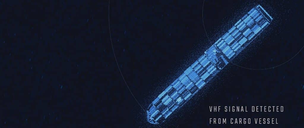
Vessels that turn off their GPS and Automatic Identification Systems ( AIS) are called dark ships. With the help of SAR and other satellites, it has become possible to monitor these ships that navigate stealthily.
HawkEye 360, a company that provides RF data and analytics from space, has a maritime analytics capability which analyzes RF signal geolocations and global AIS maritime geolocations to provide insight into potential dark activity across the global.
The Quad initiative is also an opportunity for partnerships with specialized private players and satellite imagery providers. Quad has stated that the data would be ‘unclassified’ so that it can be widely shared with other partners countries or organizations, or used to create wide public awareness.
Using SAR and RF satellite analytics, ships can be tracked even if they turn off or tamper with the AIS signal. This is because ships use very high frequency X-band radars that can be geolocated.
For active support, cooperation, coordination, and knowledge sharing there would be regional fusion centers in India, Singapore, Solomon Islands and Vanuatu. The Pacific Islands Forum Fisheries Agency and the Pacific Fusion center, based in the Solomon Islands and Vanuatu respectively, will get support from Australia.
“As the initiative proceeds, the Quad will identify future technologies of promise, allowing IPMDA to remain a cutting-edge partnership that promotes peace and stability throughout the region”, says the statement.
Maritime Domain Awareness depends heavily on Earth Observation. This is why to bolster it as well as to ratchet technological capability and foster innovations, wide-ranging cooperation in space has been announced.
Any sort of sweeping real-time detection and monitoring is inconceivable without EO today. The Quad countries have pledged to increase ‘free, full and open’ sharing of EO data for civil purposes and to work towards the promotion of open space.
US has taken the lead to spearhead cooperation in EO that will include NASA Globe and Develop programs, NOAA Community Satellite Processing Package (CSPP) and Satellite Proving Ground Flood Mapping Portal, and the U.S. Geological Survey (USGS) National Land Imaging Program.
In order to curtail climate change, “the Quad will cooperate on disaster risk reduction for extreme weather events, including through the Coalition for Disaster Resilient Infrastructure (CDRI)”.
Indian Prime Minister Narendra Modi termed the Quad ‘a force for good’ and his recently sworn-in Australian counterpart Anthony Albanese said it will lead to a ‘free, open and resilient Indo-Pacific’.
© Geospatial Media and Communications. All Rights Reserved.