NRDI, NHAI, BRO and other bagged GeoSmart Infrastructure Excellence Awards for road, railway, bridge, and tunnel construction
GeoSmart Infrastructure 2022 brings together industry leaders from across the country to share digital use-cases for designing, building, and maintaining world class transport infrastructure assets, and plan for the future demands of the nation.
Nitin Gadkari, Minister for Ministry of Road Transport and Highways (MoRTH) inaugurated the conference and released the National BIM and Digital Twin Strategy report.
“We need to accept good technology, research, innovation and successful practices from across the world and from within India. We should use alternative materials to reduce cost without compromising on quality. Time is the most important aspect in construction, it is the biggest asset,” said Gadkari.
The GeoSmart Infrastructure 2022 presents the GeoSmart Infrastructure Awards, which aims to celebrate technology’s best-in-class application and leadership in transport infrastructure development and asset management. The awards felicitates the forward-looking organizations, projects, and individuals for their impeccable work in the field of digital construction and engineering.
General (Dr.) Vijay Kumar Singh PVSM, AVSM, VSM (Retd.), Minister of State, Ministry of Road Transport and Highways released the “BIM’s Strategic Return on Investment (ROI) in Indian Infrastructure Projects” presented the awards to the winners at Geosmart Infrastructure Awards.
“As technology gets used more, challenges like time overrun and cost overrun can be addressed. We need to develop technology such that users find it useful and easy, thus we can get benefit in terms of quality, methodology, time and cost effective. Infrastructure industry and construction tech are changing by leaps and bounds. As land area is shrinking, we need technology and innovation to help us meet the requirements of infrastructure development as well as future of people,” said General Singh.
Here are the winners:
1. GEOSMART INFRASTRUCTURE EXCELLENCE AWARD
National Rural Infrastructure Development Agency for project operations and maintenance
Project: GeoSadak
GeoSadak, rural connectivity GIS Data for Pradhan Mantri Gram Sadak Yojana (PMGSY) has been developed utilizing fully indigenous GIS data layers and satellite data services. 800,000+ rural facilities as points, 1 million + habitations and 25,00,000+ km of rural roads, have been geo-tagged under Government’s Open Data License.
It enables infrastructure planning, management, and monitoring. 12000+ road proposal has been created, audited and approved through online. This unique dataset is a public good and can revolutionize travel & commerce, increase innovation and research, and can bridge the gap between urban and rural India. An Integrated MIS-GIS solution has potential to create new services for businesses and citizens and give a boost to the rural economy.
2. GEOSMART INFRASTRUCTURE EXCELLENCE AWARD
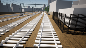
Konkan Railway Corporation Limited for Bridge Project
Project: Chenab Bridge
Under the initiative to connect the city of Katra with Banihal was the project to construct a 345-km-long Jammu-Udhampur-Srinagar-Baramulla Rail Line (JUSBRL), inclusive of numerous bridges and tunnels. Among the many bridges on the line is the Chenab bridge, the world’s tallest and longest single span rail arch bridge.
To address the geographical adversities and complexities at the project site, the creation of a 3D model of the bridge design was mandated. The use of digital technologies reduced safety hazards and identified potential issues in advance, thus allowing for better and more holistic management of the project. An estimated 225 resource days were saved using reality modeling and drones for surveying, mapping and creating 3D design models. It saw a reduction in construction inspection time by almost 80 percent.
3. GEOSMART INFRASTRUCTURE EXCELLENCE AWARD
Bangalore International Airport Limited for Airport Project
Project: Kempegowda International Airport Terminal 2
Kempegowda International Airport Terminal 2 expansion project includes a 2,55,000 square meter terminal. An intelligent 3D design technology (BIM) is used to build the Terminal 2. It ensures the entire team involved in the construction has access to all kinds of information: from “design, fabrication, and construction to operations and maintenance”.
It aids in making informed decisions “from a common point of understanding.” This has expedited the design and construction processes, including delivery of 5000 drawings in six months. It has seen 75% reduction in RFI time and zero working hours lost, seamless multi-stakeholder collaboration and intelligent real-time digital models as single source of truth.
4. GEOSMART INFRASTRUCTURE EXCELLENCE AWARD
Maharashtra Metro Rail Corporation Limited (MAHA-METRO) for metro project
Project: Nagpur Metro Rail Project
The Nagpur Metro Rail Project spanning over 38-km of route deployed 22 design consultants and 15 contractors. In the initial phase of the project, drones were used to carry out survey along the alignment of the corridor.
The 5D BIM Digital Project Management Platform was created and implemented as the central platform wherein the 5D BIM software was integrated with other software such as GIS, ERP and drone output data to see all in a single platform allowing view of the project in real-time. It is estimated that use of 5D BIM enabled savings of up to $1.5 million in terms of project delivery, while maintenance savings could touch $222 million for 25 years.
5. GeoSmart Infrastructure Excellence Award
National Highways Authority of India (NHAI) for road highway and expressway project
Project: Vadodara-Mumbai Expressway Package 1
Vadodara-Mumbai Expressway Package 1 is the eight-lane fully access controlled expressway under Bharatmala Pariyojana. This expressway on the western India will become one of the important transportation corridors in developing India. The Mumbai Vadodara expressway along with the other expressway from Vadodara to Delhi comprises to the Popular Delhi Mumbai Expressway.
3D parametric modelling design environment with capabilities for surveying, drainage, subsurface utilities, roadway design and site design is used that has helped simplify the interchange layout and resolve any clashes with existing roads and structures. It has reduced construction design by 1.5 months. The new expressway, once built, will reduce vehicle operating costs and travel time by 50%.
6. GEOSMART INFRASTRUCTURE EXCELLENCE AWARD
Border Road Organization for tunnel project
Project: Atal Tunnel
The Atal Tunnel – 9.02 km two-lane and single tube horseshoe-shaped tunnel, links Lahaul valley to Manali valley providing all-year connectivity. Considering the complexity of work on the Atal Tunnel it was a herculean task for the stakeholders to carry out construction and monitoring activities.
The planning stage saw the use of Differential Global Positioning System to check the accuracy of traverse data. The mapping activities were executed by aerial survey along with off-site evaluations. The use of technology across the plan, design, and build stages on such a complex project led to a successful breakthrough of the project with an accuracy of +/- 5 cms.