
AI Startup Synthetaic backtracked the trajectory of a Chinese spy balloon that was shot down by the U.S. military off the coast of South Carolina. They did it using Earth imaging data from Planet Labs satellites tracking the balloon’s path across the US continent.
Founded in 2019, Synthetaic is a startup, that uses artificial intelligence (AI) to process and analyze satellite imagery that has many applications, from environmental monitoring to urban planning and defense.
Mystery Chinese Balloon
The Chinese balloon was first spotted by the US on 28th January, 2023. The US military eventually shot the balloon down on 4th February, 2023 off the coast of South Carolina on the orders of President Joe Biden after it had crossed the country. It reportedly flew over a number of sensitive military sites before getting shot down.
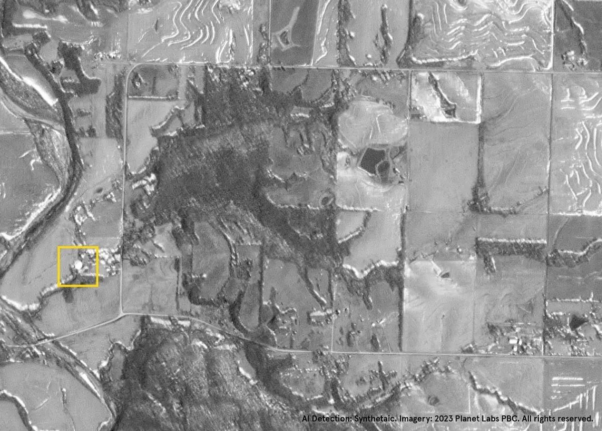
Synthetaic founder Corey Jaskolski said that he first saw the balloon in the satellite data over the Atlantic about two hours before an Air Force fighter jet took it down. The company started tracing backwards across the United States and got a total of four hits: two in South Carolina, one in Missouri, and one in Canada.
Jaskolski also added that this was a novel way to use commercial satellite imagery to track aerial vehicles that might not be seen by radar or by ground observers. It’s also another way to exploit open-source data to independently confirm where the Chinese balloon or other objects came from, he said.
“The hit that we got in Canada was over snow and ice, and we were still able to pick up the balloon,” Jaskolski was quoted as saying. “We were able to take measurements from the pixels and validate it was about 148 feet in diameter and flying at 58,000 feet. Once we had those calculations, we knew for sure it was the balloon. As soon as we found it, we had a signature that we could use in RAIC and we could start working our way backwards.”
Using AI tool RAIC
On February 11, 2023, Synthetaic traced the balloon in Planet’s satellite data fairly quickly using RAIC.
RAIC or Rapid Automatic Image Categorization is Synthetaic’s AI tool. It’s based on a new form of AI system that quickly analyzes unsupervised data because it doesn’t require pre-trained models or extensive image labeling.
RAIC runs on geospatial data, full motion video and imagery.
Other tools require deep and time-intensive calibration for each type of object, RAIC can immediately detect and classify anything from a single source image. RAIC therefore exponentially accelerates speed-to-value ratio.
Using this AI, the company has worked with the nonprofit Climate TRACE to identify the location of concentrated animal feeding operations, and with National Geographic to help track rare species, endangered by poaching.
This AI technology has the potential to transform many fields, from defense and security to environmental monitoring and beyond.


