
The AI boom is leaving no stone unturned, and satellite data analytics is the next step. The downstream space segment is facing the urgency of adopting AI and pushing in its offering to cater to the next-gen needs of its customers. But will it be sustained or is it just hype?
To discuss these points, a session on the third day of the Geospatial World Forum 2024 was held with the theme Technology Convergence Powering the Downstream Space Segment.
Moderated by Alexis Conte, Manager at Novaspace, the session embarked on the new age technologies and how they can benefit society and aid in solving modern-day problems.
Data Accountability
Kumar Navulur, Founder & CEO, GeoCognition explained how he is working to bring gaming technology to geospatial, “When you look at AR, VR, natural language processing, and large language models, these are going to influence how we’re going to gather the information from our pixels.”
“When you start analysing the data, we need to think about using multiple scales and abstraction. If you’re going to do analysis of the entire globe, you don’t want to be at 30cm if you’re doing forestry. The industry can step back, including academia and think about how we can use information at multiple scales so that we can use it for various applications,” he added.
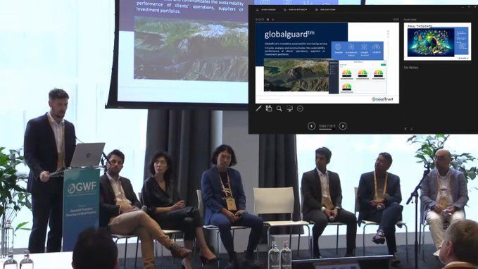
Steve Spittle, CTO & Co-founder, GlobalTrust described how on-board processing is an exciting trend with the capability of doing things such as analytics and data compression in a cost-effective manner. “You can store more data and explore new aspects all the way to complex analytics.”
“But when you start to do that and bring that data down to the clients, how do you have as much trust and faith in that output? We have to make sure there’s traceability through the entire process,” he emphasized.
“We can do that with on-board processing but we need to think about what the end-users are wanting before we just jump-in and do tech innovation for the sake of it,” Steve added.
Power of SAR
As for the first gen of Sentinal satellites, seven of them are in operation, covering a wide range of technologies such as C-band SAR, multispectral, and so on, explained Gulin Dede, Copernicus Space Segment Engineering Coordinator, European Space Agency (ESA) while talking about the new age capabilities of ESA’s Copernicus satellite constellation.
“What is unique about Copernicus constellation is that it provides a unified system through which all this data is fed into a range of thematic information services which are used in supporting the green deal and address climate change issues such as wildfires, iceberg tracking, biomass mapping, air pollution, cyclone tracking etc,” she said.
The constellation is now being expanded and the development of 6 new missions is ongoing, planned to launch between 2026 and 2028.
Meanwhile, Keizo Fujiwara, General Manager, Solution Development Dept, Synspective reiterated the importance of SAR in various facets of human life. “Why SAR? As you may know, unlike optical, SAR sensors allow us to capture images irrespective of the time, weather, and meteorological conditions in the sky. With this, StriX can obtain data covering over 1,000 square kilometers and in 0.9-3.6 meter resolution at once anywhere in the world.”
Synspective currently has 3 satellites from the StriX constellation in orbit with one more planned to be launched this Sunday.
Data Implication
“There is an urgent need for downstream applications, especially when you look at the events happened in last 4 years; the pandemic, various geopolitical conflicts, climate change and its impact on almost everything, all of these tie back to space in some way,” said Navaneeth Soori, Senior Product Marketing Manager, UP42.
When you look at the ways to solve it, space comes out as one of the fundamental tools, he emphasized.
Talking about the convergence of different technologies with space tech, he explained how there has been a boom in satellite earth observation capabilities.
“The cost of satellite launching have gone down and unsurprisingly, the number of satellites being launched have gone up. On the new age technology side cloud computing, GenAI, machine learning, and AI-based geospatial analytics have risen as well,” he added.
This has had a big impact on geospatial platforms in general as well as it has made combining both these things to serve the end users better, stated Navaneeth.


