
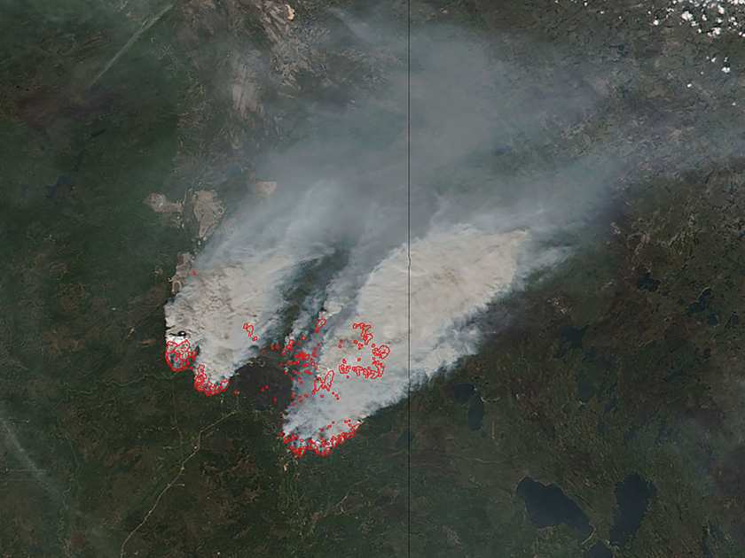
Canada: A University of Calgary engineering professor, Quazi Hassan, is working on the NASA-gathered satellite data to anticipate dangerous forest fire conditions across Alberta, Canada. Quazi has been doing it from past five years and he is paying attention even to the nooks and crannies of the province unable to be accurately watched in the past.
“Not only the fires but any source of natural hazards, if I can handle those using remote sensor data it would be my pleasure to do that sort of research,” said Quazi.
“In this particular province we experience lots of fires like this, so definitely I think this type of research can help people to understand the danger conditions, number one, and secondly I think in the long run, if we can do more and more research, then we can understand how to design better cities.”
The NASA satellite data, which Quazi has been accessing in the last five years, has proven fruitful, said Quazi.
“Our view is, especially in the remote areas where accessibility is extremely poor, installing and running weather stations is not that easy,” Quazi said.
“We thought we can develop some system, which can cover those remote locations.
“For a long, long time — I’ll say since 1996 — I started to do research using remote sensing of the satellite imaging area, then in 2005 I started to look into some forestry applications.”
What Quazi’s project aims to do in terms of predicting where forest fires could occur, he said, is not to replace the current system but cover those untouched remote areas and add another layer of information where there is already coverage.
He’s looking forward to the next five years, which he plans to spend expanding what information he’s looking at.
“I would like to investigate more and more emerging factors … how during the growing season vegetation changes and how that particular change can be related to the fire danger,” he said.
“I would be interested to see how the topography can influence the fire.
“What could be the influence of the road network? What could be the influence of the long weekends on the fires?”

