
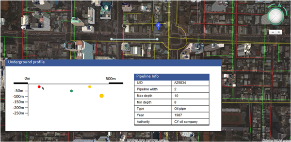
 China: SuperGIS 3D Earth Server is working on developing underground utilities and traffic applications. Since the product offers the ability to visualize and manage underground utilities and allows users to take a tour on a specific route to simulate a real-world driving scenario, it is believed that its suitable for managing underground utilities and modeling real-world traffic. In addition to 3D views of underground utilities, users can generate a profile of them. SuperGIS 3D Earth Server provides an interactive profile view interface so that the pipeline information will be shown and highlighted in the 3D map once the pipeline is clicked in the profile view.
Source: Supergeo

