
Belgium: Orbit GeoSpatial Technologies has announced to launch its Orbit Mobile Mapping portfolio version 17, at Intergeo, Hamburg, that is taking place in October 2016. Visit booth C4.039 in Hall 4.
“We are very happy to make version 17 available”, says Peter Bonne, CEO of Orbit GT. “Version 17 brings many improvements and some striking innovations, such as automated feature extraction. Launching at Intergeo, the globally largest event in the Geobusiness, brings supplementary momentum to our portfolio and over the years has become a good habbit.”
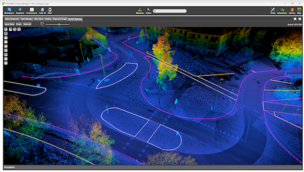
The Mobile Mapping Version 17 release focusses on the improvements for the Content Manager, a necessity for data capturers, and innovations for Feature Extraction, such as paralle extraction, curbstrone and ridge detection, wire detection, road markings and rail detection and many more.
Version 17 will be available for the Mobile Mapping portfolio by October 1st, followed soon by version 17 for the Oblique and UAS portfolios.

