
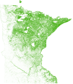
 US: Spatial data products provider, EarthDefine, has created a tree canopy dataset for Minnesota. The Minnesota SpatialCover Tree Canopy dataset maps trees with 98 percent accuracy. The 1-meter resolution dataset also boasts 30 times the resolution of existing state level datasets. The interactive map will allow users to compare woody vegetation between different cities. The tree data supports a variety of applications like biomass estimation, wildfire risk monitoring, quantification of ecosystem services and improved modeling of storm-water flows.
Source: EarthDefine

