UK, September 10, 2014: Archaeologists of the Stonehenge Hidden Landscapes Project, led by the University of Birmingham in conjunction with the Ludwig Boltzmann Institute for Archaeological Prospection and Virtual Archaeology, have unveiled the most detailed map ever produced of the earth beneath Stonehenge and its surrounding area.
Remote sensing techniques and geophysical surveys have discovered hundreds of new features which now form part of the most detailed archaeological digital map of the Stonehenge landscape ever produced. The startling results of the survey include 17 previously unknown ritual monuments dating to the period when Stonehenge achieved its iconic shape.
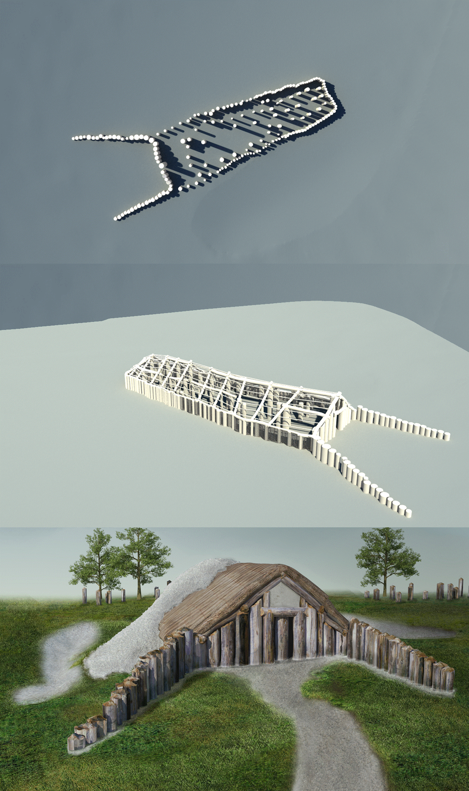
Dozens of burial mounds have been mapped in minute detail, including a long barrow (a burial mound dating to before Stonehenge) which revealed a massive timber building, probably used for the ritual inhumation of the dead following a complicated sequence of exposure and excarnation (defleshing), and which was finally covered by an earthen mound.
For the survey, in addition to near-surface geophysical prospection technologies, the archaeologists used three remote sensing methods: aerial photography, laser scanning and airborne imaging spectroscopy. They combined different instruments to scan the area to a depth of three metres, with unprecedented resolution.


