
US: Bentley Systems has announced the release of ContextCapture and ContextCapture Center. The release enhances the accessibility, scale, and quality of reality models that can be produced for use in BIM and geospatial workflows.
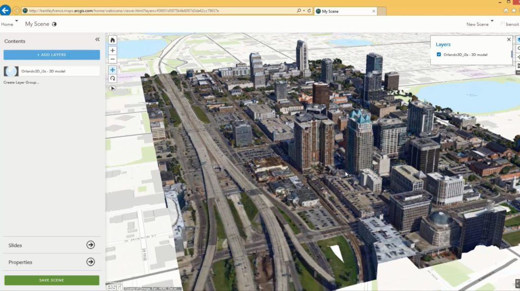
Featuring multi-resolution mesh support for third-party formats, ContextCapture includes, Esri i3s, Google Earth KML, SpaceEyes3D, OSGB (OpenSceneGraph), and LODTreeExport formats. It has a Multi-resolution mesh support for ContextCapture’s native 3MX format; and a threefold increase from 30 to 100 gigapixels of imagery that can be processed with ContextCapture.
This expansion of multi-resolution format support enables ContextCapture to provide improved quality and performance of reality modeling data within geospatial workflows, particularly valuable for the large community of ArcGIS and other geospatial users. These users can now reduce the cost and time for reality capture and increase accessibility of reality data throughout projects and among enterprise stakeholders.
The expansion in processing capacity to 100 gigapixels for ContextCapture makes it affordable and easier to produce larger models and 3D meshes with high fidelity and cm level precision, even at scales as large as entire cities (kilometer scale models).
“With this release of ContextCapture, reality meshes are now more accessible throughout ArcGIS workflows as well as Bentley’s native V8i design modeling workflows including those using OpenRoads, AECOsim, and OpenPlant. Through our advances in integrating reality models of any scale into geospatial workflows, GIS professionals, particularly those using Esri ArcGIS products, can now affordably incorporate high-fidelity models of the real world into their existing GIS datasets,” said Santanu Das, SVP, design modeling at Bentley Systems.

