Hydrospatial Infrastructure and Blue Economy

Theme: Mapping the Blue Frontier: Hydrospatial Innovation for a Resilient Ocean Economy

Seminar

30 April 2026


Overview

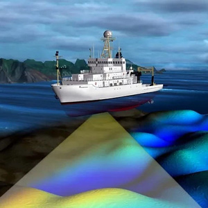
As ocean-based industries drive nearly $4 trillion in annual global output and ocean assets hold a collective value of $24 trillion, the need for smart, sustainable marine governance has never been greater. Hydrospatial infrastructure—merging traditional hydrography with advanced geospatial intelligence—offers transformative potential for blue carbon restoration, maritime resilience, marine energy, and coastal economy revitalization. This one-day summit will explore how geospatial solutions can underpin the future of the blue economy, balancing economic growth with environmental protection across ocean and coastal ecosystems.

Agenda

Blue Carbon Ecosystem Mapping for Climate Resilience
  • Geospatial mapping supports the restoration of mangroves, seagrasses, and coral reefs to boost carbon sequestration.
  • Coastal ecosystems act as natural buffers against extreme weather events and sea-level rise.
  • Hydrospatial tools help quantify, monitor, and verify blue carbon benefits for climate finance and biodiversity credits.
Smart Ocean Governance Through Data Integration
  • A global hydrospatial data framework enables better ocean science collaboration across borders.
  • Real-time marine data supports policy enforcement, ecosystem management, and illegal fishing detection.
  • Linked to the UN Decade of Ocean Science, coordinated geospatial strategies foster transparency and accountability.
Securing Maritime Trade with Geospatial Intelligence
  • Over 80% of global trade depends on maritime routes vulnerable to climate risks and geopolitical tensions.
  • Smart ports use real-time geospatial data for logistics optimization and risk assessment.
  • Maritime corridor mapping enhances cross-border cooperation for resilient supply chains and marine safety.
Coastal Economy Growth via Marine Industry Planning
  • Marine sectors like shipbuilding, aquaculture, and logistics contribute over $1.5 trillion to GDP.
  • Spatial planning ensures sustainable coastal infrastructure, zoning, and resource use.
  • Hydrospatial infrastructure helps balance economic activity with environmental preservation in coastal zones.
Marine Renewable Energy and Seabed Intelligence
  • Offshore wind, tidal, and wave energy projects rely on precise seabed mapping for site selection and development.
  • Marine spatial planning reduces conflicts between energy, fishing, tourism, and conservation zones.
  • Hydrospatial intelligence supports regulatory approvals, environmental impact analysis, and infrastructure safety.
0930 - 1000
Opening Keynote Address
John Nyberg
John Nyberg

Director
International Hydrographic Organization (IHO)
Monaco

Michael Tischler
Michael Tischler

Associate Director for Core Science Systems
United States Geological Survey (USGS)
USA

1000 - 1130
Session 1: Smart Ocean Governance Through Data Integration

Focus Areas

This session highlights the role of integrated hydrospatial data systems and real-time marine intelligence in evidence-based governance. It will showcase approaches to improve cross-border coordination, ecosystem management, maritime safety, and regulatory enforcement. Discussions will focus on standardizing data, fostering interoperability, and enabling nations and industries to proactively manage emerging risks and strengthen sustainable ocean policies.
Dana J. Caccamise

Moderator

Dana J. Caccamise

Regional Geodetic Advisor, Western & Pacific Regions
NOAA's National Geodetic Survey (NGS) Organisation
USA

Friedhelm Moggert Kageler

Director Product Management
Teledyne CARIS
Germany

Gregory Hay
Gregory Hay

Founder and Director
Noto Analytics
Canada

Jon Pye
Jon Pye

Director of Data Operations
Ocean Tracking Network
Canada

Jeffrey Lenard
Jeffrey Lenard

Firefighter/EMT
Special Operations Division - Fireboat Company Master Public Safety Diver
District of Columbia - USA

Thomas Chenworth

Co Presenter

Thomas Chenworth

Deputy Fire Chief of Operations
District of Columbia Fire and EMS Department
USA

Nirdesh Kumar Sharma

Founder & CEO
EarthSense Labs Pvt. Ltd
India

1130 - 1330
Networking Tea / Coffee followed by Lunch Break
1330 - 1500
Session 2: Geospatial Intelligence for Resilient Ports and Maritime Trade

Focus Areas

This session explores how geospatial intelligence enhances port operations, shipping corridor planning, and maritime trade resilience. It will examine the growing need for reliable harbor infrastructure data, standardized data exchange between ports and stakeholders, and interoperable technical formats. The session will also highlight early implementations improving logistics efficiency, marine safety, and climate-resilient maritime supply chains.
Hermen M. Westerbeeke

Moderator

Hermen M. Westerbeeke

Director - Blue Economy
Responsible Alpha Inc
Germany

Rajesh Asati

Keynote

Rajesh Asati

Deputy Secretary - (PPP and Special Initiatives)
Ministry of Ports, Shipping and Waterways
Government of India

India

Capt Ben van Scherpenzeel

Chairman
International Taskforce Port Call Optimization
The Netherlands

Paige Roepers
Paige Roepers

Chief Executive Officer
Ocean Ledger
UK

Caroline Levey
Caroline Levey

Managing Director
OceanWise Ltd - England
United Kingdom

1500 - 1600
Networking Coffee/Tea Break
1600 - 1730
Session 3: Resilient Coastal Economy & Sustainable Marine Resource Management

Focus Areas

This session examines leveraging hydrospatial infrastructure to build a safe, resilient, and productive coastal and marine economy. It will explore sustainable development of aquaculture, marine farming, fisheries, and biodiversity management, integrating ocean risk and safety intelligence to safeguard operations and ecosystems. Discussions will focus on planning frameworks, cross-sectoral coordination & best practices to balance economic growth with environmental stewardship, strengthen livelihoods, and enable long-term sustainable Blue Economy outcomes.
Flavia Cavaliere

Moderator

Flavia Cavaliere

Blue Economy Expert
Sustainable Blue Economy Partnership (Italian Ministry of University & Research)
Italy

Pratap Sinha
Pratap Sinha

Advisor
GIZ
India

Pooja Mahapatra
Pooja Mahapatra

Head of Product - Climate & Nature
Fugro
The Netherlands

Meghna Sengupta
Meghna Sengupta

Geospatial Data Scientist
Marble Imaging
Germany

Bjorn Backeberg
Bjorn Backeberg

Senior Research Scientist
Deltares

Jyoti Rohodia
Jyoti Rohodia

Lead - GIS Engineer
Boskalis Westminster Contracting Limited
UAE

Eka Ardhi
Eka Ardhi

Lecturer
Institut Teknologi Sepuluh Nopember (ITS)
Indonesia

Target Segments

Hydrographic Offices & Ocean Data Agencies Ports & Maritime Authorities Energy, Environment & Coastal Ministries Blue Economy Startups & ESG Investors Academic & Marine Research Institutions Climate & Marine Conservation NGOs Fisheries, Logistics & Offshore Energy Industries